Pleasantville is a city in Marion County in Iowa, United States. The population was 1,676 at the time of the 2020 census. Pleasantville is most famous for being the corporate headquarters of Smokey Row Coffee and the hometown of softball player Chelsea Thomas whose honors include, three time All American at The University of Missouri (2011, 2012, 2013), three time conference pitcher of the year (twice in the Big 12, once in the SEC), and United States National Team member.
| Name: | Pleasantville city |
|---|---|
| LSAD Code: | 25 |
| LSAD Description: | city (suffix) |
| State: | Iowa |
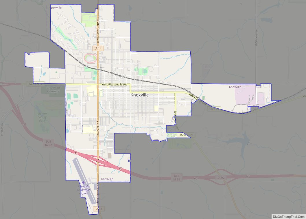
| County: | Marion County |
| Elevation: | 912 ft (278 m) |
| Total Area: | 2.45 sq mi (6.35 km²) |
| Land Area: | 2.45 sq mi (6.34 km²) |
| Water Area: | 0.00 sq mi (0.01 km²) |
| Total Population: | 1,676 |
| Population Density: | 684.92/sq mi (264.49/km²) |
| ZIP code: | 50225 |
| Area code: | 515 |
| FIPS code: | 1963750 |
| GNISfeature ID: | 0460321 |
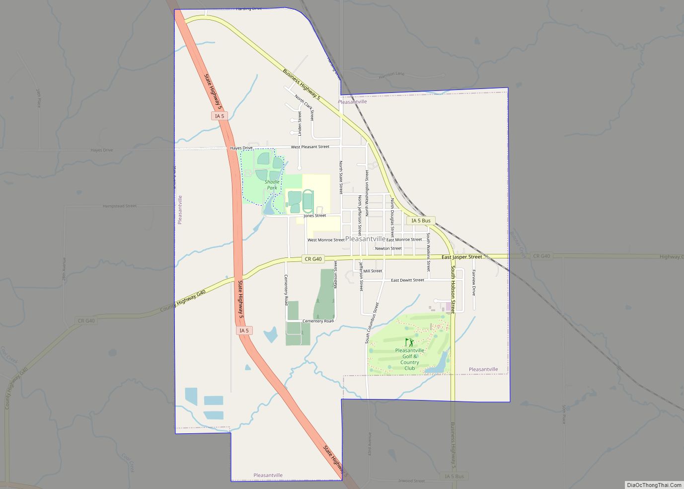
Online Interactive Map
Click on ![]() to view map in "full screen" mode.
to view map in "full screen" mode.
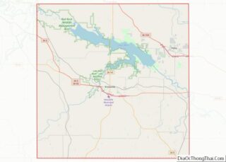
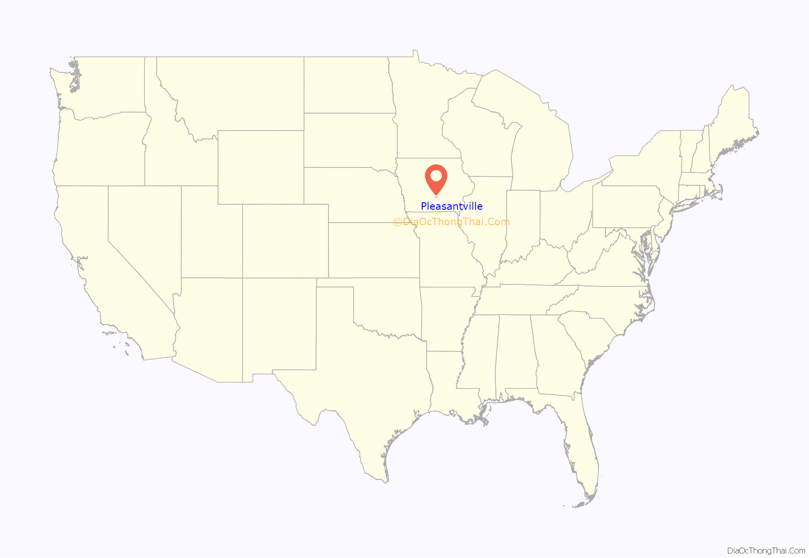
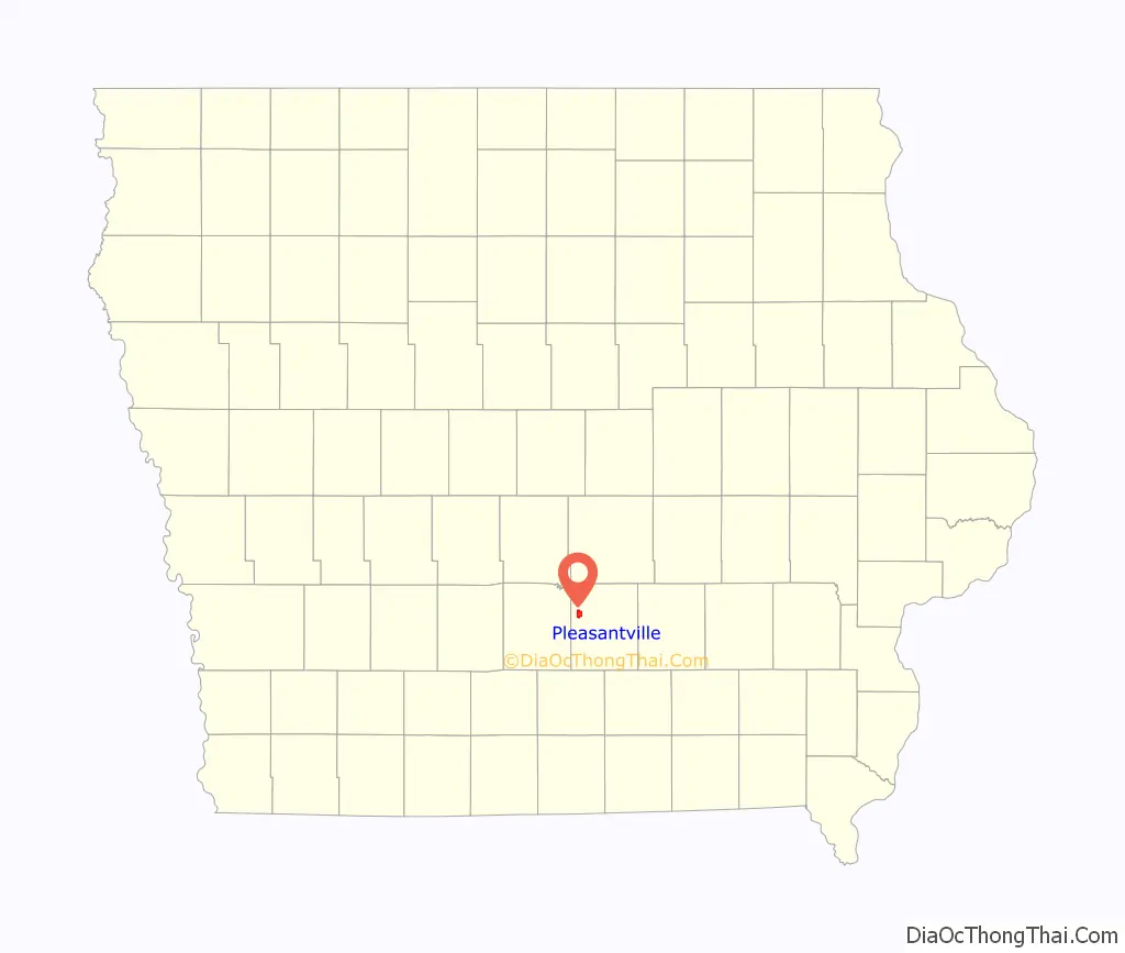
Pleasantville location map. Where is Pleasantville city?
History
Pleasantville was surveyed and established as a town on August 1, 1849 on land then owned by William Wesley Jordan. Previous to the ownership of Mr. Jordan, the land comprising the original town plot of Pleasantville changed hands for one horse and $30.
A petition for incorporation was filed in District Court on June 11, 1872 with an election subsequently held in which there were 46 votes in favor and 16 votes against.
The completion of the Chicago, Burlington, and Quincy Railroad Line through Pleasantville in 1879 caused an increase in development and Pleasantville became one of the active business centers in Marion County and the principal shipping point between Knoxville and Des Moines.
The earliest population figures available begin in 1900 with 738 residents.
The first school was built in the fall of 1847, and in 1868, the school district joined with the Masonic Lodge in building a three-story brick building that remained a school facility until 1992. Today, the Pleasantville School district consists of three buildings, an elementary, a middle school, and a high school.
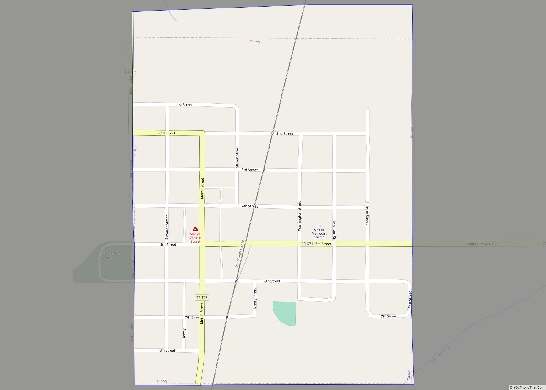
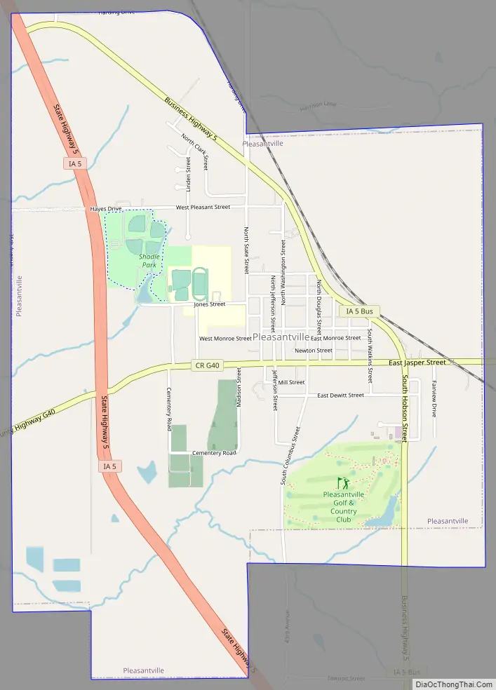
Pleasantville Road Map
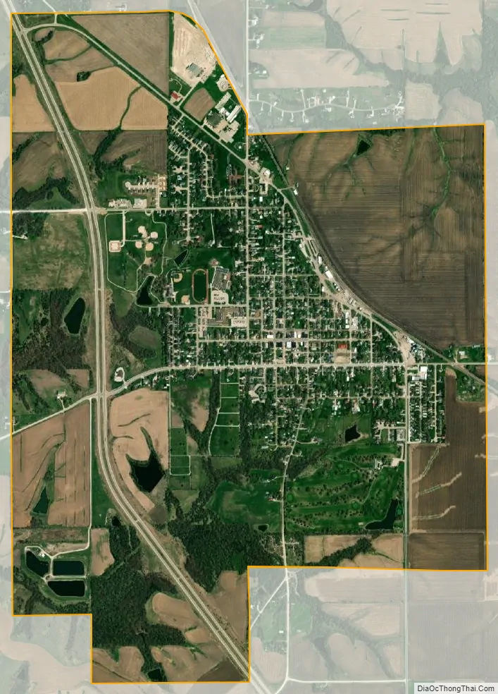
Pleasantville city Satellite Map
Geography
Pleasantville is located at 41°23′16″N 93°16′07″W / 41.387772°N 93.268680°W / 41.387772; -93.268680 (41.387772, -93.268680).
According to the United States Census Bureau, the city has a total area of 2.54 square miles (6.58 km), of which, 2.53 square miles (6.55 km) is land and 0.01 square miles (0.03 km) is water.
See also
Map of Iowa State and its subdivision:- Adair
- Adams
- Allamakee
- Appanoose
- Audubon
- Benton
- Black Hawk
- Boone
- Bremer
- Buchanan
- Buena Vista
- Butler
- Calhoun
- Carroll
- Cass
- Cedar
- Cerro Gordo
- Cherokee
- Chickasaw
- Clarke
- Clay
- Clayton
- Clinton
- Crawford
- Dallas
- Davis
- Decatur
- Delaware
- Des Moines
- Dickinson
- Dubuque
- Emmet
- Fayette
- Floyd
- Franklin
- Fremont
- Greene
- Grundy
- Guthrie
- Hamilton
- Hancock
- Hardin
- Harrison
- Henry
- Howard
- Humboldt
- Ida
- Iowa
- Jackson
- Jasper
- Jefferson
- Johnson
- Jones
- Keokuk
- Kossuth
- Lee
- Linn
- Louisa
- Lucas
- Lyon
- Madison
- Mahaska
- Marion
- Marshall
- Mills
- Mitchell
- Monona
- Monroe
- Montgomery
- Muscatine
- O'Brien
- Osceola
- Page
- Palo Alto
- Plymouth
- Pocahontas
- Polk
- Pottawattamie
- Poweshiek
- Ringgold
- Sac
- Scott
- Shelby
- Sioux
- Story
- Tama
- Taylor
- Union
- Van Buren
- Wapello
- Warren
- Washington
- Wayne
- Webster
- Winnebago
- Winneshiek
- Woodbury
- Worth
- Wright
- Alabama
- Alaska
- Arizona
- Arkansas
- California
- Colorado
- Connecticut
- Delaware
- District of Columbia
- Florida
- Georgia
- Hawaii
- Idaho
- Illinois
- Indiana
- Iowa
- Kansas
- Kentucky
- Louisiana
- Maine
- Maryland
- Massachusetts
- Michigan
- Minnesota
- Mississippi
- Missouri
- Montana
- Nebraska
- Nevada
- New Hampshire
- New Jersey
- New Mexico
- New York
- North Carolina
- North Dakota
- Ohio
- Oklahoma
- Oregon
- Pennsylvania
- Rhode Island
- South Carolina
- South Dakota
- Tennessee
- Texas
- Utah
- Vermont
- Virginia
- Washington
- West Virginia
- Wisconsin
- Wyoming