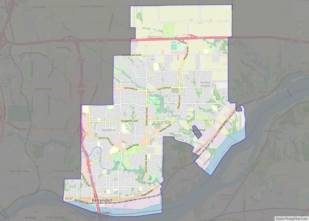
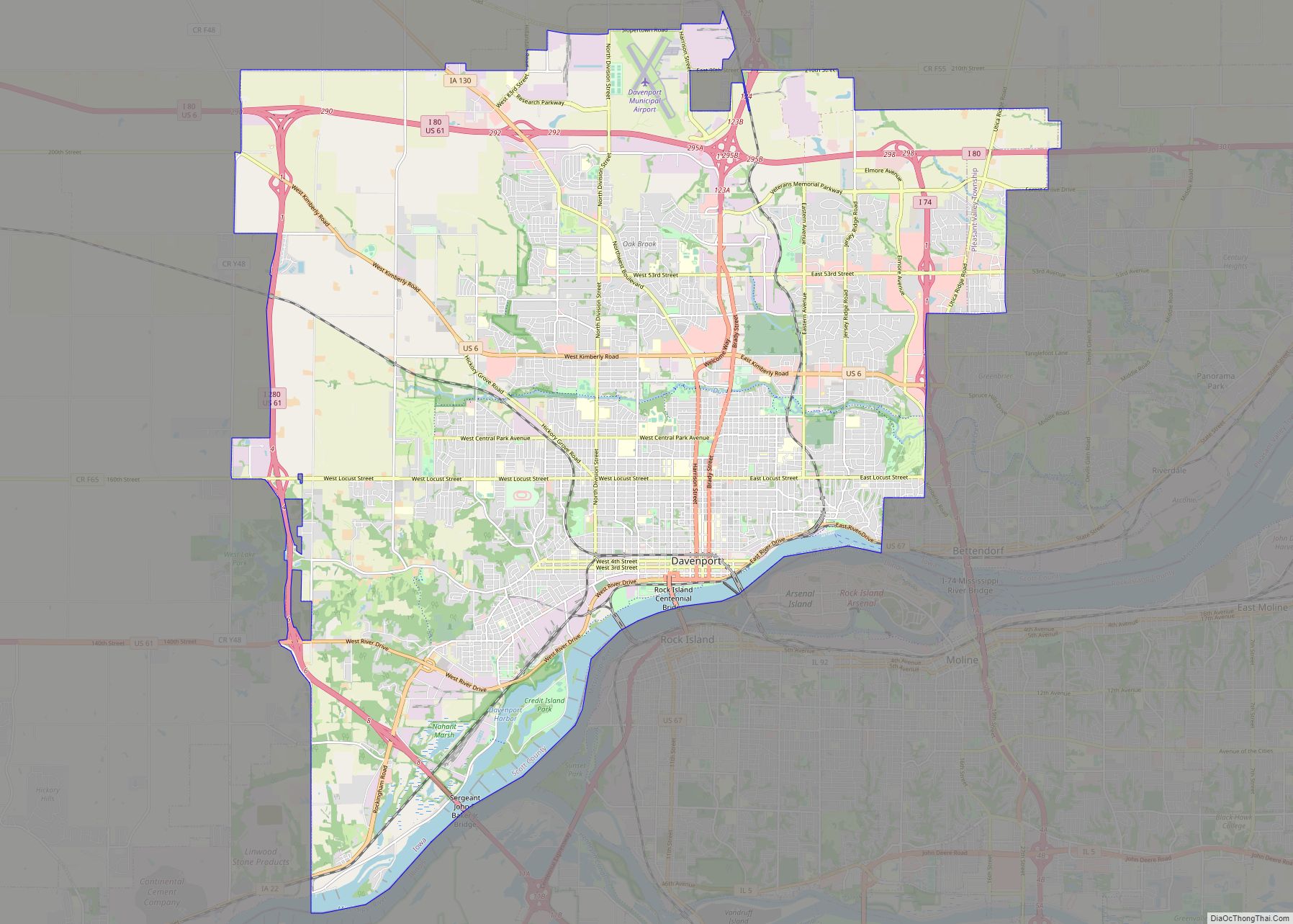
Riverdale is a city in Scott County, Iowa, United States. The population was 379 at the time of the 2020 census.
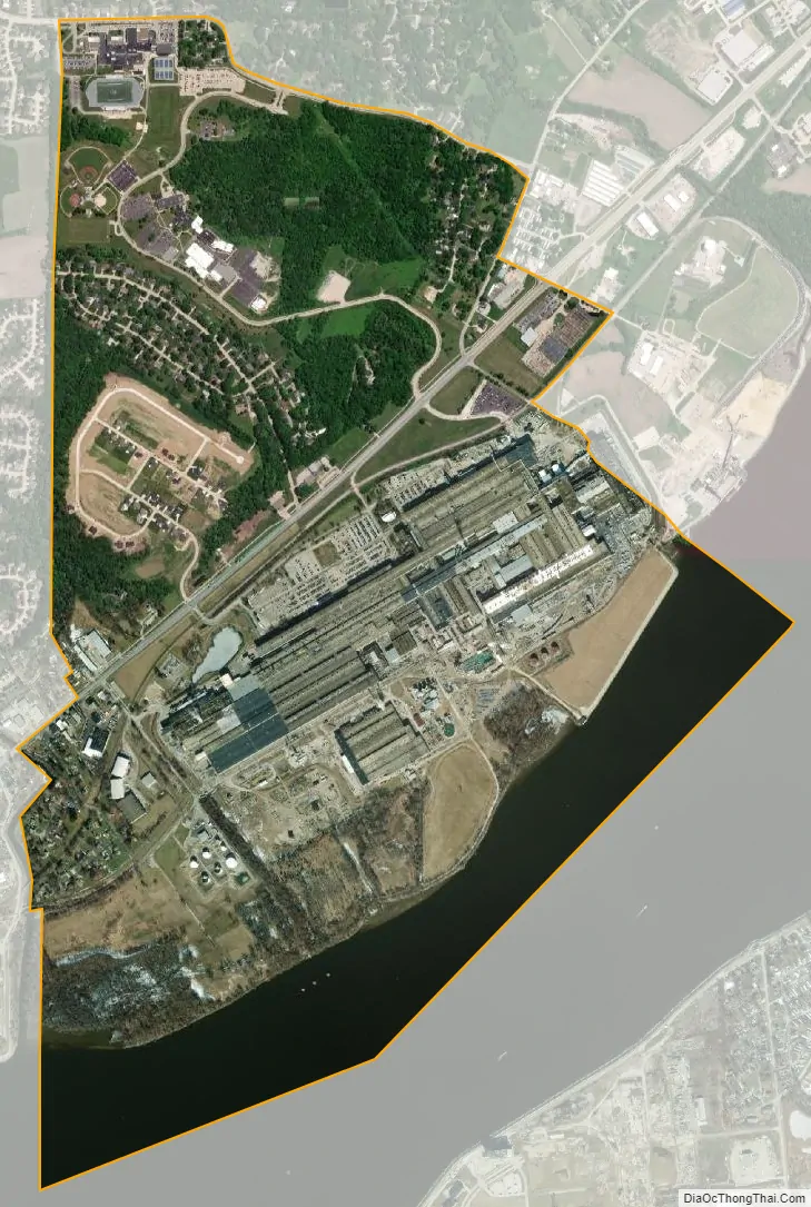
Arconic has an aluminum rolling mill in Riverdale that employs approximately 2,000 people. The city is surrounded on three sides by the city of Bettendorf, and on the fourth by the Mississippi River. Riverdale is part of the Quad Cities metropolitan area.
| Name: | Riverdale city |
|---|---|
| LSAD Code: | 25 |
| LSAD Description: | city (suffix) |
| State: | Iowa |
| County: | Scott County |
| Incorporated: | December 27, 1950 |
| Elevation: | 604 ft (184 m) |
| Land Area: | 1.84 sq mi (4.76 km²) |
| Water Area: | 0.37 sq mi (0.96 km²) |
| Population Density: | 206.09/sq mi (79.58/km²) |
| ZIP code: | 52722 |
| Area code: | 563 |
| FIPS code: | 1967350 |
| GNISfeature ID: | 0464721 |
| Website: | http://www.riverdaleia.org |
Online Interactive Map
Click on ![]() to view map in "full screen" mode.
to view map in "full screen" mode.
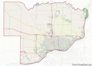
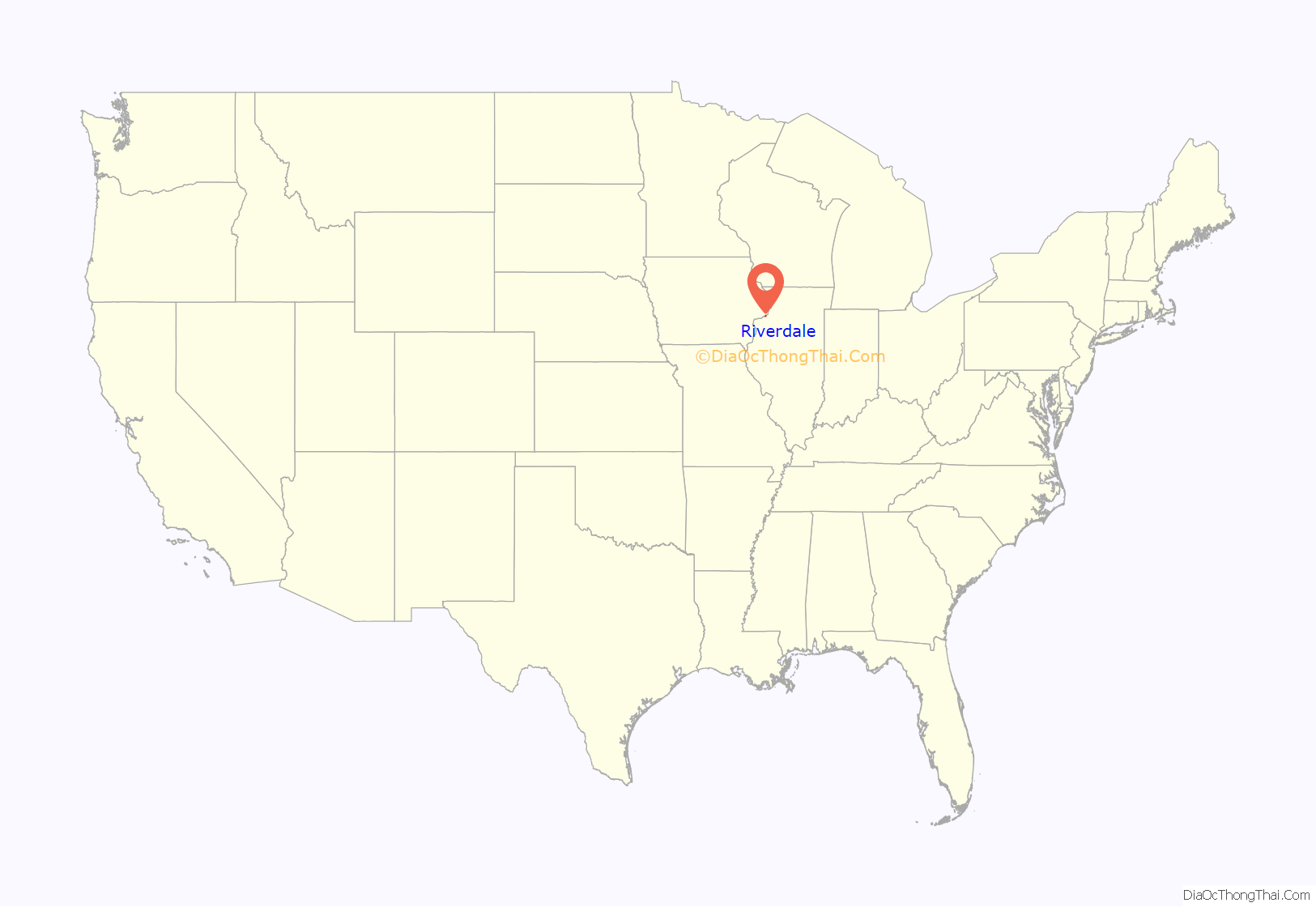
Riverdale location map. Where is Riverdale city?
History
In 1912, Iowana Dairy Farms was established by Col. G. W. French in what is today the city of Riverdale. French’s herd of Holstein cattle became one of the largest and most outstanding in the United States. After the death of Col. French, Glenn Moore took over part of the operation as Iowana Milk Farm, and G. Decker French operated the other part of the operation as Iowana Holstein Farm. The Aluminum Company of America, (ALCOA), moved to the area in 1946. By the middle of 1948 the new plant’s construction was finished and operations began in 1949.
The city of Riverdale was incorporated December 27, 1950. After a three-year incorporation challenge by the city of Bettendorf, the Iowa Supreme Court upheld the incorporation and the city of Riverdale was granted its independence on February 10, 1953.
Riverdale is part of the Quad Cities community. The area was originally called the Tri-Cities which included Moline, Rock Island, and Davenport. Later the name was changed to the Quad Cities with the addition of East Moline. Today the Quad Cities community consists of the larger cities of Davenport, Iowa; Bettendorf, Iowa; Moline, Illinois; Rock Island, Illinois; and East Moline, Illinois, as well as surrounding smaller cities Eldridge, Long Grove, Park View, Blue Grass, Buffalo, Walcott, Maysville, Mount Joy, Pleasant Valley, LeClaire, Panorama Park, and Riverdale in Iowa and Silvis, Milan, Hampton, Carbon Cliff, Port Byron, Andalusia, Coal Valley, and Colona in Illinois. The Quad Cities has a total population of over 380,000 people.
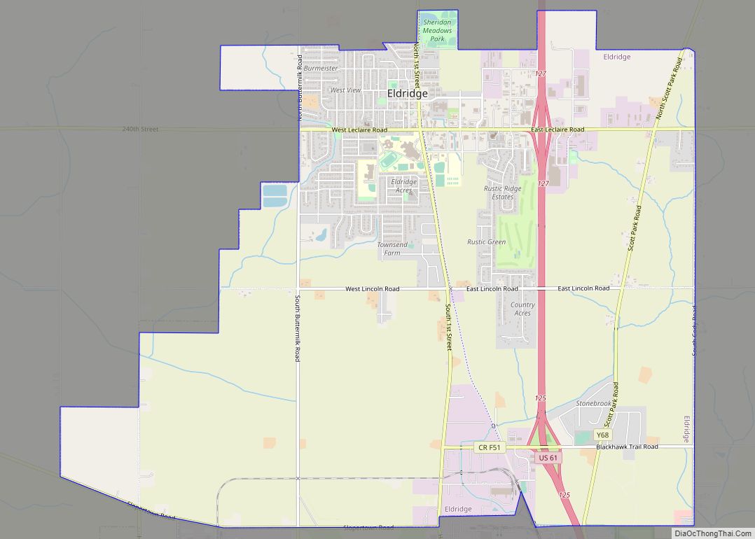
Riverdale Road Map

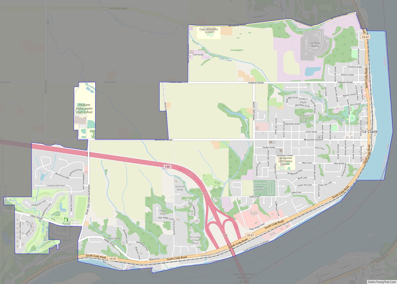
Riverdale city Satellite Map
Geography
Riverdale is located at 41°32′8″N 90°28′2″W / 41.53556°N 90.46722°W / 41.53556; -90.46722 (41.535466, −90.467216).
According to the United States Census Bureau, the city has a total area of 2.20 square miles (5.70 km), of which 1.84 square miles (4.77 km) is land and 0.36 square miles (0.93 km) is water.
See also
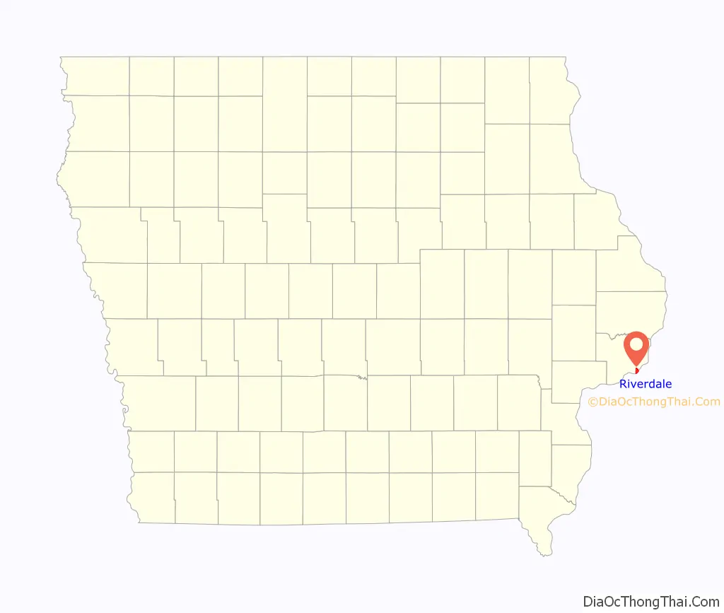
Map of Iowa State and its subdivision:- Adair
- Adams
- Allamakee
- Appanoose
- Audubon
- Benton
- Black Hawk
- Boone
- Bremer
- Buchanan
- Buena Vista
- Butler
- Calhoun
- Carroll
- Cass
- Cedar
- Cerro Gordo
- Cherokee
- Chickasaw
- Clarke
- Clay
- Clayton
- Clinton
- Crawford
- Dallas
- Davis
- Decatur
- Delaware
- Des Moines
- Dickinson
- Dubuque
- Emmet
- Fayette
- Floyd
- Franklin
- Fremont
- Greene
- Grundy
- Guthrie
- Hamilton
- Hancock
- Hardin
- Harrison
- Henry
- Howard
- Humboldt
- Ida
- Iowa
- Jackson
- Jasper
- Jefferson
- Johnson
- Jones
- Keokuk
- Kossuth
- Lee
- Linn
- Louisa
- Lucas
- Lyon
- Madison
- Mahaska
- Marion
- Marshall
- Mills
- Mitchell
- Monona
- Monroe
- Montgomery
- Muscatine
- O'Brien
- Osceola
- Page
- Palo Alto
- Plymouth
- Pocahontas
- Polk
- Pottawattamie
- Poweshiek
- Ringgold
- Sac
- Scott
- Shelby
- Sioux
- Story
- Tama
- Taylor
- Union
- Van Buren
- Wapello
- Warren
- Washington
- Wayne
- Webster
- Winnebago
- Winneshiek
- Woodbury
- Worth
- Wright
- Alabama
- Alaska
- Arizona
- Arkansas
- California
- Colorado
- Connecticut
- Delaware
- District of Columbia
- Florida
- Georgia
- Hawaii
- Idaho
- Illinois
- Indiana
- Iowa
- Kansas
- Kentucky
- Louisiana
- Maine
- Maryland
- Massachusetts
- Michigan
- Minnesota
- Mississippi
- Missouri
- Montana
- Nebraska
- Nevada
- New Hampshire
- New Jersey
- New Mexico
- New York
- North Carolina
- North Dakota
- Ohio
- Oklahoma
- Oregon
- Pennsylvania
- Rhode Island
- South Carolina
- South Dakota
- Tennessee
- Texas
- Utah
- Vermont
- Virginia
- Washington
- West Virginia
- Wisconsin
- Wyoming