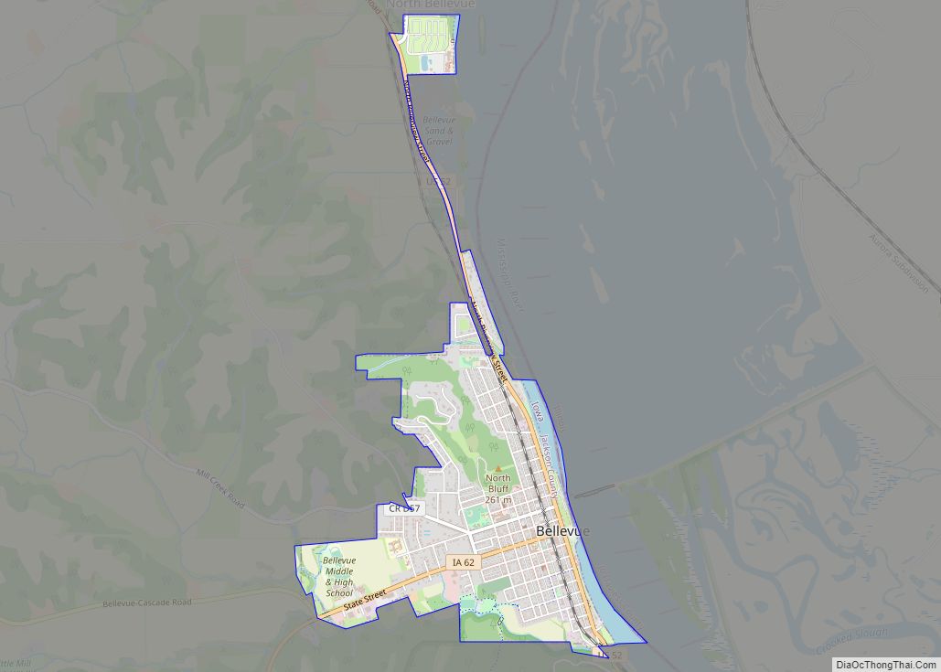
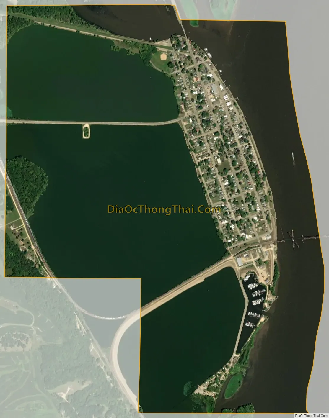
Sabula is a city in Jackson County, Iowa, United States. The population was 506 at the 2020 census. Sabula is the site of Iowa’s only island city. The island has a beach and a campground, as well as a harbor with boat docks and storage sheds to store boats during the winter. Because of its proximity to Chicago (three-hour drive), Sabula has become a popular vacation destination during the summer months. Sabula is the northern terminus of U.S. Route 67, a 1,560 mile (2,511 km) long north–south highway in the Central United States. The southern terminus of the route is at the United States–Mexico border in Presidio, Texas.
| Name: | Sabula city |
|---|---|
| LSAD Code: | 25 |
| LSAD Description: | city (suffix) |
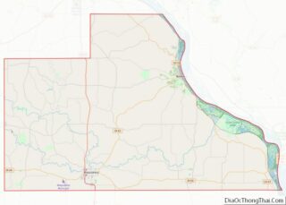
| State: | Iowa |
| County: | Jackson County |
| Incorporated: | September 1864 |
| Elevation: | 591 ft (180 m) |
| Total Area: | 1.46 sq mi (3.77 km²) |
| Land Area: | 0.49 sq mi (1.28 km²) |
| Water Area: | 0.96 sq mi (2.49 km²) |
| Total Population: | 506 |
| Population Density: | 1,024.29/sq mi (395.21/km²) |
| ZIP code: | 52070 |
| Area code: | 563 |
| FIPS code: | 1969510 |
| GNISfeature ID: | 0460877 |
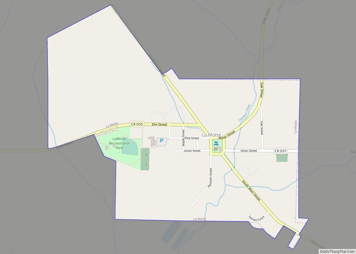
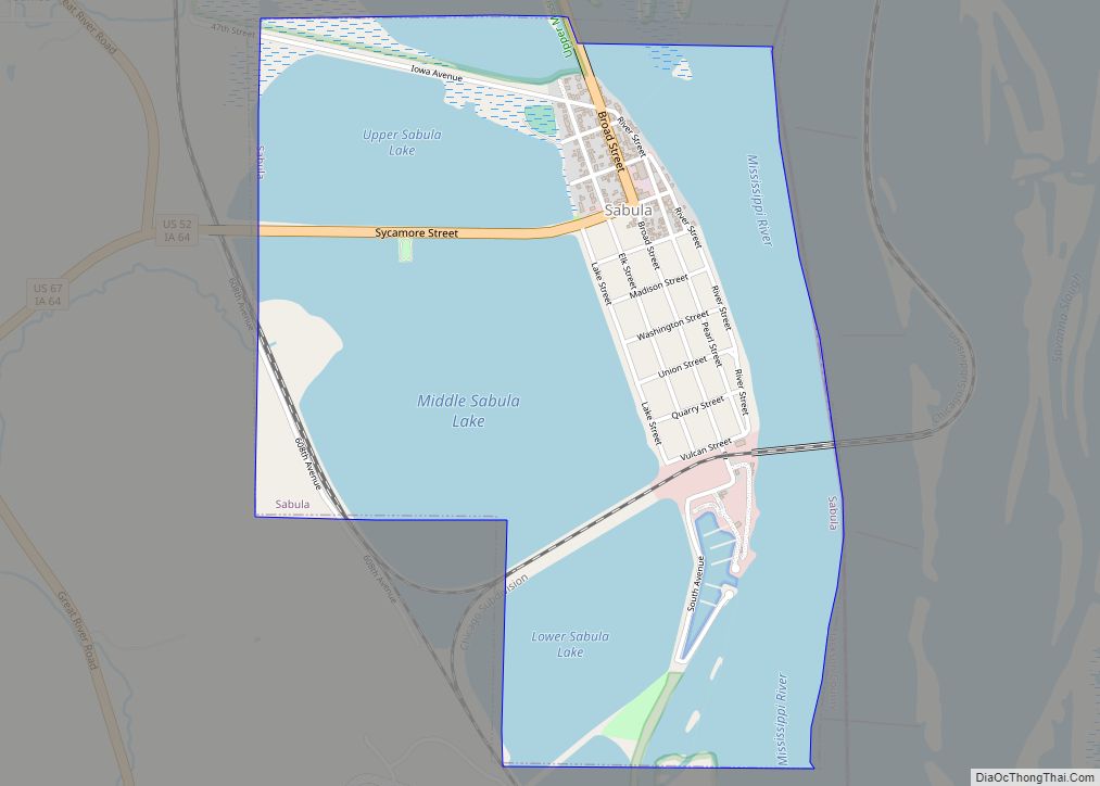
Online Interactive Map
Click on ![]() to view map in "full screen" mode.
to view map in "full screen" mode.
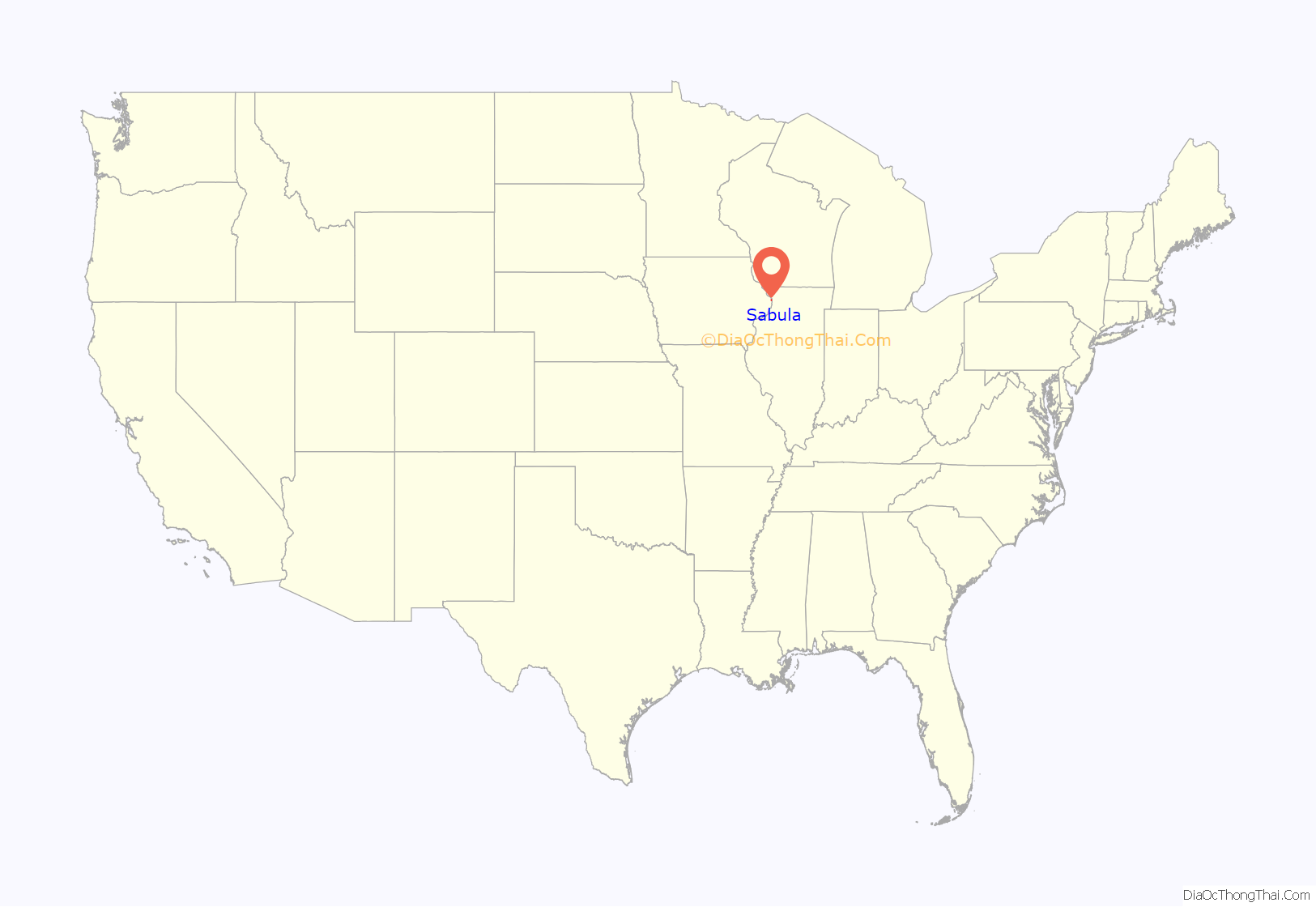
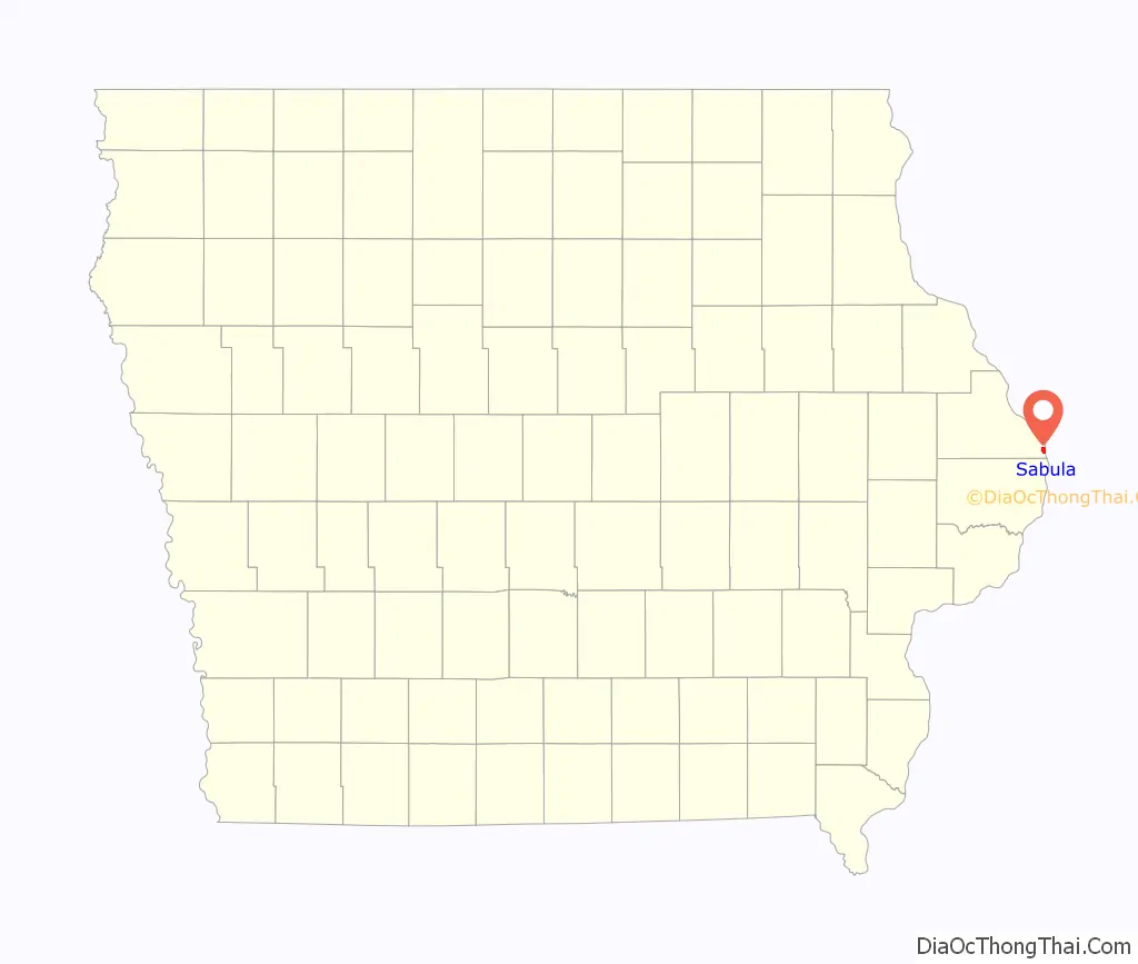
Sabula location map. Where is Sabula city?
History
Sabula was established in 1835 when, according to legend, Isaac Dorman crossed the river from the Illinois side on a log and decided to settle on the present site of Sabula. Sabula is a name of French origin meaning “sand”; this refers to the sandy soil of the area.
In the late 19th century the principal industries in the community included a large “pearl button” factory—which produced buttons from clam shells harvested from large clam beds located in the river adjacent to the shoreline. (The factory is no longer there.) The thriving community also supported a large hog slaughtering industry.
The community did not actually become an island until the lock and dam system was constructed by the Army Corps of Engineers on the upper Mississippi in the 1930s. The construction of Lock and Dam No. 13 between Clinton, Iowa and Fulton, Illinois in 1939 left the lowlands west of the townsite permanently flooded, creating the “Island City,” as the town is now known.
Sabula Road Map

Sabula city Satellite Map
Geography
Sabula is located at 42°4′4″N 90°10′27″W / 42.06778°N 90.17417°W / 42.06778; -90.17417 (42.067866, −90.174270).
According to the United States Census Bureau, the city has a total area of 1.26 square miles (3.26 km), of which 0.40 square miles (1.04 km) is land and 0.86 square miles (2.23 km) is water.
Sabula is connected to Iowa via a roadway that runs between two lakes and with Savanna, Illinois, by another roadway that leads to a bridge that crosses the Mississippi River.
See also
Map of Iowa State and its subdivision:- Adair
- Adams
- Allamakee
- Appanoose
- Audubon
- Benton
- Black Hawk
- Boone
- Bremer
- Buchanan
- Buena Vista
- Butler
- Calhoun
- Carroll
- Cass
- Cedar
- Cerro Gordo
- Cherokee
- Chickasaw
- Clarke
- Clay
- Clayton
- Clinton
- Crawford
- Dallas
- Davis
- Decatur
- Delaware
- Des Moines
- Dickinson
- Dubuque
- Emmet
- Fayette
- Floyd
- Franklin
- Fremont
- Greene
- Grundy
- Guthrie
- Hamilton
- Hancock
- Hardin
- Harrison
- Henry
- Howard
- Humboldt
- Ida
- Iowa
- Jackson
- Jasper
- Jefferson
- Johnson
- Jones
- Keokuk
- Kossuth
- Lee
- Linn
- Louisa
- Lucas
- Lyon
- Madison
- Mahaska
- Marion
- Marshall
- Mills
- Mitchell
- Monona
- Monroe
- Montgomery
- Muscatine
- O'Brien
- Osceola
- Page
- Palo Alto
- Plymouth
- Pocahontas
- Polk
- Pottawattamie
- Poweshiek
- Ringgold
- Sac
- Scott
- Shelby
- Sioux
- Story
- Tama
- Taylor
- Union
- Van Buren
- Wapello
- Warren
- Washington
- Wayne
- Webster
- Winnebago
- Winneshiek
- Woodbury
- Worth
- Wright
- Alabama
- Alaska
- Arizona
- Arkansas
- California
- Colorado
- Connecticut
- Delaware
- District of Columbia
- Florida
- Georgia
- Hawaii
- Idaho
- Illinois
- Indiana
- Iowa
- Kansas
- Kentucky
- Louisiana
- Maine
- Maryland
- Massachusetts
- Michigan
- Minnesota
- Mississippi
- Missouri
- Montana
- Nebraska
- Nevada
- New Hampshire
- New Jersey
- New Mexico
- New York
- North Carolina
- North Dakota
- Ohio
- Oklahoma
- Oregon
- Pennsylvania
- Rhode Island
- South Carolina
- South Dakota
- Tennessee
- Texas
- Utah
- Vermont
- Virginia
- Washington
- West Virginia
- Wisconsin
- Wyoming