Sidney is a city in Fremont County, Iowa, United States. The population was 1,070 at the time of the 2020 census. It is the county seat of Fremont County and is one of the smallest county seats in the state.
| Name: | Sidney city |
|---|---|
| LSAD Code: | 25 |
| LSAD Description: | city (suffix) |
| State: | Iowa |
| County: | Fremont County |
| Elevation: | 1,168 ft (356 m) |
| Total Area: | 1.37 sq mi (3.55 km²) |
| Land Area: | 1.37 sq mi (3.55 km²) |
| Water Area: | 0.00 sq mi (0.00 km²) |
| Total Population: | 1,070 |
| Population Density: | 780.45/sq mi (301.34/km²) |
| ZIP code: | 51652 |
| Area code: | 712 |
| FIPS code: | 1973065 |
| GNISfeature ID: | 0461599 |
| Website: | sidneyiowa.org |
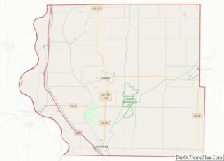
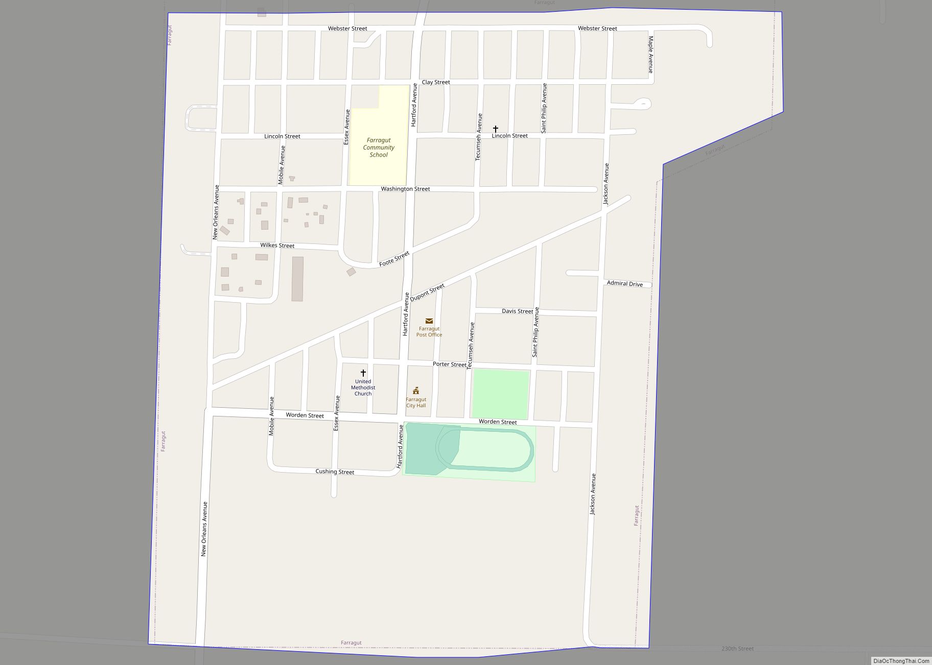
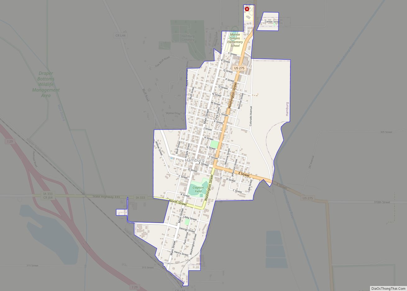
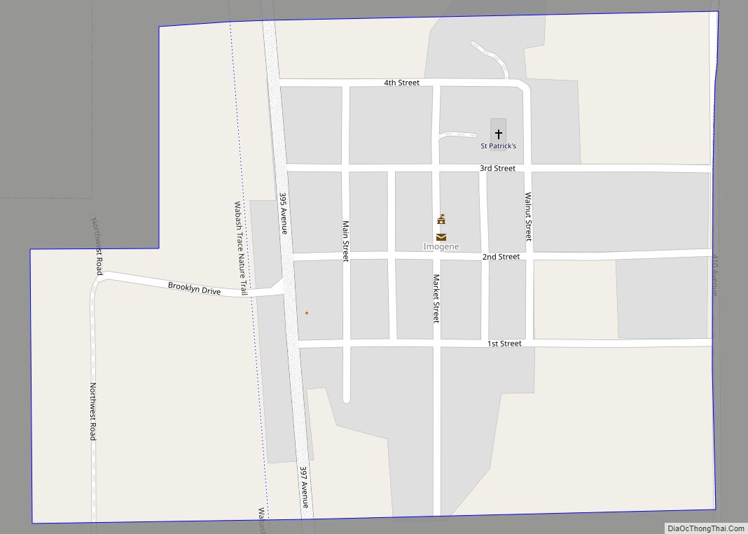
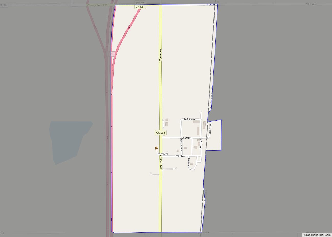
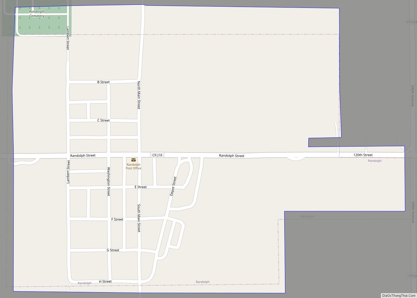
Online Interactive Map
Click on ![]() to view map in "full screen" mode.
to view map in "full screen" mode.
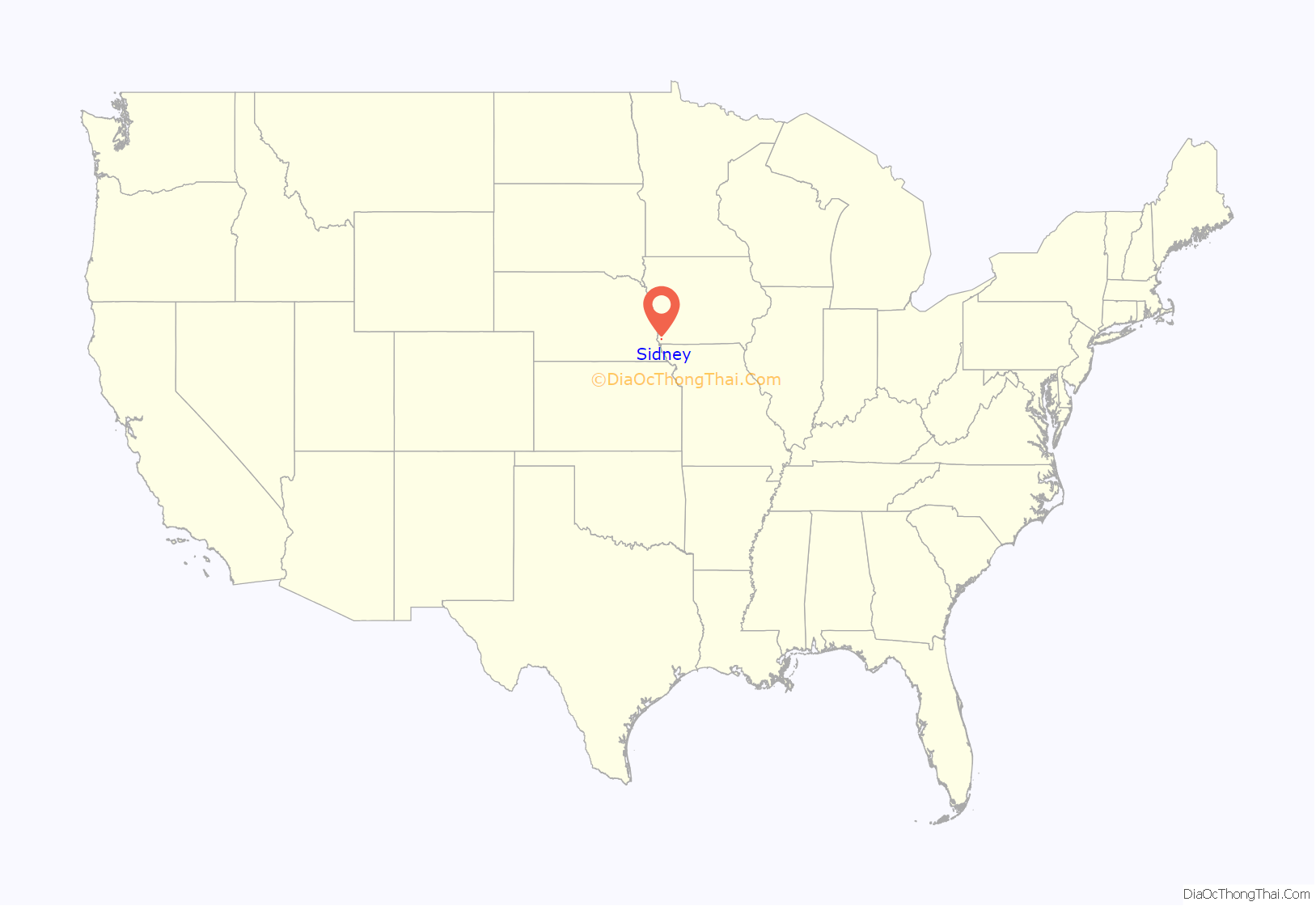
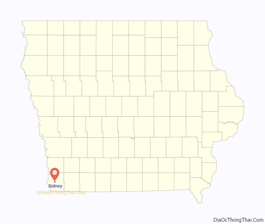
Sidney location map. Where is Sidney city?
History
Sidney was laid out in 1851 and was originally to be named Dayton. The surveyors were boarding with the Milton Richards family. Richards’ wife suggested they rename the city for her hometown of Sidney, Ohio.
The Sidney Iowa Championship Rodeo, operated by American Legion Post No. 128 since 1924, claims to be the world’s largest continuous outdoor rodeo and one of the world’s largest rodeos with around 38,000 visitors each year. The event is held in late July/early August.
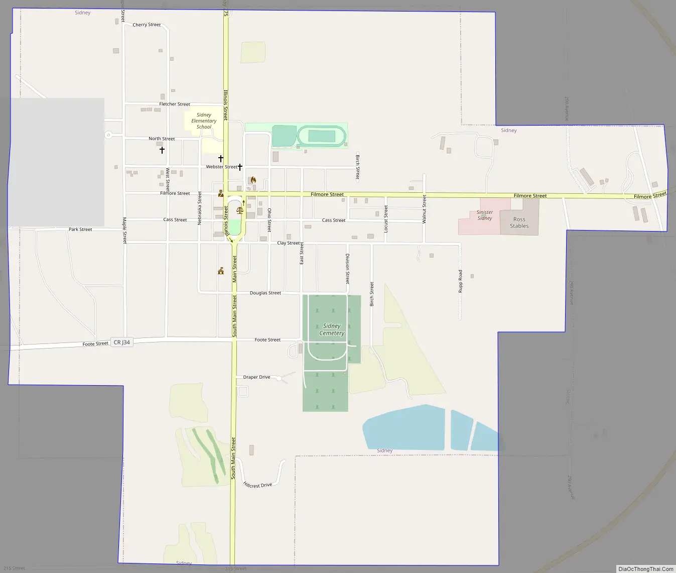
Sidney Road Map
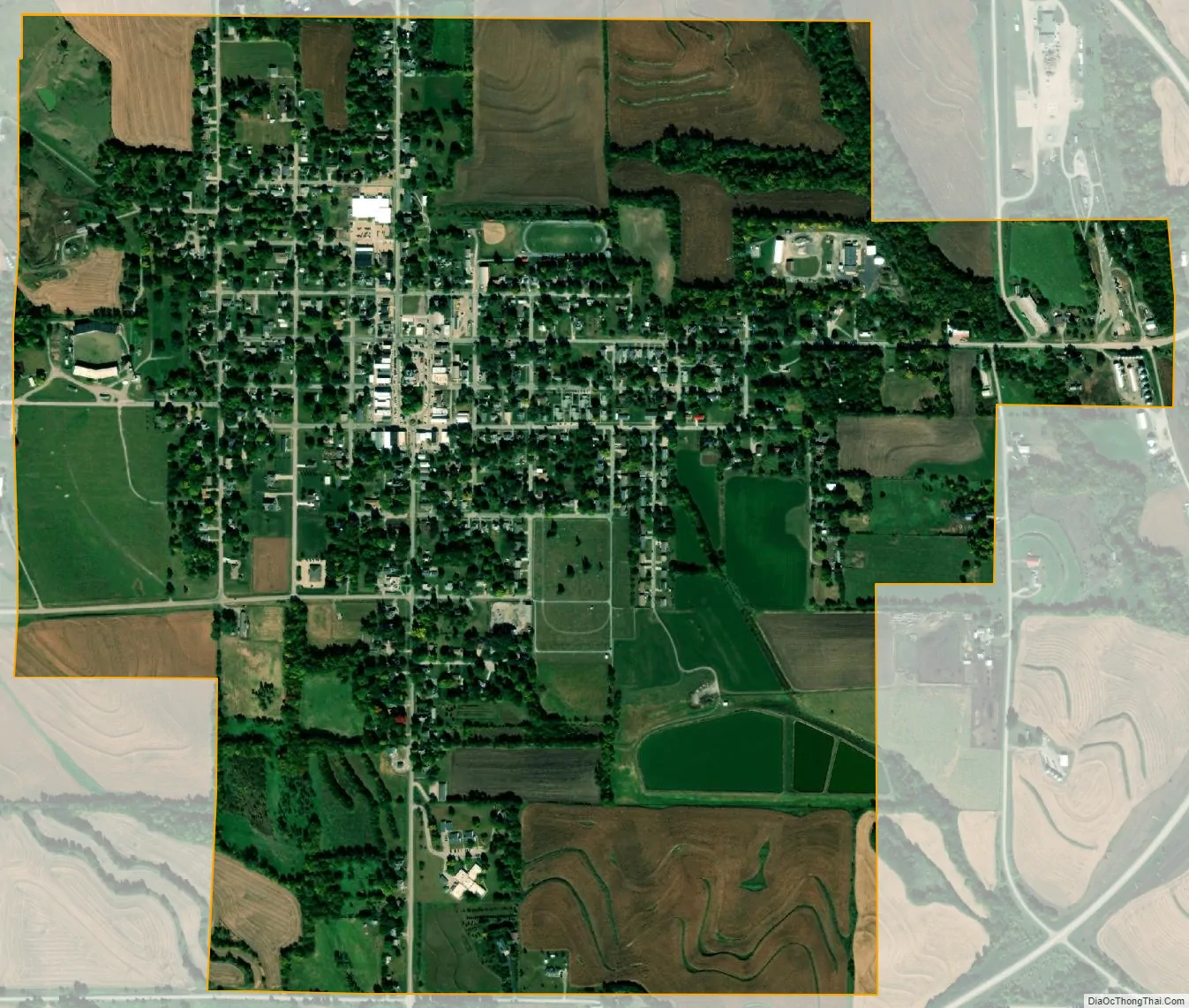
Sidney city Satellite Map
Geography
Sidney is located at 40°44’50” North, 95°38’49” West (40.747198, -95.646810). According to the United States Census Bureau, the city has a total area of 1.38 square miles (3.57 km), all land.
See also
Map of Iowa State and its subdivision:- Adair
- Adams
- Allamakee
- Appanoose
- Audubon
- Benton
- Black Hawk
- Boone
- Bremer
- Buchanan
- Buena Vista
- Butler
- Calhoun
- Carroll
- Cass
- Cedar
- Cerro Gordo
- Cherokee
- Chickasaw
- Clarke
- Clay
- Clayton
- Clinton
- Crawford
- Dallas
- Davis
- Decatur
- Delaware
- Des Moines
- Dickinson
- Dubuque
- Emmet
- Fayette
- Floyd
- Franklin
- Fremont
- Greene
- Grundy
- Guthrie
- Hamilton
- Hancock
- Hardin
- Harrison
- Henry
- Howard
- Humboldt
- Ida
- Iowa
- Jackson
- Jasper
- Jefferson
- Johnson
- Jones
- Keokuk
- Kossuth
- Lee
- Linn
- Louisa
- Lucas
- Lyon
- Madison
- Mahaska
- Marion
- Marshall
- Mills
- Mitchell
- Monona
- Monroe
- Montgomery
- Muscatine
- O'Brien
- Osceola
- Page
- Palo Alto
- Plymouth
- Pocahontas
- Polk
- Pottawattamie
- Poweshiek
- Ringgold
- Sac
- Scott
- Shelby
- Sioux
- Story
- Tama
- Taylor
- Union
- Van Buren
- Wapello
- Warren
- Washington
- Wayne
- Webster
- Winnebago
- Winneshiek
- Woodbury
- Worth
- Wright
- Alabama
- Alaska
- Arizona
- Arkansas
- California
- Colorado
- Connecticut
- Delaware
- District of Columbia
- Florida
- Georgia
- Hawaii
- Idaho
- Illinois
- Indiana
- Iowa
- Kansas
- Kentucky
- Louisiana
- Maine
- Maryland
- Massachusetts
- Michigan
- Minnesota
- Mississippi
- Missouri
- Montana
- Nebraska
- Nevada
- New Hampshire
- New Jersey
- New Mexico
- New York
- North Carolina
- North Dakota
- Ohio
- Oklahoma
- Oregon
- Pennsylvania
- Rhode Island
- South Carolina
- South Dakota
- Tennessee
- Texas
- Utah
- Vermont
- Virginia
- Washington
- West Virginia
- Wisconsin
- Wyoming