Winfield is a city in Henry County, Iowa, United States. The population was 1,033 at the time of the 2020 census.
| Name: | Winfield city |
|---|---|
| LSAD Code: | 25 |
| LSAD Description: | city (suffix) |
| State: | Iowa |
| County: | Henry County |
| Elevation: | 686 ft (209 m) |
| Total Area: | 1.04 sq mi (2.70 km²) |
| Land Area: | 1.04 sq mi (2.70 km²) |
| Water Area: | 0.00 sq mi (0.00 km²) |
| Total Population: | 1,033 |
| Population Density: | 992.32/sq mi (383.14/km²) |
| ZIP code: | 52659 |
| Area code: | 319 |
| FIPS code: | 1986385 |
| GNISfeature ID: | 0463130 |
| Website: | http://www.winfieldiowa.com/ |
Online Interactive Map
Click on ![]() to view map in "full screen" mode.
to view map in "full screen" mode.
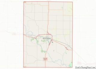
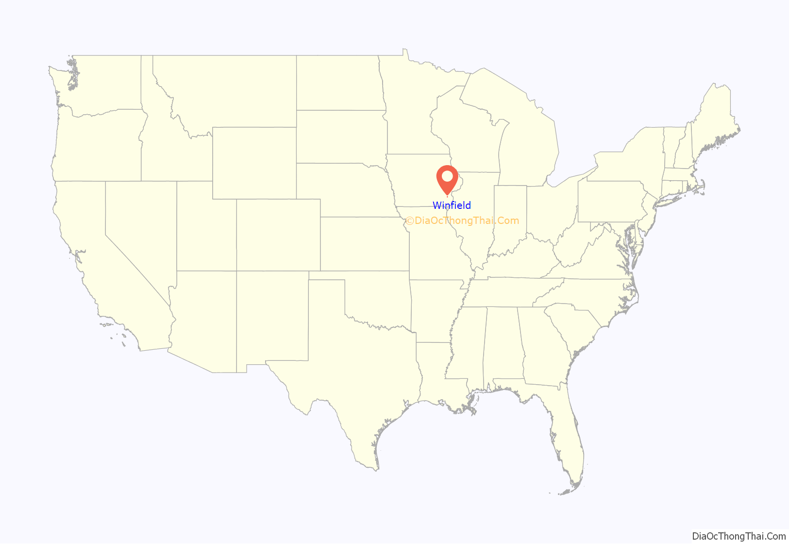
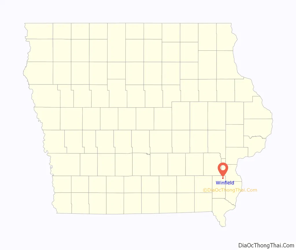
Winfield location map. Where is Winfield city?
History
Winfield was laid out in 1852. It experienced a growth with the arrival of the Burlington and Northwestern Railway in late 1876, connecting the town with Burlington. The line was extended along the east side of town and reached Washington at the start of 1880, and in 1881, the Burlington and Western Railway was incorporated to build a line from Winfield to Oskaloosa. The new line branched from the Burlington and Northwestern just north of town reached Coppock the spring of 1882 and Oskaloosa in late 1883. These were 3 ft gauge railways.
In 1882, the Chicago, Burlington and Pacific constructed a rail line west from a railroad ferry crossing of the Mississippi River at Oakville, Iowa to Oskaloosa. This line passed Winfield along the south border of Winfield, and it largely paralleled the Burlington and Western to Oskaloosa, Iowa. The line was sold to the Central Iowa Railway as soon as it was built, and that line became the Iowa Central Railway a few years later.
Winfield was the hometown of the sports reporter Bill Bryson Sr.
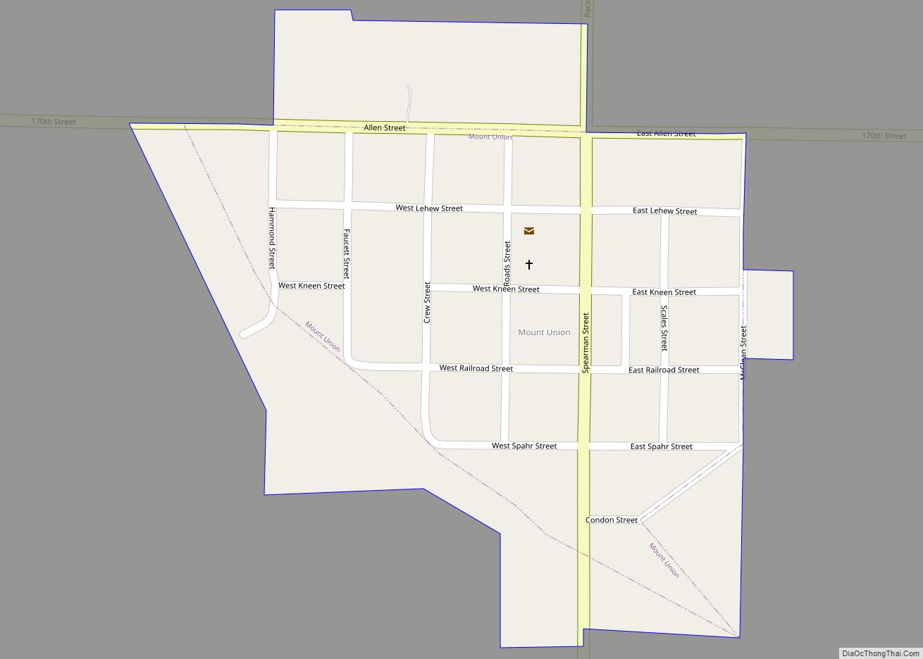
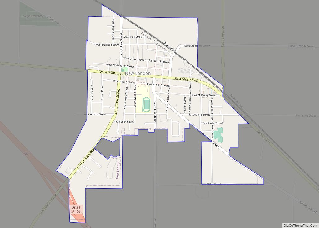
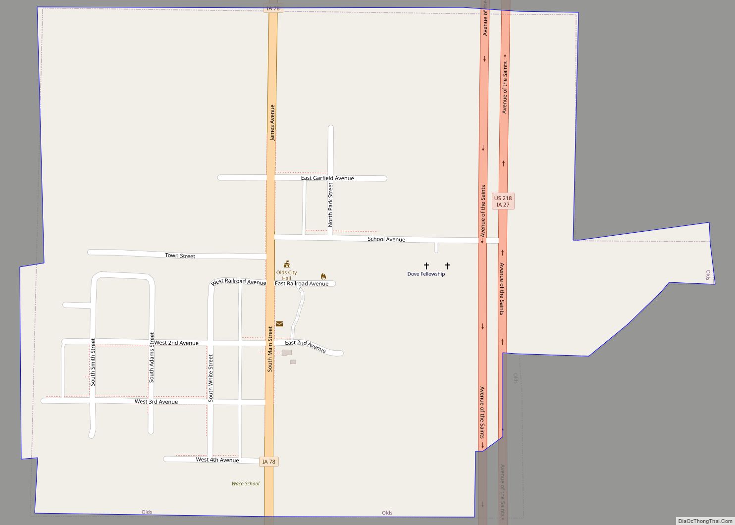
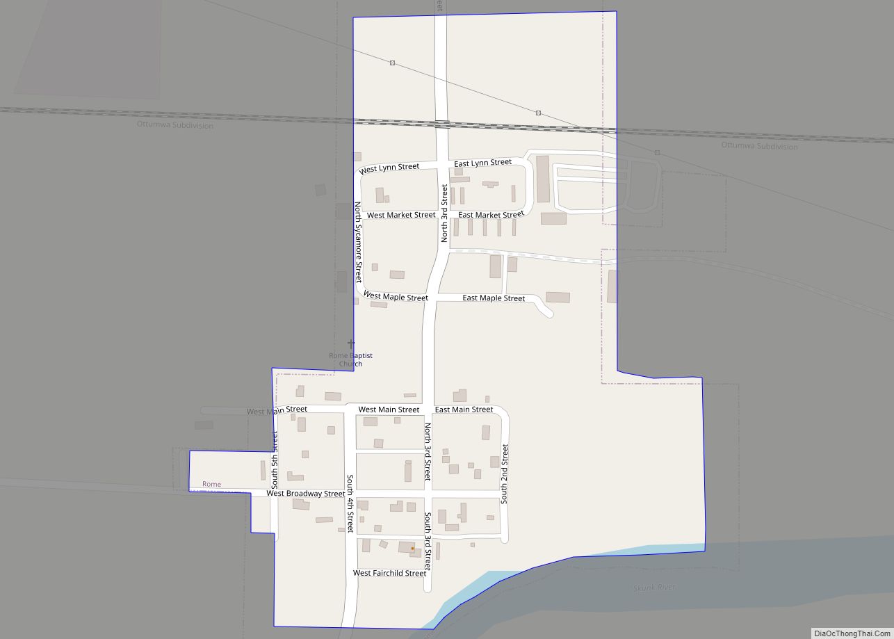
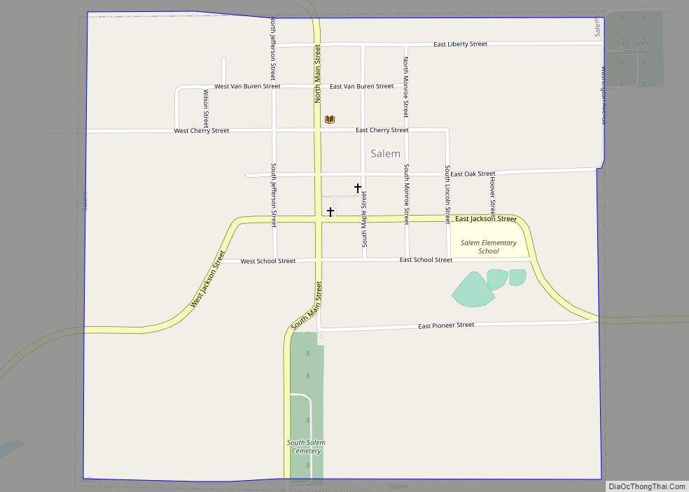
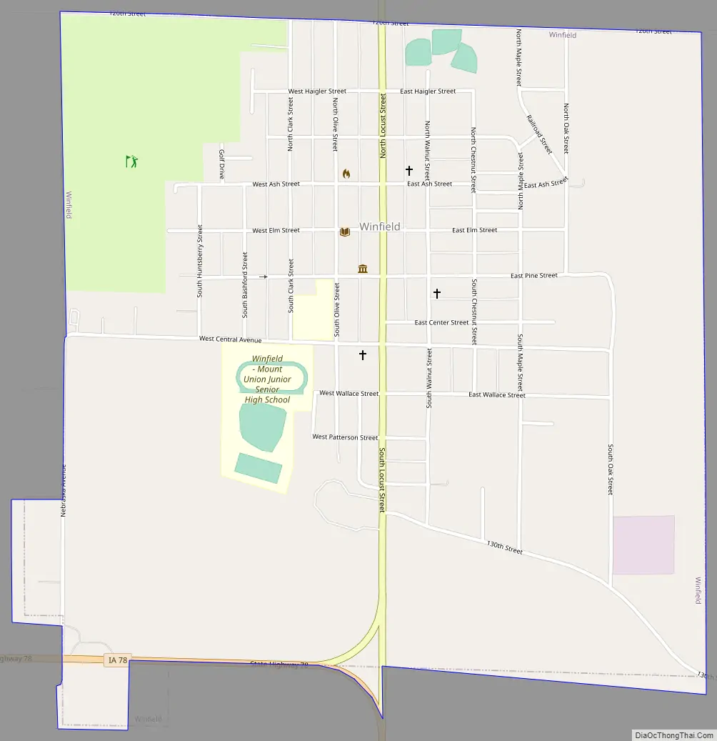
Winfield Road Map
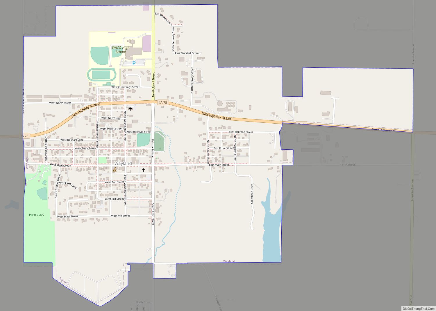
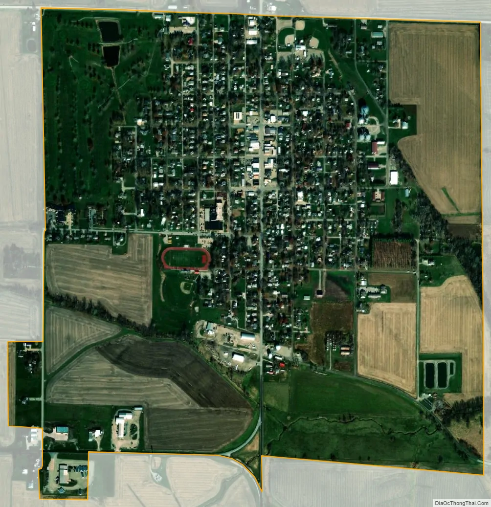
Winfield city Satellite Map
Geography
Winfield is located in northeast Henry County just north of Iowa Highway 78. The East fork of Crooked Creek flows past just east of the city. Mount Pleasant is approximately 12 miles to the southwest.
According to the United States Census Bureau, the city has a total area of 1.05 square miles (2.72 km), all land.
See also
Map of Iowa State and its subdivision:- Adair
- Adams
- Allamakee
- Appanoose
- Audubon
- Benton
- Black Hawk
- Boone
- Bremer
- Buchanan
- Buena Vista
- Butler
- Calhoun
- Carroll
- Cass
- Cedar
- Cerro Gordo
- Cherokee
- Chickasaw
- Clarke
- Clay
- Clayton
- Clinton
- Crawford
- Dallas
- Davis
- Decatur
- Delaware
- Des Moines
- Dickinson
- Dubuque
- Emmet
- Fayette
- Floyd
- Franklin
- Fremont
- Greene
- Grundy
- Guthrie
- Hamilton
- Hancock
- Hardin
- Harrison
- Henry
- Howard
- Humboldt
- Ida
- Iowa
- Jackson
- Jasper
- Jefferson
- Johnson
- Jones
- Keokuk
- Kossuth
- Lee
- Linn
- Louisa
- Lucas
- Lyon
- Madison
- Mahaska
- Marion
- Marshall
- Mills
- Mitchell
- Monona
- Monroe
- Montgomery
- Muscatine
- O'Brien
- Osceola
- Page
- Palo Alto
- Plymouth
- Pocahontas
- Polk
- Pottawattamie
- Poweshiek
- Ringgold
- Sac
- Scott
- Shelby
- Sioux
- Story
- Tama
- Taylor
- Union
- Van Buren
- Wapello
- Warren
- Washington
- Wayne
- Webster
- Winnebago
- Winneshiek
- Woodbury
- Worth
- Wright
- Alabama
- Alaska
- Arizona
- Arkansas
- California
- Colorado
- Connecticut
- Delaware
- District of Columbia
- Florida
- Georgia
- Hawaii
- Idaho
- Illinois
- Indiana
- Iowa
- Kansas
- Kentucky
- Louisiana
- Maine
- Maryland
- Massachusetts
- Michigan
- Minnesota
- Mississippi
- Missouri
- Montana
- Nebraska
- Nevada
- New Hampshire
- New Jersey
- New Mexico
- New York
- North Carolina
- North Dakota
- Ohio
- Oklahoma
- Oregon
- Pennsylvania
- Rhode Island
- South Carolina
- South Dakota
- Tennessee
- Texas
- Utah
- Vermont
- Virginia
- Washington
- West Virginia
- Wisconsin
- Wyoming