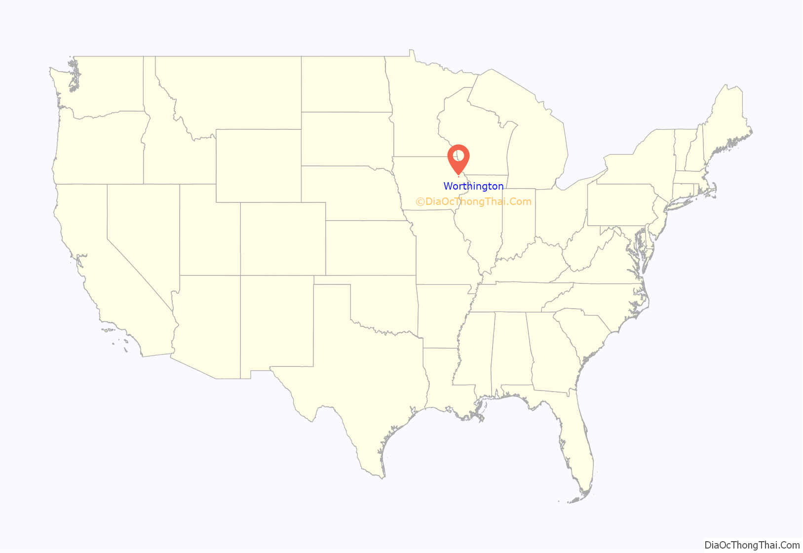
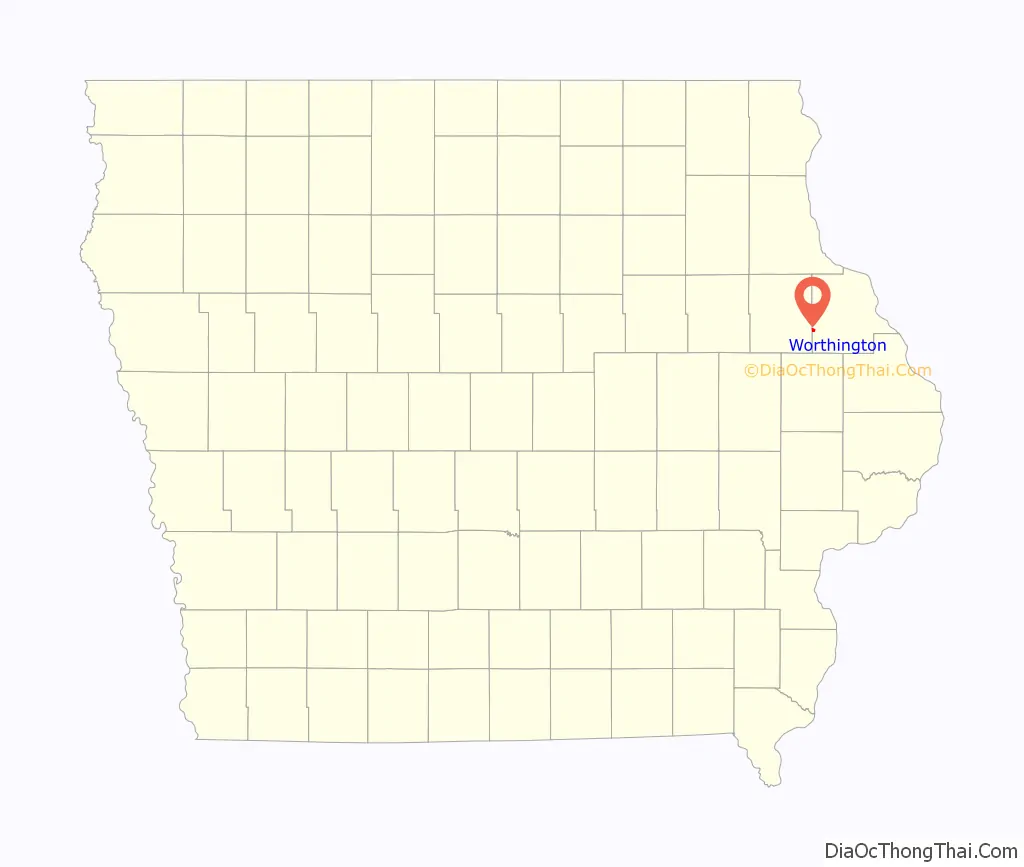
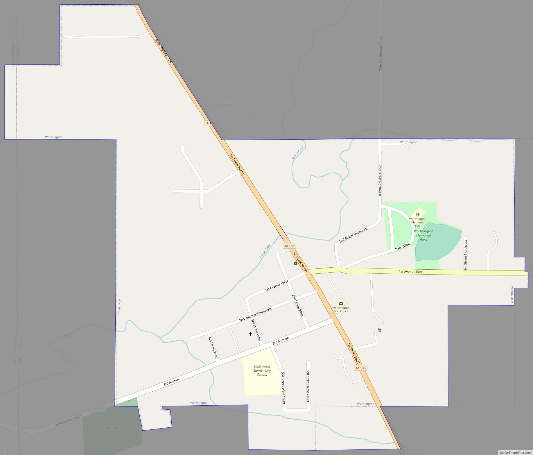
Worthington is a city in Dubuque County, Iowa, United States. The population was 382 at the time of the 2020 census, up from 381 in 2000. Iowa Highway 136 passes through Worthington, which is situated north of Cascade and south of Dyersville.
| Name: | Worthington city |
|---|---|
| LSAD Code: | 25 |
| LSAD Description: | city (suffix) |
| State: | Iowa |
| County: | Dubuque County |
| Elevation: | 919 ft (280 m) |
| Total Area: | 0.45 sq mi (1.17 km²) |
| Land Area: | 0.45 sq mi (1.17 km²) |
| Water Area: | 0.00 sq mi (0.00 km²) |
| Total Population: | 382 |
| Population Density: | 845.13/sq mi (326.22/km²) |
| ZIP code: | 52078 |
| Area code: | 563 |
| FIPS code: | 1987060 |
| GNISfeature ID: | 0463210 |
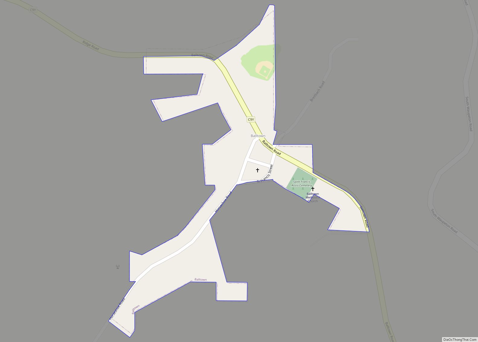
Online Interactive Map
Click on ![]() to view map in "full screen" mode.
to view map in "full screen" mode.
Worthington location map. Where is Worthington city?
History
The land on which Worthington is currently located was originally purchased by David Lovelace from the United States Government. The Dubuque South-Western Railroad — the local branch of the Chicago-Milwaukee and St. Paul lines — was contracted to establish a line from Farley to Cedar Rapids, Iowa. In 1858, an Englishman named Amos Worthington came to the area to establish a general store. By November of that year, the area became an unincorporated town known as the village of Worthington. By May of the following year regular rail service was established. A plat of Worthington was established with the Dubuque county recorder in 1858.
In 1861, Worthington sold his store to a William Moore and left for Cincinnati, Ohio. Eventually this store became known as the Heffner and Lattner Store. Settlers also began arriving in the area, with a number of people setting up businesses.
Soon a Baptist church was established in Worthington, with James Hill as Pastor. In 1868 Father Kortenkamp of St. Francis parish in Dyersville decided that Worthington was large enough to merit its own Catholic parish, and St. Paul’s Catholic Church was begun.
On October 1, 1892, a number of local citizens filed a petition in the District Court of Iowa in and for Dubuque County asking for Worthington to be formally incorporated as a town. On November 23, the court called for village inhabitants Peter Baum, W. Lattner, G.A. Dando, Louis Hoppleu, and Theodore Ament to act as commissioners. As commissioners they were to call for a special election of all qualified people in the proposed area to vote on the matter of being incorporated. This election was held on January 2, 1893. There were 42 votes cast — 32 were for the proposal and ten were against. On January 10, 1893, the Clerk of the District Court reported that the election was held.
The notice of the incorporation election was posted in the Dyersville Commercial for several weeks, with the last notice being published on February 17, 1893. Then on March 6, 1893, the results of the election were formally certified by the District Court Clerk — finalizing the incorporation of Worthington, Iowa. The formal date of incorporation of Worthington was set as January 10, 1893 when the special election had taken place.
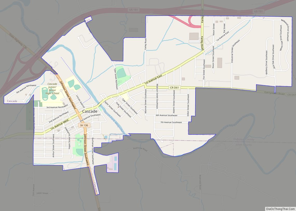
Worthington Road Map
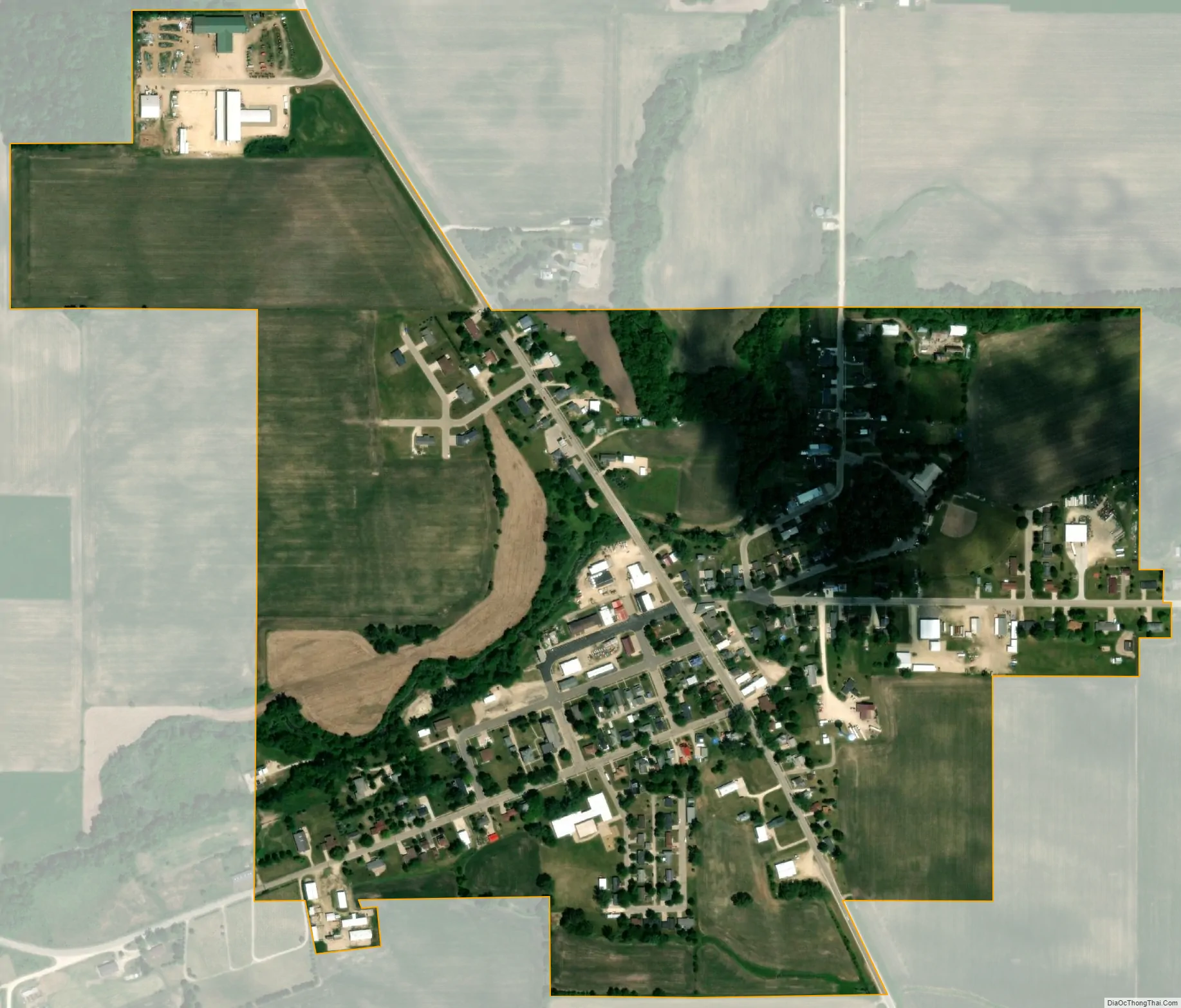
Worthington city Satellite Map
Geography
Worthington is located at 42°23′48″N 91°7′10″W / 42.39667°N 91.11944°W / 42.39667; -91.11944 (42.396745, -91.119529).
According to the United States Census Bureau, the city has a total area of 0.39 square miles (1.01 km), all land.
See also
Map of Iowa State and its subdivision:- Adair
- Adams
- Allamakee
- Appanoose
- Audubon
- Benton
- Black Hawk
- Boone
- Bremer
- Buchanan
- Buena Vista
- Butler
- Calhoun
- Carroll
- Cass
- Cedar
- Cerro Gordo
- Cherokee
- Chickasaw
- Clarke
- Clay
- Clayton
- Clinton
- Crawford
- Dallas
- Davis
- Decatur
- Delaware
- Des Moines
- Dickinson
- Dubuque
- Emmet
- Fayette
- Floyd
- Franklin
- Fremont
- Greene
- Grundy
- Guthrie
- Hamilton
- Hancock
- Hardin
- Harrison
- Henry
- Howard
- Humboldt
- Ida
- Iowa
- Jackson
- Jasper
- Jefferson
- Johnson
- Jones
- Keokuk
- Kossuth
- Lee
- Linn
- Louisa
- Lucas
- Lyon
- Madison
- Mahaska
- Marion
- Marshall
- Mills
- Mitchell
- Monona
- Monroe
- Montgomery
- Muscatine
- O'Brien
- Osceola
- Page
- Palo Alto
- Plymouth
- Pocahontas
- Polk
- Pottawattamie
- Poweshiek
- Ringgold
- Sac
- Scott
- Shelby
- Sioux
- Story
- Tama
- Taylor
- Union
- Van Buren
- Wapello
- Warren
- Washington
- Wayne
- Webster
- Winnebago
- Winneshiek
- Woodbury
- Worth
- Wright
- Alabama
- Alaska
- Arizona
- Arkansas
- California
- Colorado
- Connecticut
- Delaware
- District of Columbia
- Florida
- Georgia
- Hawaii
- Idaho
- Illinois
- Indiana
- Iowa
- Kansas
- Kentucky
- Louisiana
- Maine
- Maryland
- Massachusetts
- Michigan
- Minnesota
- Mississippi
- Missouri
- Montana
- Nebraska
- Nevada
- New Hampshire
- New Jersey
- New Mexico
- New York
- North Carolina
- North Dakota
- Ohio
- Oklahoma
- Oregon
- Pennsylvania
- Rhode Island
- South Carolina
- South Dakota
- Tennessee
- Texas
- Utah
- Vermont
- Virginia
- Washington
- West Virginia
- Wisconsin
- Wyoming