Bloomingdale is a village in DuPage County, Illinois, United States, settled in 1833, and 25 miles northwest of downtown Chicago. The population was 22,382 at the 2020 census.
| Name: | Bloomingdale village |
|---|---|
| LSAD Code: | 47 |
| LSAD Description: | village (suffix) |
| State: | Illinois |
| County: | DuPage County |
| Incorporated: | 1889 |
| Total Area: | 7.03 sq mi (18.20 km²) |
| Land Area: | 6.77 sq mi (17.52 km²) |
| Water Area: | 0.26 sq mi (0.68 km²) 3.69% |
| Total Population: | 22,382 |
| Population Density: | 3,308.1/sq mi (1,277.28/km²) |
| ZIP code: | 60108 |
| FIPS code: | 1706587 |
| Website: | www.villageofbloomingdale.org |
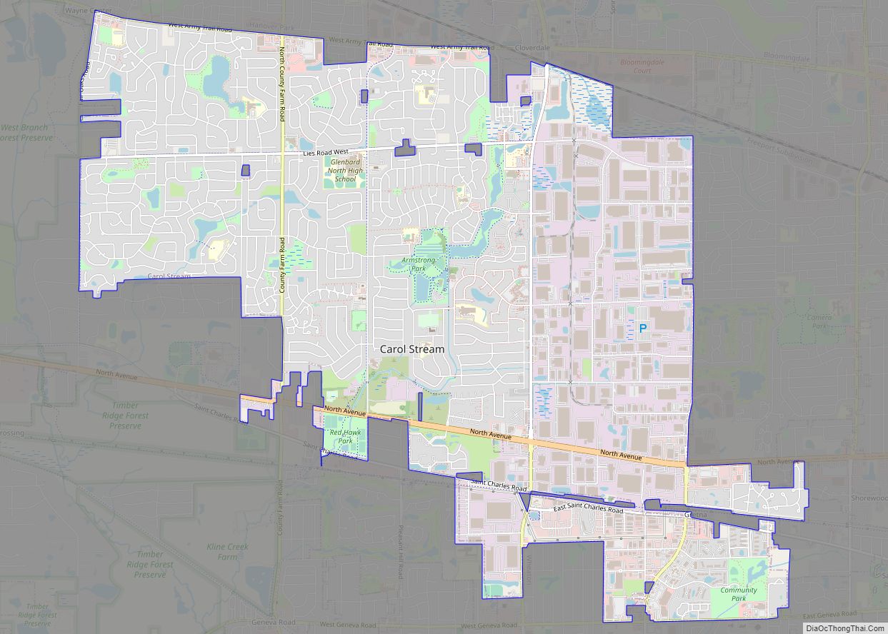
Online Interactive Map
Click on ![]() to view map in "full screen" mode.
to view map in "full screen" mode.
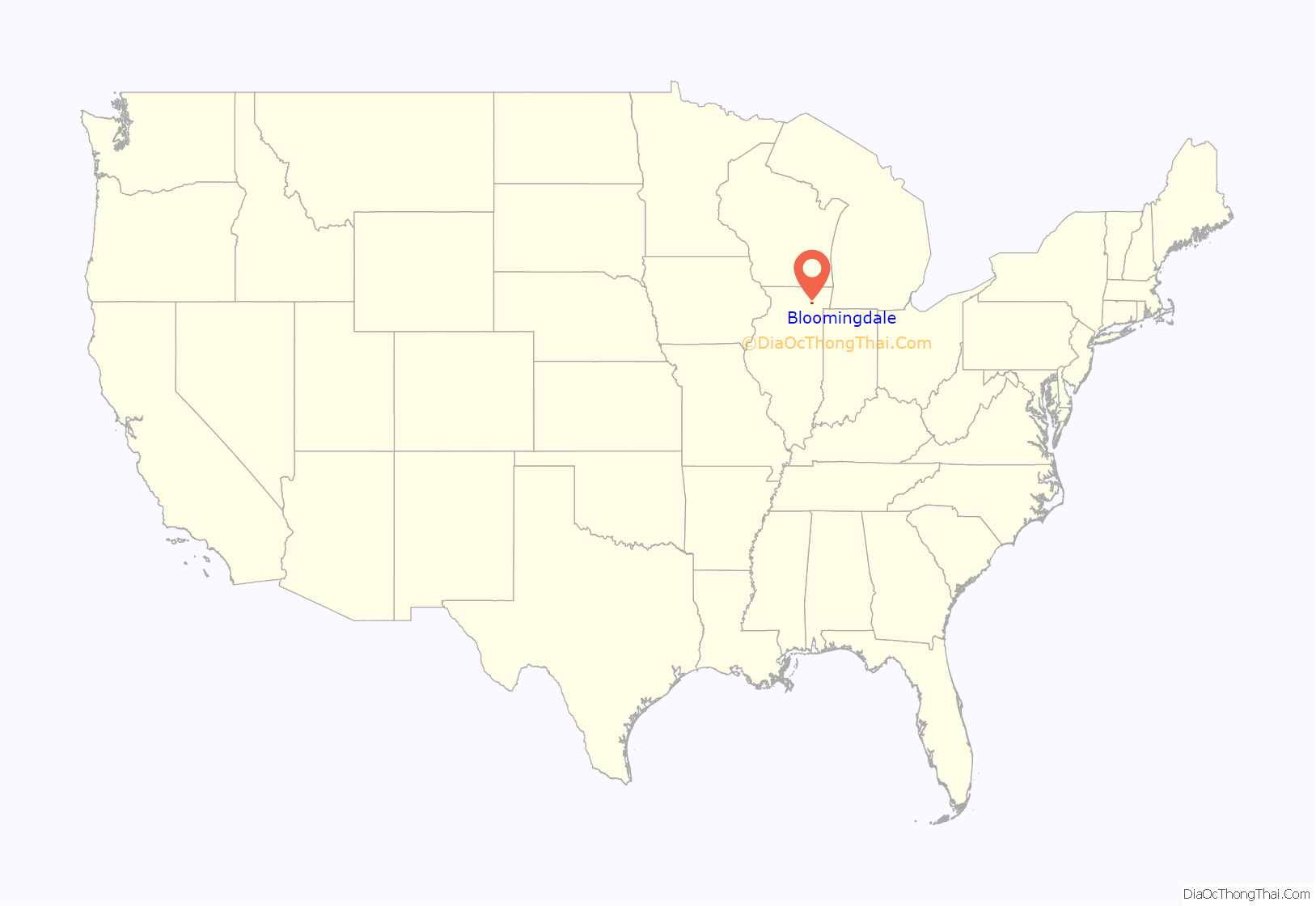
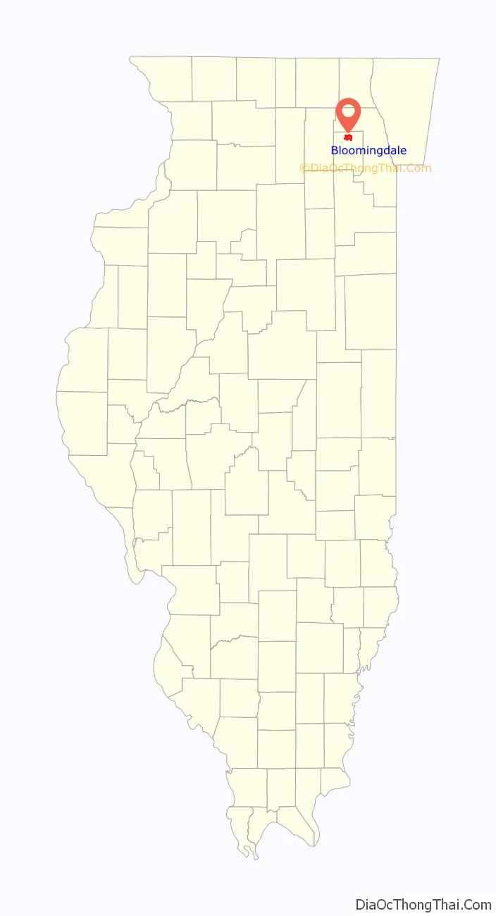
Bloomingdale location map. Where is Bloomingdale village?
History
Bloomingdale is one of the earliest villages settled in what is now DuPage County. The Puzia family settled here in 1833, and by the end of the following year, 12 to 15 families had settled in the locality. It was originally named Meacham’s Grove. The community was served by the Chicago-Galena Highway, modern day Lake Street. It became an important stop for stage coaches and westward travelers. Originally a Cook County settlement, it was annexed by DuPage County in 1839. The northern part of the village wanted to develop commercially while the southern part wished to remain a farming community. In 1923, the village split to accommodate this—the northern portion of the town was incorporated as Roselle. From 1950 to 1980, the population increased from 338 to 12,659.
The landmark U.S. Supreme Court case Illinois v. Gates began with an anonymous letter written to the Bloomingdale police department.
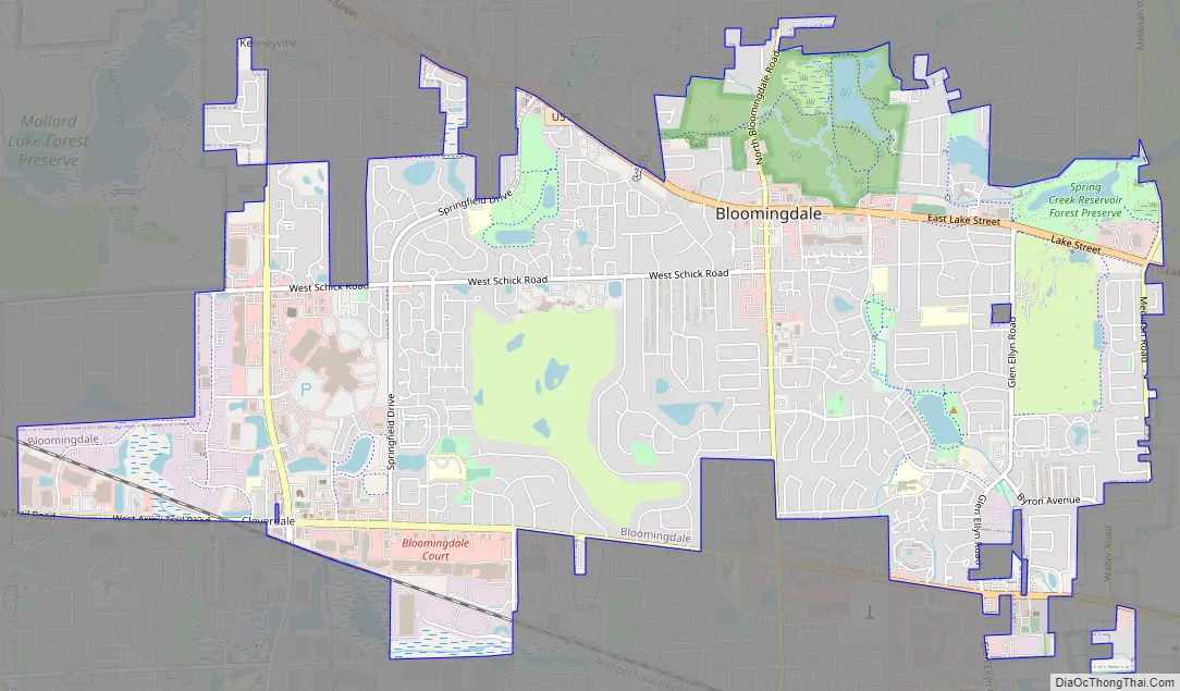
Bloomingdale Road Map
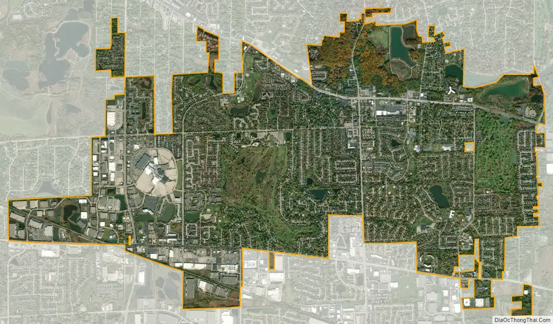
Bloomingdale city Satellite Map
Geography
Bloomingdale is located at 41°56′58″N 88°4′57″W / 41.94944°N 88.08250°W / 41.94944; -88.08250 (41.949540, -88.082564).
According to the 2021 census gazetteer files, Bloomingdale has a total area of 7.03 square miles (18.21 km), of which 6.77 square miles (17.53 km) (or 96.29%) is land and 0.26 square miles (0.67 km) (or 3.71%) is water.
See also
Map of Illinois State and its subdivision:- Adams
- Alexander
- Bond
- Boone
- Brown
- Bureau
- Calhoun
- Carroll
- Cass
- Champaign
- Christian
- Clark
- Clay
- Clinton
- Coles
- Cook
- Crawford
- Cumberland
- De Kalb
- De Witt
- Douglas
- Dupage
- Edgar
- Edwards
- Effingham
- Fayette
- Ford
- Franklin
- Fulton
- Gallatin
- Greene
- Grundy
- Hamilton
- Hancock
- Hardin
- Henderson
- Henry
- Iroquois
- Jackson
- Jasper
- Jefferson
- Jersey
- Jo Daviess
- Johnson
- Kane
- Kankakee
- Kendall
- Knox
- La Salle
- Lake
- Lake Michigan
- Lawrence
- Lee
- Livingston
- Logan
- Macon
- Macoupin
- Madison
- Marion
- Marshall
- Mason
- Massac
- McDonough
- McHenry
- McLean
- Menard
- Mercer
- Monroe
- Montgomery
- Morgan
- Moultrie
- Ogle
- Peoria
- Perry
- Piatt
- Pike
- Pope
- Pulaski
- Putnam
- Randolph
- Richland
- Rock Island
- Saint Clair
- Saline
- Sangamon
- Schuyler
- Scott
- Shelby
- Stark
- Stephenson
- Tazewell
- Union
- Vermilion
- Wabash
- Warren
- Washington
- Wayne
- White
- Whiteside
- Will
- Williamson
- Winnebago
- Woodford
- Alabama
- Alaska
- Arizona
- Arkansas
- California
- Colorado
- Connecticut
- Delaware
- District of Columbia
- Florida
- Georgia
- Hawaii
- Idaho
- Illinois
- Indiana
- Iowa
- Kansas
- Kentucky
- Louisiana
- Maine
- Maryland
- Massachusetts
- Michigan
- Minnesota
- Mississippi
- Missouri
- Montana
- Nebraska
- Nevada
- New Hampshire
- New Jersey
- New Mexico
- New York
- North Carolina
- North Dakota
- Ohio
- Oklahoma
- Oregon
- Pennsylvania
- Rhode Island
- South Carolina
- South Dakota
- Tennessee
- Texas
- Utah
- Vermont
- Virginia
- Washington
- West Virginia
- Wisconsin
- Wyoming