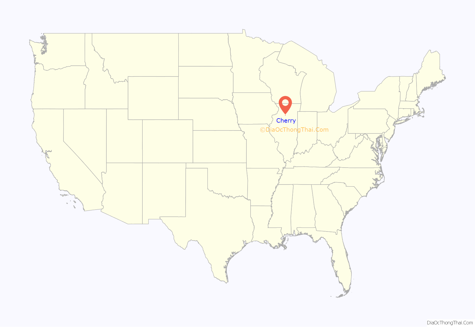
Cherry is a village in Bureau County, Illinois, United States. The population was 435 at the 2020 census. It is part of the Ottawa Micropolitan Statistical Area. It is located northwest of LaSalle–Peru, just a few miles north of Interstate 80, and is about 75 miles (121 km) east of the Quad Cities.
Cherry was the site of the Cherry Mine Disaster, which killed 259 coal miners in November 1909. This was the third most deadly mine disaster in U.S. history (as of 2005).
| Name: | Cherry village |
|---|---|
| LSAD Code: | 47 |
| LSAD Description: | village (suffix) |
| State: | Illinois |
| County: | Bureau County |
| Total Area: | 0.51 sq mi (1.3 km²) |
| Land Area: | 0.51 sq mi (1.3 km²) |
| Water Area: | 0.00 sq mi (0.0 km²) 0% |
| Total Population: | 435 |
| Population Density: | 850/sq mi (330/km²) |
| Area code: | 815 & 779 |
| FIPS code: | 1712970 |
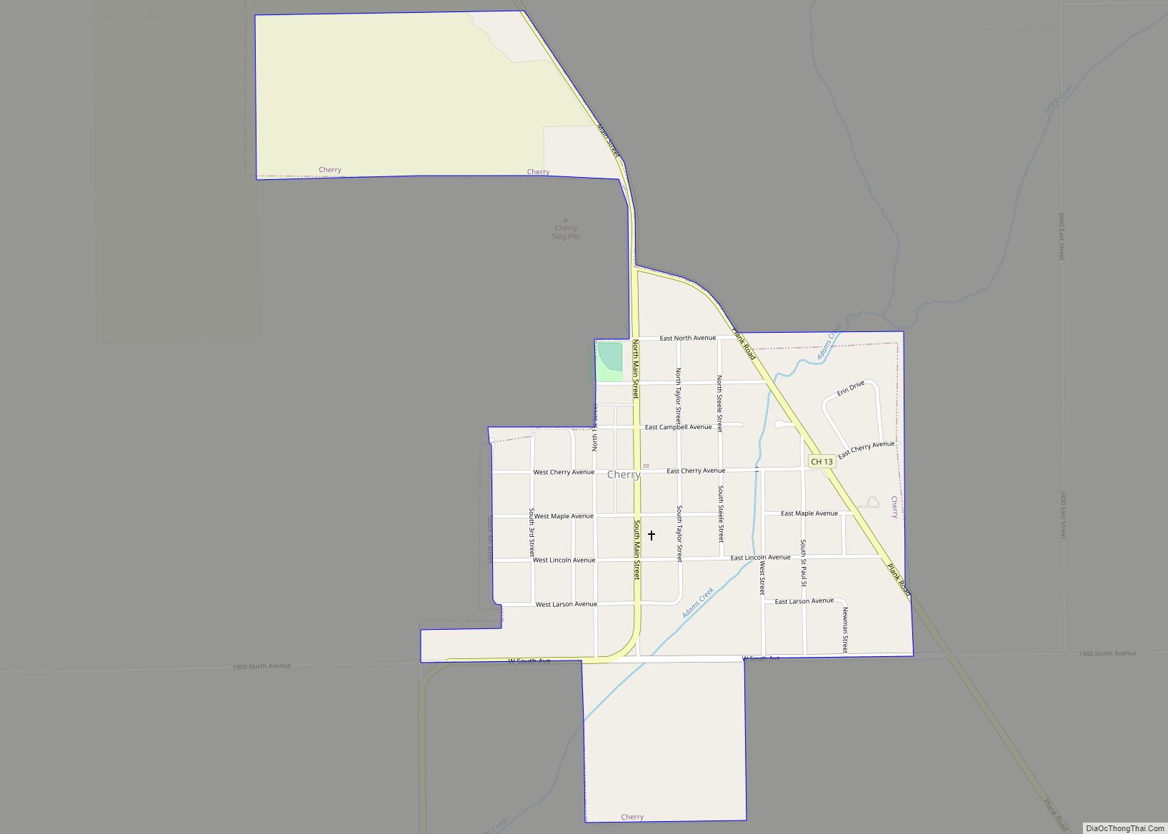
Online Interactive Map
Click on ![]() to view map in "full screen" mode.
to view map in "full screen" mode.
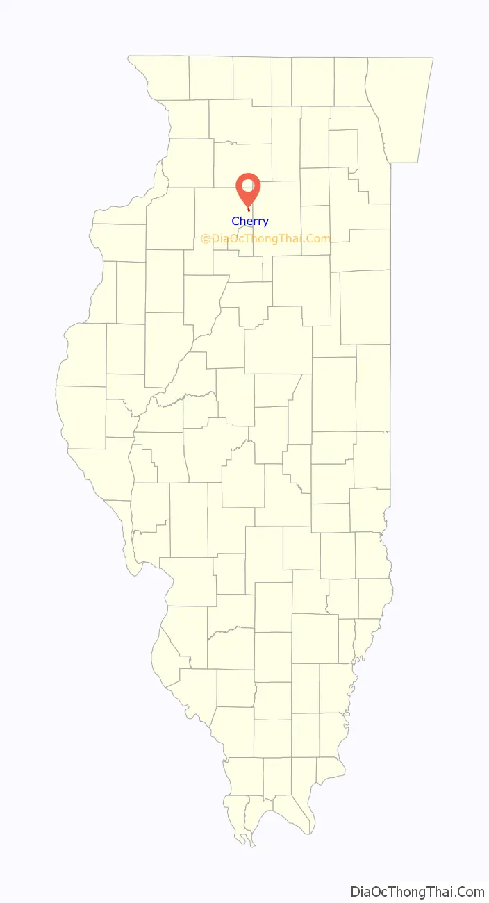
Cherry location map. Where is Cherry village?
History
The St. Paul Coal Company sank a shaft at the Cherry Mine in 1905. The mine supplied coal for Chicago, Milwaukee and St. Paul Railroad locomotives, and was named for the first mine superintendent, James Cherry. The Cherry Mine Disaster occurred in 1909, and remains one of the worst coal mining disasters in United States history. The disaster led to changes in US and Illinois mining and labor regulations, as well as enforced of child labor laws and the requirement in Illinois that mines have fire fighting equipment and more fireproof materials. Cherry Coal Company took over operations from 1929 until 1935 when it closed.
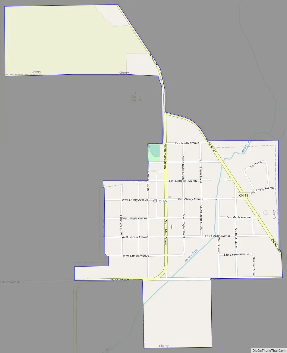
Cherry Road Map
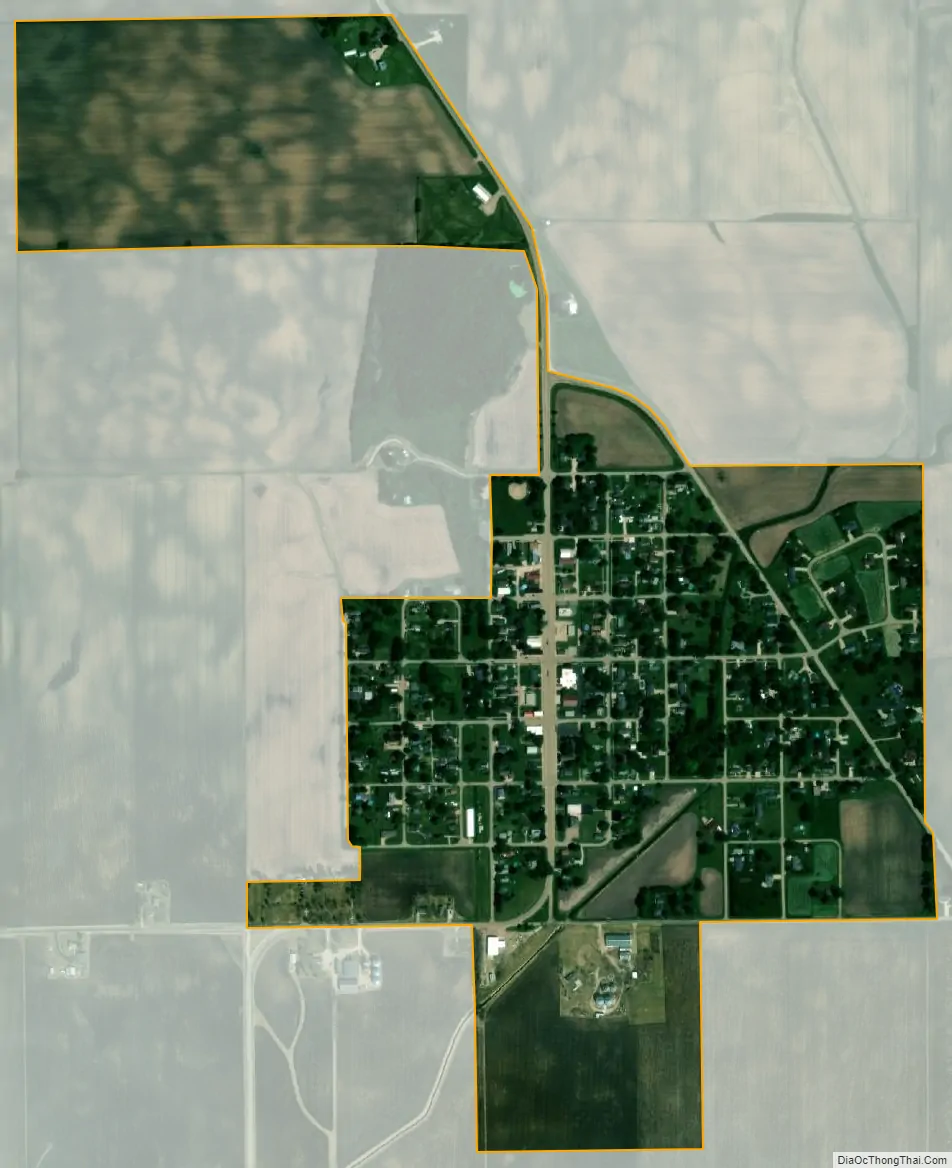
Cherry city Satellite Map
Geography
According to the 2021 census gazetteer files, Cherry has a total area of 0.51 square miles (1.32 km), all land.
See also
Map of Illinois State and its subdivision:- Adams
- Alexander
- Bond
- Boone
- Brown
- Bureau
- Calhoun
- Carroll
- Cass
- Champaign
- Christian
- Clark
- Clay
- Clinton
- Coles
- Cook
- Crawford
- Cumberland
- De Kalb
- De Witt
- Douglas
- Dupage
- Edgar
- Edwards
- Effingham
- Fayette
- Ford
- Franklin
- Fulton
- Gallatin
- Greene
- Grundy
- Hamilton
- Hancock
- Hardin
- Henderson
- Henry
- Iroquois
- Jackson
- Jasper
- Jefferson
- Jersey
- Jo Daviess
- Johnson
- Kane
- Kankakee
- Kendall
- Knox
- La Salle
- Lake
- Lake Michigan
- Lawrence
- Lee
- Livingston
- Logan
- Macon
- Macoupin
- Madison
- Marion
- Marshall
- Mason
- Massac
- McDonough
- McHenry
- McLean
- Menard
- Mercer
- Monroe
- Montgomery
- Morgan
- Moultrie
- Ogle
- Peoria
- Perry
- Piatt
- Pike
- Pope
- Pulaski
- Putnam
- Randolph
- Richland
- Rock Island
- Saint Clair
- Saline
- Sangamon
- Schuyler
- Scott
- Shelby
- Stark
- Stephenson
- Tazewell
- Union
- Vermilion
- Wabash
- Warren
- Washington
- Wayne
- White
- Whiteside
- Will
- Williamson
- Winnebago
- Woodford
- Alabama
- Alaska
- Arizona
- Arkansas
- California
- Colorado
- Connecticut
- Delaware
- District of Columbia
- Florida
- Georgia
- Hawaii
- Idaho
- Illinois
- Indiana
- Iowa
- Kansas
- Kentucky
- Louisiana
- Maine
- Maryland
- Massachusetts
- Michigan
- Minnesota
- Mississippi
- Missouri
- Montana
- Nebraska
- Nevada
- New Hampshire
- New Jersey
- New Mexico
- New York
- North Carolina
- North Dakota
- Ohio
- Oklahoma
- Oregon
- Pennsylvania
- Rhode Island
- South Carolina
- South Dakota
- Tennessee
- Texas
- Utah
- Vermont
- Virginia
- Washington
- West Virginia
- Wisconsin
- Wyoming