DePue is a village in Bureau County, Illinois, United States. The population was 1,633 at the 2020 census. It is part of the Ottawa Micropolitan Statistical Area.
| Name: | De Pue village |
|---|---|
| LSAD Code: | 47 |
| LSAD Description: | village (suffix) |
| State: | Illinois |
| County: | Bureau County |
| Total Area: | 2.55 sq mi (6.61 km²) |
| Land Area: | 2.45 sq mi (6.34 km²) |
| Water Area: | 0.11 sq mi (0.28 km²) |
| Total Population: | 1,633 |
| Population Density: | 667.35/sq mi (257.69/km²) |
| Area code: | 815 |
| FIPS code: | 1719499 |
| Website: | www.villageofdepue.com |
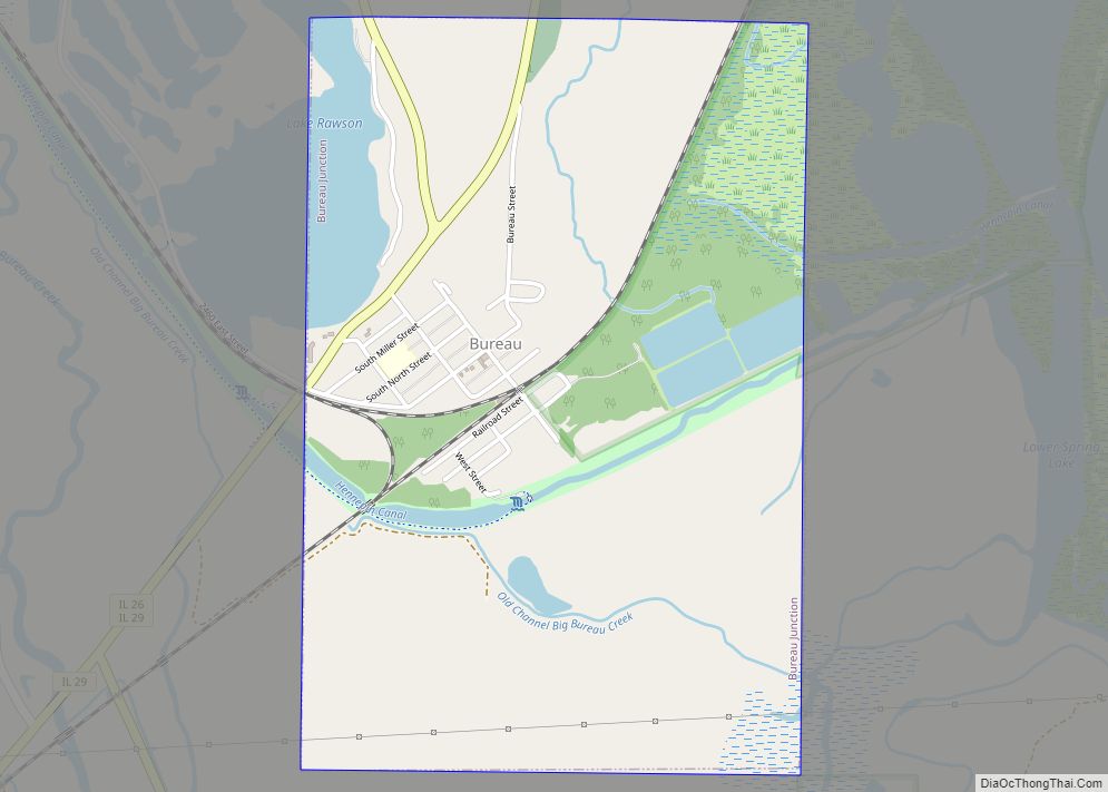
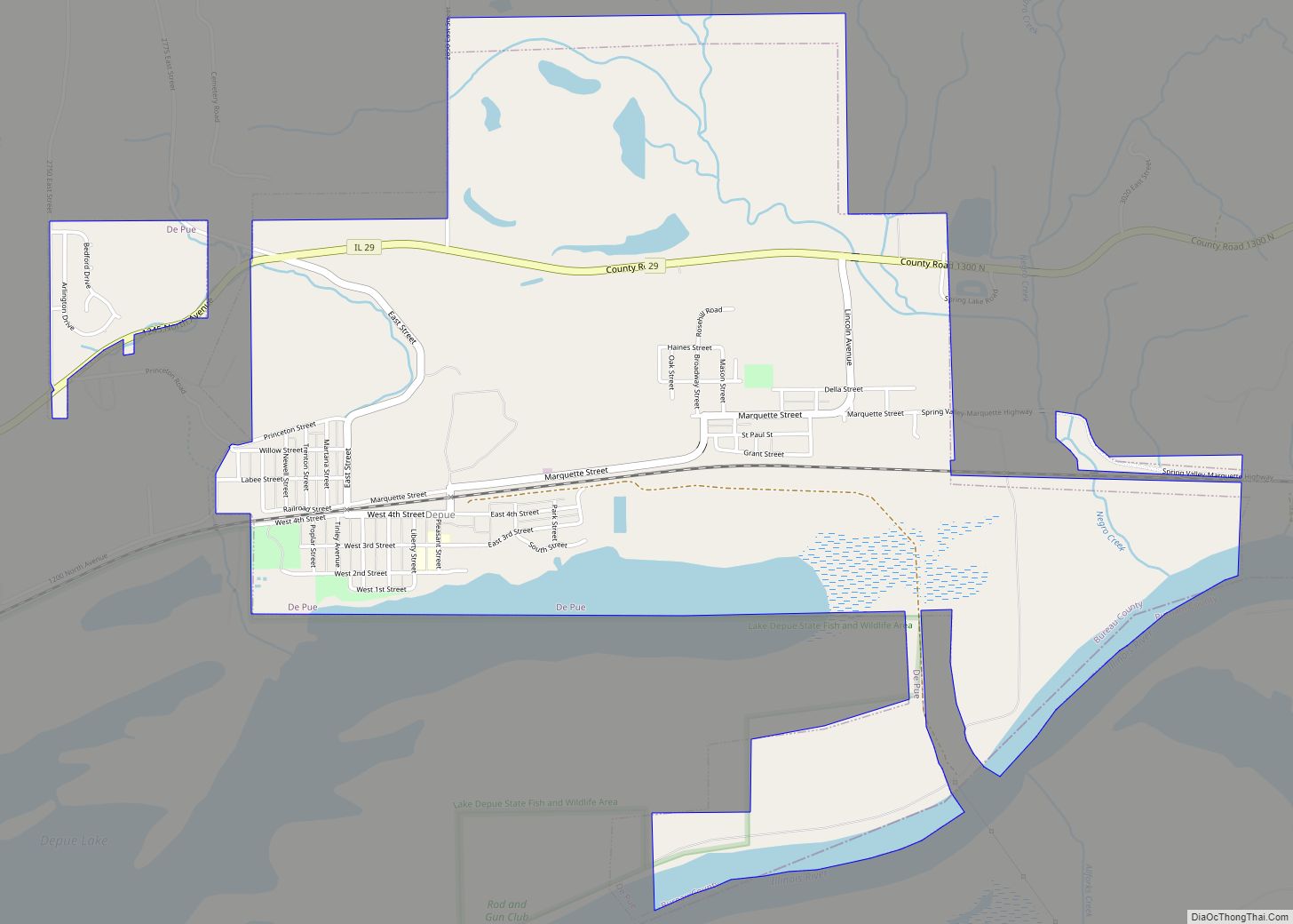
Online Interactive Map
Click on ![]() to view map in "full screen" mode.
to view map in "full screen" mode.
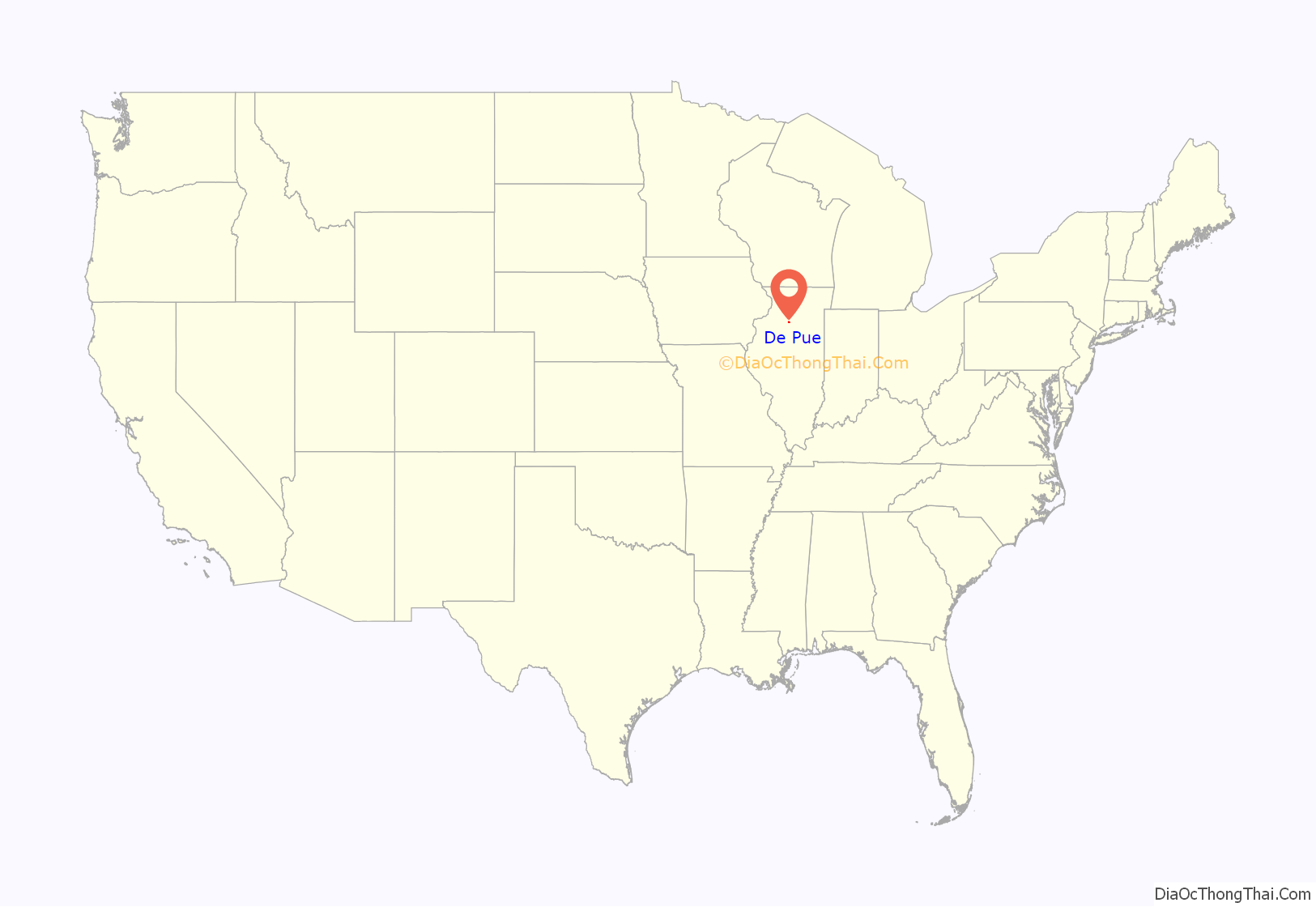
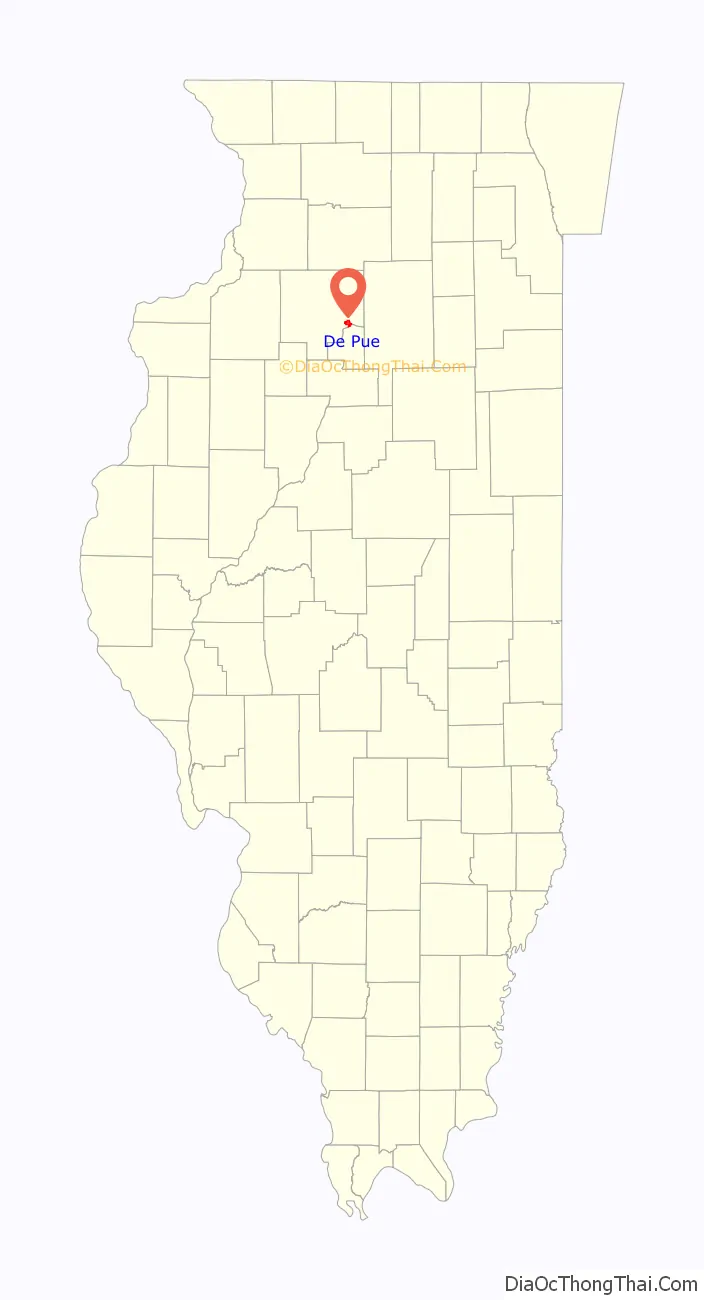
De Pue location map. Where is De Pue village?
History
DePue, originally called Trenton, was established in 1853. The present name refers to an early French fur trader by the name of De Pue. The site had long been used as a port and ice harvesting center on the Illinois River. In 1905, the Mineral Point Zinc Company started a plant to produce slab zinc for automobile and appliances in DePue, taking advantage of the nearby coalfields and trained labor force of the LaSalle–Peru zinc processing center. The plant was shortly after acquired by New Jersey Zinc and finally closed in 1990.
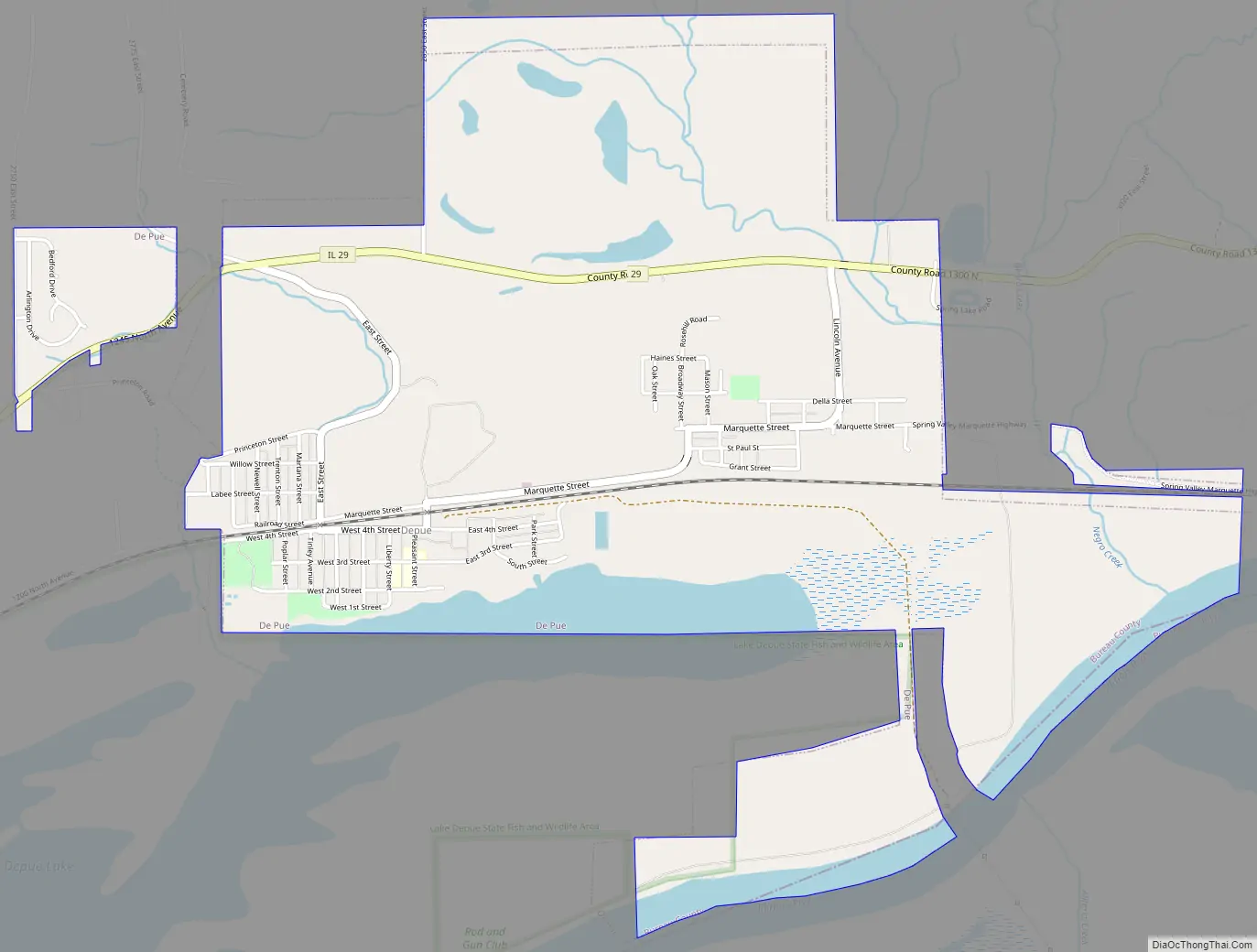
De Pue Road Map
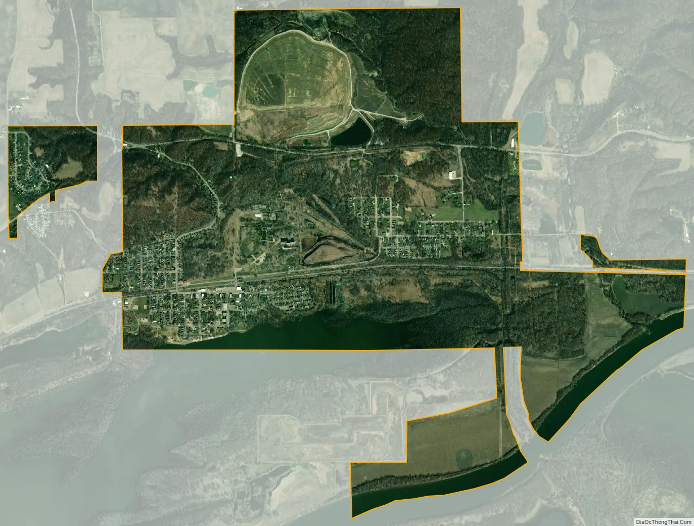
De Pue city Satellite Map
Geography
DePue is located at 41°19′34″N 89°18′4″W / 41.32611°N 89.30111°W / 41.32611; -89.30111 (41.326112, -89.301184).
According to the 2010 census, DePue has a total area of 2.999 square miles (7.77 km), of which 2.74 square miles (7.10 km) (or 91.36%) is land and 0.259 square miles (0.67 km) (or 8.64%) is water.
See also
Map of Illinois State and its subdivision:- Adams
- Alexander
- Bond
- Boone
- Brown
- Bureau
- Calhoun
- Carroll
- Cass
- Champaign
- Christian
- Clark
- Clay
- Clinton
- Coles
- Cook
- Crawford
- Cumberland
- De Kalb
- De Witt
- Douglas
- Dupage
- Edgar
- Edwards
- Effingham
- Fayette
- Ford
- Franklin
- Fulton
- Gallatin
- Greene
- Grundy
- Hamilton
- Hancock
- Hardin
- Henderson
- Henry
- Iroquois
- Jackson
- Jasper
- Jefferson
- Jersey
- Jo Daviess
- Johnson
- Kane
- Kankakee
- Kendall
- Knox
- La Salle
- Lake
- Lake Michigan
- Lawrence
- Lee
- Livingston
- Logan
- Macon
- Macoupin
- Madison
- Marion
- Marshall
- Mason
- Massac
- McDonough
- McHenry
- McLean
- Menard
- Mercer
- Monroe
- Montgomery
- Morgan
- Moultrie
- Ogle
- Peoria
- Perry
- Piatt
- Pike
- Pope
- Pulaski
- Putnam
- Randolph
- Richland
- Rock Island
- Saint Clair
- Saline
- Sangamon
- Schuyler
- Scott
- Shelby
- Stark
- Stephenson
- Tazewell
- Union
- Vermilion
- Wabash
- Warren
- Washington
- Wayne
- White
- Whiteside
- Will
- Williamson
- Winnebago
- Woodford
- Alabama
- Alaska
- Arizona
- Arkansas
- California
- Colorado
- Connecticut
- Delaware
- District of Columbia
- Florida
- Georgia
- Hawaii
- Idaho
- Illinois
- Indiana
- Iowa
- Kansas
- Kentucky
- Louisiana
- Maine
- Maryland
- Massachusetts
- Michigan
- Minnesota
- Mississippi
- Missouri
- Montana
- Nebraska
- Nevada
- New Hampshire
- New Jersey
- New Mexico
- New York
- North Carolina
- North Dakota
- Ohio
- Oklahoma
- Oregon
- Pennsylvania
- Rhode Island
- South Carolina
- South Dakota
- Tennessee
- Texas
- Utah
- Vermont
- Virginia
- Washington
- West Virginia
- Wisconsin
- Wyoming