Diamond is a village in Grundy and Will Counties, Illinois. The population was 2,527 at the 2010 census. Terry Kernc is the current mayor of Diamond.
| Name: | Diamond village |
|---|---|
| LSAD Code: | 47 |
| LSAD Description: | village (suffix) |
| State: | Illinois |
| County: | Grundy County, Will County |
| Elevation: | 561 ft (171 m) |
| Total Area: | 1.90 sq mi (4.92 km²) |
| Land Area: | 1.90 sq mi (4.92 km²) |
| Water Area: | 0.00 sq mi (0.00 km²) |
| Total Population: | 2,640 |
| Population Density: | 1,389.47/sq mi (536.58/km²) |
| FIPS code: | 1719837 |
| Website: | www.villageofdiamond.org |
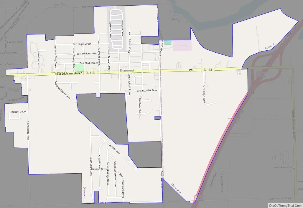
Online Interactive Map
Click on ![]() to view map in "full screen" mode.
to view map in "full screen" mode.
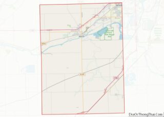
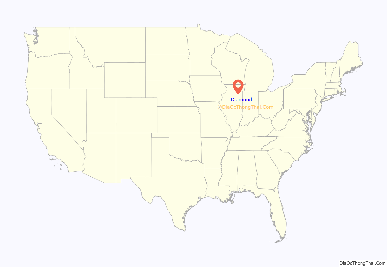
Diamond location map. Where is Diamond village?
History
A post office called Diamond was established in 1872, and remained in operation until 1909. Black Diamond had its start as a coal town. The village was named for its location in the center of the “Black Diamond” coal district.
On February 16, 1883 the Diamond Mine flooded, killing 72 miners. A monument was erected in Diamond memorializing the event.
On November 17, 2013, an EF-2 tornado hit Diamond.
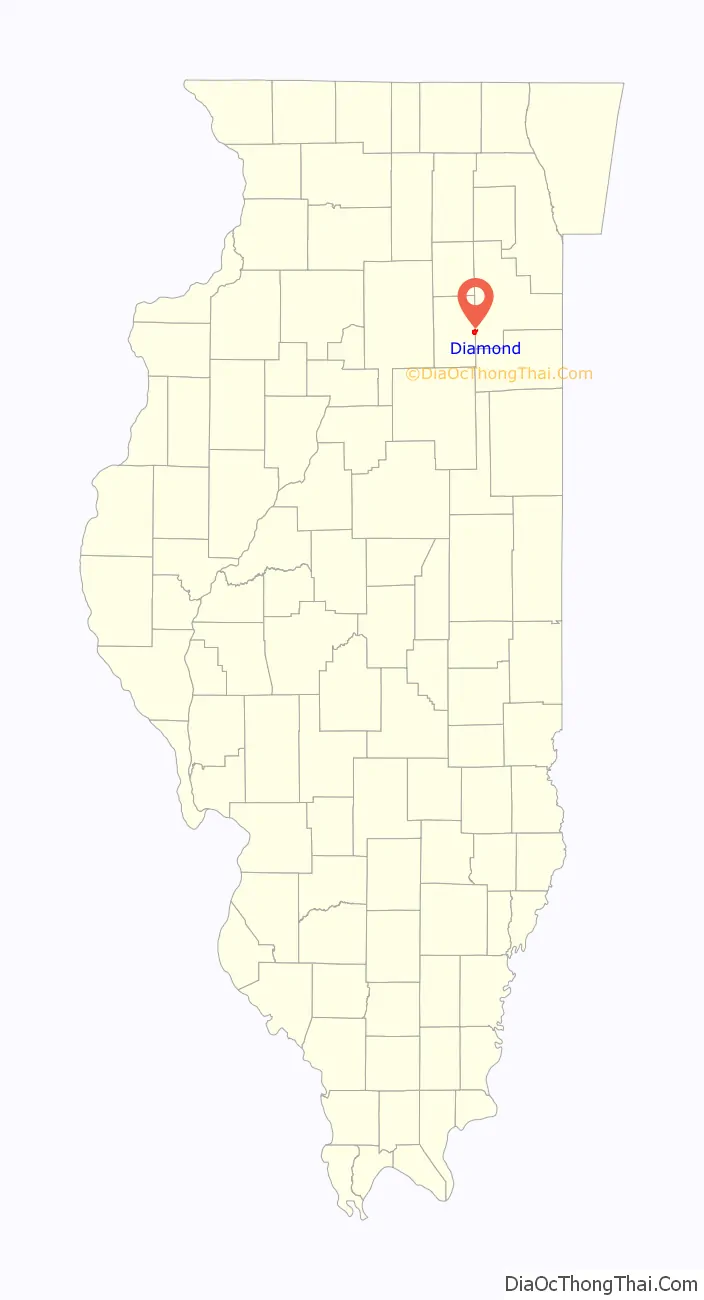
Diamond Road Map
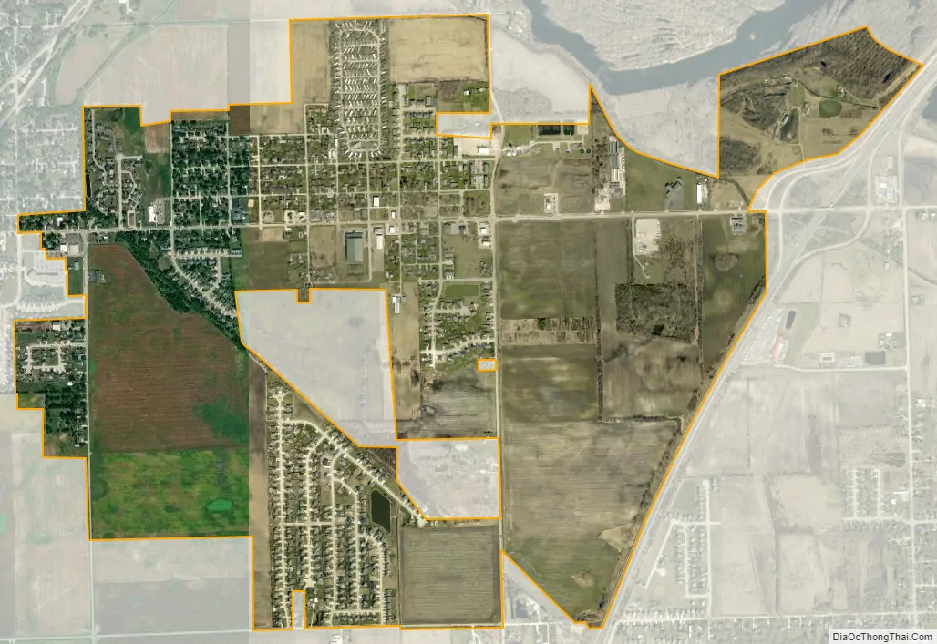
Diamond city Satellite Map
Geography
Diamond is located at 41°17′16″N 88°15′14″W / 41.28778°N 88.25389°W / 41.28778; -88.25389 (41.287699, -88.253824).
According to the 2010 census, Diamond has a total area of 1.89 square miles (4.90 km), all land.
See also
Map of Illinois State and its subdivision:- Adams
- Alexander
- Bond
- Boone
- Brown
- Bureau
- Calhoun
- Carroll
- Cass
- Champaign
- Christian
- Clark
- Clay
- Clinton
- Coles
- Cook
- Crawford
- Cumberland
- De Kalb
- De Witt
- Douglas
- Dupage
- Edgar
- Edwards
- Effingham
- Fayette
- Ford
- Franklin
- Fulton
- Gallatin
- Greene
- Grundy
- Hamilton
- Hancock
- Hardin
- Henderson
- Henry
- Iroquois
- Jackson
- Jasper
- Jefferson
- Jersey
- Jo Daviess
- Johnson
- Kane
- Kankakee
- Kendall
- Knox
- La Salle
- Lake
- Lake Michigan
- Lawrence
- Lee
- Livingston
- Logan
- Macon
- Macoupin
- Madison
- Marion
- Marshall
- Mason
- Massac
- McDonough
- McHenry
- McLean
- Menard
- Mercer
- Monroe
- Montgomery
- Morgan
- Moultrie
- Ogle
- Peoria
- Perry
- Piatt
- Pike
- Pope
- Pulaski
- Putnam
- Randolph
- Richland
- Rock Island
- Saint Clair
- Saline
- Sangamon
- Schuyler
- Scott
- Shelby
- Stark
- Stephenson
- Tazewell
- Union
- Vermilion
- Wabash
- Warren
- Washington
- Wayne
- White
- Whiteside
- Will
- Williamson
- Winnebago
- Woodford
- Alabama
- Alaska
- Arizona
- Arkansas
- California
- Colorado
- Connecticut
- Delaware
- District of Columbia
- Florida
- Georgia
- Hawaii
- Idaho
- Illinois
- Indiana
- Iowa
- Kansas
- Kentucky
- Louisiana
- Maine
- Maryland
- Massachusetts
- Michigan
- Minnesota
- Mississippi
- Missouri
- Montana
- Nebraska
- Nevada
- New Hampshire
- New Jersey
- New Mexico
- New York
- North Carolina
- North Dakota
- Ohio
- Oklahoma
- Oregon
- Pennsylvania
- Rhode Island
- South Carolina
- South Dakota
- Tennessee
- Texas
- Utah
- Vermont
- Virginia
- Washington
- West Virginia
- Wisconsin
- Wyoming