Glendale Heights is a village in DuPage County, Illinois, United States. Per the 2020 census, the population was 33,176. The village is almost entirely residential, and is a far west suburb of Chicago.
| Name: | Glendale Heights village |
|---|---|
| LSAD Code: | 47 |
| LSAD Description: | village (suffix) |
| State: | Illinois |
| County: | DuPage County |
| Incorporated: | 1959 |
| Total Area: | 5.53 sq mi (14.31 km²) |
| Land Area: | 5.38 sq mi (13.95 km²) |
| Water Area: | 0.14 sq mi (0.36 km²) |
| Total Population: | 33,176 |
| Population Density: | 6,160.82/sq mi (2,378.76/km²) |
| Area code: | 630 and 331 |
| FIPS code: | 1729730 |
| Website: | www.glendaleheights.org |
Online Interactive Map
Click on ![]() to view map in "full screen" mode.
to view map in "full screen" mode.
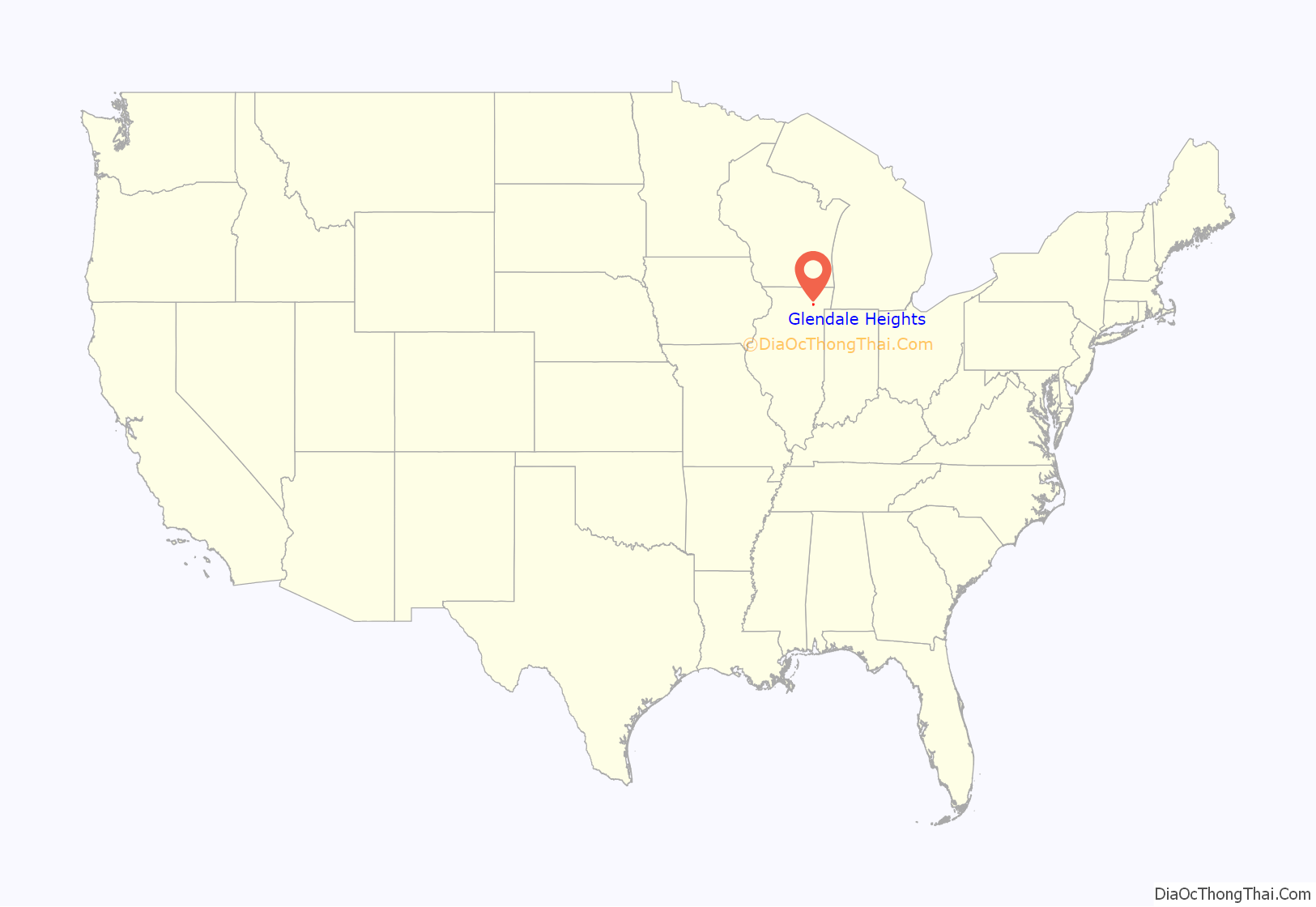
Glendale Heights location map. Where is Glendale Heights village?
History
Glendale Heights was a small farming area served by the Glen Ellyn post office up until the 1950s, with a population of just 104 in 1959. Midland Enterprises ran by Charles and Harold Reskin started building houses in Glendale Heights in 1958. The Reskins bought two farms on Glen Ellyn Road north of North Avenue. Houses were first built on Glen Ellyn Road and Larry Lane near Fullerton Avenue. On June 16, 1959, a petition was filed and on July 13, the village became incorporated. The first election was held later on that summer on August 2.
The town was originally named Glendale as it was between Glen Ellyn and Bloomingdale, but after a conflict arose with the small town of Glendale in Southern Illinois, the city decided in March 1960 to add the term Heights, in reference to its different topographies, a difference of about 100 feet because of its location straddling the Valparaiso Morraine, thus becoming Glendale Heights.
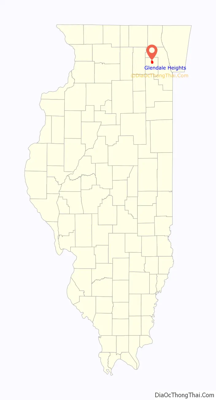
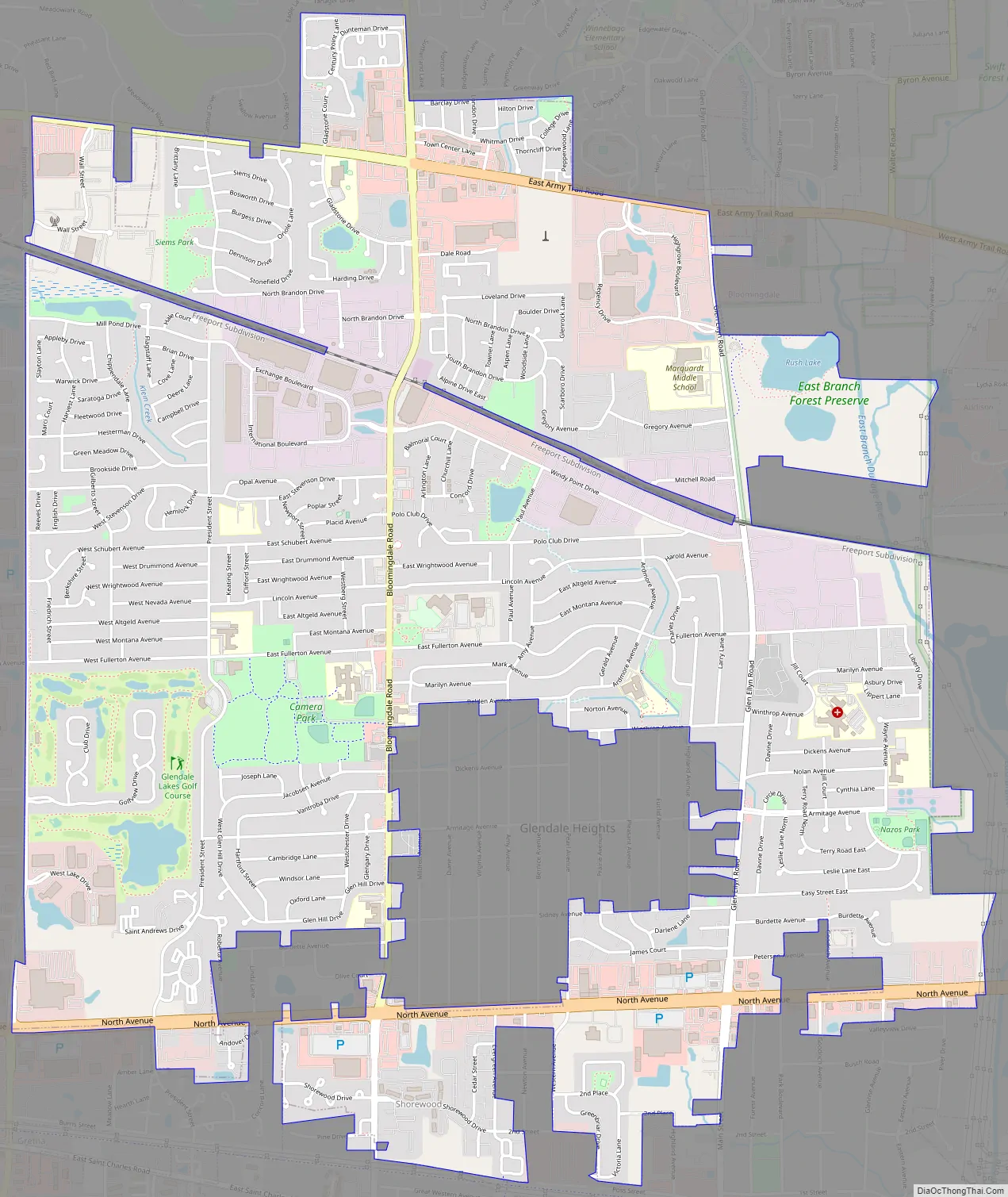
Glendale Heights Road Map
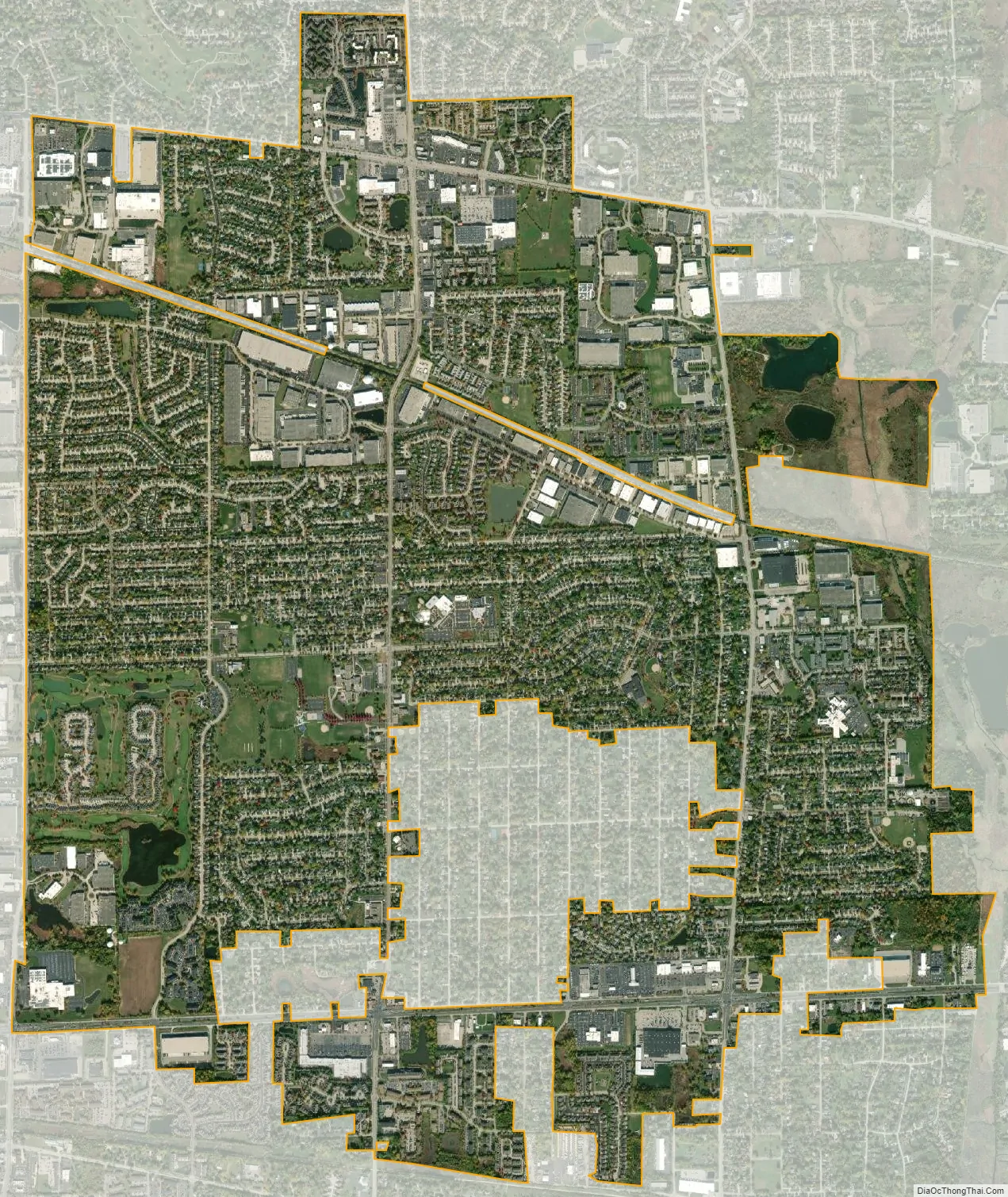
Glendale Heights city Satellite Map
Geography
Glendale Heights is located at 41°55′13″N 88°4′44″W / 41.92028°N 88.07889°W / 41.92028; -88.07889 (41.920228, −88.078918).
According to the 2021 census gazetteer files, Glendale Heights has a total area of 5.53 square miles (14.32 km), of which 5.39 square miles (13.96 km) (or 97.45%) is land and 0.14 square miles (0.36 km) (or 2.55%) is water.
See also
Map of Illinois State and its subdivision:- Adams
- Alexander
- Bond
- Boone
- Brown
- Bureau
- Calhoun
- Carroll
- Cass
- Champaign
- Christian
- Clark
- Clay
- Clinton
- Coles
- Cook
- Crawford
- Cumberland
- De Kalb
- De Witt
- Douglas
- Dupage
- Edgar
- Edwards
- Effingham
- Fayette
- Ford
- Franklin
- Fulton
- Gallatin
- Greene
- Grundy
- Hamilton
- Hancock
- Hardin
- Henderson
- Henry
- Iroquois
- Jackson
- Jasper
- Jefferson
- Jersey
- Jo Daviess
- Johnson
- Kane
- Kankakee
- Kendall
- Knox
- La Salle
- Lake
- Lake Michigan
- Lawrence
- Lee
- Livingston
- Logan
- Macon
- Macoupin
- Madison
- Marion
- Marshall
- Mason
- Massac
- McDonough
- McHenry
- McLean
- Menard
- Mercer
- Monroe
- Montgomery
- Morgan
- Moultrie
- Ogle
- Peoria
- Perry
- Piatt
- Pike
- Pope
- Pulaski
- Putnam
- Randolph
- Richland
- Rock Island
- Saint Clair
- Saline
- Sangamon
- Schuyler
- Scott
- Shelby
- Stark
- Stephenson
- Tazewell
- Union
- Vermilion
- Wabash
- Warren
- Washington
- Wayne
- White
- Whiteside
- Will
- Williamson
- Winnebago
- Woodford
- Alabama
- Alaska
- Arizona
- Arkansas
- California
- Colorado
- Connecticut
- Delaware
- District of Columbia
- Florida
- Georgia
- Hawaii
- Idaho
- Illinois
- Indiana
- Iowa
- Kansas
- Kentucky
- Louisiana
- Maine
- Maryland
- Massachusetts
- Michigan
- Minnesota
- Mississippi
- Missouri
- Montana
- Nebraska
- Nevada
- New Hampshire
- New Jersey
- New Mexico
- New York
- North Carolina
- North Dakota
- Ohio
- Oklahoma
- Oregon
- Pennsylvania
- Rhode Island
- South Carolina
- South Dakota
- Tennessee
- Texas
- Utah
- Vermont
- Virginia
- Washington
- West Virginia
- Wisconsin
- Wyoming