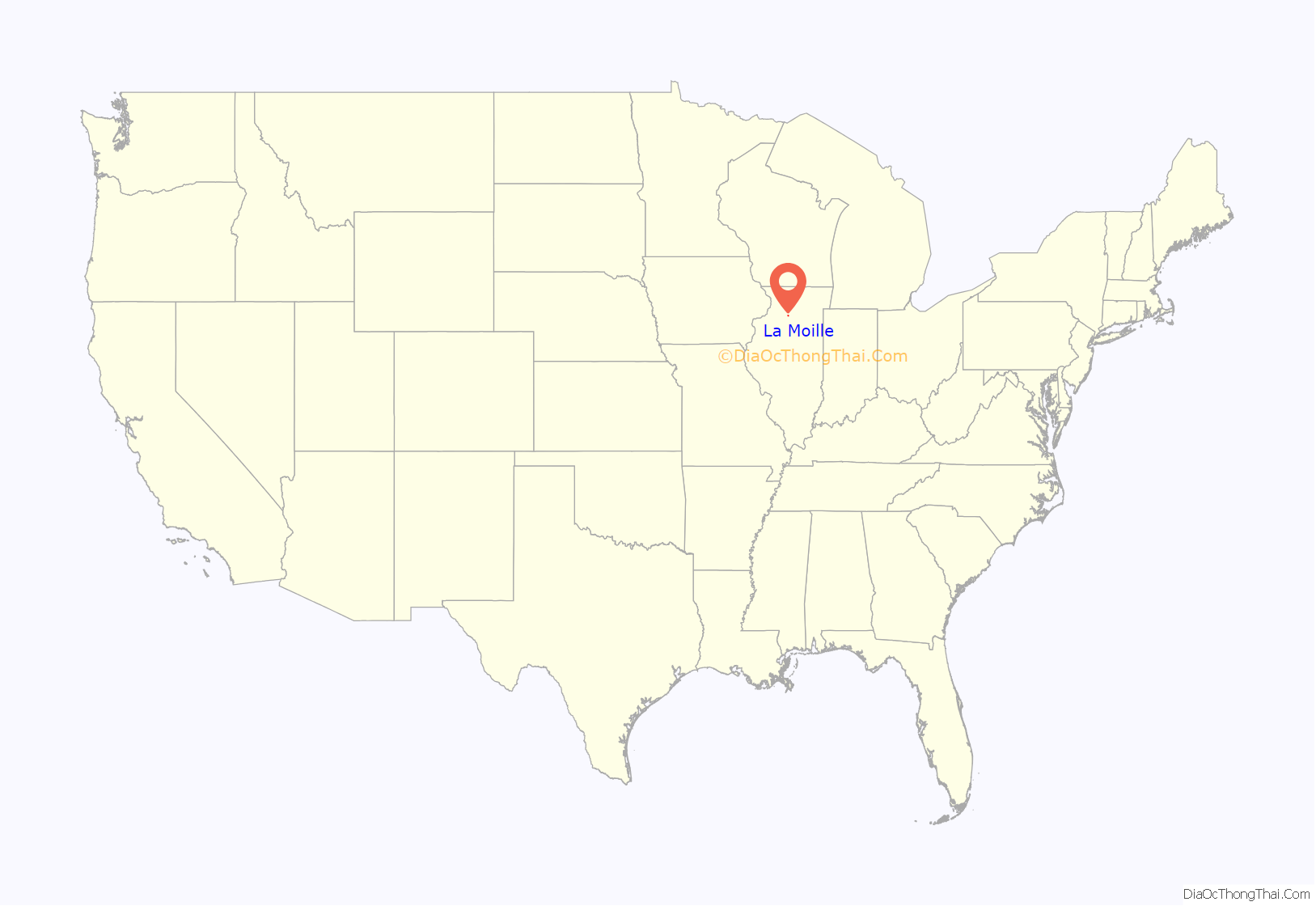
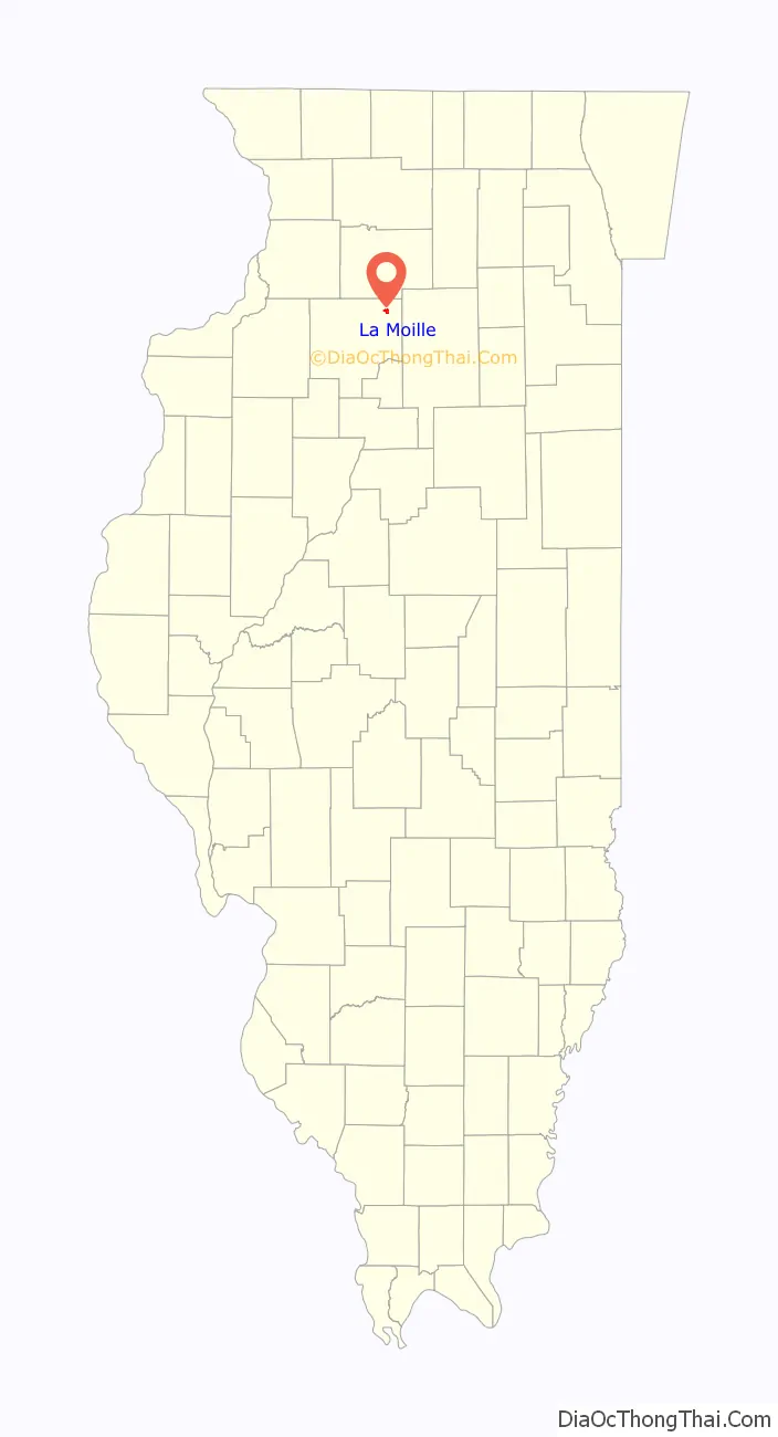
La Moille is a village in Bureau County, Illinois, United States. The population was 679 at the 2020 census. It is part of the Ottawa Micropolitan Statistical Area.
La Moille was named after the Lamoille River valley, in Vermont.
| Name: | La Moille village |
|---|---|
| LSAD Code: | 47 |
| LSAD Description: | village (suffix) |
| State: | Illinois |
| County: | Bureau County |
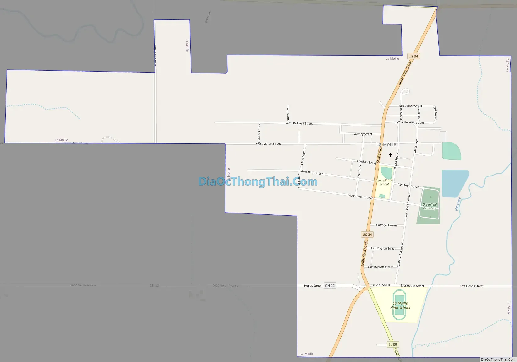
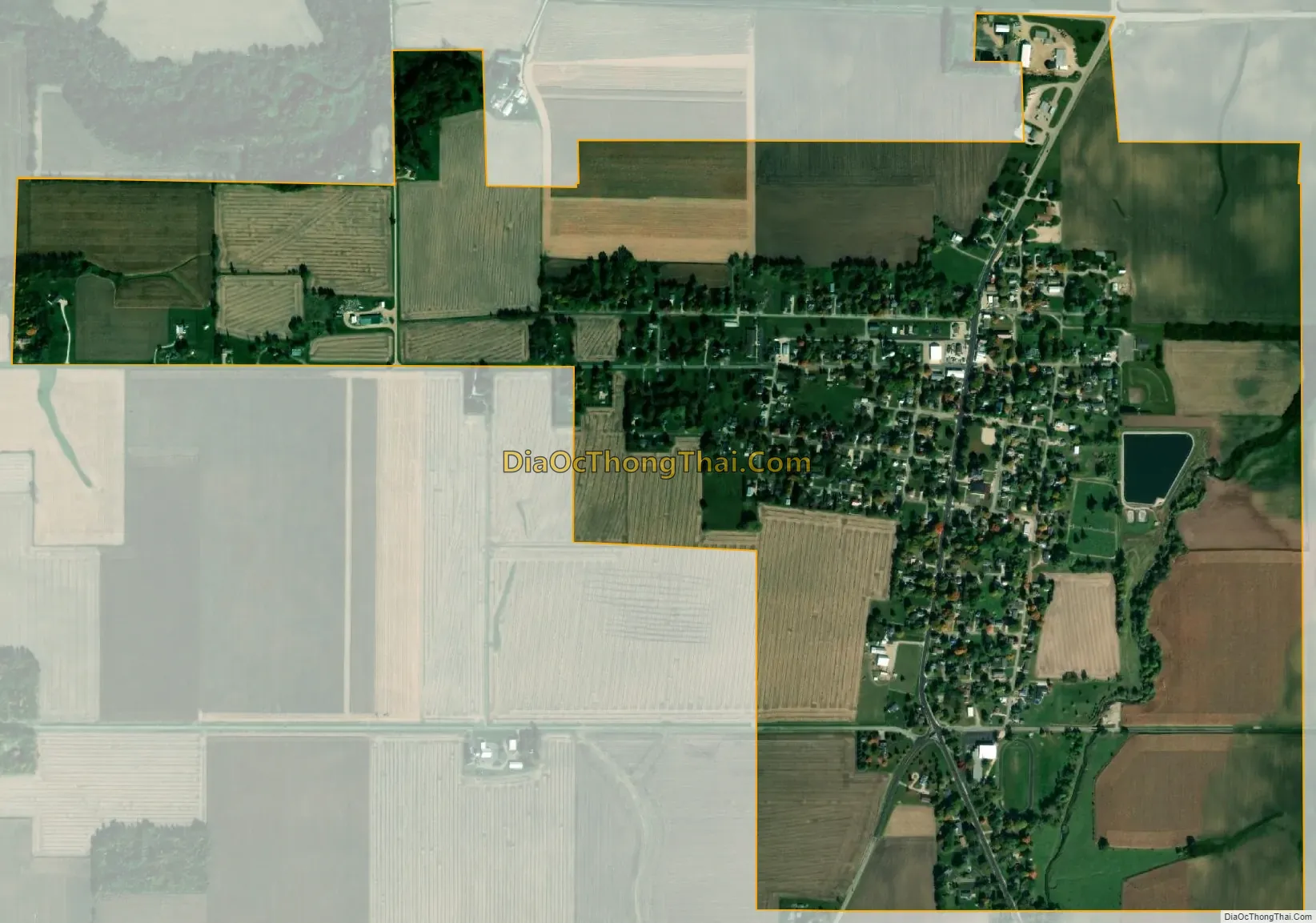
| Total Area: | 1.16 sq mi (3.0 km²) |
| Land Area: | 1.16 sq mi (3.0 km²) |
| Water Area: | 0.00 sq mi (0.0 km²) 0% |
| Total Population: | 679 |
| Population Density: | 590/sq mi (230/km²) |
| Area code: | 815 |
| FIPS code: | 1741794 |
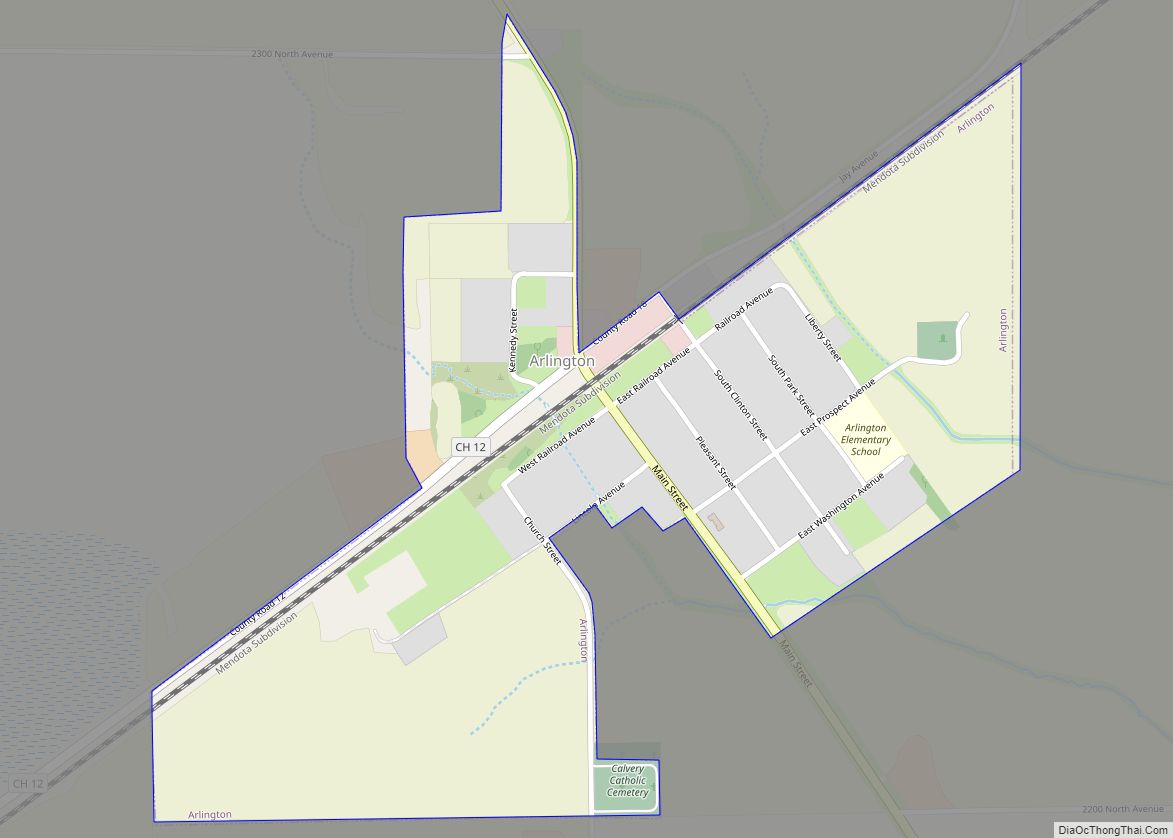
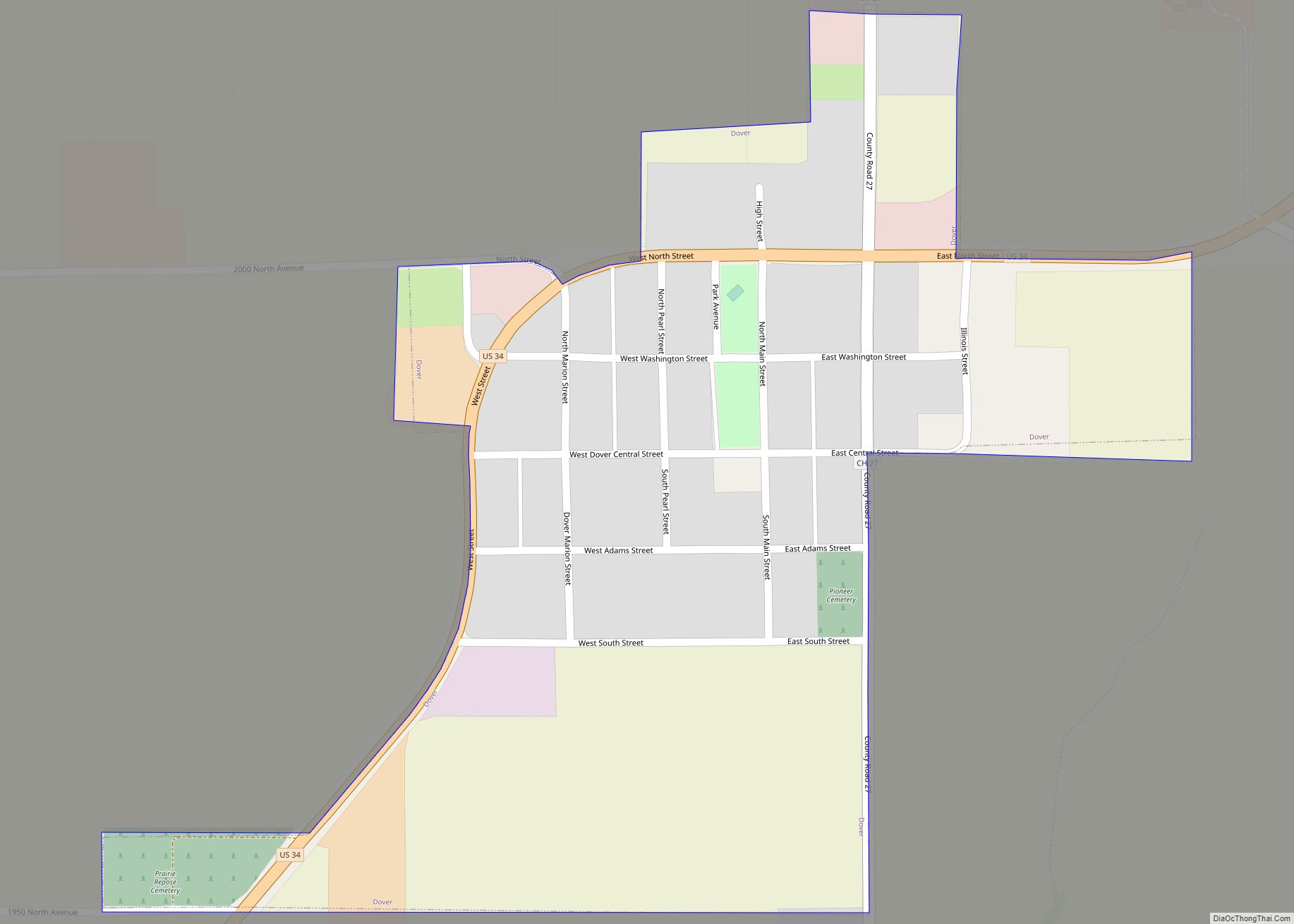
Online Interactive Map
Click on ![]() to view map in "full screen" mode.
to view map in "full screen" mode.
La Moille location map. Where is La Moille village?
History
La Moille was first settled in 1830 by Daniel Dimmick, who went on to found Dimmick, Illinois after the Blackhawk War. The village was originally named Greenfield when platted, but was soon after changed to La Moille. In 1870, an extension of the Chicago, Burlington, and Quincy Railroad began passenger and freight service between Mendota, IL and Fulton, IL.
By 1877, the town was home to a hotel, several churches, more than a dozen stores, a grain elevator, doctors, and a one room schoolhouse. These businesses made up a downtown area of three blocks. The Allen School was built in 1887 to alleviate overcrowding brought on by the increasing population and consolidation of public schools. A fire on May 19, 1916, destroyed much of the northern portion of the downtown area.
La Moille Road Map
La Moille city Satellite Map
Geography
La Moille is located at 41°31′45″N 89°16′52″W / 41.52917°N 89.28111°W / 41.52917; -89.28111 (41.529204, -89.281187).
According to the 2021 census gazetteer files, La Moille has a total area of 1.16 square miles (3.00 km), all land.
The village is at the junction of State Highway 92 and U.S. Route 34, as well as State Highway 89 and U.S. Route 34.
Pike Creek, a tributary to Big Bureau Creek, flows south through the town.
See also
Map of Illinois State and its subdivision:- Adams
- Alexander
- Bond
- Boone
- Brown
- Bureau
- Calhoun
- Carroll
- Cass
- Champaign
- Christian
- Clark
- Clay
- Clinton
- Coles
- Cook
- Crawford
- Cumberland
- De Kalb
- De Witt
- Douglas
- Dupage
- Edgar
- Edwards
- Effingham
- Fayette
- Ford
- Franklin
- Fulton
- Gallatin
- Greene
- Grundy
- Hamilton
- Hancock
- Hardin
- Henderson
- Henry
- Iroquois
- Jackson
- Jasper
- Jefferson
- Jersey
- Jo Daviess
- Johnson
- Kane
- Kankakee
- Kendall
- Knox
- La Salle
- Lake
- Lake Michigan
- Lawrence
- Lee
- Livingston
- Logan
- Macon
- Macoupin
- Madison
- Marion
- Marshall
- Mason
- Massac
- McDonough
- McHenry
- McLean
- Menard
- Mercer
- Monroe
- Montgomery
- Morgan
- Moultrie
- Ogle
- Peoria
- Perry
- Piatt
- Pike
- Pope
- Pulaski
- Putnam
- Randolph
- Richland
- Rock Island
- Saint Clair
- Saline
- Sangamon
- Schuyler
- Scott
- Shelby
- Stark
- Stephenson
- Tazewell
- Union
- Vermilion
- Wabash
- Warren
- Washington
- Wayne
- White
- Whiteside
- Will
- Williamson
- Winnebago
- Woodford
- Alabama
- Alaska
- Arizona
- Arkansas
- California
- Colorado
- Connecticut
- Delaware
- District of Columbia
- Florida
- Georgia
- Hawaii
- Idaho
- Illinois
- Indiana
- Iowa
- Kansas
- Kentucky
- Louisiana
- Maine
- Maryland
- Massachusetts
- Michigan
- Minnesota
- Mississippi
- Missouri
- Montana
- Nebraska
- Nevada
- New Hampshire
- New Jersey
- New Mexico
- New York
- North Carolina
- North Dakota
- Ohio
- Oklahoma
- Oregon
- Pennsylvania
- Rhode Island
- South Carolina
- South Dakota
- Tennessee
- Texas
- Utah
- Vermont
- Virginia
- Washington
- West Virginia
- Wisconsin
- Wyoming