Lombard is a village in DuPage County, Illinois, United States, and a suburb of Chicago. The population was 44,476 at the 2020 census.
| Name: | Lombard village |
|---|---|
| LSAD Code: | 47 |
| LSAD Description: | village (suffix) |
| State: | Illinois |
| County: | DuPage County |
| Incorporated: | 1869 |
| Total Area: | 10.41 sq mi (26.95 km²) |
| Land Area: | 10.22 sq mi (26.47 km²) |
| Water Area: | 0.19 sq mi (0.48 km²) 1.91% |
| Total Population: | 44,476 |
| Population Density: | 4,351.86/sq mi (1,680.19/km²) |
| Area code: | 630 and 331 |
| FIPS code: | 1744407 |
| Website: | www.villageoflombard.org |
Online Interactive Map
Click on ![]() to view map in "full screen" mode.
to view map in "full screen" mode.
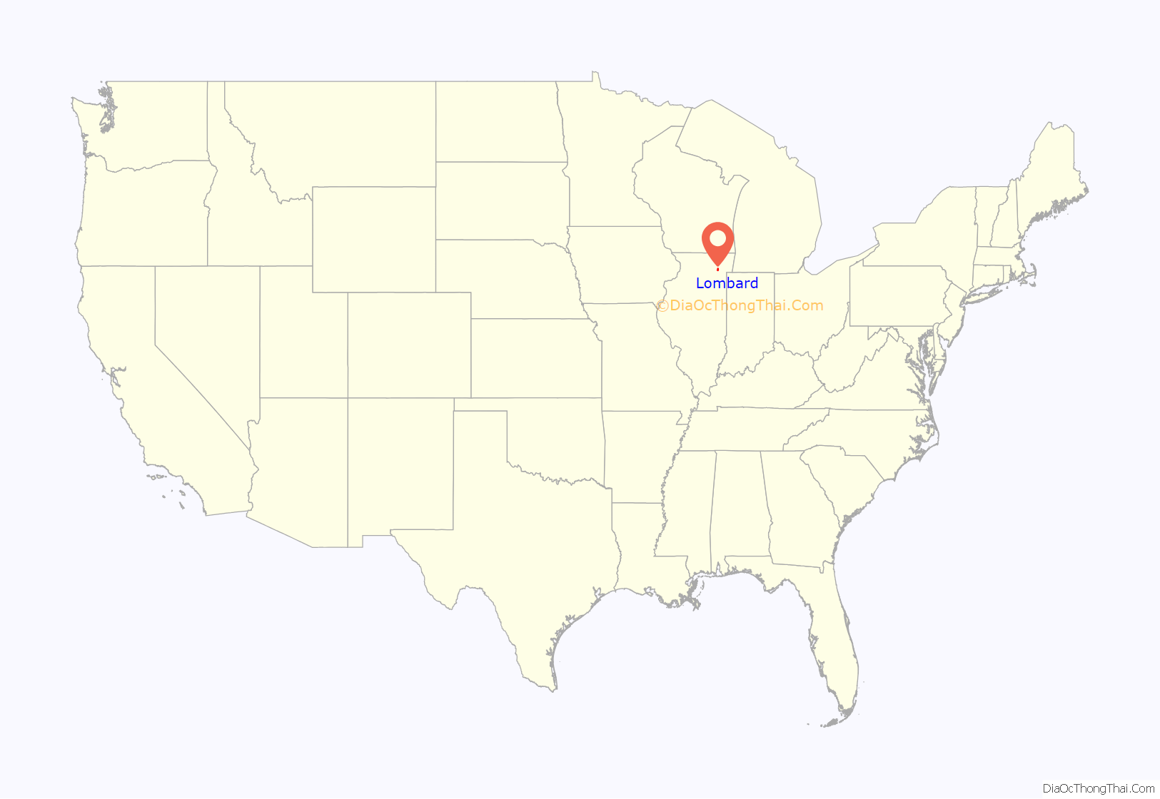
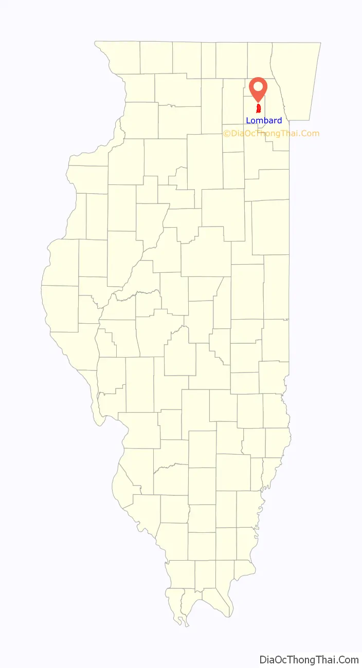
Lombard location map. Where is Lombard village?
History
Originally part of Potawatomi Native American landscape, the Lombard area was first settled by Americans of European descent in the 1830s. Lombard shares its early history with Glen Ellyn. Brothers Ralph and Morgan Babcock settled in a grove of trees along the DuPage River. In what was known as Babcock’s Grove, Lombard developed to the east and Glen Ellyn to the west. In 1837, Babcock’s Grove was connected to Chicago by a stagecoach line which stopped at Stacy’s Tavern at Geneva and St. Charles Roads. Fertile land, the DuPage River, and plentiful timber drew farmers to the area.
Sheldon and Harriet Peck moved from Onondaga, New York, to this area in 1837 to farm 80 acres (320,000 m) of land. In addition, Peck was an artist and primitive portrait painter who traveled to clients across northeastern Illinois. The Peck house also served as the area’s first school and has been restored by the Lombard Historical Society. In 2011, the Peck House was inducted into the National Park Service’s Network to Freedom—a list of verified Underground Railroad locations.
The 1848 arrival of the Galena and Chicago Union Railroad provided local farmers and merchants rail access to Chicago, and commercial buildings soon sprang up around the train station. Lombard was officially incorporated in 1869, named after Chicago banker and real estate developer Josia Lewis Lombard.
Women’s rights
On April 6, 1891, Ellen A. Martin led a group of women to the voting place at the general store. She demanded that the three male election judges allow the women to vote. The judges were so surprised that one of them had a “spasm,” one leaned against the wall for support, and the other fell backwards into a barrel of flour. They acquiesced to Ellen, but fundamentally did not want to let the women vote, so a county judge was asked to decide. He agreed that the women were right. Ellen Martin then became the first woman in Illinois to vote, and one of the first in the entire U.S. In 1916 Illinois women could vote in national elections, but the 19th Amendment (the Women’s Suffrage Amendment) was not passed until 1920.
In 2008, Lombard declared April 6 to be “Ellen Martin Day” in commemoration of Ms. Martin’s historic victory for women’s suffrage.
Little Orphan Annie House
William LeRoy built a home in the Italianate style on Lombard’s Main Street in 1881. LeRoy specialized in making artificial limbs for civil war veterans and lived in this house until 1900. The house would eventually become the home of Harold Gray’s parents and the studio of Harold Gray, the originator of Little Orphan Annie cartoon strip. Harold Gray used the home’s study to work on the Annie cartoons, and some features of the house are drawn into some of his cartoons, such as the grand staircase and the outer deck. Gray lived at 215 S. Stewart Ave in Lombard at this time. Later, he remarried and moved to the east coast. Harold Gray was a charter member of Lombard Masonic Lodge #1098, A.F. & A.M. in 1923.
The Lilac Village
In 1927, the estate of Colonel William Plum, a local resident, was bequeathed to the village. The Plum property included his home, which became the Helen M. Plum Memorial Library, and a large garden containing 200 varieties of lilac bushes. This garden became a public park, Lilacia Park.
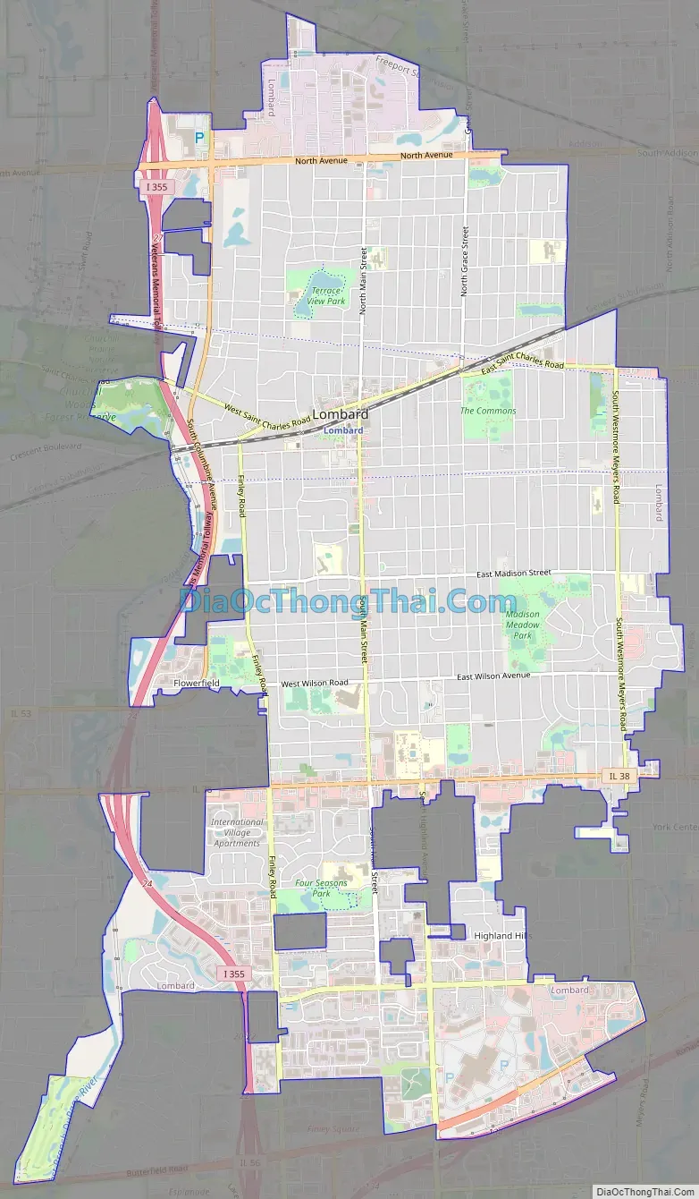
Lombard Road Map
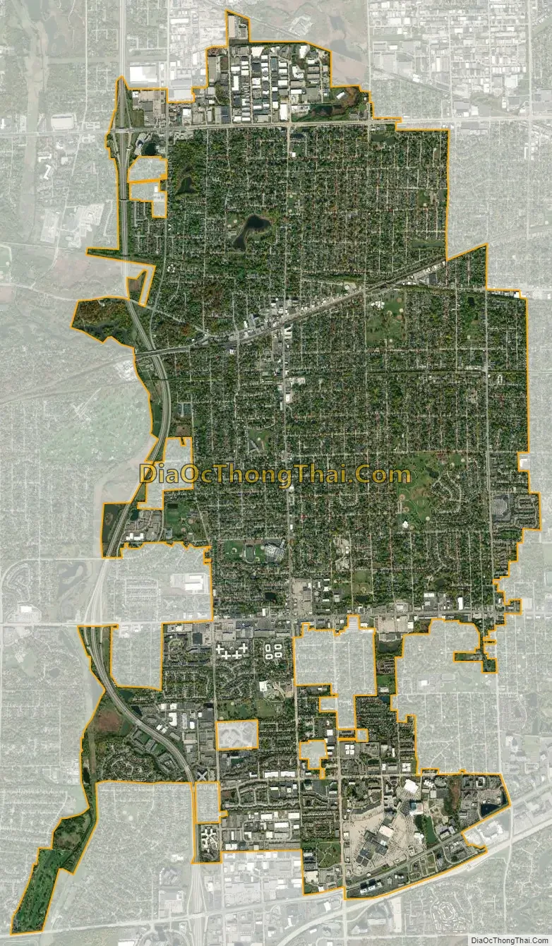
Lombard city Satellite Map
Geography
Lombard is located at 41°52′34″N 88°0′54″W / 41.87611°N 88.01500°W / 41.87611; -88.01500 (41.875979, -88.015060).
According to the 2021 census gazetteer files, Lombard has a total area of 10.41 square miles (26.96 km), of which 10.22 square miles (26.47 km) (or 98.21%) is land and 0.19 square miles (0.49 km) (or 1.79%) is water.
See also
Map of Illinois State and its subdivision:- Adams
- Alexander
- Bond
- Boone
- Brown
- Bureau
- Calhoun
- Carroll
- Cass
- Champaign
- Christian
- Clark
- Clay
- Clinton
- Coles
- Cook
- Crawford
- Cumberland
- De Kalb
- De Witt
- Douglas
- Dupage
- Edgar
- Edwards
- Effingham
- Fayette
- Ford
- Franklin
- Fulton
- Gallatin
- Greene
- Grundy
- Hamilton
- Hancock
- Hardin
- Henderson
- Henry
- Iroquois
- Jackson
- Jasper
- Jefferson
- Jersey
- Jo Daviess
- Johnson
- Kane
- Kankakee
- Kendall
- Knox
- La Salle
- Lake
- Lake Michigan
- Lawrence
- Lee
- Livingston
- Logan
- Macon
- Macoupin
- Madison
- Marion
- Marshall
- Mason
- Massac
- McDonough
- McHenry
- McLean
- Menard
- Mercer
- Monroe
- Montgomery
- Morgan
- Moultrie
- Ogle
- Peoria
- Perry
- Piatt
- Pike
- Pope
- Pulaski
- Putnam
- Randolph
- Richland
- Rock Island
- Saint Clair
- Saline
- Sangamon
- Schuyler
- Scott
- Shelby
- Stark
- Stephenson
- Tazewell
- Union
- Vermilion
- Wabash
- Warren
- Washington
- Wayne
- White
- Whiteside
- Will
- Williamson
- Winnebago
- Woodford
- Alabama
- Alaska
- Arizona
- Arkansas
- California
- Colorado
- Connecticut
- Delaware
- District of Columbia
- Florida
- Georgia
- Hawaii
- Idaho
- Illinois
- Indiana
- Iowa
- Kansas
- Kentucky
- Louisiana
- Maine
- Maryland
- Massachusetts
- Michigan
- Minnesota
- Mississippi
- Missouri
- Montana
- Nebraska
- Nevada
- New Hampshire
- New Jersey
- New Mexico
- New York
- North Carolina
- North Dakota
- Ohio
- Oklahoma
- Oregon
- Pennsylvania
- Rhode Island
- South Carolina
- South Dakota
- Tennessee
- Texas
- Utah
- Vermont
- Virginia
- Washington
- West Virginia
- Wisconsin
- Wyoming