Mazon (məˈzɒn/) is a village in Mazon Township, Grundy County, Illinois, United States. The name derives from the Potawatomi word for “nettles” (mzan). The population was 1,015 at the 2010 census. The center of population of Illinois is located in Mazon. Illinois’ State Fossil, the unique and bizarre Tully Monster was first found in nearby Mazon Creek. Mazon was formerly served by the Santa Fe railway at the Mazon Depot. It was established in 1876.
| Name: | Mazon village |
|---|---|
| LSAD Code: | 47 |
| LSAD Description: | village (suffix) |
| State: | Illinois |
| County: | Grundy County |
| Elevation: | 586 ft (179 m) |
| Total Area: | 0.61 sq mi (1.58 km²) |
| Land Area: | 0.60 sq mi (1.56 km²) |
| Water Area: | 0.01 sq mi (0.02 km²) |
| Total Population: | 979 |
| Population Density: | 1,626.25/sq mi (628.06/km²) |
| ZIP code: | 60444 |
| FIPS code: | 1747787 |
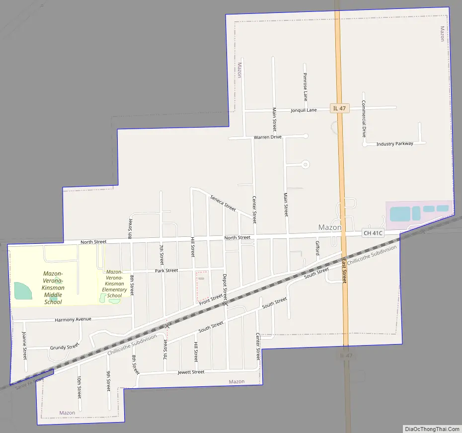
Online Interactive Map
Click on ![]() to view map in "full screen" mode.
to view map in "full screen" mode.
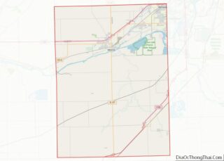
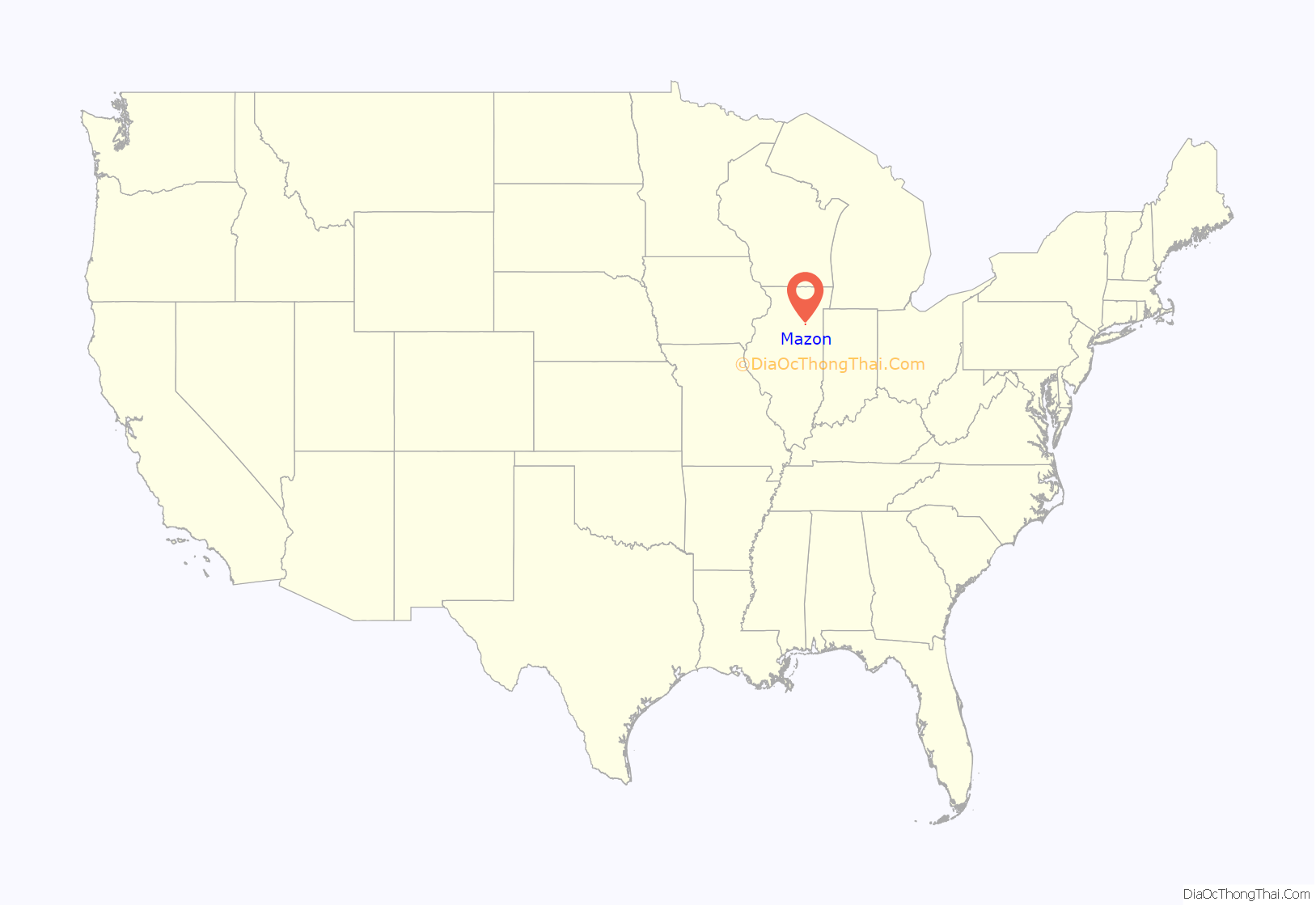
Mazon location map. Where is Mazon village?
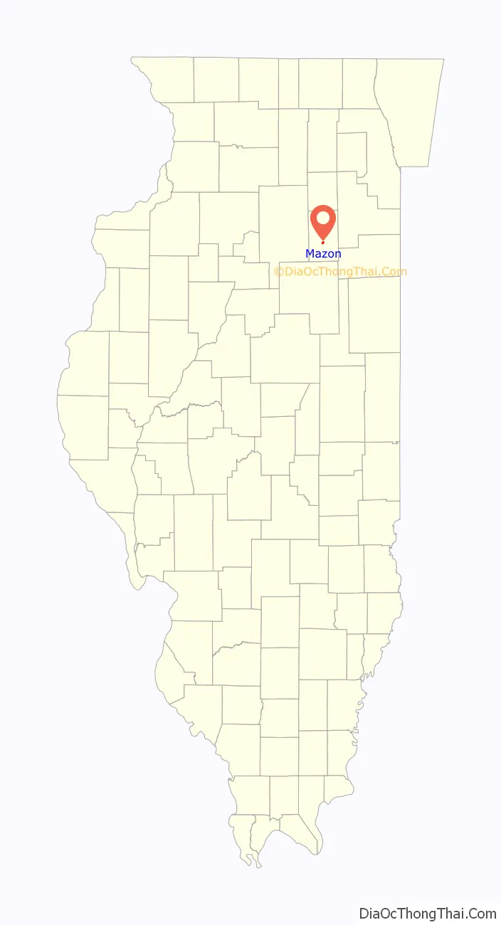
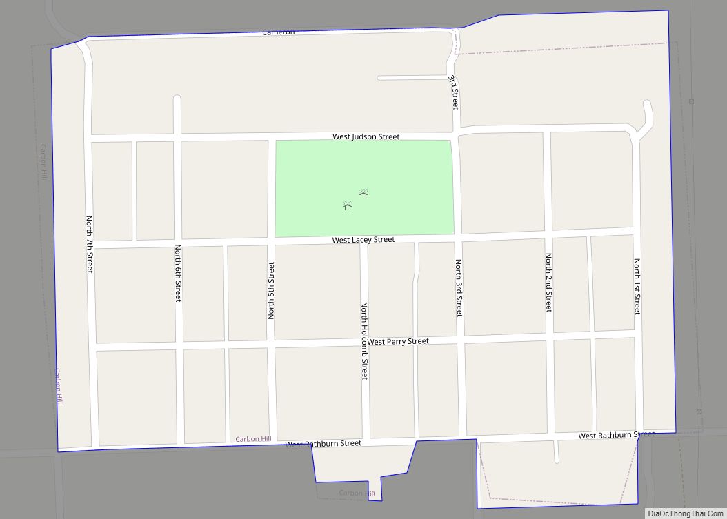
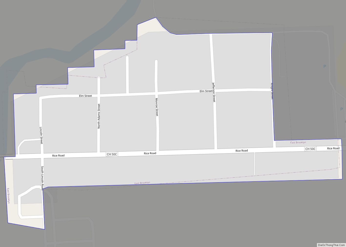
Mazon Road Map
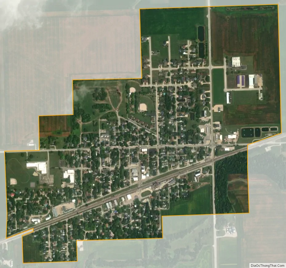
Mazon city Satellite Map
Geography
According to the 2010 census, Mazon has a total area of 0.596 square miles (1.54 km), of which 0.59 square miles (1.53 km) (or 98.99%) is land and 0.006 square miles (0.02 km) (or 1.01%) is water.
See also
Map of Illinois State and its subdivision:- Adams
- Alexander
- Bond
- Boone
- Brown
- Bureau
- Calhoun
- Carroll
- Cass
- Champaign
- Christian
- Clark
- Clay
- Clinton
- Coles
- Cook
- Crawford
- Cumberland
- De Kalb
- De Witt
- Douglas
- Dupage
- Edgar
- Edwards
- Effingham
- Fayette
- Ford
- Franklin
- Fulton
- Gallatin
- Greene
- Grundy
- Hamilton
- Hancock
- Hardin
- Henderson
- Henry
- Iroquois
- Jackson
- Jasper
- Jefferson
- Jersey
- Jo Daviess
- Johnson
- Kane
- Kankakee
- Kendall
- Knox
- La Salle
- Lake
- Lake Michigan
- Lawrence
- Lee
- Livingston
- Logan
- Macon
- Macoupin
- Madison
- Marion
- Marshall
- Mason
- Massac
- McDonough
- McHenry
- McLean
- Menard
- Mercer
- Monroe
- Montgomery
- Morgan
- Moultrie
- Ogle
- Peoria
- Perry
- Piatt
- Pike
- Pope
- Pulaski
- Putnam
- Randolph
- Richland
- Rock Island
- Saint Clair
- Saline
- Sangamon
- Schuyler
- Scott
- Shelby
- Stark
- Stephenson
- Tazewell
- Union
- Vermilion
- Wabash
- Warren
- Washington
- Wayne
- White
- Whiteside
- Will
- Williamson
- Winnebago
- Woodford
- Alabama
- Alaska
- Arizona
- Arkansas
- California
- Colorado
- Connecticut
- Delaware
- District of Columbia
- Florida
- Georgia
- Hawaii
- Idaho
- Illinois
- Indiana
- Iowa
- Kansas
- Kentucky
- Louisiana
- Maine
- Maryland
- Massachusetts
- Michigan
- Minnesota
- Mississippi
- Missouri
- Montana
- Nebraska
- Nevada
- New Hampshire
- New Jersey
- New Mexico
- New York
- North Carolina
- North Dakota
- Ohio
- Oklahoma
- Oregon
- Pennsylvania
- Rhode Island
- South Carolina
- South Dakota
- Tennessee
- Texas
- Utah
- Vermont
- Virginia
- Washington
- West Virginia
- Wisconsin
- Wyoming