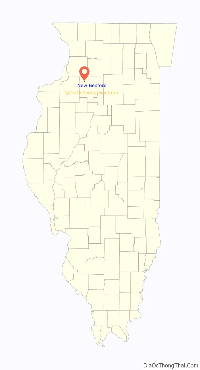
New Bedford is a village in Bureau County, Illinois, United States. The population was 76 at the 2020 census. It is part of the Ottawa Micropolitan Statistical Area.
| Name: | New Bedford village |
|---|---|
| LSAD Code: | 47 |
| LSAD Description: | village (suffix) |
| State: | Illinois |
| County: | Bureau County |
| Total Area: | 0.155 sq mi (0.40 km²) |
| Land Area: | 0.155 sq mi (0.40 km²) |
| Water Area: | 0.00 sq mi (0.0 km²) 0% |
| Total Population: | 76 |
| Population Density: | 490/sq mi (190/km²) |
| FIPS code: | 1752155 |
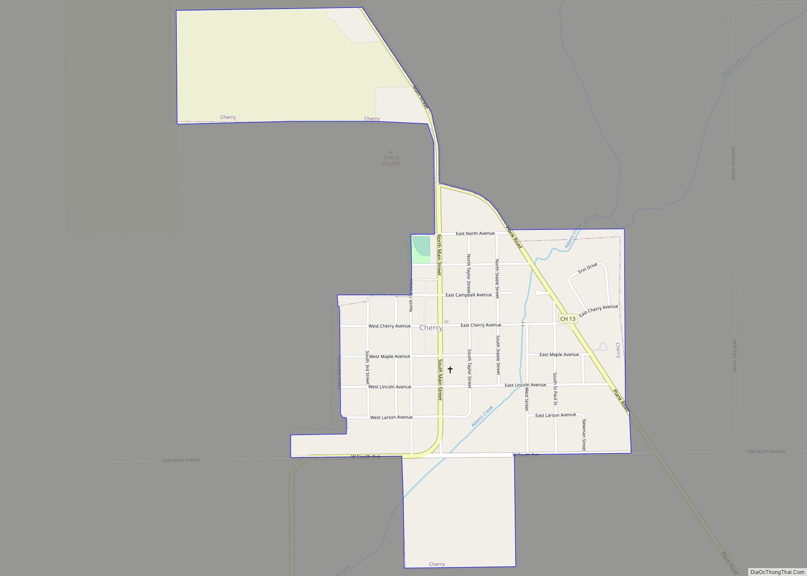
Online Interactive Map
Click on ![]() to view map in "full screen" mode.
to view map in "full screen" mode.
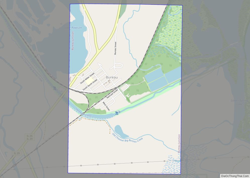
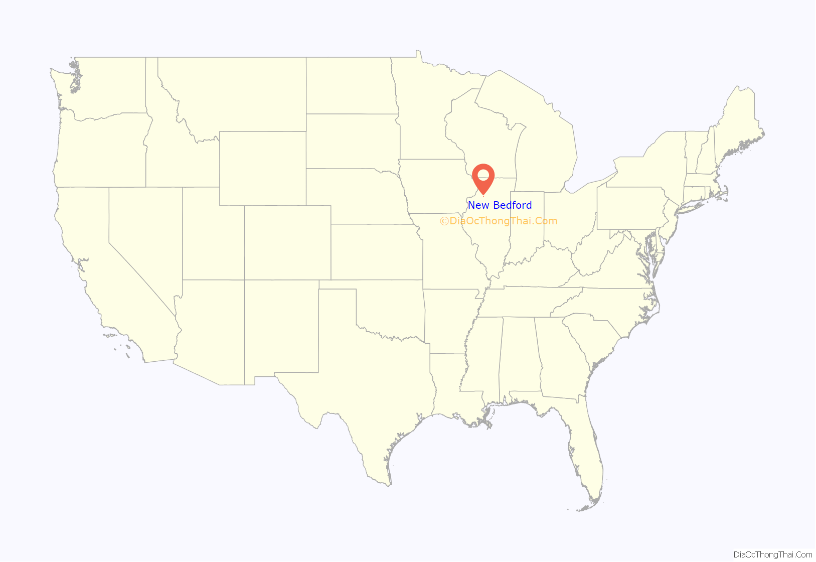
New Bedford location map. Where is New Bedford village?
History
In October 1836, Henry Thomas of West Bureau Township registered land at the narrows (now New Bedford) and for a number of years it was the only registered tract in that section of the county. In the spring of 1837, Cyrus Watson, the first settler on Green river, built a cabin on Thomas’ land, believing it to be vacant. About this time a state road was laid from Princeton to Prophetstown on the Rock River, crossing the Green River at this point. Henry Thomas built a ferry boat, and for a number of years it was known as Thomas’ Ferry.
Main St. New Bedford, IL. c. 1910, Pic.1
Main St. New Bedford, IL. c. 1910, Pic.2
Green River bridge. c. 1910, Pic.3
Green River bridge. c. 1910, Pic.4
Spratt’s Department store. c. 1910, Pic.5
F.Janderson Department store. c. 1910, Pic.6
Pic.1: Looking Northward from West side of Main Street.
Pic.2: Looking Northward from East side of Main Street.
Pic.3: Looking Northward across the Green River bridge. This section of the river is now called the Old Channel.
Pic.4: Looking Southward across the Green River bridge. Large house on right belonged to the Bollman family.
Pic.5: Spratt Department store on East side of Main street. The cement step still remains, located across the street from the Post Office.
Pic.6: F. Janderson Department store on West side of Main street.
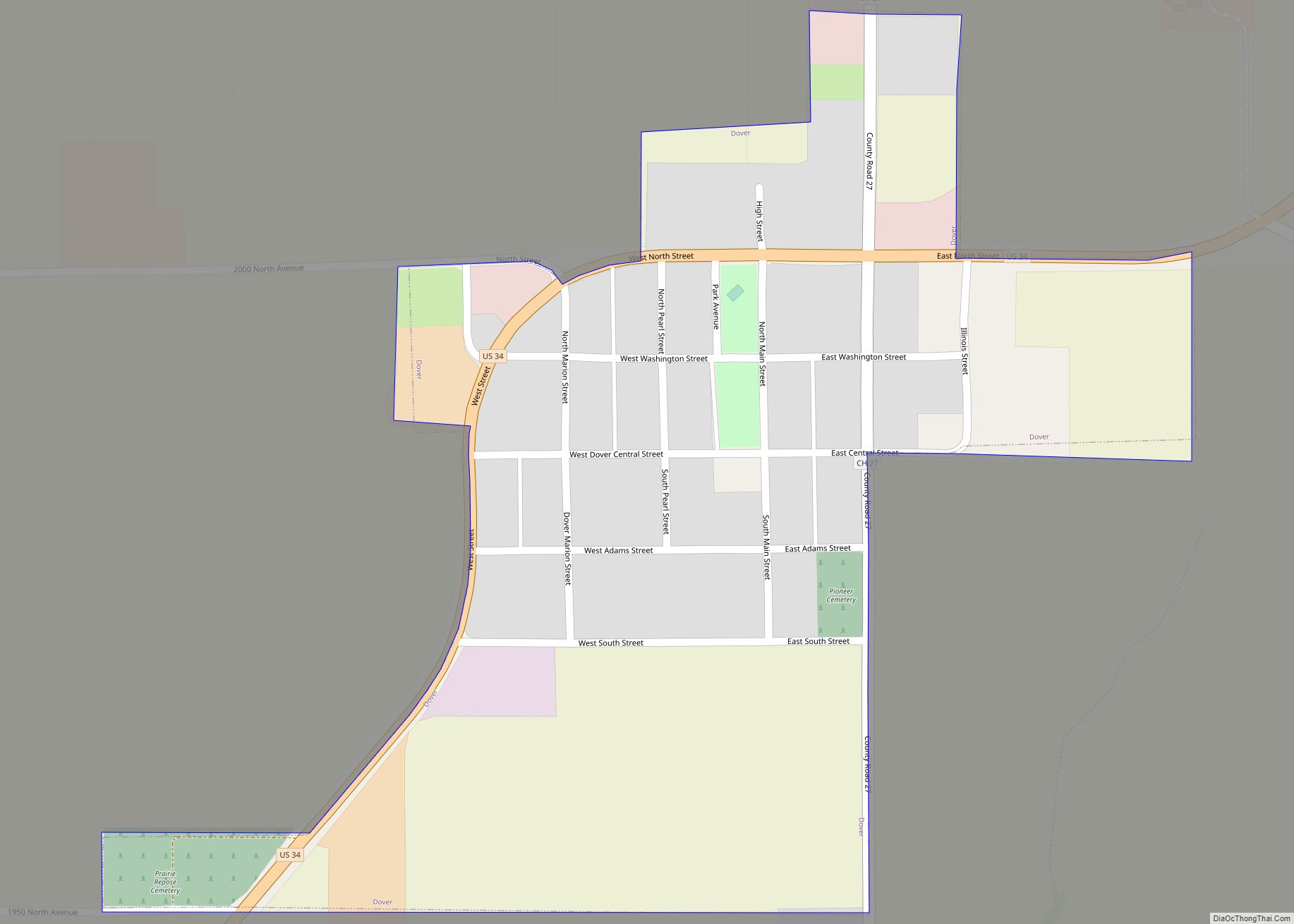
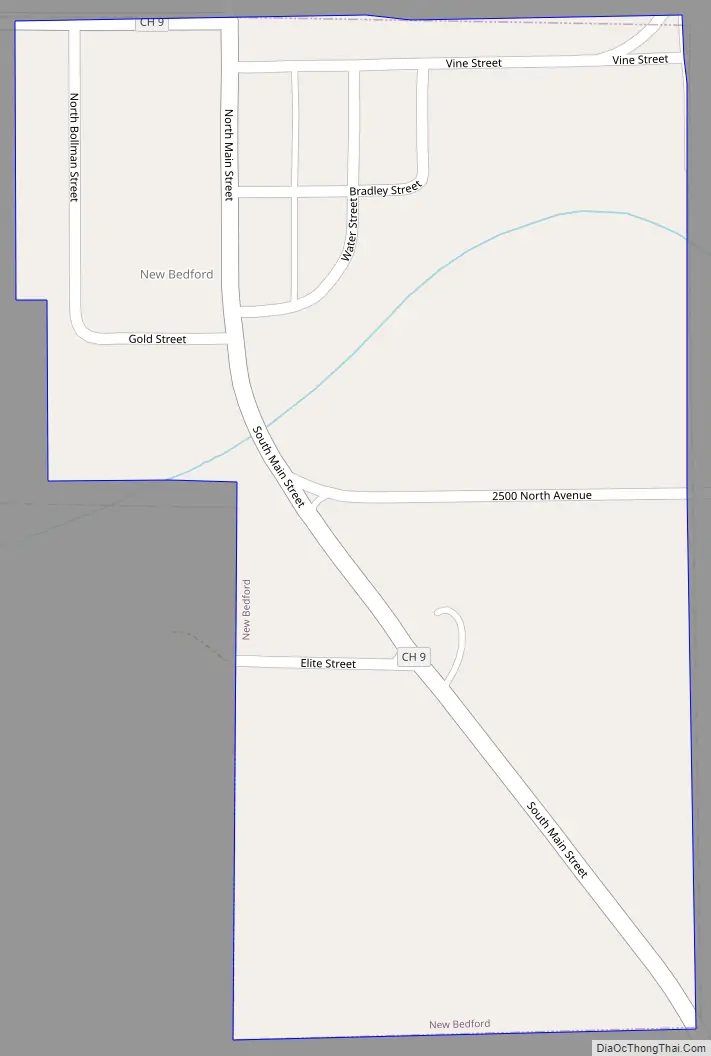
New Bedford Road Map
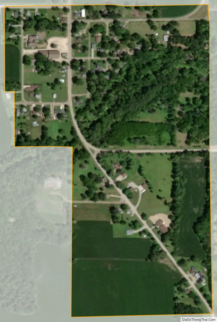
New Bedford city Satellite Map
Geography
New Bedford is located at 41°30′47″N 89°43′09″W / 41.51306°N 89.71917°W / 41.51306; -89.71917.
According to the 2021 census gazetteer files, New Bedford has a total area of 0.16 square miles (0.41 km), all land.
See also
Map of Illinois State and its subdivision:- Adams
- Alexander
- Bond
- Boone
- Brown
- Bureau
- Calhoun
- Carroll
- Cass
- Champaign
- Christian
- Clark
- Clay
- Clinton
- Coles
- Cook
- Crawford
- Cumberland
- De Kalb
- De Witt
- Douglas
- Dupage
- Edgar
- Edwards
- Effingham
- Fayette
- Ford
- Franklin
- Fulton
- Gallatin
- Greene
- Grundy
- Hamilton
- Hancock
- Hardin
- Henderson
- Henry
- Iroquois
- Jackson
- Jasper
- Jefferson
- Jersey
- Jo Daviess
- Johnson
- Kane
- Kankakee
- Kendall
- Knox
- La Salle
- Lake
- Lake Michigan
- Lawrence
- Lee
- Livingston
- Logan
- Macon
- Macoupin
- Madison
- Marion
- Marshall
- Mason
- Massac
- McDonough
- McHenry
- McLean
- Menard
- Mercer
- Monroe
- Montgomery
- Morgan
- Moultrie
- Ogle
- Peoria
- Perry
- Piatt
- Pike
- Pope
- Pulaski
- Putnam
- Randolph
- Richland
- Rock Island
- Saint Clair
- Saline
- Sangamon
- Schuyler
- Scott
- Shelby
- Stark
- Stephenson
- Tazewell
- Union
- Vermilion
- Wabash
- Warren
- Washington
- Wayne
- White
- Whiteside
- Will
- Williamson
- Winnebago
- Woodford
- Alabama
- Alaska
- Arizona
- Arkansas
- California
- Colorado
- Connecticut
- Delaware
- District of Columbia
- Florida
- Georgia
- Hawaii
- Idaho
- Illinois
- Indiana
- Iowa
- Kansas
- Kentucky
- Louisiana
- Maine
- Maryland
- Massachusetts
- Michigan
- Minnesota
- Mississippi
- Missouri
- Montana
- Nebraska
- Nevada
- New Hampshire
- New Jersey
- New Mexico
- New York
- North Carolina
- North Dakota
- Ohio
- Oklahoma
- Oregon
- Pennsylvania
- Rhode Island
- South Carolina
- South Dakota
- Tennessee
- Texas
- Utah
- Vermont
- Virginia
- Washington
- West Virginia
- Wisconsin
- Wyoming