Peru is a city in LaSalle County, Illinois, United States. The population was 9,896 at the 2020 census, down from 10,295 at the 2010 census. It is part of the Ottawa, IL Micropolitan Statistical Area. Peru and its twin city, LaSalle, make up the core of Illinois Valley.
| Name: | Peru city |
|---|---|
| LSAD Code: | 25 |
| LSAD Description: | city (suffix) |
| State: | Illinois |
| County: | LaSalle County |
| Elevation: | 640 ft (200 m) |
| Total Area: | 10.12 sq mi (26.21 km²) |
| Land Area: | 9.99 sq mi (25.86 km²) |
| Water Area: | 0.13 sq mi (0.35 km²) |
| Total Population: | 9,896 |
| Population Density: | 977.87/sq mi (377.57/km²) |
| Area code: | 815 |
| FIPS code: | 1759234 |
| GNISfeature ID: | 2396189 |
Online Interactive Map
Click on ![]() to view map in "full screen" mode.
to view map in "full screen" mode.
Peru location map. Where is Peru city?
History
The city’s first settler was John Hays, who arrived in 1830. The city was organized as a borough in 1838, incorporated as a village February 25, 1845, and incorporated as a city on March 13, 1851. The original plat was between West Street, 4th Street, and East Street (now Pine Street).
River City (1831–1933)
Since the first steamboat Traveler reached Peru in 1831, the city had high hopes of being the western terminus for the Illinois & Michigan Canal. LaSalle won that designation, but Peru became a busy steamboat port at the head of navigation on the Illinois River. Captain McCormick was involved in the Five Day Line, making record fast trips between Peru and St. Louis, Missouri. Senator Gilson reported to land surveyor, Grenville Dodge, that the town would soon outstrip Chicago due to its favorable location along the river and railroads.
Water Street was a thin ribbon pressed between the bluff and the river, leading to the growth eastward of a large industrial district. Developed along the river and the canal, it was served by the Rock Island Railroad and Chicago Burlington and Quincy. These important transportation routes, along with coal mining in at least four mines lasting from 1857 until 1949, were the basis for Peru’s rise to an industrial center. Many entrepreneurs grew into prominent businessmen and advanced the interests of Peru and the region. Prominent companies from that time included Maze Lumber, Maze Nails, Peru Plow and Wheel Works, Huse and Loomis Ice Co, Brunner Foundry, Star Union Brewery, Hebel Brewery, Illinois Zinc (Peru and LaSalle were sometimes referred to as “Zinc City”) and many others. Peru’s citizens were intent on improving their town, so far as constructing a plank road, northwest of town, a toll road meant to reach Dixon, Illinois.
Peru’s story became a story of two levels. The story of Water Street and the bottoms, and the town growing above the bluff. Peru tried hard to link the two. For example, the Peru Horse and Dummy Railroad was driven to dissolution by the city’s impossible mandate that it create a loop from Water Street to the upper bluff.
Clock City (1884–1980)
In 1884, Stahlberg started the United Clock Company in Peru. Shortly afterward, it went bankrupt and was reorganized with the help of Frederick William Matthiessen as the Western Clock Company. By 1905 it had grown into a national company, producing over 1 million alarm clocks per year. In 1909, they trademarked “Westclox”. In 1917 they became a model for workers’ benefits, one of the early companies to pay life insurance and have a safety committee. Later on, they limited the work week, constructed a company park with a tennis court and horseshoe courts, developed workers’ housing, and established a school for watchmakers with provision for scholarships. In 1935 it was the safest company in the nation, with 11 million hours without a lost time accident.
During World War II the company made mechanical fuses for the government and had more than 600 of its employees enter the armed forces. At its height it manufactured nearly 2 million clocks and watches annually and employed over 4,000 persons. It closed the Peru factory in 1980; the loss of jobs caused a rapid decline in population in LaSalle and Peru.
Today the old Westclox Administration Building is now the headquarter for the Carus Corporation and the rest of the Westclox complex is being redeveloped into a commercial center. The building is also home to the Westclox Museum.
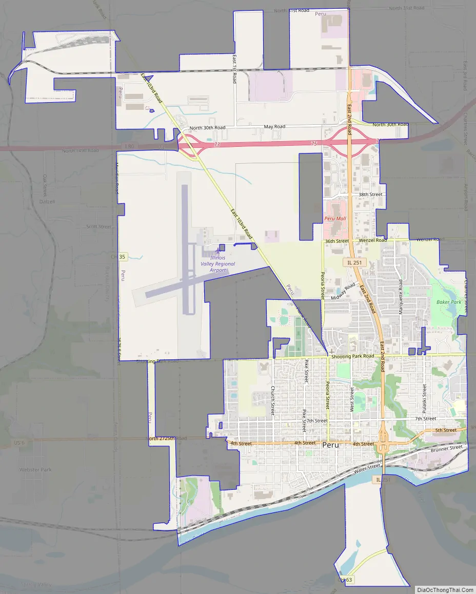
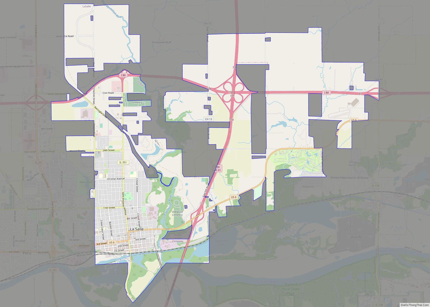
Peru Road Map
Peru city Satellite Map
Geography
As of 2021, Peru has a total area of 10.12 square miles (26.21 km), of which 9.986 square miles (25.86 km) (or 98.68%) is land and 0.134 square miles (0.35 km) (or 1.32%) is water.
Located on the Illinois River, Peru lies 3 miles (4.8 km) west of the intersection of two major interstate highways: Interstate 39 and Interstate 80. The city is also the western terminus of the historic Illinois and Michigan Canal. Before the Illinois Waterway was constructed, the Illinois River was navigable only up to Peru. Starved Rock State Park, a regional tourist attraction, is located 5 miles (8.0 km) south-east of the community. Peru has a twin city on its eastern edge, LaSalle.
Climate
See also
Map of Illinois State and its subdivision:- Adams
- Alexander
- Bond
- Boone
- Brown
- Bureau
- Calhoun
- Carroll
- Cass
- Champaign
- Christian
- Clark
- Clay
- Clinton
- Coles
- Cook
- Crawford
- Cumberland
- De Kalb
- De Witt
- Douglas
- Dupage
- Edgar
- Edwards
- Effingham
- Fayette
- Ford
- Franklin
- Fulton
- Gallatin
- Greene
- Grundy
- Hamilton
- Hancock
- Hardin
- Henderson
- Henry
- Iroquois
- Jackson
- Jasper
- Jefferson
- Jersey
- Jo Daviess
- Johnson
- Kane
- Kankakee
- Kendall
- Knox
- La Salle
- Lake
- Lake Michigan
- Lawrence
- Lee
- Livingston
- Logan
- Macon
- Macoupin
- Madison
- Marion
- Marshall
- Mason
- Massac
- McDonough
- McHenry
- McLean
- Menard
- Mercer
- Monroe
- Montgomery
- Morgan
- Moultrie
- Ogle
- Peoria
- Perry
- Piatt
- Pike
- Pope
- Pulaski
- Putnam
- Randolph
- Richland
- Rock Island
- Saint Clair
- Saline
- Sangamon
- Schuyler
- Scott
- Shelby
- Stark
- Stephenson
- Tazewell
- Union
- Vermilion
- Wabash
- Warren
- Washington
- Wayne
- White
- Whiteside
- Will
- Williamson
- Winnebago
- Woodford
- Alabama
- Alaska
- Arizona
- Arkansas
- California
- Colorado
- Connecticut
- Delaware
- District of Columbia
- Florida
- Georgia
- Hawaii
- Idaho
- Illinois
- Indiana
- Iowa
- Kansas
- Kentucky
- Louisiana
- Maine
- Maryland
- Massachusetts
- Michigan
- Minnesota
- Mississippi
- Missouri
- Montana
- Nebraska
- Nevada
- New Hampshire
- New Jersey
- New Mexico
- New York
- North Carolina
- North Dakota
- Ohio
- Oklahoma
- Oregon
- Pennsylvania
- Rhode Island
- South Carolina
- South Dakota
- Tennessee
- Texas
- Utah
- Vermont
- Virginia
- Washington
- West Virginia
- Wisconsin
- Wyoming


