Rushville is a city in Schuyler County, Illinois, United States. The population was 3,192 at the 2010 census and 2,902 in 2018. It is the county seat of Schuyler County. It was first settled by Euro-Americans in 1823.
| Name: | Rushville city |
|---|---|
| LSAD Code: | 25 |
| LSAD Description: | city (suffix) |
| State: | Illinois |
| County: | Schuyler County |
| Elevation: | 669 ft (204 m) |
| Total Area: | 1.65 sq mi (4.28 km²) |
| Land Area: | 1.65 sq mi (4.28 km²) |
| Water Area: | 0.00 sq mi (0.00 km²) |
| Total Population: | 3,005 |
| Population Density: | 1,819.01/sq mi (702.14/km²) |
| Area code: | 217 |
| FIPS code: | 1766339 |
| GNISfeature ID: | 2396453 |
| Website: | rushvilleillinois.us |
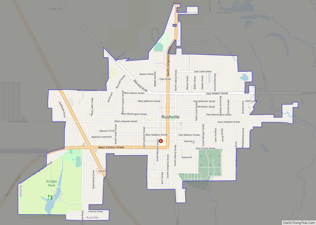
Online Interactive Map
Click on ![]() to view map in "full screen" mode.
to view map in "full screen" mode.
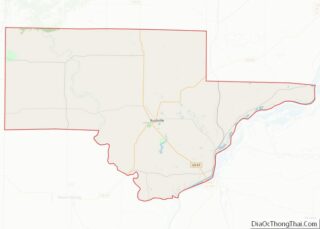
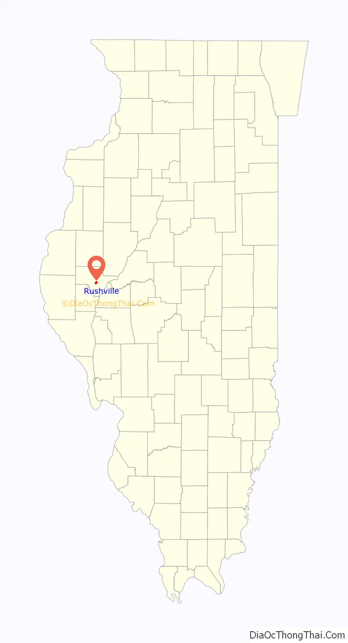
Rushville location map. Where is Rushville city?

History
In 1823, Calvin Hobart and his family became the region’s first settlers. When Schuyler County was first established in 1825, it originally contained portions of the counties of Pike, Fulton, and Brown. Benjamin Rush’s hometown of Rushton changed its name to “Rushville” in 1826.
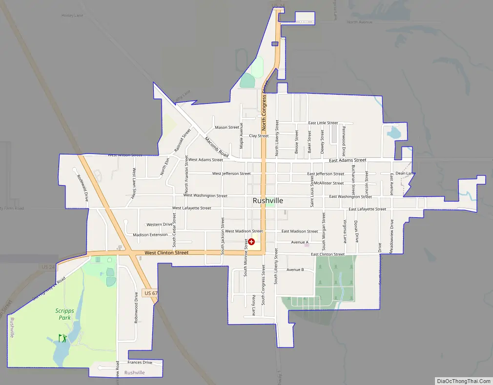
Rushville Road Map
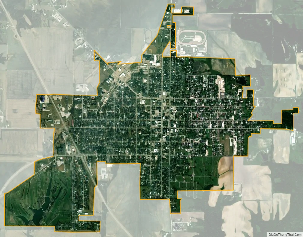
Rushville city Satellite Map
Geography
According to the 2010 census, Rushville has a total area of 1.65 square miles (4.27 km), all land.
See also
Map of Illinois State and its subdivision:- Adams
- Alexander
- Bond
- Boone
- Brown
- Bureau
- Calhoun
- Carroll
- Cass
- Champaign
- Christian
- Clark
- Clay
- Clinton
- Coles
- Cook
- Crawford
- Cumberland
- De Kalb
- De Witt
- Douglas
- Dupage
- Edgar
- Edwards
- Effingham
- Fayette
- Ford
- Franklin
- Fulton
- Gallatin
- Greene
- Grundy
- Hamilton
- Hancock
- Hardin
- Henderson
- Henry
- Iroquois
- Jackson
- Jasper
- Jefferson
- Jersey
- Jo Daviess
- Johnson
- Kane
- Kankakee
- Kendall
- Knox
- La Salle
- Lake
- Lake Michigan
- Lawrence
- Lee
- Livingston
- Logan
- Macon
- Macoupin
- Madison
- Marion
- Marshall
- Mason
- Massac
- McDonough
- McHenry
- McLean
- Menard
- Mercer
- Monroe
- Montgomery
- Morgan
- Moultrie
- Ogle
- Peoria
- Perry
- Piatt
- Pike
- Pope
- Pulaski
- Putnam
- Randolph
- Richland
- Rock Island
- Saint Clair
- Saline
- Sangamon
- Schuyler
- Scott
- Shelby
- Stark
- Stephenson
- Tazewell
- Union
- Vermilion
- Wabash
- Warren
- Washington
- Wayne
- White
- Whiteside
- Will
- Williamson
- Winnebago
- Woodford
- Alabama
- Alaska
- Arizona
- Arkansas
- California
- Colorado
- Connecticut
- Delaware
- District of Columbia
- Florida
- Georgia
- Hawaii
- Idaho
- Illinois
- Indiana
- Iowa
- Kansas
- Kentucky
- Louisiana
- Maine
- Maryland
- Massachusetts
- Michigan
- Minnesota
- Mississippi
- Missouri
- Montana
- Nebraska
- Nevada
- New Hampshire
- New Jersey
- New Mexico
- New York
- North Carolina
- North Dakota
- Ohio
- Oklahoma
- Oregon
- Pennsylvania
- Rhode Island
- South Carolina
- South Dakota
- Tennessee
- Texas
- Utah
- Vermont
- Virginia
- Washington
- West Virginia
- Wisconsin
- Wyoming