South Wilmington is a village in Grundy County, Illinois, United States. The population was 702 at the 2020 census.
Although the name might indicate proximity to the city of Wilmington, South Wilmington is approximately 11 miles southwest of Wilmington, and is separated from it by several communities, including Gardner, Braceville, Godley, and Braidwood.
| Name: | South Wilmington village |
|---|---|
| LSAD Code: | 47 |
| LSAD Description: | village (suffix) |
| State: | Illinois |
| County: | Grundy County |
| Elevation: | 585 ft (178 m) |
| Total Area: | 0.49 sq mi (1.27 km²) |
| Land Area: | 0.49 sq mi (1.27 km²) |
| Water Area: | 0.00 sq mi (0.00 km²) |
| Total Population: | 710 |
| Population Density: | 1,443.09/sq mi (557.29/km²) |
| FIPS code: | 1771370 |
| Website: | villageofsouthwilmington.com |
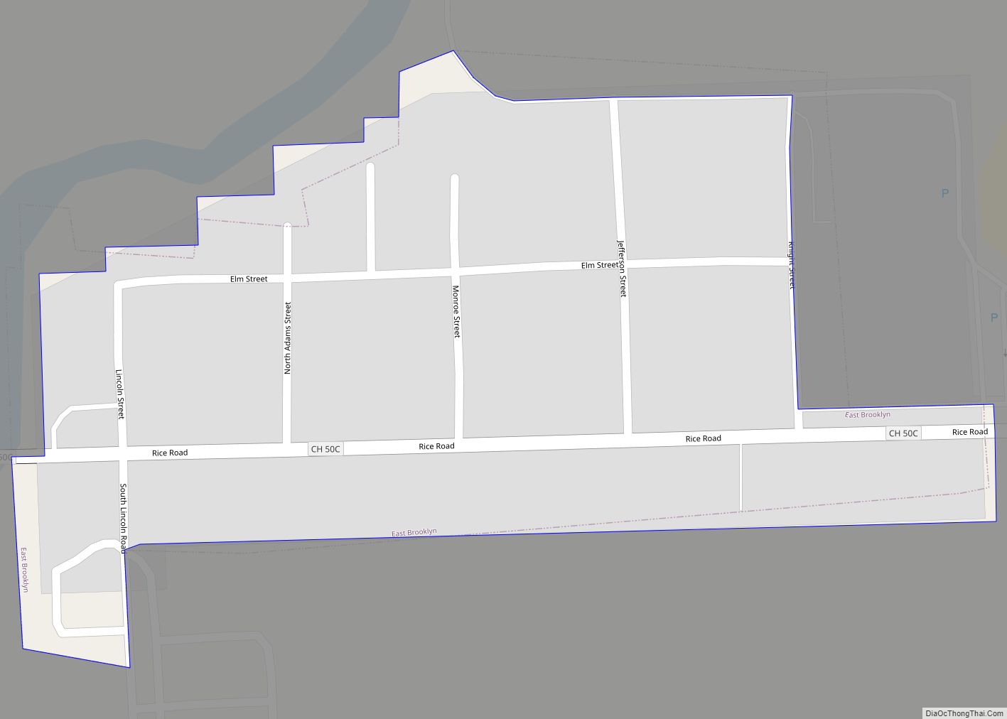
Online Interactive Map
Click on ![]() to view map in "full screen" mode.
to view map in "full screen" mode.
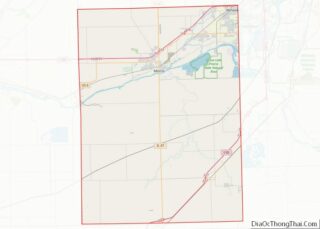
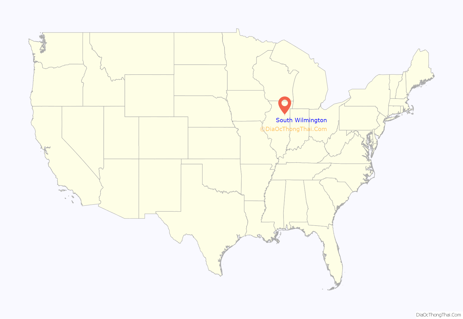
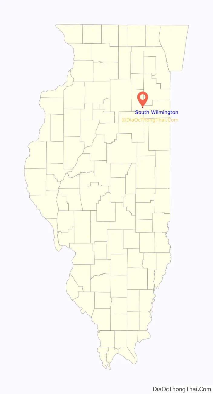
South Wilmington location map. Where is South Wilmington village?
History
South Wilmington came into existence August 23, 1900. The first election for village officers was held September 10, 1899, and the first set of officers elected were: Robert McXulty, St., president; Mike Finn, clerk; Walter Ferguson, treasurer; Charles McLean, constable; William Walker, street commissioner; Levi Simms, police magistrate, and William Purdy, Martin Ferrero. Patrick Corrigan, Hugh Young and John Hammer, trustees.
The family of Mr. Gibson Simpson were the first to locate at South Wilmington, moving into a house taken there from Braidwood that had belonged to Ed Blandey. The second family was that of Patrick Corrigan, who came to take charge of the hotel which was built by the C. W. and C. Coal Company, it being the first to be put in South Wilmington. In 1899 the coal company commenced to build new houses and sell them to their employees, and a great many were moved in from the surrounding towns of Braceville, Braidwood, Coal City, and Clarke City.
A meeting of the citizens was held in the fall of 1899 and donations were asked for the commencement of a school for the benefit of the few children here. School commenced that same fall, being held in an old store building which had been moved in on Third Avenue. Miss Carrie Peart was employed as the first teacher. The miners would pay a fee of twenty-five cents per week to operate the school and to pay Miss Carrie Peart. The people responded so generously to the request for funds that by the fall of 1900, a 4-room schoolhouse was ready in District 74, and in May 1902, four more rooms were added.
The first religious services held in South Wilmington were by the Baptist Sunday School in the fall of 1900. They were conducted in what was known as the Prophet Building, which was moved from Gardner. Rev. J. Blodgett and John C. Wilson organized it. and F. E. Floyd was the first superintendent. Later, a church building was moved from Braceville to host the Baptist services. in 1901. Rev. J. Blodgett was the first pastor. The church was organized the same year, but only remained by itself a short time, becoming a mission of Gardner, until February 6, 1910, when it became once more a separate church.
Notable Residents:
Louis Bottino (1907–1979), Illinois state representative and educator, was born in South Wilmington in 1907.
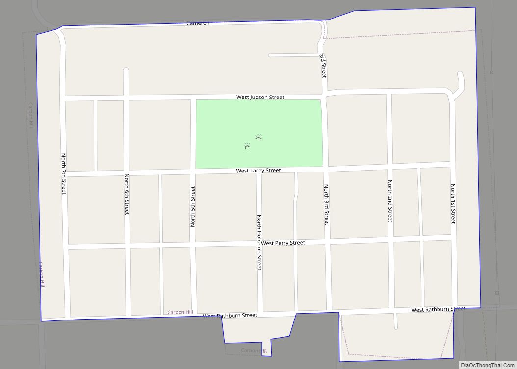
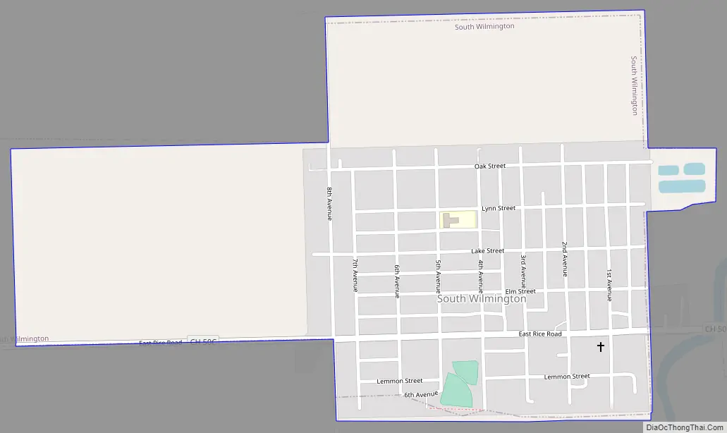
South Wilmington Road Map
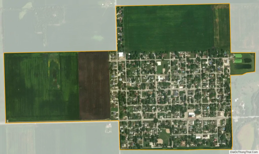
South Wilmington city Satellite Map
Geography
South Wilmington is located at 41°10′24″N 88°16′35″W / 41.17333°N 88.27639°W / 41.17333; -88.27639 (41.173268, -88.276271).
According to the 2010 census, South Wilmington has a total area of 0.56 square miles (1.45 km), all land.
See also
Map of Illinois State and its subdivision:- Adams
- Alexander
- Bond
- Boone
- Brown
- Bureau
- Calhoun
- Carroll
- Cass
- Champaign
- Christian
- Clark
- Clay
- Clinton
- Coles
- Cook
- Crawford
- Cumberland
- De Kalb
- De Witt
- Douglas
- Dupage
- Edgar
- Edwards
- Effingham
- Fayette
- Ford
- Franklin
- Fulton
- Gallatin
- Greene
- Grundy
- Hamilton
- Hancock
- Hardin
- Henderson
- Henry
- Iroquois
- Jackson
- Jasper
- Jefferson
- Jersey
- Jo Daviess
- Johnson
- Kane
- Kankakee
- Kendall
- Knox
- La Salle
- Lake
- Lake Michigan
- Lawrence
- Lee
- Livingston
- Logan
- Macon
- Macoupin
- Madison
- Marion
- Marshall
- Mason
- Massac
- McDonough
- McHenry
- McLean
- Menard
- Mercer
- Monroe
- Montgomery
- Morgan
- Moultrie
- Ogle
- Peoria
- Perry
- Piatt
- Pike
- Pope
- Pulaski
- Putnam
- Randolph
- Richland
- Rock Island
- Saint Clair
- Saline
- Sangamon
- Schuyler
- Scott
- Shelby
- Stark
- Stephenson
- Tazewell
- Union
- Vermilion
- Wabash
- Warren
- Washington
- Wayne
- White
- Whiteside
- Will
- Williamson
- Winnebago
- Woodford
- Alabama
- Alaska
- Arizona
- Arkansas
- California
- Colorado
- Connecticut
- Delaware
- District of Columbia
- Florida
- Georgia
- Hawaii
- Idaho
- Illinois
- Indiana
- Iowa
- Kansas
- Kentucky
- Louisiana
- Maine
- Maryland
- Massachusetts
- Michigan
- Minnesota
- Mississippi
- Missouri
- Montana
- Nebraska
- Nevada
- New Hampshire
- New Jersey
- New Mexico
- New York
- North Carolina
- North Dakota
- Ohio
- Oklahoma
- Oregon
- Pennsylvania
- Rhode Island
- South Carolina
- South Dakota
- Tennessee
- Texas
- Utah
- Vermont
- Virginia
- Washington
- West Virginia
- Wisconsin
- Wyoming