Stillman Valley is a village in Marion Township, Ogle County, Illinois, United States. It lies east of Byron, south of Rockford and west of Davis Junction. The population was 1,120 at the 2010 census, up from 1,048 in 2000. The village is located on the Iowa, Chicago and Eastern Railroad, on the old Chicago Great Western Railway before it merged and was pulled up. Also, Illinois Route 72 runs through the village. It is near the site of the first battle of the Black Hawk War of 1832. The war memorial for the Battle of Stillman’s Run is located in this village.
| Name: | Stillman Valley village |
|---|---|
| LSAD Code: | 47 |
| LSAD Description: | village (suffix) |
| State: | Illinois |
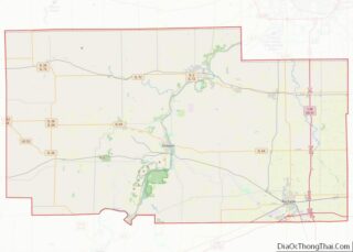
| County: | Ogle County |
| Total Area: | 0.57 sq mi (1.48 km²) |
| Land Area: | 0.57 sq mi (1.48 km²) |
| Water Area: | 0.00 sq mi (0.00 km²) |
| Total Population: | 1,075 |
| Population Density: | 1,885.96/sq mi (727.94/km²) |
| Area code: | 815 |
| FIPS code: | 1772702 |
| Website: | www.stillmanvalley.us |
Online Interactive Map
Click on ![]() to view map in "full screen" mode.
to view map in "full screen" mode.
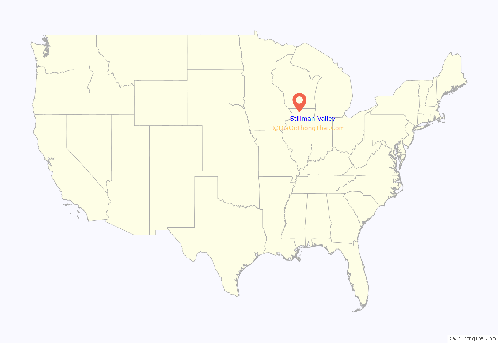
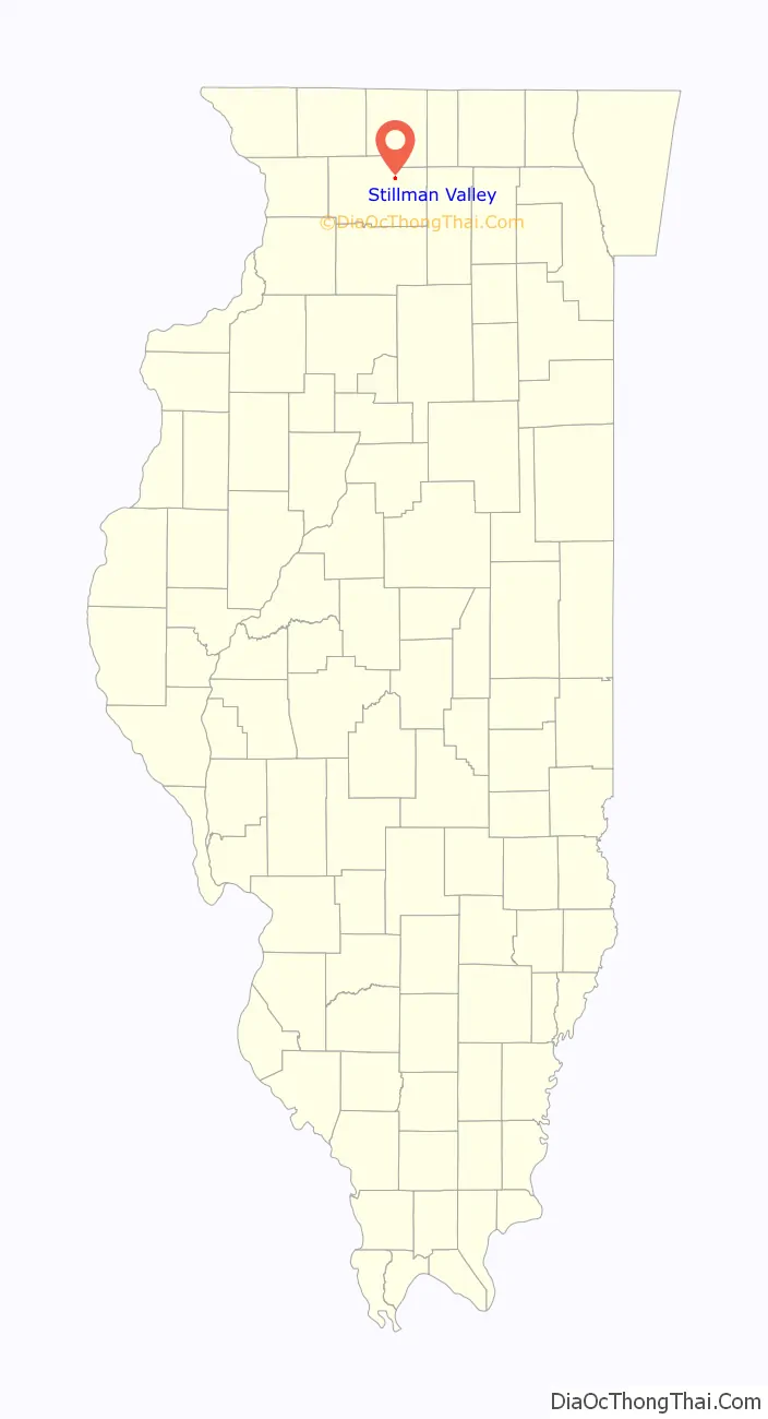
Stillman Valley location map. Where is Stillman Valley village?
History
Stillman Valley was founded by European-American settlers in north central Illinois in 1876. A creek running through the community was named after Major Stillman of the Illinois Militia who on May 14, 1832 led troops in what became the first named battle of the Black Hawk War. The battle and the creek were called “Stillman’s Run” after Stillman and his men fled the battlefield in the belief that they had been attacked by a superior force of Chief Black Hawk’s warriors. The day after the battle, Abraham Lincoln was with the militia who buried the dead soldiers from the battle. The village was named after Stillman Creek; the valley serves as the watershed for the creek, hence the name Stillman Valley.
The Stillman’s Run Battle Site and burial ground are in present-day Stillman Valley. A large memorial to this battle was erected in 1901. It reads, in part: “Here, on May 14, 1832, the first engagement of the Black Hawk War took place. When 275 Illinois militiamen under Maj. Isaiah Stillman were put to flight by Black Hawk and his warriors.”
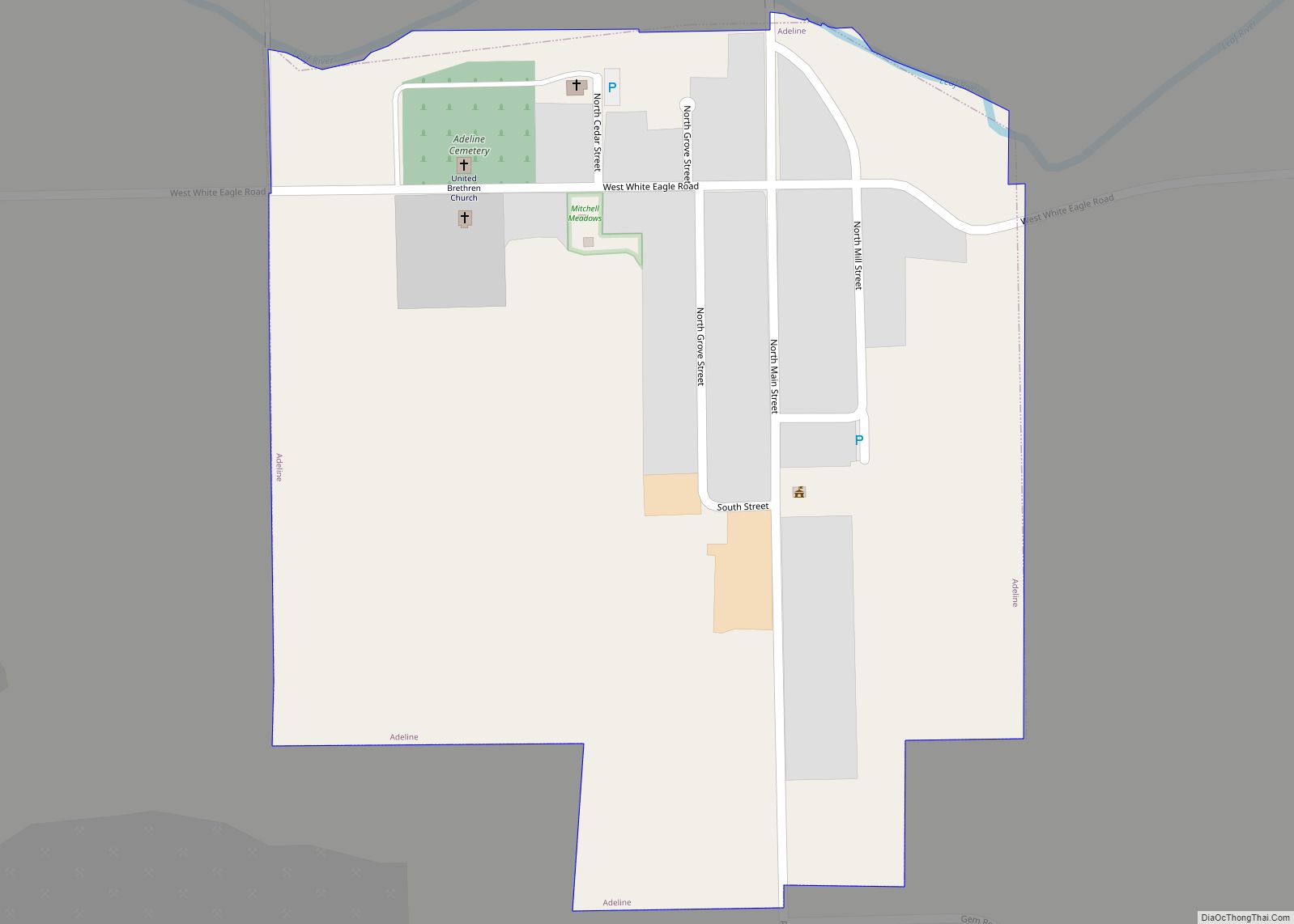
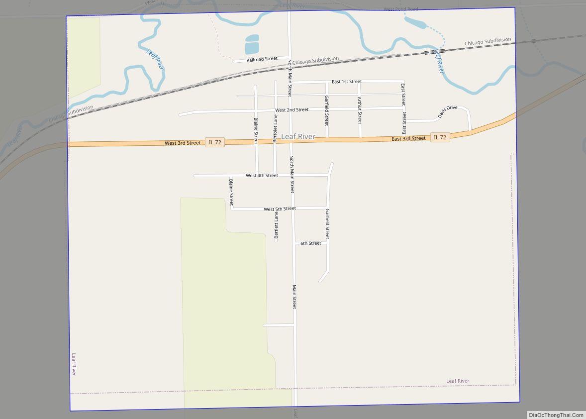
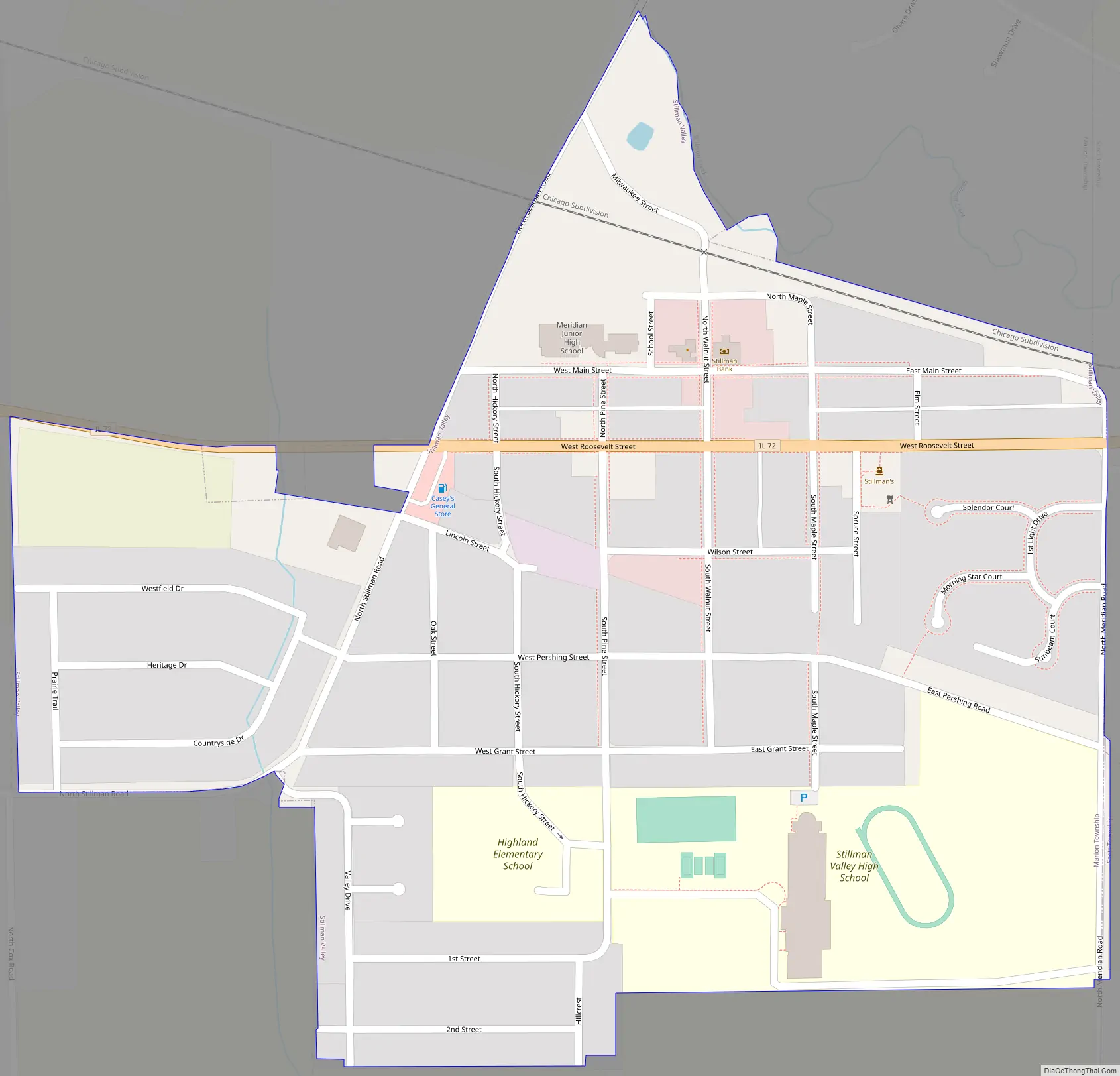
Stillman Valley Road Map
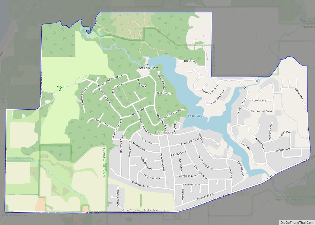
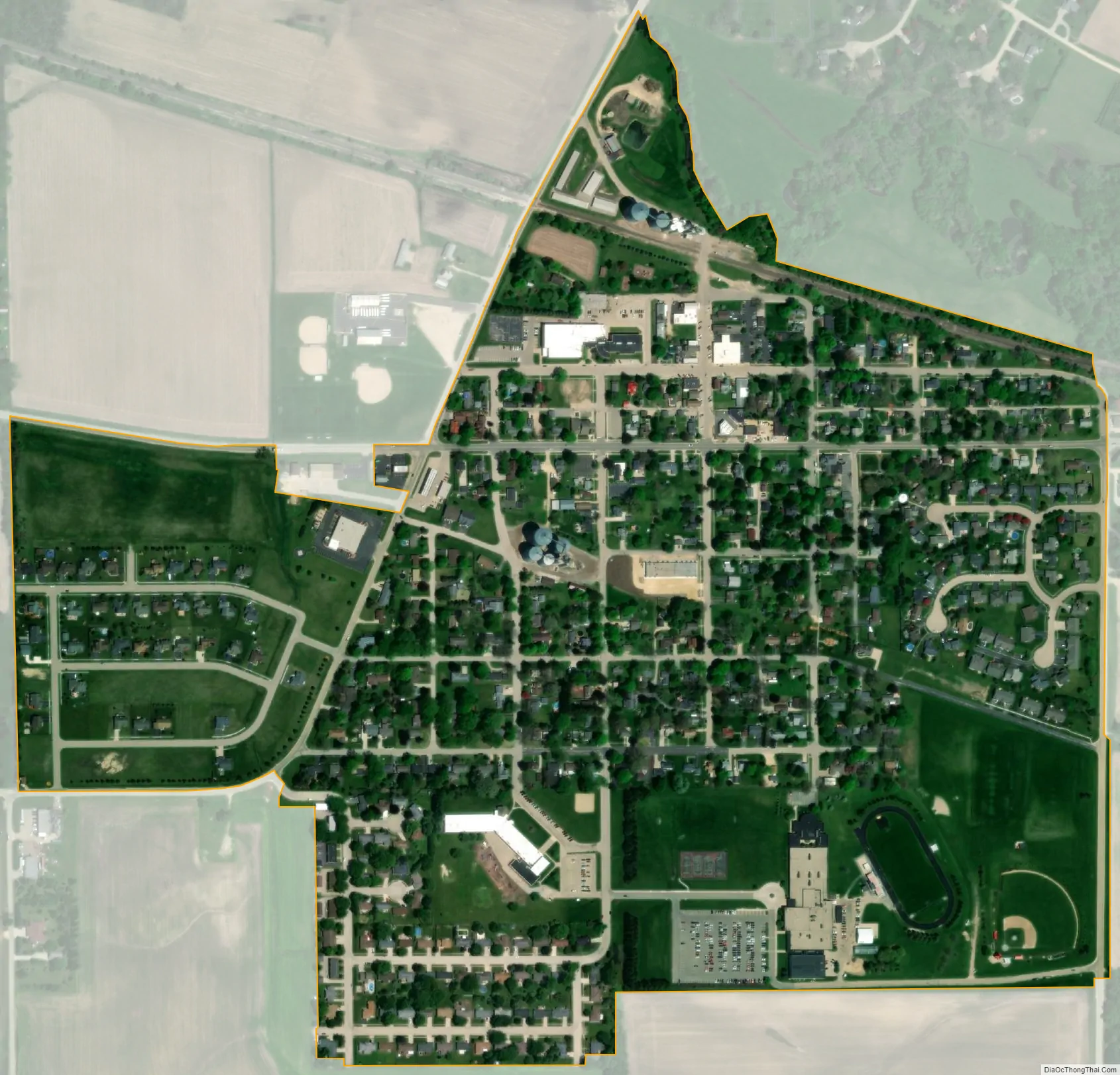
Stillman Valley city Satellite Map
Geography
According to the 2010 census, Stillman Valley has a total area of 0.54 square miles (1.40 km), all land.
See also
Map of Illinois State and its subdivision:- Adams
- Alexander
- Bond
- Boone
- Brown
- Bureau
- Calhoun
- Carroll
- Cass
- Champaign
- Christian
- Clark
- Clay
- Clinton
- Coles
- Cook
- Crawford
- Cumberland
- De Kalb
- De Witt
- Douglas
- Dupage
- Edgar
- Edwards
- Effingham
- Fayette
- Ford
- Franklin
- Fulton
- Gallatin
- Greene
- Grundy
- Hamilton
- Hancock
- Hardin
- Henderson
- Henry
- Iroquois
- Jackson
- Jasper
- Jefferson
- Jersey
- Jo Daviess
- Johnson
- Kane
- Kankakee
- Kendall
- Knox
- La Salle
- Lake
- Lake Michigan
- Lawrence
- Lee
- Livingston
- Logan
- Macon
- Macoupin
- Madison
- Marion
- Marshall
- Mason
- Massac
- McDonough
- McHenry
- McLean
- Menard
- Mercer
- Monroe
- Montgomery
- Morgan
- Moultrie
- Ogle
- Peoria
- Perry
- Piatt
- Pike
- Pope
- Pulaski
- Putnam
- Randolph
- Richland
- Rock Island
- Saint Clair
- Saline
- Sangamon
- Schuyler
- Scott
- Shelby
- Stark
- Stephenson
- Tazewell
- Union
- Vermilion
- Wabash
- Warren
- Washington
- Wayne
- White
- Whiteside
- Will
- Williamson
- Winnebago
- Woodford
- Alabama
- Alaska
- Arizona
- Arkansas
- California
- Colorado
- Connecticut
- Delaware
- District of Columbia
- Florida
- Georgia
- Hawaii
- Idaho
- Illinois
- Indiana
- Iowa
- Kansas
- Kentucky
- Louisiana
- Maine
- Maryland
- Massachusetts
- Michigan
- Minnesota
- Mississippi
- Missouri
- Montana
- Nebraska
- Nevada
- New Hampshire
- New Jersey
- New Mexico
- New York
- North Carolina
- North Dakota
- Ohio
- Oklahoma
- Oregon
- Pennsylvania
- Rhode Island
- South Carolina
- South Dakota
- Tennessee
- Texas
- Utah
- Vermont
- Virginia
- Washington
- West Virginia
- Wisconsin
- Wyoming