Sublette is a village in Lee County, Illinois, United States. The population was 449 at the 2010 census.
| Name: | Sublette village |
|---|---|
| LSAD Code: | 47 |
| LSAD Description: | village (suffix) |
| State: | Illinois |
| County: | Lee County |
| Incorporated: | February 18, 1857 |
| Elevation: | 927 ft (283 m) |
| Total Area: | 0.40 sq mi (1.04 km²) |
| Land Area: | 0.40 sq mi (1.04 km²) |
| Water Area: | 0.00 sq mi (0.00 km²) |
| Total Population: | 380 |
| Population Density: | 947.63/sq mi (366.04/km²) |
| ZIP code: | 61367 |
| Area code: | 815 |
| FIPS code: | 1773287 |
| Website: | www.subletteweb.com |
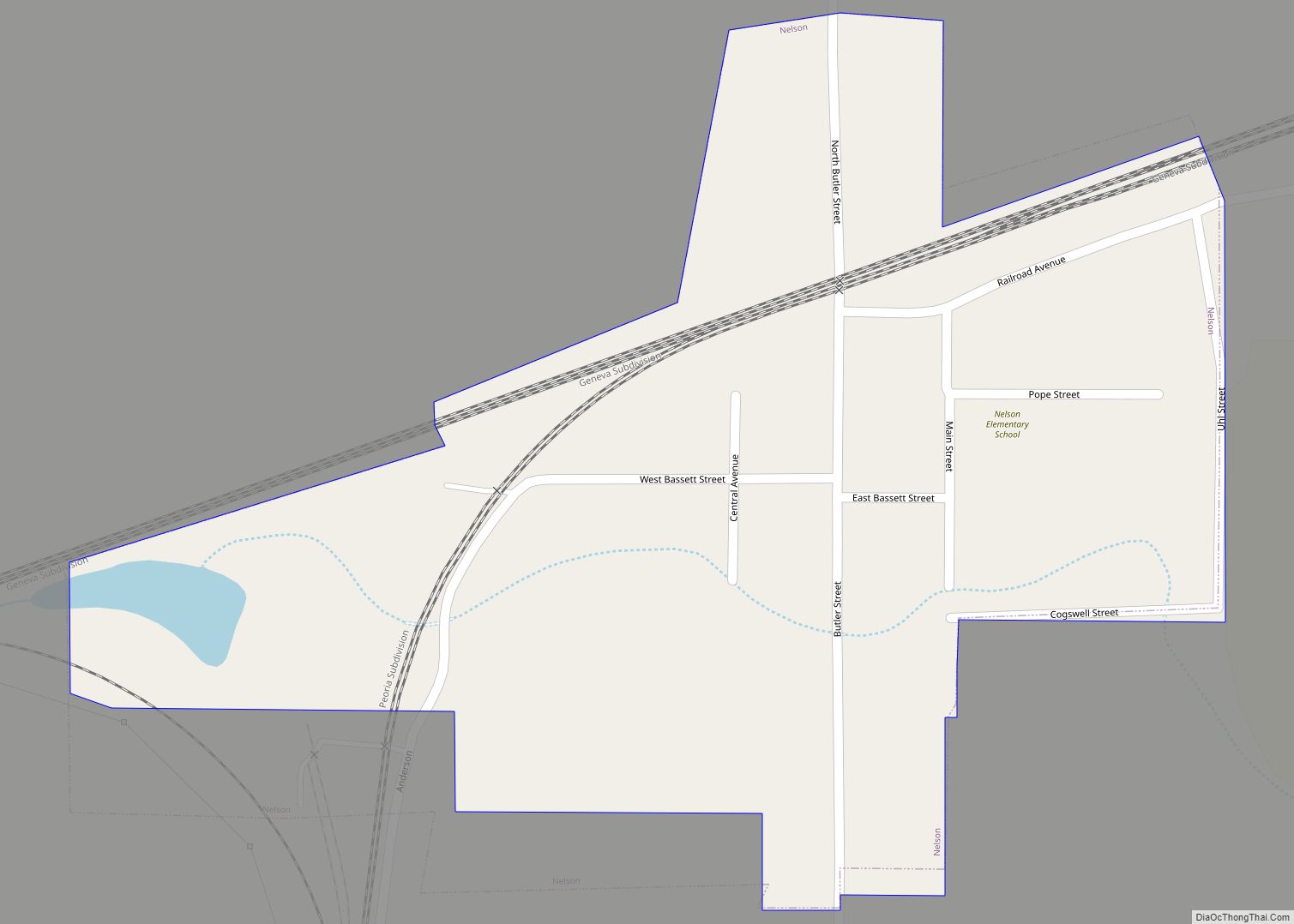
Online Interactive Map
Click on ![]() to view map in "full screen" mode.
to view map in "full screen" mode.
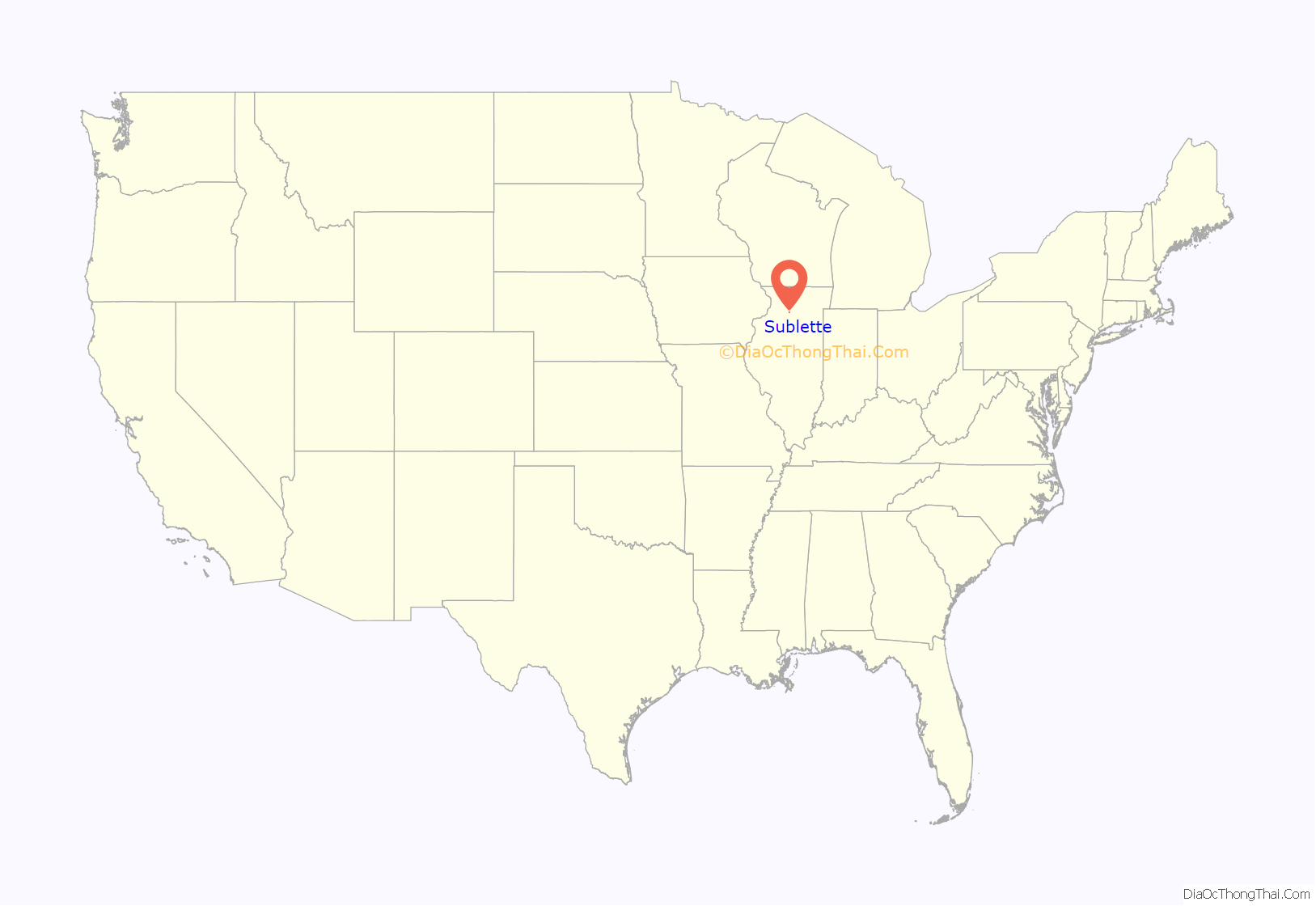
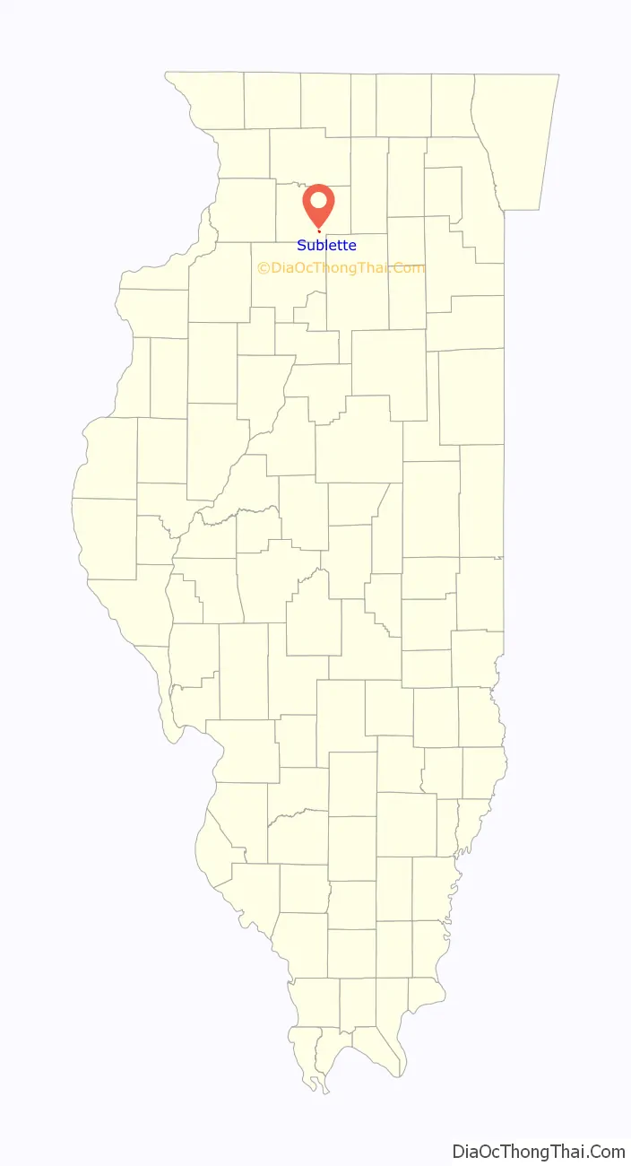
Sublette location map. Where is Sublette village?
History
The earliest references to Sublette as a town are from plat maps dating to the 1850s. At this point in time, Sublette was known as “Hanno” (named for Hanau, Prussia). It was a small cluster of houses just north of the settlement at Knox Grove.
In 1854, the Illinois Central Railroad built a line through Hanno and constructed a depot there for passenger and freight services. A plat map from the following year lists the town’s name as being “Soublette” or the “Town of Soublett”. The town name was officially changed to “Sublette” by an act of the state legislature in 1857. The name is unaffiliated with the town being sublet from the railroad; it likely traces back to an Americanized spelling of the French surname Soblet.
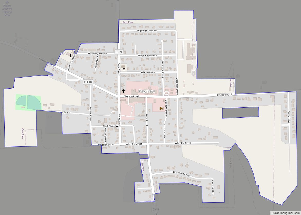
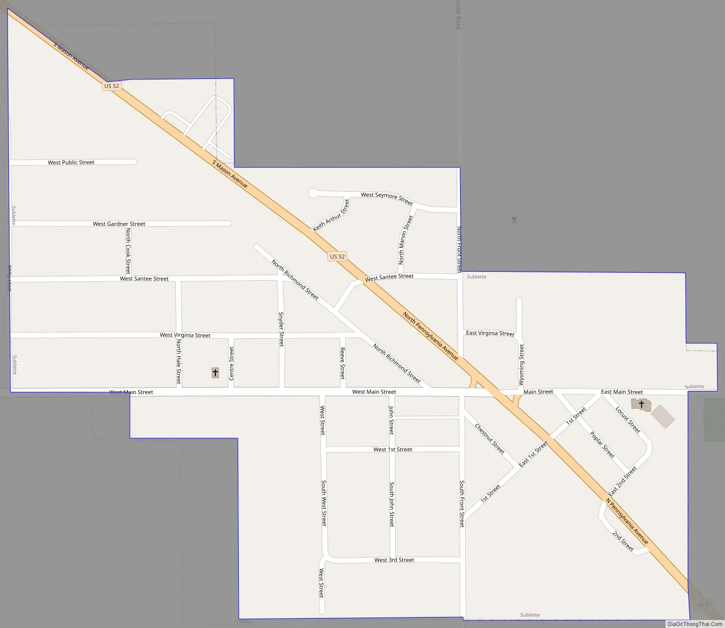
Sublette Road Map
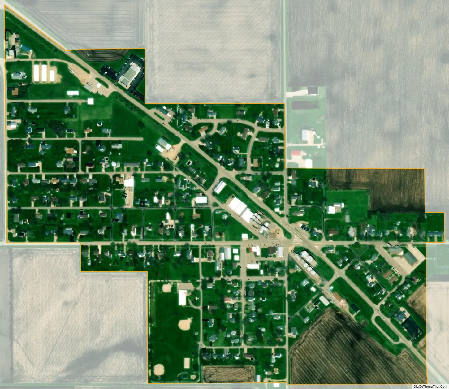
Sublette city Satellite Map
Geography
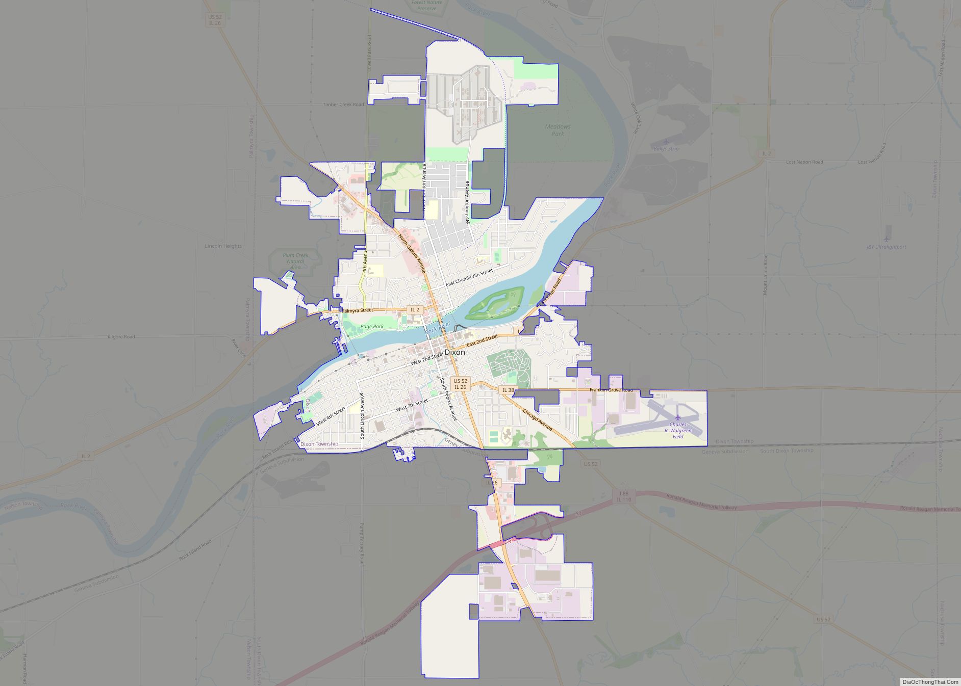
Sublette is located in southern Lee County at 41°38′35″N 89°13′50″W / 41.64306°N 89.23056°W / 41.64306; -89.23056 (41.643141, -89.230460). U.S. Route 52 passes through the village as North Pennsylvania Avenue. US 52 leads northwest 7 miles (11 km) to Amboy and southeast 9 miles (14 km) to Mendota. Dixon, the Lee county seat, is 20 miles (32 km) northwest of Sublette via US 52.
Woodhaven Lakes, a private camping resort, is 3 miles (5 km) northwest of Sublette.
According to the 2010 census, Sublette has a total area of 0.35 square miles (0.91 km), all land.
See also
Map of Illinois State and its subdivision:- Adams
- Alexander
- Bond
- Boone
- Brown
- Bureau
- Calhoun
- Carroll
- Cass
- Champaign
- Christian
- Clark
- Clay
- Clinton
- Coles
- Cook
- Crawford
- Cumberland
- De Kalb
- De Witt
- Douglas
- Dupage
- Edgar
- Edwards
- Effingham
- Fayette
- Ford
- Franklin
- Fulton
- Gallatin
- Greene
- Grundy
- Hamilton
- Hancock
- Hardin
- Henderson
- Henry
- Iroquois
- Jackson
- Jasper
- Jefferson
- Jersey
- Jo Daviess
- Johnson
- Kane
- Kankakee
- Kendall
- Knox
- La Salle
- Lake
- Lake Michigan
- Lawrence
- Lee
- Livingston
- Logan
- Macon
- Macoupin
- Madison
- Marion
- Marshall
- Mason
- Massac
- McDonough
- McHenry
- McLean
- Menard
- Mercer
- Monroe
- Montgomery
- Morgan
- Moultrie
- Ogle
- Peoria
- Perry
- Piatt
- Pike
- Pope
- Pulaski
- Putnam
- Randolph
- Richland
- Rock Island
- Saint Clair
- Saline
- Sangamon
- Schuyler
- Scott
- Shelby
- Stark
- Stephenson
- Tazewell
- Union
- Vermilion
- Wabash
- Warren
- Washington
- Wayne
- White
- Whiteside
- Will
- Williamson
- Winnebago
- Woodford
- Alabama
- Alaska
- Arizona
- Arkansas
- California
- Colorado
- Connecticut
- Delaware
- District of Columbia
- Florida
- Georgia
- Hawaii
- Idaho
- Illinois
- Indiana
- Iowa
- Kansas
- Kentucky
- Louisiana
- Maine
- Maryland
- Massachusetts
- Michigan
- Minnesota
- Mississippi
- Missouri
- Montana
- Nebraska
- Nevada
- New Hampshire
- New Jersey
- New Mexico
- New York
- North Carolina
- North Dakota
- Ohio
- Oklahoma
- Oregon
- Pennsylvania
- Rhode Island
- South Carolina
- South Dakota
- Tennessee
- Texas
- Utah
- Vermont
- Virginia
- Washington
- West Virginia
- Wisconsin
- Wyoming