Wood Dale is a city in Addison Township, DuPage County, Illinois, United States. Per the 2020 census, the population was 14,012.
| Name: | Wood Dale city |
|---|---|
| LSAD Code: | 25 |
| LSAD Description: | city (suffix) |
| State: | Illinois |
| County: | DuPage County |
| Founded: | 1928 |
| Elevation: | 686 ft (209 m) |
| Total Area: | 4.85 sq mi (12.55 km²) |
| Land Area: | 4.74 sq mi (12.29 km²) |
| Water Area: | 0.10 sq mi (0.26 km²) |
| Total Population: | 14,012 |
| Population Density: | 2,953.63/sq mi (1,140.44/km²) |
| Area code: | 630 |
| FIPS code: | 1782985 |
| GNISfeature ID: | 2397360 |
| Website: | http://www.wooddale.com |
Online Interactive Map
Click on ![]() to view map in "full screen" mode.
to view map in "full screen" mode.
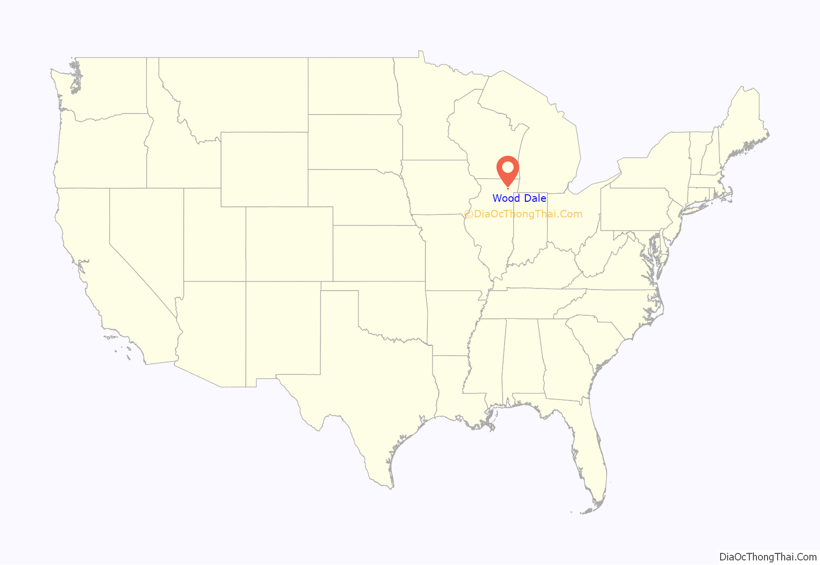
Wood Dale location map. Where is Wood Dale city?
History
Wood Dale was originally known as Lester’s Station, after John Lester, an early settler.
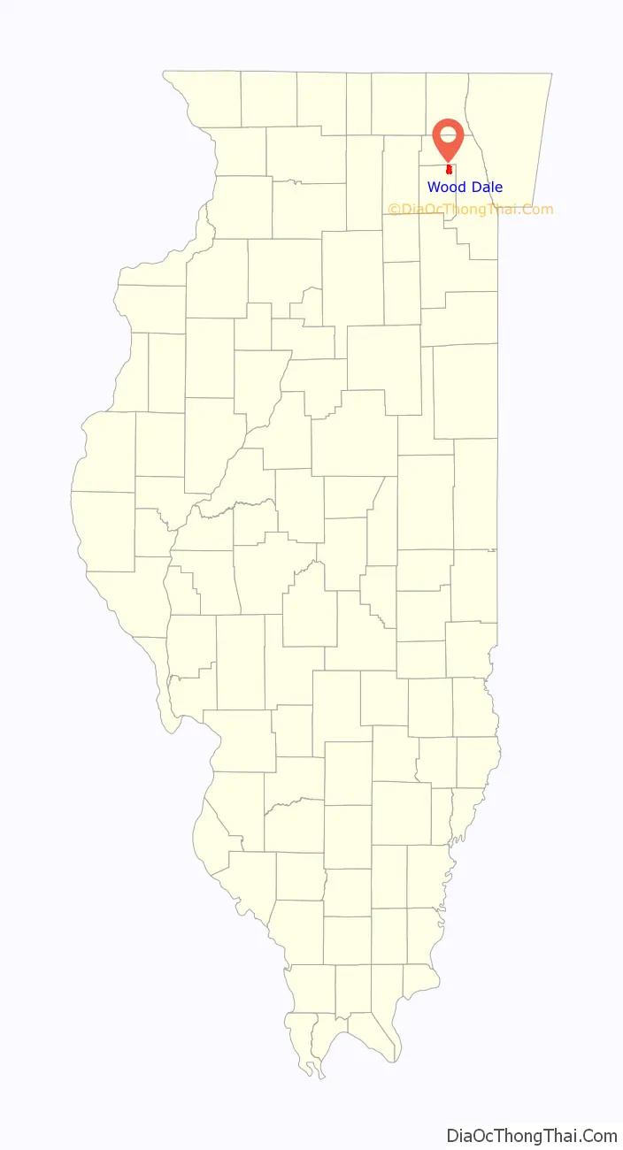
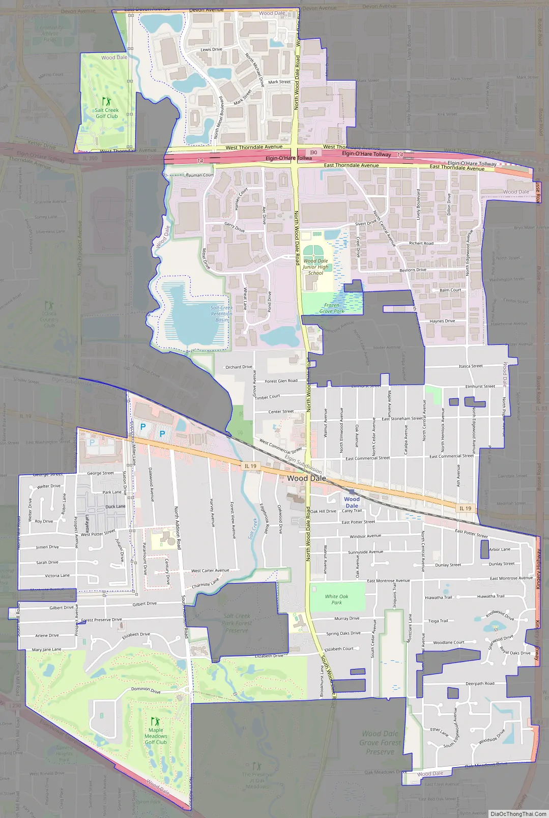
Wood Dale Road Map
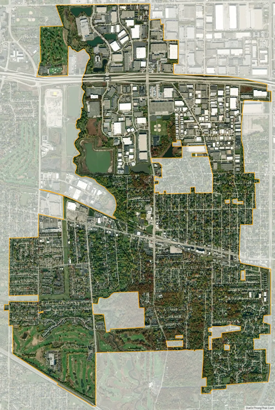
Wood Dale city Satellite Map
Geography
According to the 2021 census gazetteer files, Wood Dale has a total area of 4.89 square miles (12.67 km), of which 4.78 square miles (12.38 km) (or 97.91%) is land and 0.10 square miles (0.26 km) (or 2.09%) is water.
Wood Dale shares borders with Elk Grove Village (on the north), Bensenville (east), Addison (south, southwest) and Itasca (west).
See also
Map of Illinois State and its subdivision:- Adams
- Alexander
- Bond
- Boone
- Brown
- Bureau
- Calhoun
- Carroll
- Cass
- Champaign
- Christian
- Clark
- Clay
- Clinton
- Coles
- Cook
- Crawford
- Cumberland
- De Kalb
- De Witt
- Douglas
- Dupage
- Edgar
- Edwards
- Effingham
- Fayette
- Ford
- Franklin
- Fulton
- Gallatin
- Greene
- Grundy
- Hamilton
- Hancock
- Hardin
- Henderson
- Henry
- Iroquois
- Jackson
- Jasper
- Jefferson
- Jersey
- Jo Daviess
- Johnson
- Kane
- Kankakee
- Kendall
- Knox
- La Salle
- Lake
- Lake Michigan
- Lawrence
- Lee
- Livingston
- Logan
- Macon
- Macoupin
- Madison
- Marion
- Marshall
- Mason
- Massac
- McDonough
- McHenry
- McLean
- Menard
- Mercer
- Monroe
- Montgomery
- Morgan
- Moultrie
- Ogle
- Peoria
- Perry
- Piatt
- Pike
- Pope
- Pulaski
- Putnam
- Randolph
- Richland
- Rock Island
- Saint Clair
- Saline
- Sangamon
- Schuyler
- Scott
- Shelby
- Stark
- Stephenson
- Tazewell
- Union
- Vermilion
- Wabash
- Warren
- Washington
- Wayne
- White
- Whiteside
- Will
- Williamson
- Winnebago
- Woodford
- Alabama
- Alaska
- Arizona
- Arkansas
- California
- Colorado
- Connecticut
- Delaware
- District of Columbia
- Florida
- Georgia
- Hawaii
- Idaho
- Illinois
- Indiana
- Iowa
- Kansas
- Kentucky
- Louisiana
- Maine
- Maryland
- Massachusetts
- Michigan
- Minnesota
- Mississippi
- Missouri
- Montana
- Nebraska
- Nevada
- New Hampshire
- New Jersey
- New Mexico
- New York
- North Carolina
- North Dakota
- Ohio
- Oklahoma
- Oregon
- Pennsylvania
- Rhode Island
- South Carolina
- South Dakota
- Tennessee
- Texas
- Utah
- Vermont
- Virginia
- Washington
- West Virginia
- Wisconsin
- Wyoming