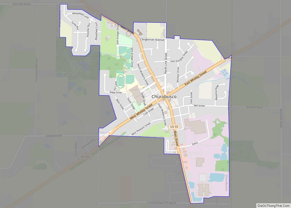
Churubusco (/ˌtʃɛrəˈbʌskoʊ/ or /ˌtʃɛriˈbʌsɡoʊ/); often shortened to Busco (/ˈbʌskoʊ/), is a town located near the headwaters of the Eel River in the extreme northeast corner of Whitley County, Indiana, United States, in Smith Township, about 16 miles (26 km) northwest of Fort Wayne. The population was 1,796 at the 2010 census.
| Name: | Churubusco town |
|---|---|
| LSAD Code: | 43 |
| LSAD Description: | town (suffix) |
| State: | Indiana |
| County: | Whitley County |
| Elevation: | 896 ft (273 m) |
| Total Area: | 1.05 sq mi (2.71 km²) |
| Land Area: | 1.05 sq mi (2.71 km²) |
| Water Area: | 0.00 sq mi (0.00 km²) |
| Total Population: | 1,870 |
| Population Density: | 1,784.35/sq mi (689.18/km²) |
| ZIP code: | 46723 |
| Area code: | 260 |
| FIPS code: | 1812610 |
| GNISfeature ID: | 432516 |
| Website: | http://www.townofchurubusco.com |
Online Interactive Map
Click on ![]() to view map in "full screen" mode.
to view map in "full screen" mode.
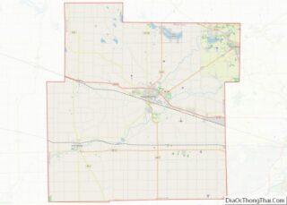
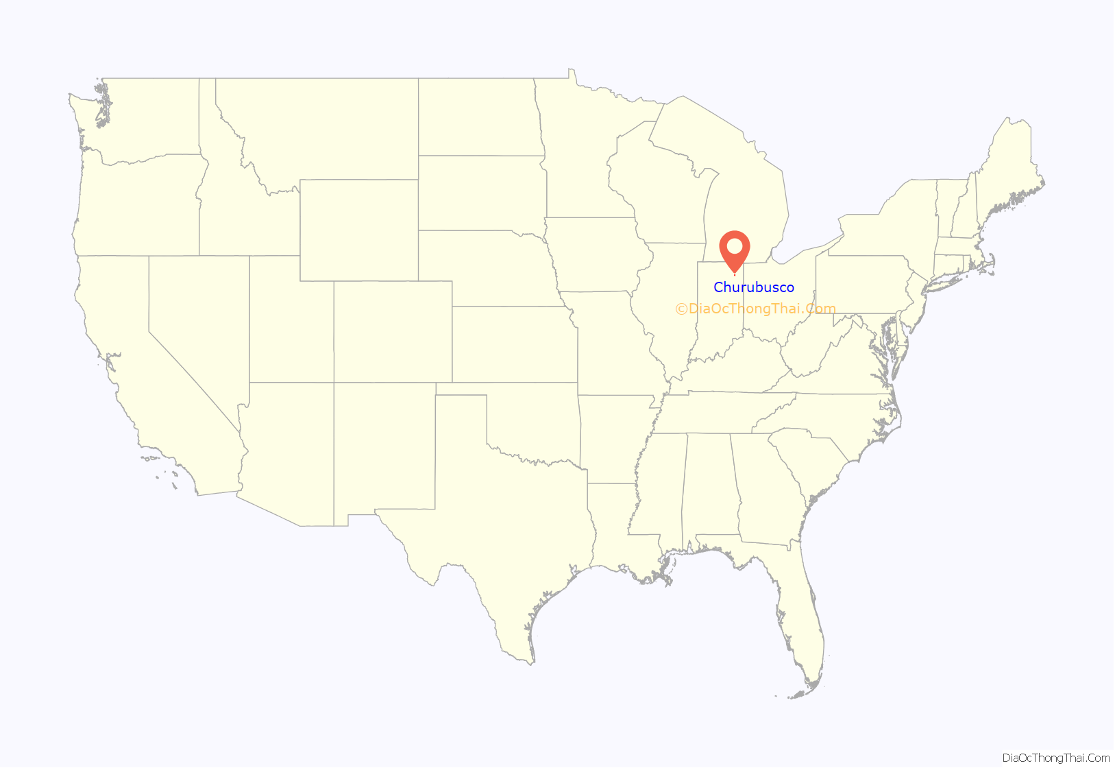
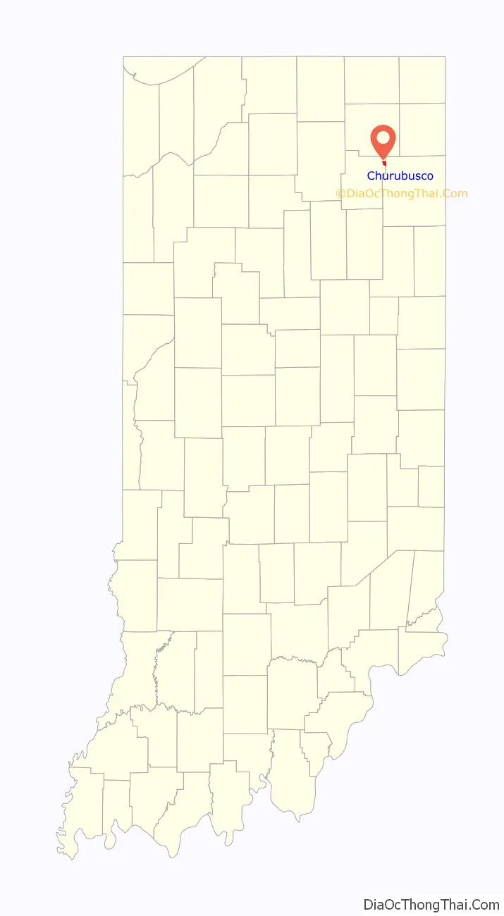
Churubusco location map. Where is Churubusco town?
History
Originally, the area of Churubusco was made up of two towns founded in the 19th century by European Americans: Union and Franklin (in honor of Founding Father Benjamin Franklin) that bordered each other across a railroad track. In the 1840s, the populations of both Franklin and Union grew large enough to qualify each for a post office. Before that time, residents of both towns had to trek 11 miles by foot or horse and buggy to nearby Columbia City to get their mail. Since the towns were in the same location, the Postmaster General ordered the towns to apply for a joint post office. The Postmaster General denied the use of either “Union” and “Franklin” as the new post office name, since both were already used by other Indiana towns.
After a community meeting, the residents selected Churubusco for the new post office, named after the site of the 1847 Battle of Churubusco, in Mexico during the Mexican–American War. At the time, after the suggestion of local school teacher Eliza Rich, the townsfolk thought it was as patriotic a name as Union and Franklin, since the United States won a large victory there. More importantly, they were certain no other Indiana town would already have chosen such a unique name. The Churubusco post office has been in operation since 1848.
The name Churubusco is a Spanish corruption of an indigenous Nahuatl toponym (place name) referring to a temple area celebrating the Aztec god Huitzilopochtli. It is bordered by the Rio Churubusco in Mexico City. The Spanish-Nahuatl word literally translates as ‘place (or temple) of Huitzilopochtli (the left side or south of the hummingbird)’.
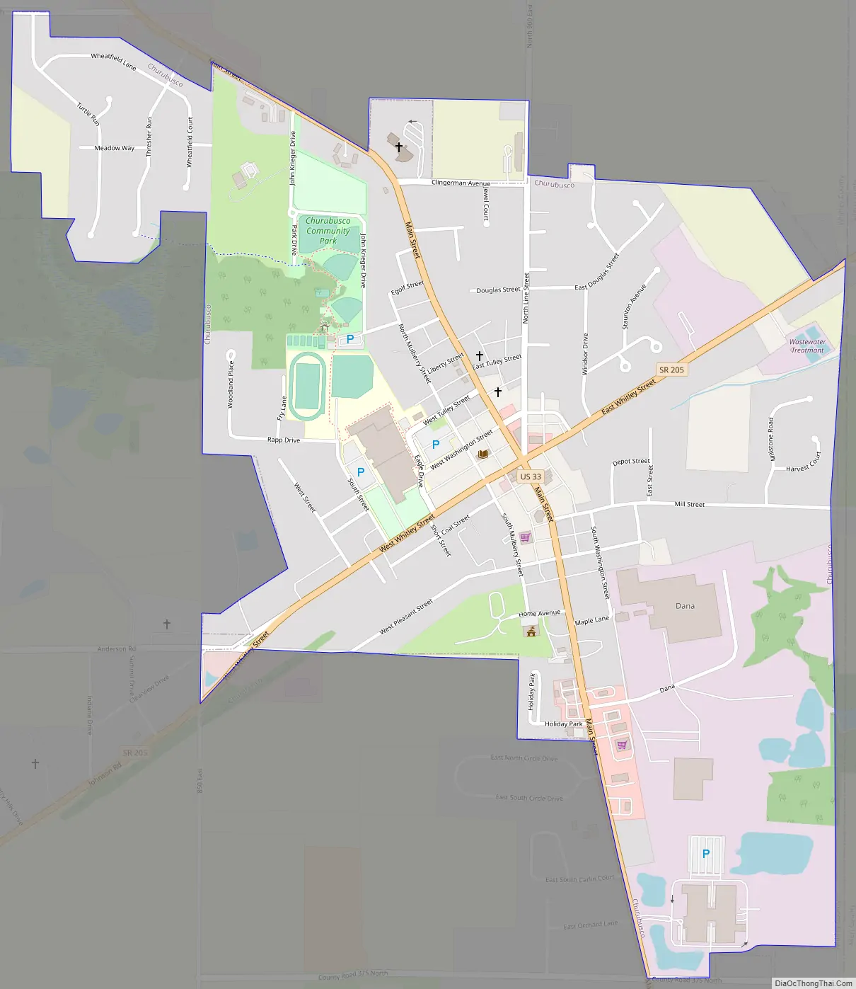
Churubusco Road Map
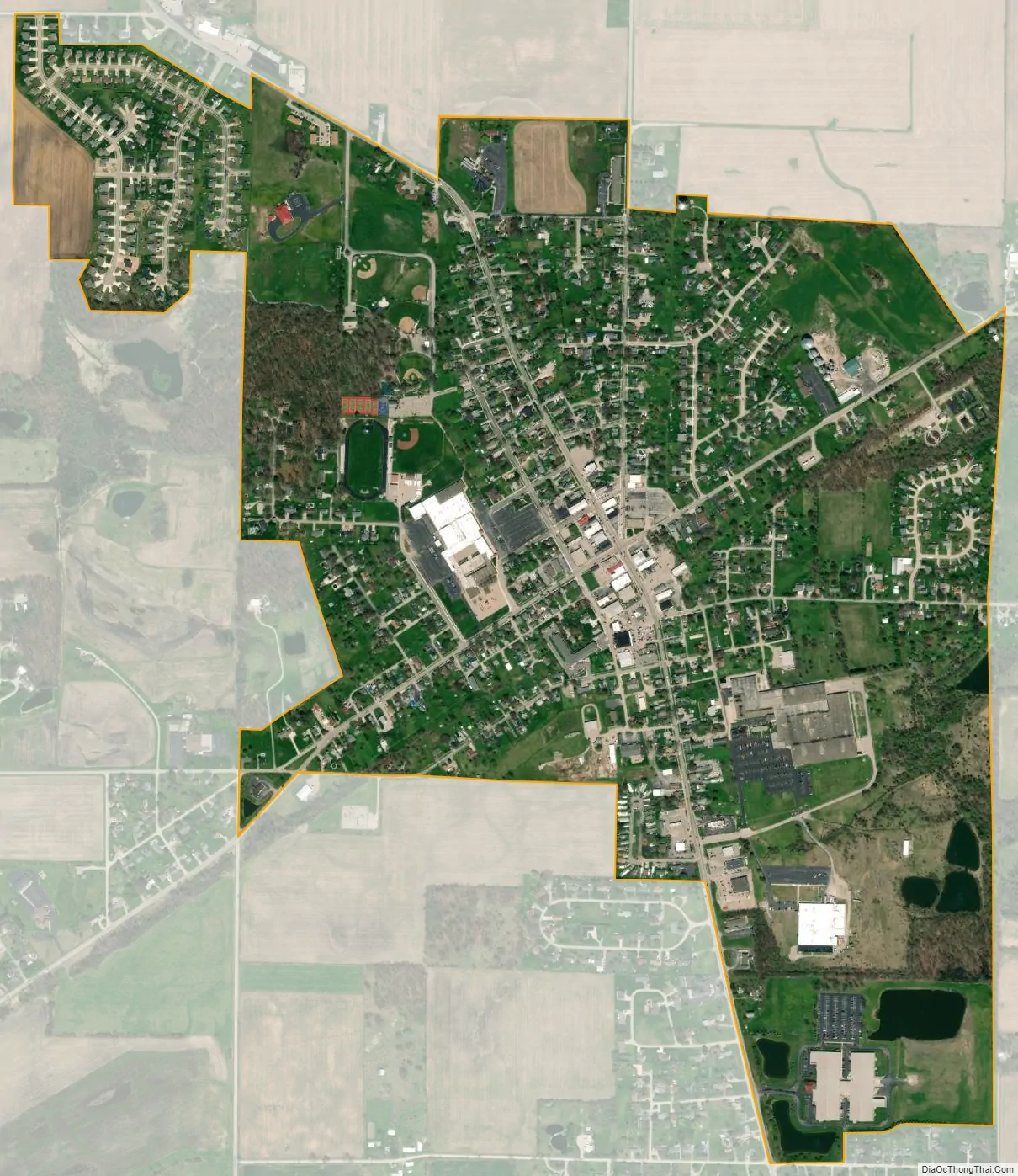
Churubusco city Satellite Map
Geography
According to the 2010 census, Churubusco has a total area of 0.9 square miles (2.33 km), all land.
See also
Map of Indiana State and its subdivision:- Adams
- Allen
- Bartholomew
- Benton
- Blackford
- Boone
- Brown
- Carroll
- Cass
- Clark
- Clay
- Clinton
- Crawford
- Daviess
- De Kalb
- Dearborn
- Decatur
- Delaware
- Dubois
- Elkhart
- Fayette
- Floyd
- Fountain
- Franklin
- Fulton
- Gibson
- Grant
- Greene
- Hamilton
- Hancock
- Harrison
- Hendricks
- Henry
- Howard
- Huntington
- Jackson
- Jasper
- Jay
- Jefferson
- Jennings
- Johnson
- Knox
- Kosciusko
- LaGrange
- Lake
- Lake Michigan
- LaPorte
- Lawrence
- Madison
- Marion
- Marshall
- Martin
- Miami
- Monroe
- Montgomery
- Morgan
- Newton
- Noble
- Ohio
- Orange
- Owen
- Parke
- Perry
- Pike
- Porter
- Posey
- Pulaski
- Putnam
- Randolph
- Ripley
- Rush
- Saint Joseph
- Scott
- Shelby
- Spencer
- Starke
- Steuben
- Sullivan
- Switzerland
- Tippecanoe
- Tipton
- Union
- Vanderburgh
- Vermillion
- Vigo
- Wabash
- Warren
- Warrick
- Washington
- Wayne
- Wells
- White
- Whitley
- Alabama
- Alaska
- Arizona
- Arkansas
- California
- Colorado
- Connecticut
- Delaware
- District of Columbia
- Florida
- Georgia
- Hawaii
- Idaho
- Illinois
- Indiana
- Iowa
- Kansas
- Kentucky
- Louisiana
- Maine
- Maryland
- Massachusetts
- Michigan
- Minnesota
- Mississippi
- Missouri
- Montana
- Nebraska
- Nevada
- New Hampshire
- New Jersey
- New Mexico
- New York
- North Carolina
- North Dakota
- Ohio
- Oklahoma
- Oregon
- Pennsylvania
- Rhode Island
- South Carolina
- South Dakota
- Tennessee
- Texas
- Utah
- Vermont
- Virginia
- Washington
- West Virginia
- Wisconsin
- Wyoming