Lonsdale is a city in Rice County, Minnesota, United States. The population was 4,686 at the 2020 census, with a 2023 estimate of 5,009. A fast growing exurb of the Minneapolis-Saint Paul metropolitan area, Lonsdale is located 40 miles south of downtown Minneapolis.
| Name: | Lonsdale city |
|---|---|
| LSAD Code: | 25 |
| LSAD Description: | city (suffix) |
| State: | Minnesota |
| County: | Rice County |
| Incorporated: | 1903 |
| Elevation: | 1,093 ft (333 m) |
| Total Area: | 2.66 sq mi (6.88 km²) |
| Land Area: | 2.63 sq mi (6.81 km²) |
| Water Area: | 0.03 sq mi (0.06 km²) |
| Total Population: | 4,686 |
| Population Density: | 1,781.07/sq mi (687.70/km²) |
| ZIP code: | 55046 |
| Area code: | 507 |
| FIPS code: | 2738150 |
| GNISfeature ID: | 0647154 |
| Website: | www.lonsdale.govoffice.com |
Online Interactive Map
Click on ![]() to view map in "full screen" mode.
to view map in "full screen" mode.
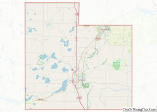
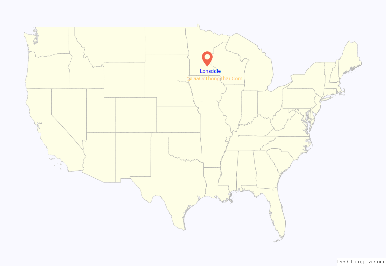
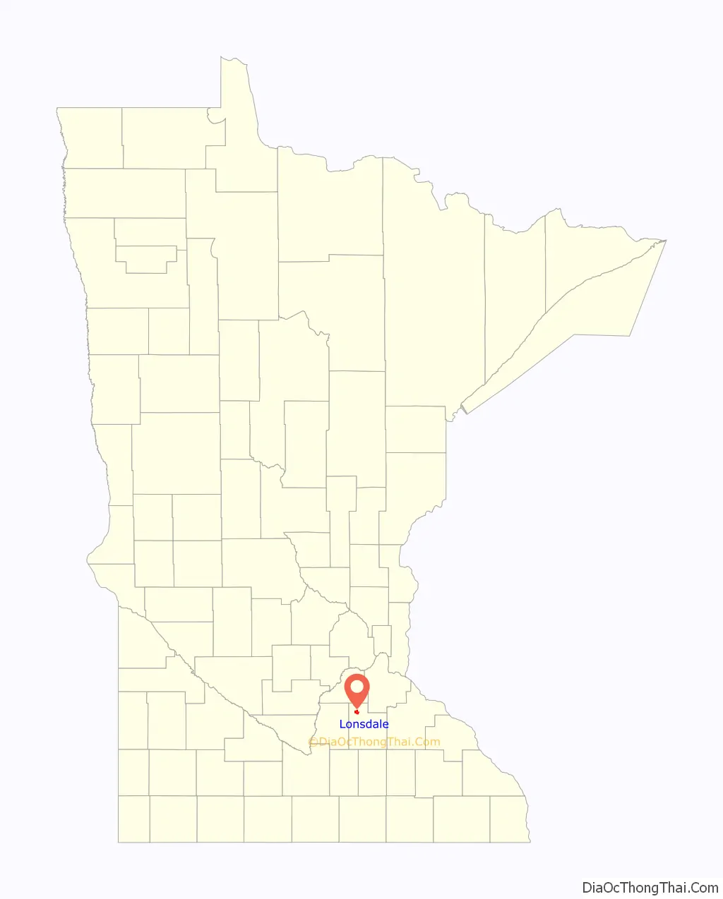
Lonsdale location map. Where is Lonsdale city?
History
Prior to the American Civil War, a number of families of Czech descent had begun migrating to south central Minnesota from Bohemia. In 1878, a small settlement of Norwegian farmers built a Lutheran church slightly to the southeast of present day Lonsdale. They called the area Trondhjem, after the name of the city in Norway from which they had descended. In 1891, a proposed new railroad from Mankato to Farmington was reported in the New Prague Times. However, construction of this railroad was never initiated due to an economic downturn.
It was the Chicago, Milwaukee and St. Paul Railway that proceeded with plans for their existing branch line from Wells to Mankato, to begin constructing trackage northeastward into Farmington. The extension of this line would bring the possibility of development, population growth and job opportunities to towns along the prospective line such as Cleveland, Le Sueur Center, Veseli and New Market. But the businesses of the Veseli area favored the construction of a spur line of the Minneapolis & St. Louis Railway (M & St. L) from New Prague instead.
In July and August of 1901, the Chicago, Milwaukee, and St. Paul Railway created their right-of-way with the purchase of a 100 foot wide strip of land that ran through the Trondhjem settlement and was therefore also a few miles south of Veseli. At the end of 1901, landowner Thomas Wilby entered into an agreement with the Milwaukee Land Company to develop 40 acres of his property. But the contract stipulated that he must first convey land to the Chicago, Milwaukee, and St. Paul Railway that was necessary to build a train depot. The Milwaukee Land Company would then survey and plot the remaining acres of Wilby’s land in order to establish a village. By January of 1902, a total of 80 acres had been plotted as a new town site. On July 16, 1902 a grand opening of the town of Lonsdale was held as lots were auctioned for sale. Businessman Martin Benzik purchased several of these lots, and constructed the first buildings in Lonsdale: a saloon, a hotel and a livery stable.
The railroad tracks were laid in town on August 1, 1902, and a 20,000 bushel grain elevator was opened on the other side of the railroad tracks from the depot. To be closer to the railway, some former residents of Veseli placed their homes on skids and pulled them to Lonsdale, using steam tractors. In May of 1903, Martin Benzik and other businessmen petitioned for incorporation of the land, known as the Village of Lonsdale. A public election was set for July 1, 1903, and with a vote of 24-0 in favor of incorporation, the city of Lonsdale was born. The initial population of the city was 84 people.
The building of the Catholic Church of the Immaculate Conception was completed by the fall of 1904, a rectory was built alongside the church in 1907, and the Catholic school was built in 1912. Also in 1907, the city water tank was built, and the public school house was constructed in 1908. Calvary Hill Cemetery was established south of Lonsdale in 1910. Several theories exist as to how Lonsdale got its name, but it remains a mystery. One theory is that the town was named after the surveyor from the railroad. Another possibility is that it was named for another place named Lonsdale, either in the United States or England.
Lonsdale Road Map
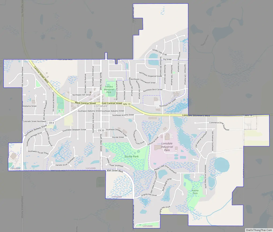
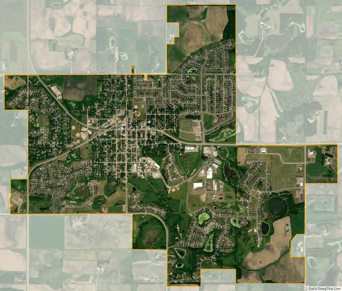
Lonsdale city Satellite Map
Geography
According to the United States Census Bureau, the city has a total area of 2.77 square miles (7.17 km); 2.73 square miles (7.07 km) is land and 0.04 square miles (0.10 km) is water.
Minnesota State Highway 19 serves as a main route in the city.
Lonsdale is six miles (10 km) from Interstate 35.
Nearby lakes
- Circle Lake
- Mazaska Lake
- Shields Lake
- Lake Pepin
Nearby places include Montgomery, Veseli, Webster, and Little Chicago.
See also
Map of Minnesota State and its subdivision:- Aitkin
- Anoka
- Becker
- Beltrami
- Benton
- Big Stone
- Blue Earth
- Brown
- Carlton
- Carver
- Cass
- Chippewa
- Chisago
- Clay
- Clearwater
- Cook
- Cottonwood
- Crow Wing
- Dakota
- Dodge
- Douglas
- Faribault
- Fillmore
- Freeborn
- Goodhue
- Grant
- Hennepin
- Houston
- Hubbard
- Isanti
- Itasca
- Jackson
- Kanabec
- Kandiyohi
- Kittson
- Koochiching
- Lac qui Parle
- Lake
- Lake of the Woods
- Lake Superior
- Le Sueur
- Lincoln
- Lyon
- Mahnomen
- Marshall
- Martin
- McLeod
- Meeker
- Mille Lacs
- Morrison
- Mower
- Murray
- Nicollet
- Nobles
- Norman
- Olmsted
- Otter Tail
- Pennington
- Pine
- Pipestone
- Polk
- Pope
- Ramsey
- Red Lake
- Redwood
- Renville
- Rice
- Rock
- Roseau
- Saint Louis
- Scott
- Sherburne
- Sibley
- Stearns
- Steele
- Stevens
- Swift
- Todd
- Traverse
- Wabasha
- Wadena
- Waseca
- Washington
- Watonwan
- Wilkin
- Winona
- Wright
- Yellow Medicine
- Alabama
- Alaska
- Arizona
- Arkansas
- California
- Colorado
- Connecticut
- Delaware
- District of Columbia
- Florida
- Georgia
- Hawaii
- Idaho
- Illinois
- Indiana
- Iowa
- Kansas
- Kentucky
- Louisiana
- Maine
- Maryland
- Massachusetts
- Michigan
- Minnesota
- Mississippi
- Missouri
- Montana
- Nebraska
- Nevada
- New Hampshire
- New Jersey
- New Mexico
- New York
- North Carolina
- North Dakota
- Ohio
- Oklahoma
- Oregon
- Pennsylvania
- Rhode Island
- South Carolina
- South Dakota
- Tennessee
- Texas
- Utah
- Vermont
- Virginia
- Washington
- West Virginia
- Wisconsin
- Wyoming