St. Francis is a city in Anoka and Isanti counties, Minnesota, United States. The population was 8,142 at the 2020 census.
Minnesota State Highway 47 serves as a main route in the city. Other routes include Ambassador Boulevard.
| Name: | St. Francis city |
|---|---|
| LSAD Code: | 25 |
| LSAD Description: | city (suffix) |
| State: | Minnesota |
| County: | Anoka County, Isanti County |
| Elevation: | 922 ft (281 m) |
| Total Area: | 23.75 sq mi (61.50 km²) |
| Land Area: | 23.32 sq mi (60.38 km²) |
| Water Area: | 0.43 sq mi (1.11 km²) |
| Total Population: | 8,142 |
| Population Density: | 349.22/sq mi (134.83/km²) |
| ZIP code: | 55070 |
| Area code: | 763 |
| FIPS code: | 2756950 |
| GNISfeature ID: | 2396487 |
| Website: | www.stfrancismn.org |
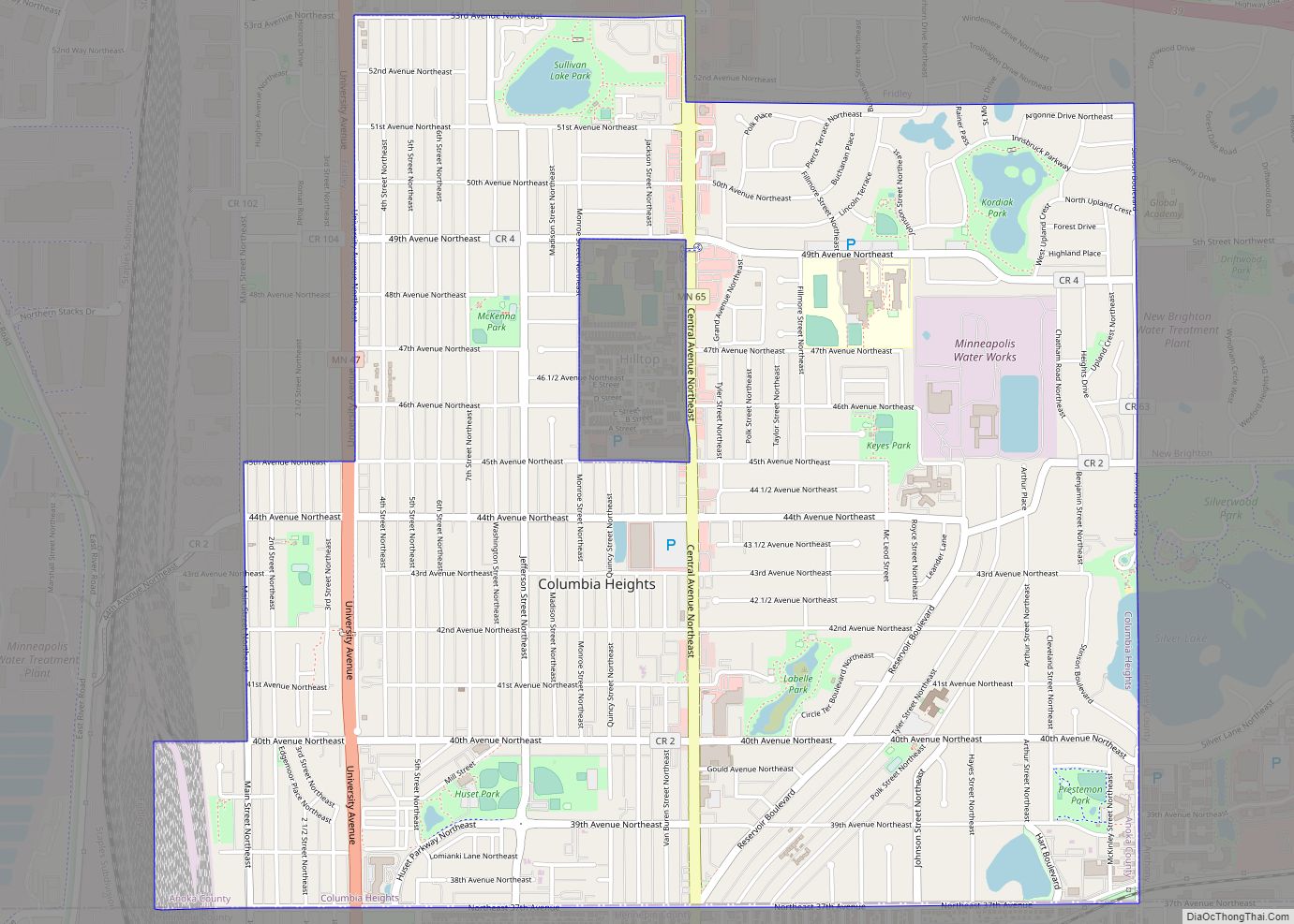
Online Interactive Map
Click on ![]() to view map in "full screen" mode.
to view map in "full screen" mode.
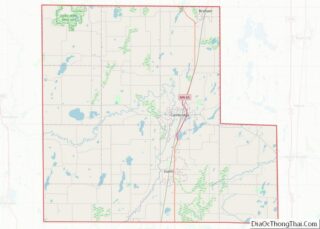
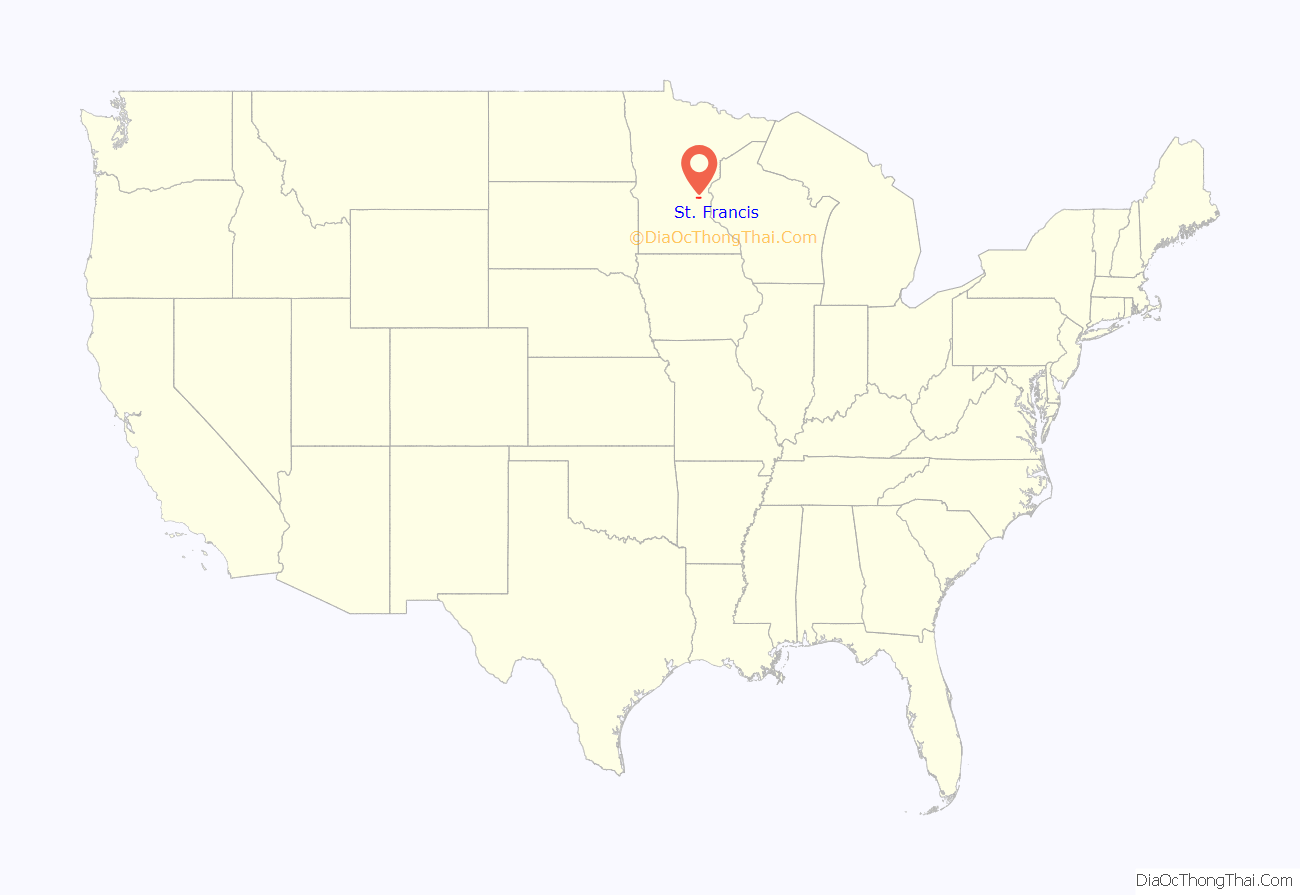
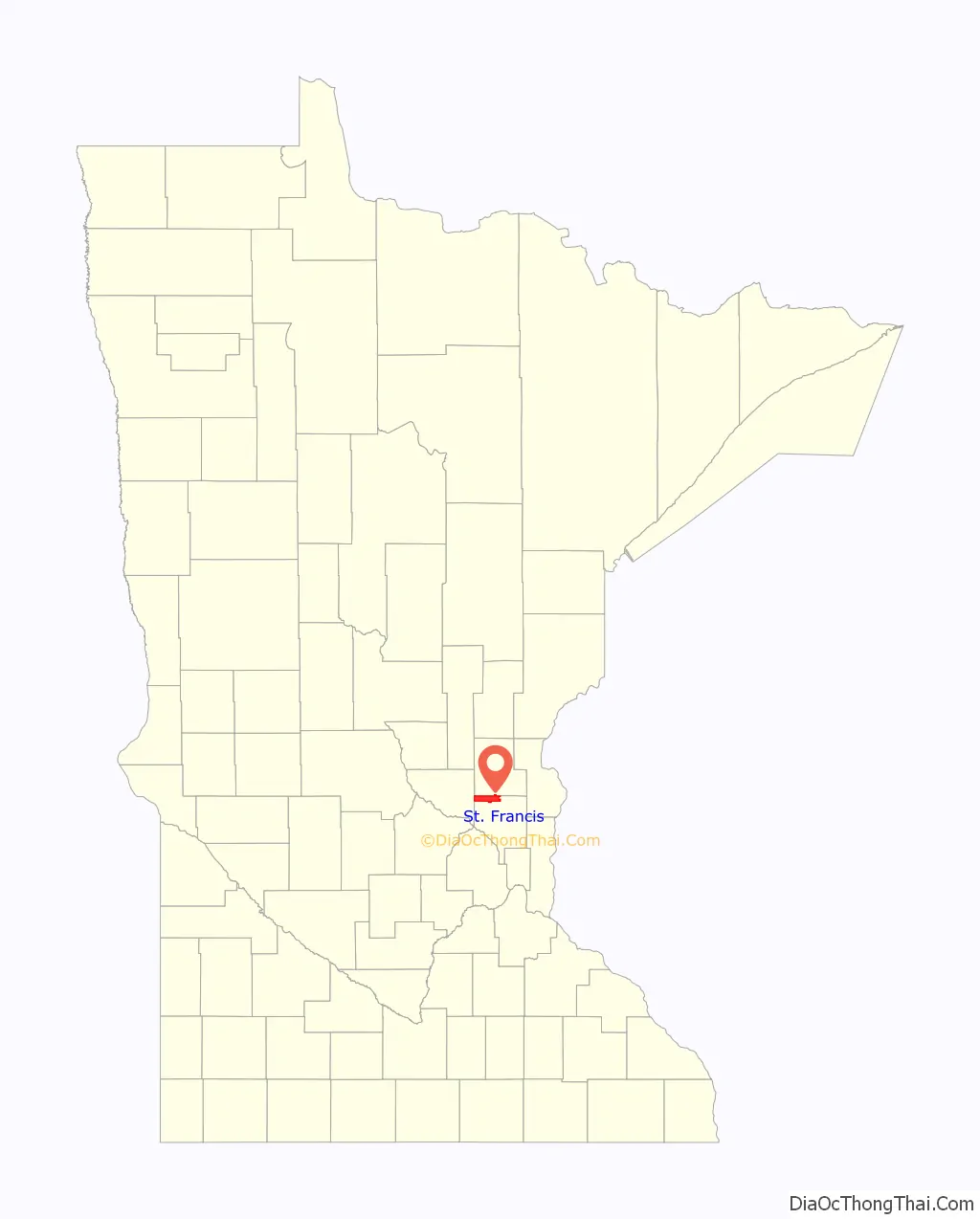
St. Francis location map. Where is St. Francis city?
History
St. Francis was named after Francis of Assisi.
In 1855 Dwight Woodbury built a dam, grist and saw mill, and the first house, which later became the Riverside Hotel. George Armsby and E. Fowler are considered to be the first settlers in the area.
St. Francis Township was settled in 1855 and organized in 1857. The name St. Francis comes from Louis Hennepin, who named the Rum River after St. Francis in 1680.
The first doctor to practice in St. Francis arrived in 1857 and was known as Dr. Marshall. In the same year, school was started at the home of M. Fowler, and Hattie Waterhouse became the first teacher.
In 1869, Burns Township (Nowthen) broke off from St. Francis Township.
In 1879, a general store was started by Pelutiar McClure. In 1888, a large mill was built and owned by Dwight Woodbury and called St. Francis Milling Co. A starch and canning factory was built in 1893. In the early 1890s, Blanchette’s Sample Room Beer Parlour was opened, and was turned into an ice cream parlor when the school was consolidated. The ice cream parlor was run until the owner died in 1933. On July 18, 1933 the mill burnt down and the dam was destroyed. By this time, there was also a blacksmith shop, drug store, and a meat market which was later turned into a livery stable.
Pioneer Days started in 1964.
St. Francis was incorporated on May 16, 1962 and became a statutory city in 1974 when villages were removed as a subdivision in Minnesota.
St. Francis Road Map
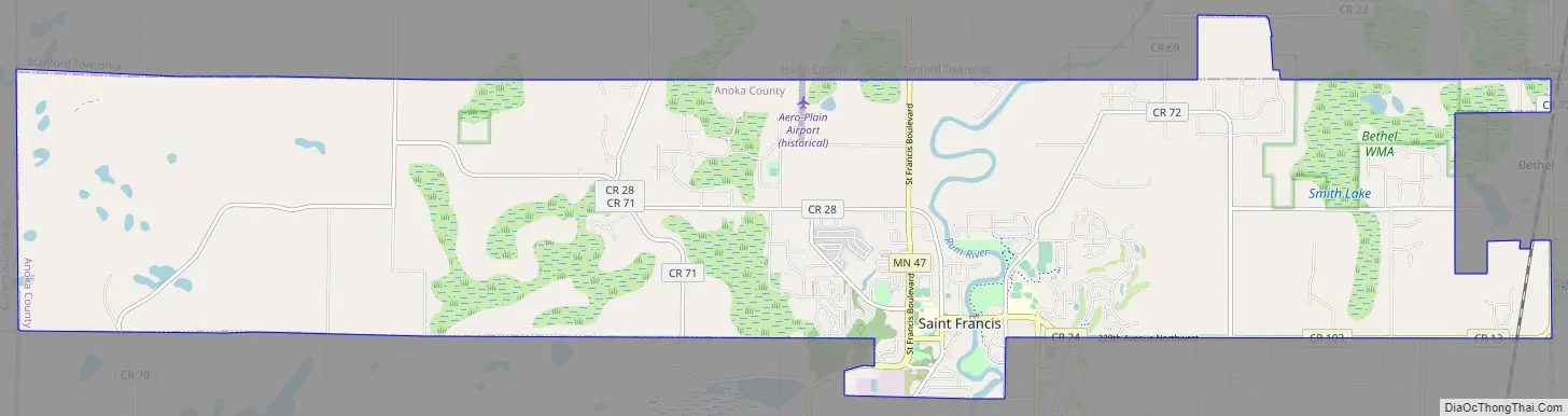
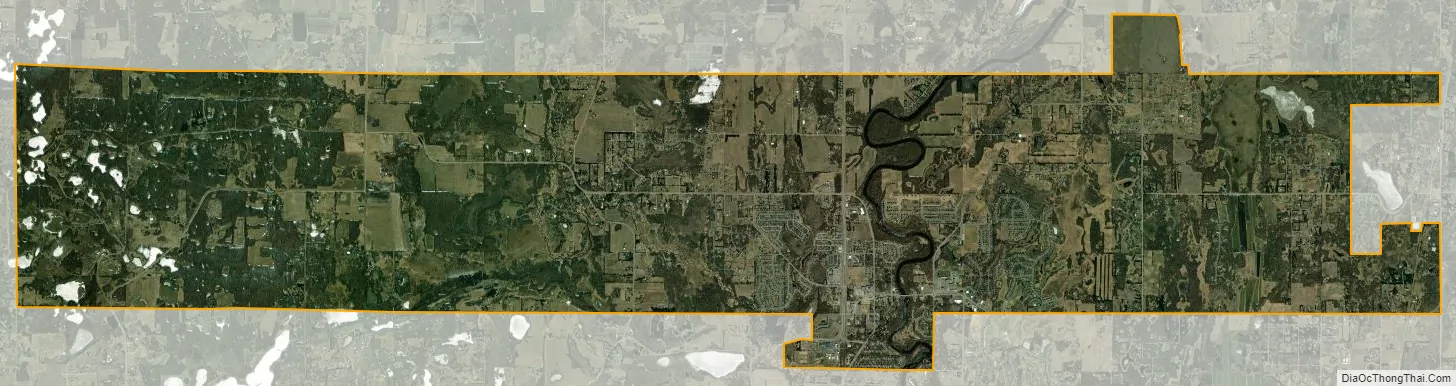
St. Francis city Satellite Map
Geography
According to the United States Census Bureau, the city has a total area of 23.97 square miles (62.08 km), of which 23.53 square miles (60.94 km) is land and 0.44 square miles (1.14 km) is water. St. Francis is located in the northwest part of Anoka County.
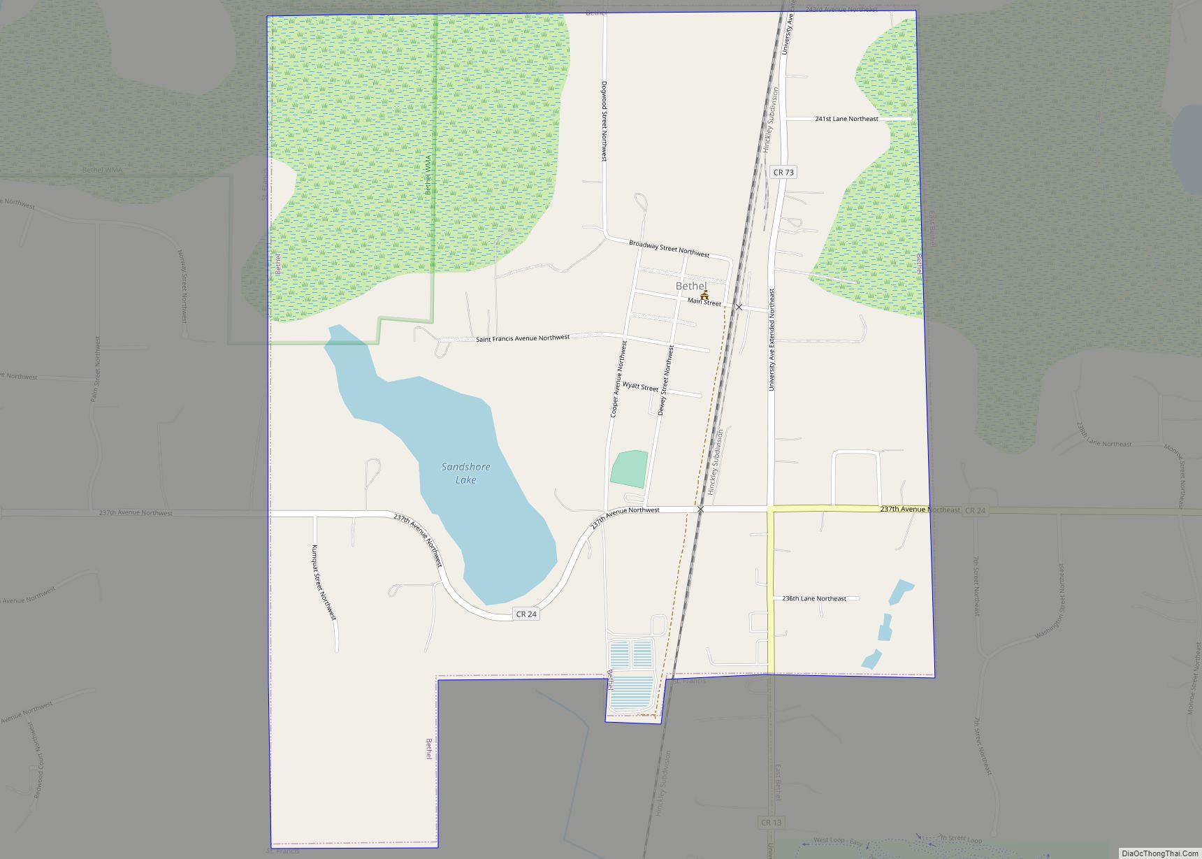
Nearby places include Bethel, East Bethel, Oak Grove, Nowthen, Elk River, Zimmerman, Crown, and Isanti.
St. Francis is located 16 miles (26 km) north of the city of Anoka. Lake George is nearby. St. Francis lies just north of the Minneapolis–Saint Paul metropolitan area.
See also
Map of Minnesota State and its subdivision:- Aitkin
- Anoka
- Becker
- Beltrami
- Benton
- Big Stone
- Blue Earth
- Brown
- Carlton
- Carver
- Cass
- Chippewa
- Chisago
- Clay
- Clearwater
- Cook
- Cottonwood
- Crow Wing
- Dakota
- Dodge
- Douglas
- Faribault
- Fillmore
- Freeborn
- Goodhue
- Grant
- Hennepin
- Houston
- Hubbard
- Isanti
- Itasca
- Jackson
- Kanabec
- Kandiyohi
- Kittson
- Koochiching
- Lac qui Parle
- Lake
- Lake of the Woods
- Lake Superior
- Le Sueur
- Lincoln
- Lyon
- Mahnomen
- Marshall
- Martin
- McLeod
- Meeker
- Mille Lacs
- Morrison
- Mower
- Murray
- Nicollet
- Nobles
- Norman
- Olmsted
- Otter Tail
- Pennington
- Pine
- Pipestone
- Polk
- Pope
- Ramsey
- Red Lake
- Redwood
- Renville
- Rice
- Rock
- Roseau
- Saint Louis
- Scott
- Sherburne
- Sibley
- Stearns
- Steele
- Stevens
- Swift
- Todd
- Traverse
- Wabasha
- Wadena
- Waseca
- Washington
- Watonwan
- Wilkin
- Winona
- Wright
- Yellow Medicine
- Alabama
- Alaska
- Arizona
- Arkansas
- California
- Colorado
- Connecticut
- Delaware
- District of Columbia
- Florida
- Georgia
- Hawaii
- Idaho
- Illinois
- Indiana
- Iowa
- Kansas
- Kentucky
- Louisiana
- Maine
- Maryland
- Massachusetts
- Michigan
- Minnesota
- Mississippi
- Missouri
- Montana
- Nebraska
- Nevada
- New Hampshire
- New Jersey
- New Mexico
- New York
- North Carolina
- North Dakota
- Ohio
- Oklahoma
- Oregon
- Pennsylvania
- Rhode Island
- South Carolina
- South Dakota
- Tennessee
- Texas
- Utah
- Vermont
- Virginia
- Washington
- West Virginia
- Wisconsin
- Wyoming