Easton is a city in, and the county seat of, Northampton County, Pennsylvania, United States. The city’s population was 28,127 as of the 2020 census. Easton is located at the confluence of the Lehigh River, a 109-mile-long (175 km) river that joins the Delaware River in Easton and serves as the city’s eastern geographic boundary with Phillipsburg, New Jersey.
Easton is the easternmost city in the Lehigh Valley, a region of 731 square miles (1,890 km) that is Pennsylvania‘s third-largest and the nation’s 68th-largest metropolitan region with 861,889 residents as of the U.S. 2020 census. Of the Valley’s three major cities, Allentown, Bethlehem, and Easton, Easton is the smallest with approximately one-fourth the population of Allentown, the Valley’s largest city.
The greater Easton area includes the city of Easton, three townships (Forks, Palmer, and Williams), and three boroughs (Glendon, West Easton, and Wilson). Centre Square, the city’s town square in its downtown neighborhood, is home to the Soldiers’ and Sailors’ Monument, a memorial for Easton area veterans killed during the American Civil War. In the first half of the 20th century, Centre Square was referred to locally as the Circle. The Peace Candle, a candle-like structure, is assembled and disassembled every year atop the Civil War monument for the Christmas season.
Norfolk Southern Railway’s Lehigh Line, formerly the main line of the Lehigh Valley Railroad, runs through Easton on its way to Bethlehem and Allentown heading west across the Delaware River to Phillipsburg, New Jersey. Easton is located 17.3 miles (27.8 km) northeast of Allentown, 77 miles (124 km) north of Philadelphia, and 72 miles (116 km) west of New York City.
| Name: | Easton city |
|---|---|
| LSAD Code: | 25 |
| LSAD Description: | city (suffix) |
| State: | Pennsylvania |
| County: | Northampton County |
| Elevation: | 211 ft (64 m) |
| Land Area: | 4.26 sq mi (11.04 km²) |
| Water Area: | 0.60 sq mi (1.54 km²) 12.35% |
| Population Density: | 6,597.94/sq mi (2,547.27/km²) |
| Area code: | 610 and 484 |
| FIPS code: | 4221648 |
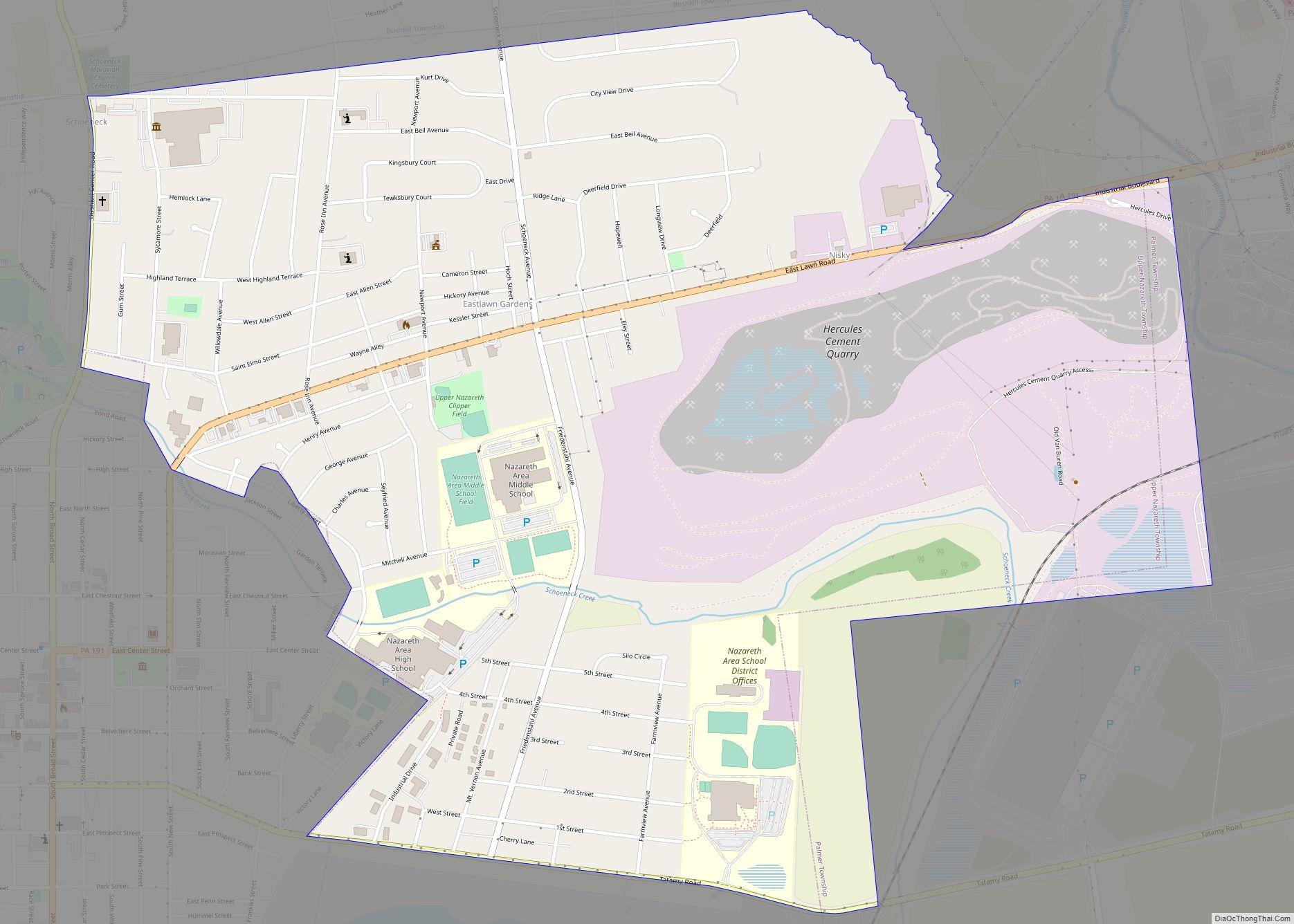
Online Interactive Map
Click on ![]() to view map in "full screen" mode.
to view map in "full screen" mode.
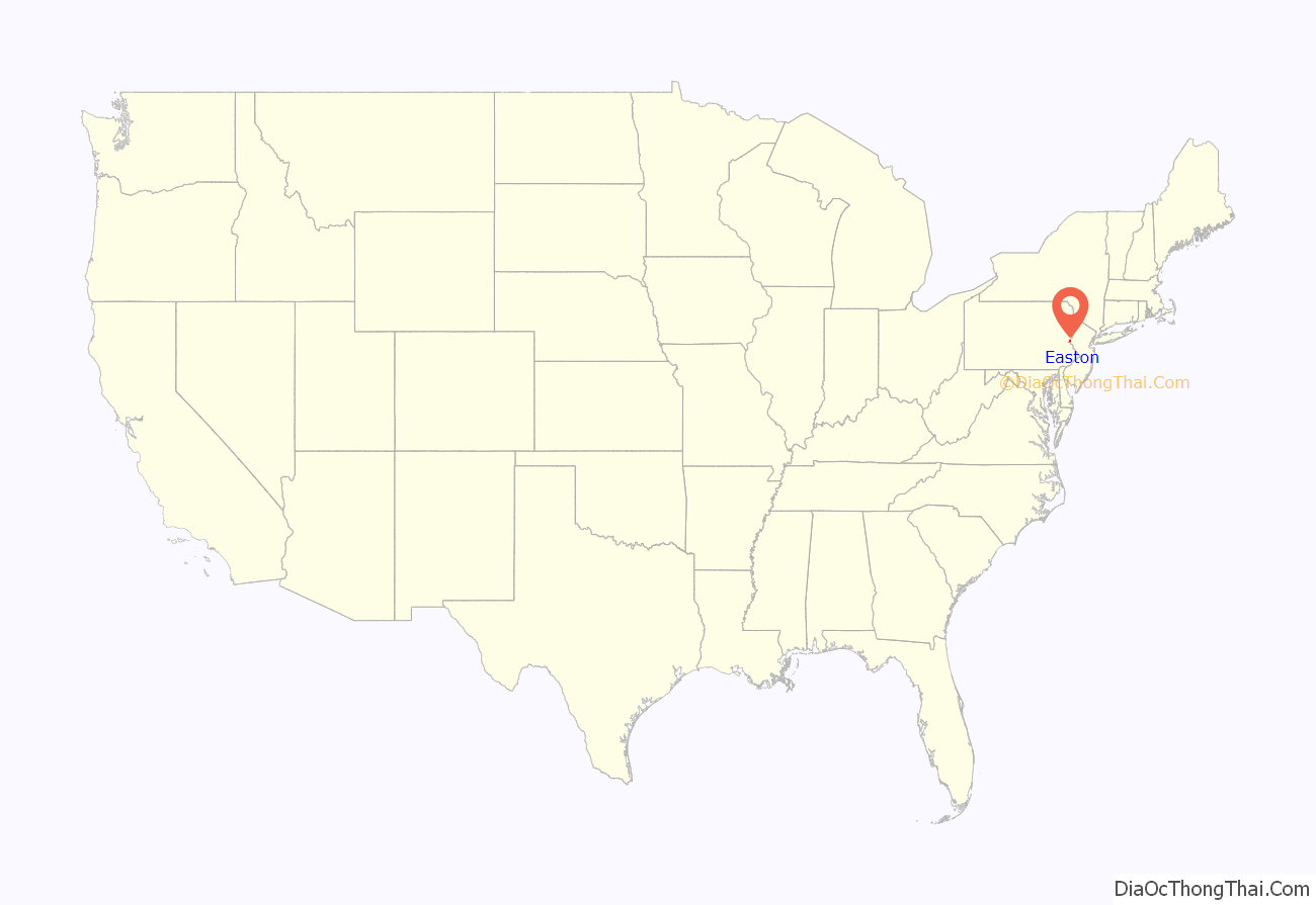
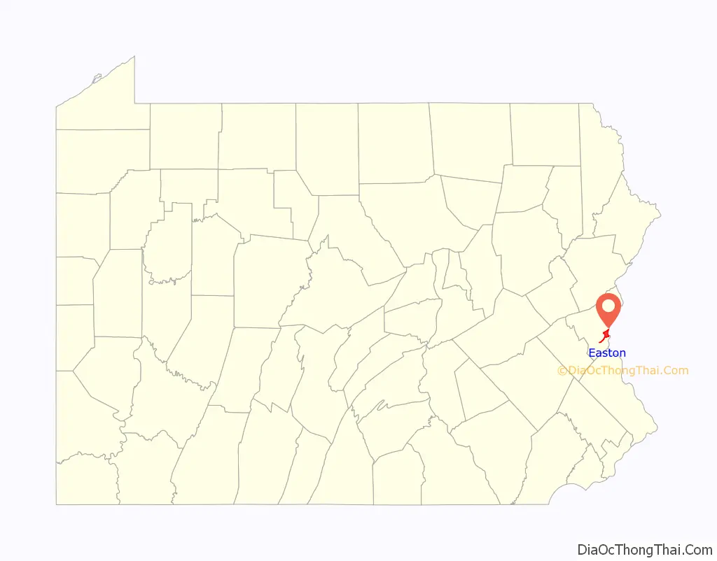
Easton location map. Where is Easton city?
History
18th century
The Lenape Native Americans originally referred to the area as Lechauwitank, or “The Place at the Forks”. The land for the future city was obtained from the Lenape in the Walking Purchase of 1737. A plaque commemorating the transaction appears in Easton’s town square. Thomas Penn set aside a 1,000-acre (4 km) tract of land at the confluence of the Lehigh and Delaware rivers for a town. Easton was settled by Europeans in 1739 and founded in 1752, As Northampton County was being formed, Easton was selected as its county seat.
During the French and Indian War, the Treaty of Easton was signed in Easton by the British colonial government of the Province of Pennsylvania and the Native American tribes in the Ohio Country, including the Shawnee and Lenape.
Easton was an important military center during the American Revolutionary War. During the Revolutionary War, Easton had a military hospital. On June 18, 1779, General John Sullivan led 2,500 Continental Army soldiers from Easton to engage British Indian allies on the frontier. Easton was one of the first three places the Declaration of Independence was publicly read, along with Philadelphia and Trenton. The Easton flag was flown during the Declaration’s reading, making it one of the first Stars and Stripes to fly over the colonies. This flag was later used by a militia during the War of 1812 and currently serves as Easton’s municipal flag.
19th century
Located at the confluence of the rapidly flowing Lehigh River and the deeper and wider Delaware River, Easton became a major commercial center during the canal and railroad periods of the 19th century and a transportation hub for the region’s coal, iron, and steel industries. The Delaware Canal was built soon after the lower Lehigh Canal was opened in 1818 and became effective in delivering much-needed anthracite coal to the region’s largest markets, Philadelphia, New Jersey, and New York City.
Seeing other ways of exploiting the new fuel source, other entrepreneurs quickly moved to connect across the Delaware River reaching into the New York City area to the east through the Morris Canal in Phillipsburg, New Jersey, so the town became a canal hub from which coal from Mauch Chunk reached the world. Early railroads were often built to parallel this transportation corridor. By the late 1860s, the Lehigh and Susquehanna Railroad (LH&S) and Lehigh Valley Railroad (LVRR) were built to augment the bulk traffic through the canals and provide lucrative passenger travel services. The LVRR, known as the Black Diamond Line operated twice daily express passenger trains to and from New York City and Buffalo, New York via Easton. The Central Railroad of New Jersey (CNJ), leased and operated the LH&S tracks from the 1870s until the Conrail consolidations absorbed both the Central Railroad of New Jersey and Lehigh Valley Railroad in 1966. Today, the Lehigh Valley Railroad’s main line is the only major rail line that goes through Easton and is now known as the Lehigh Line; the Lehigh Line was bought by the Norfolk Southern Railway in 1999.
In the mid-19th century, canal transportation was largely replaced by railroads, and Easton became a hub for five railroads, including the Jersey Central, Lehigh Valley Railroad, and others. Easton lost its prominence in passenger transportation with the rise of the automobile in the mid-20th century.
20th and 21st centuries
Like the Pennsylvania Dutch region to the southwest, Easton was settled largely by Germans. The Pennsylvania Argus, a German language newspaper, was published in Easton until 1917. As part of their heritage, the Germans put up one of the continent’s earliest Christmas trees in Easton; Daniel Foley’s book states that, “Another diary reference unearthed recently makes mention of a tree set-up at Easton, Pennsylvania, in 1816.” There is a plaque in Scott Park along the Delaware River commemorating this event. The Pennsylvania guide, compiled by the Writers’ Program of the Works Progress Administration in 1940, described the rich and cosmopolitan fabric of Easton’s society in the first half of the 20th century:
Historians of angling believe that Samuel Phillipe, an Easton gunsmith, invented the six-strip split-cane bamboo fly rod, which is commemorated by a Pennsylvania Historical and Museum Commission plaque near Easton’s Center Square.
Easton Road Map
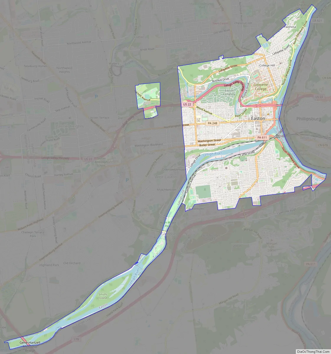
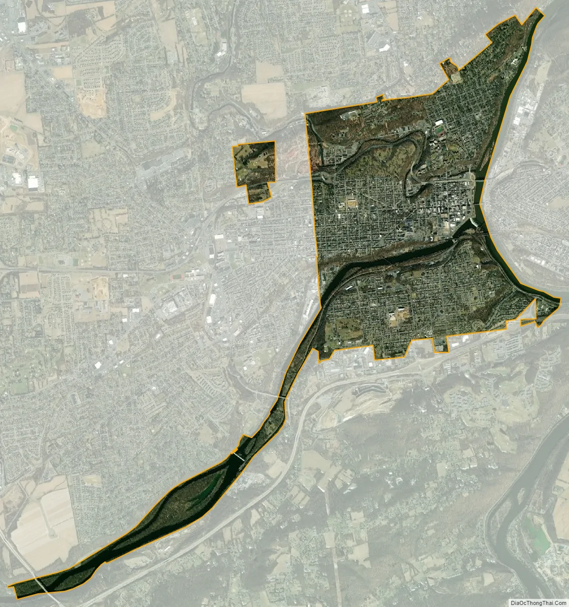
Easton city Satellite Map
Geography
Easton is located at 40°41′18″N 75°12′59″W / 40.68833°N 75.21639°W / 40.68833; -75.21639 (40.688248, −75.216458). According to the U.S. Census Bureau, the city has a total area of 4.7 square miles (12 km), 4.3 square miles (11 km) of which is land and 0.4 square miles (1.0 km) (8.39%) of which is water, including Bushkill Creek and the Lehigh and Delaware rivers. It also includes an island, Getter’s Island, which was the site of Pennsylvania’s last public execution.
Districts
Easton is divided into four districts: Downtown (DD), College Hill (CH), South Side (SS), and West Ward (WW). A number of smaller additional parks and institutional districts also exist.
Downtown Easton lies at the confluence of the Lehigh River and Delaware River and is a low-lying area surrounded by hills to the north, west, and south. North of downtown is College Hill, home of Lafayette College. South Easton, divided by the Lehigh River from the rest of the city, was a separate borough until 1898; it was settled initially by Native Americans and later by canal workers, and home to several silk mills. Wilson, West Easton, and Glendon are directly adjacent to the city. Wilson partly aligns to the same north-south grid as Easton.
Easton’s Historic Downtown District lies directly at the confluence of the north banks of the Lehigh River and west banks of the Delaware River. Downtown adjoins each of the three other districts to the north, west, and south. Downtown continues west to Sixth Street and north to US Route 22.
College Hill is located north of downtown, starting north of US Route 22. This neighborhood is home of Lafayette College, a liberal arts and engineering institution.
The South Side district lies south of the Lehigh River.
The West Ward district is located west of downtown and encompasses much of west side Easton between Sixth and Fifteenth Streets.
Climate
Under the Köppen climate classification, Easton falls within either a hot-summer humid continental climate (Dfa) if the 0 °C (32 °F) isotherm is used or a humid subtropical climate (Cfa) if the −3 °C (27 °F) isotherm is used. Summers are usually hot and very muggy, averaging in the mid-80s during the day, though the high humidity makes it feel much warmer. Fall and spring months are typically mild, offering many days in the mid-60s, as well as stronger winds. Winters are usually very cold and produce about 30 inches of snow. The local hardiness zone is 6b.
See also
Map of Pennsylvania State and its subdivision:- Adams
- Allegheny
- Armstrong
- Beaver
- Bedford
- Berks
- Blair
- Bradford
- Bucks
- Butler
- Cambria
- Cameron
- Carbon
- Centre
- Chester
- Clarion
- Clearfield
- Clinton
- Columbia
- Crawford
- Cumberland
- Dauphin
- Delaware
- Elk
- Erie
- Fayette
- Forest
- Franklin
- Fulton
- Greene
- Huntingdon
- Indiana
- Jefferson
- Juniata
- Lackawanna
- Lancaster
- Lawrence
- Lebanon
- Lehigh
- Luzerne
- Lycoming
- Mc Kean
- Mercer
- Mifflin
- Monroe
- Montgomery
- Montour
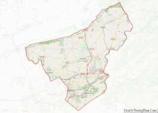
- Northampton
- Northumberland
- Perry
- Philadelphia
- Pike
- Potter
- Schuylkill
- Snyder
- Somerset
- Sullivan
- Susquehanna
- Tioga
- Union
- Venango
- Warren
- Washington
- Wayne
- Westmoreland
- Wyoming
- York
- Alabama
- Alaska
- Arizona
- Arkansas
- California
- Colorado
- Connecticut
- Delaware
- District of Columbia
- Florida
- Georgia
- Hawaii
- Idaho
- Illinois
- Indiana
- Iowa
- Kansas
- Kentucky
- Louisiana
- Maine
- Maryland
- Massachusetts
- Michigan
- Minnesota
- Mississippi
- Missouri
- Montana
- Nebraska
- Nevada
- New Hampshire
- New Jersey
- New Mexico
- New York
- North Carolina
- North Dakota
- Ohio
- Oklahoma
- Oregon
- Pennsylvania
- Rhode Island
- South Carolina
- South Dakota
- Tennessee
- Texas
- Utah
- Vermont
- Virginia
- Washington
- West Virginia
- Wisconsin
- Wyoming