Cementon is an unincorporated area and census-designated place (CDP) in Lehigh County, Pennsylvania. The town is in Whitehall Township, 7 miles (11 km) north of Allentown. As of the 2020 census, the population of Cementon was 1,657. Cementon is part of the Lehigh Valley metropolitan area, which had a population of 861,899 and was the 68th-most populous metropolitan area in the U.S. as of 2020. It uses the Whitehall Township ZIP Code of 18052.
| Name: | Cementon CDP |
|---|---|
| LSAD Code: | 57 |
| LSAD Description: | CDP (suffix) |
| State: | Pennsylvania |
| County: | Lehigh County |
| Elevation: | 315 ft (96 m) |
| Land Area: | 0.65 sq mi (1.69 km²) |
| Water Area: | 0.02 sq mi (0.05 km²) |
| Population Density: | 2,545.31/sq mi (983.32/km²) |
| ZIP code: | 18052 |
| Area code: | 610 and 484 |
| FIPS code: | 4211976 |
| GNISfeature ID: | 1171410 |
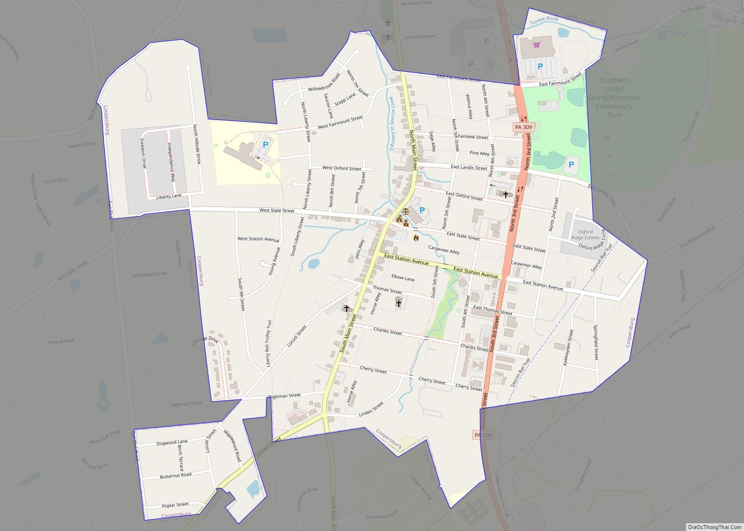
Online Interactive Map
Click on ![]() to view map in "full screen" mode.
to view map in "full screen" mode.
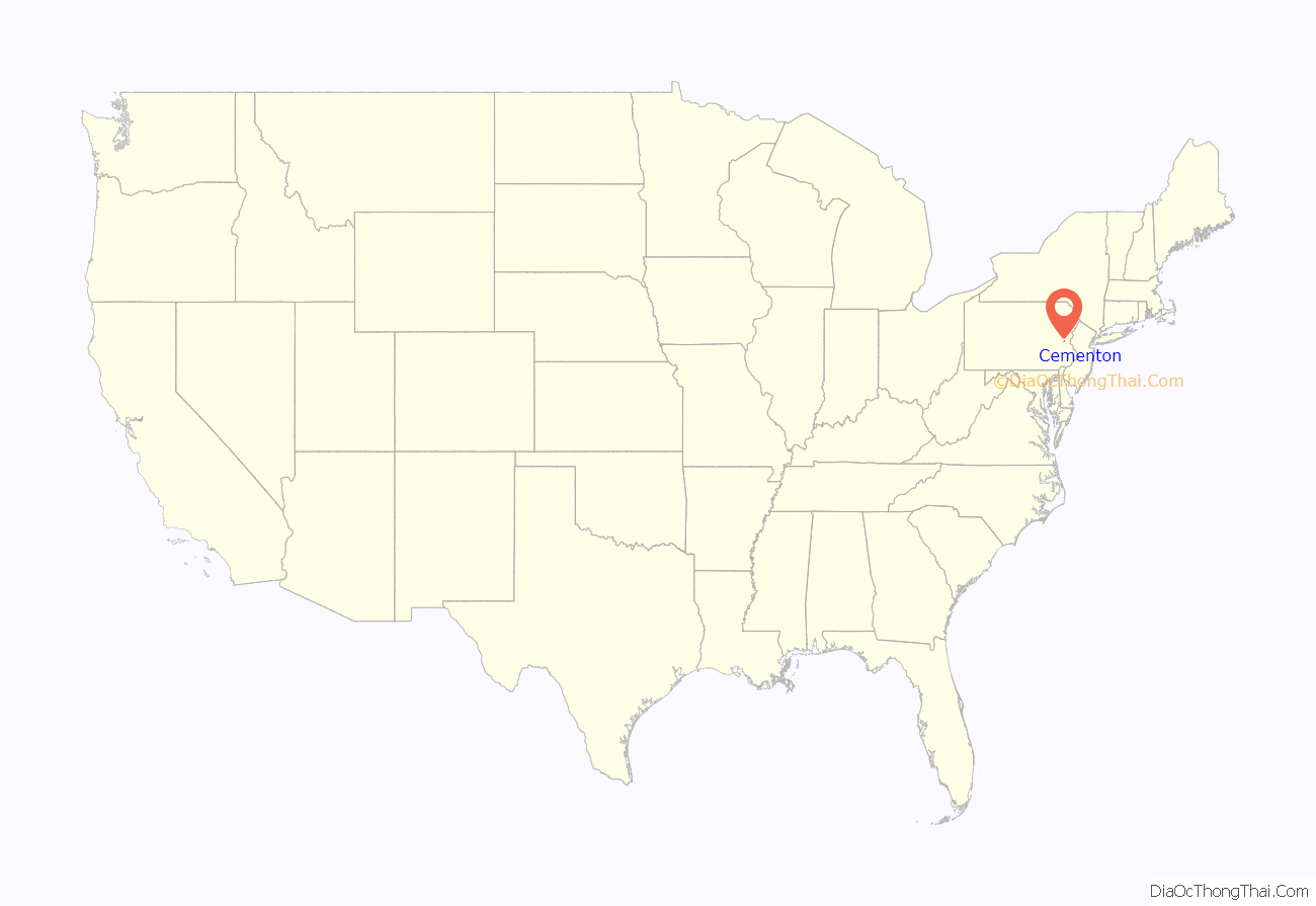
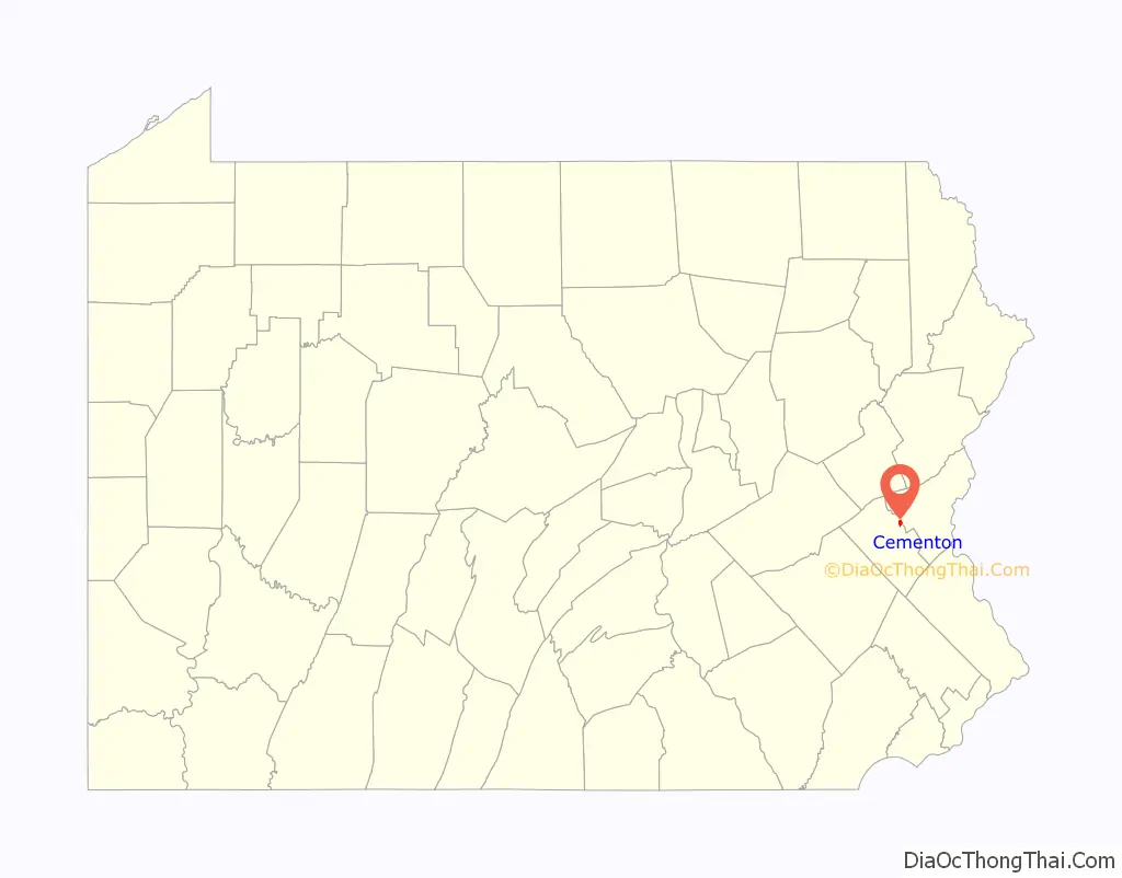
Cementon location map. Where is Cementon CDP?
History
Cementon was originally known as “Siegfried’s Ferry” as it is located directly across the Lehigh River from Siegfried, one of the three villages that would merge to become Northampton in 1902. In 1828, a bridge was built across the river, and the town became known as Siegfried’s Bridge. After a large Whitehall Portland Cement Works quarry and mill were established in 1900-01, the town was renamed “Cementon”.
Cementon Road Map
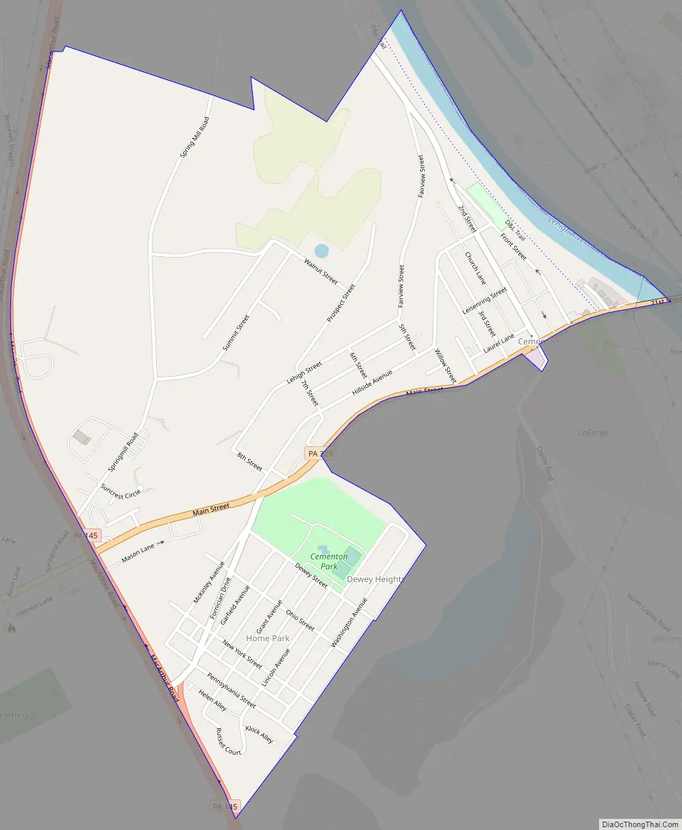
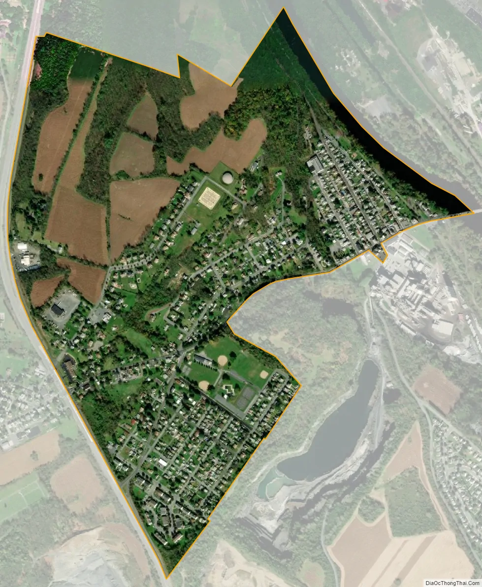
Cementon city Satellite Map
Geography
Cementon is in northeastern Lehigh County, Pennsylvania situated along the Lehigh River across from Northampton in Northampton County. It is bordered to the west by the unincorporated community of Egypt. Pennsylvania Route 329 passes through the center of Cementon, crossing the Lehigh east into Northampton and leading west through Egypt to Neffs. Pennsylvania Route 145 forms the western boundary of Cementon, crossing PA 329 in the Eagle Point neighborhood. PA 145 leads northwest 8 miles (13 km) to Walnutport and south to the center of Allentown. According to the U.S. Census Bureau, Cementon has a total area of 0.66 square miles (1.7 km), of which 0.02 square miles (0.05 km), or 2.94%, are water. The town is part of the Delaware River watershed.
See also
Map of Pennsylvania State and its subdivision:- Adams
- Allegheny
- Armstrong
- Beaver
- Bedford
- Berks
- Blair
- Bradford
- Bucks
- Butler
- Cambria
- Cameron
- Carbon
- Centre
- Chester
- Clarion
- Clearfield
- Clinton
- Columbia
- Crawford
- Cumberland
- Dauphin
- Delaware
- Elk
- Erie
- Fayette
- Forest
- Franklin
- Fulton
- Greene
- Huntingdon
- Indiana
- Jefferson
- Juniata
- Lackawanna
- Lancaster
- Lawrence
- Lebanon
- Lehigh
- Luzerne
- Lycoming
- Mc Kean
- Mercer
- Mifflin
- Monroe
- Montgomery
- Montour
- Northampton
- Northumberland
- Perry
- Philadelphia
- Pike
- Potter
- Schuylkill
- Snyder
- Somerset
- Sullivan
- Susquehanna
- Tioga
- Union
- Venango
- Warren
- Washington
- Wayne
- Westmoreland
- Wyoming
- York
- Alabama
- Alaska
- Arizona
- Arkansas
- California
- Colorado
- Connecticut
- Delaware
- District of Columbia
- Florida
- Georgia
- Hawaii
- Idaho
- Illinois
- Indiana
- Iowa
- Kansas
- Kentucky
- Louisiana
- Maine
- Maryland
- Massachusetts
- Michigan
- Minnesota
- Mississippi
- Missouri
- Montana
- Nebraska
- Nevada
- New Hampshire
- New Jersey
- New Mexico
- New York
- North Carolina
- North Dakota
- Ohio
- Oklahoma
- Oregon
- Pennsylvania
- Rhode Island
- South Carolina
- South Dakota
- Tennessee
- Texas
- Utah
- Vermont
- Virginia
- Washington
- West Virginia
- Wisconsin
- Wyoming