Homewood is a borough which is located in northern Beaver County, Pennsylvania, United States. The population was 104 at the time of the 2020 census.
It is a part of the Pittsburgh metropolitan area.
| Name: | Homewood borough |
|---|---|
| LSAD Code: | 21 |
| LSAD Description: | borough (suffix) |
| State: | Pennsylvania |
| County: | Beaver County |
| Incorporated: | 1910 |
| Elevation: | 971 ft (296 m) |
| Total Area: | 0.17 sq mi (0.44 km²) |
| Land Area: | 0.17 sq mi (0.44 km²) |
| Water Area: | 0.00 sq mi (0.00 km²) |
| Total Population: | 104 |
| Population Density: | 615.38/sq mi (236.99/km²) |
| Area code: | 724 |
| FIPS code: | 4235488 |
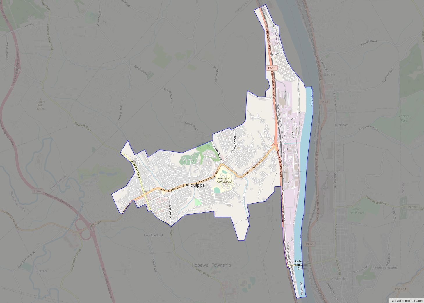
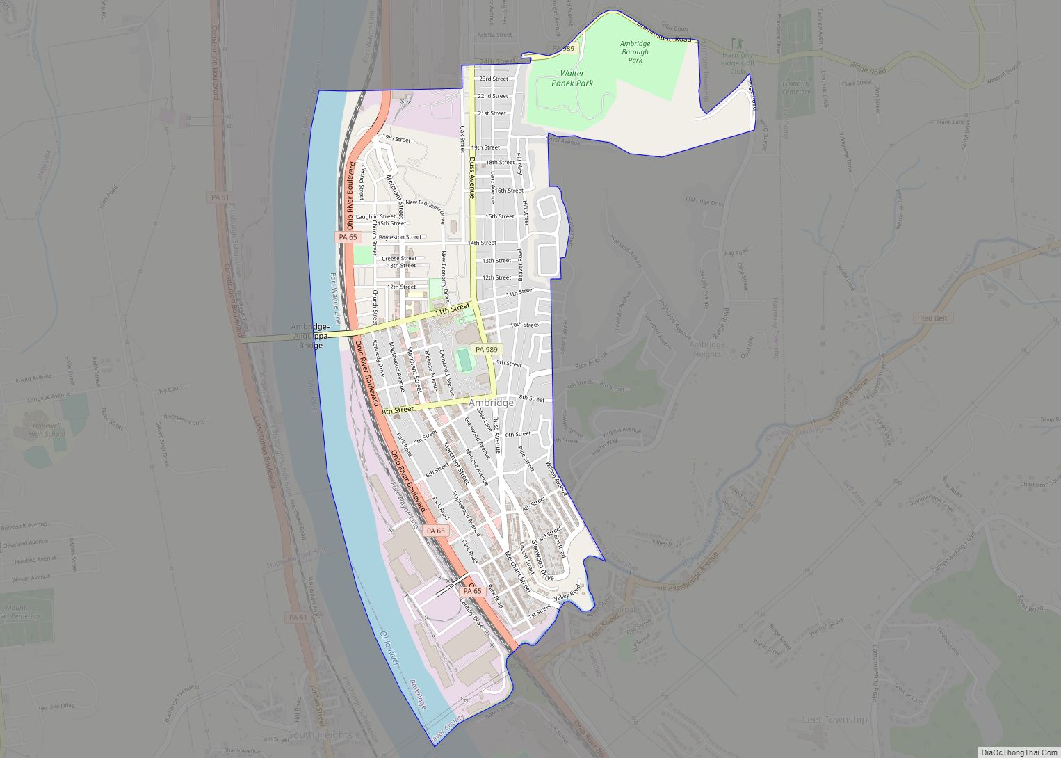
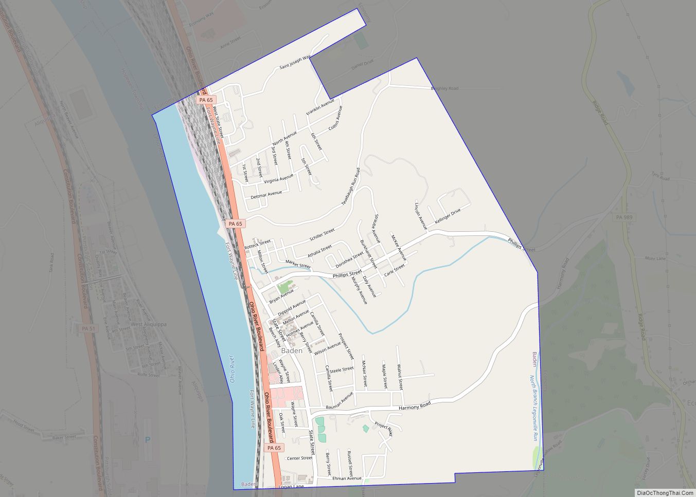
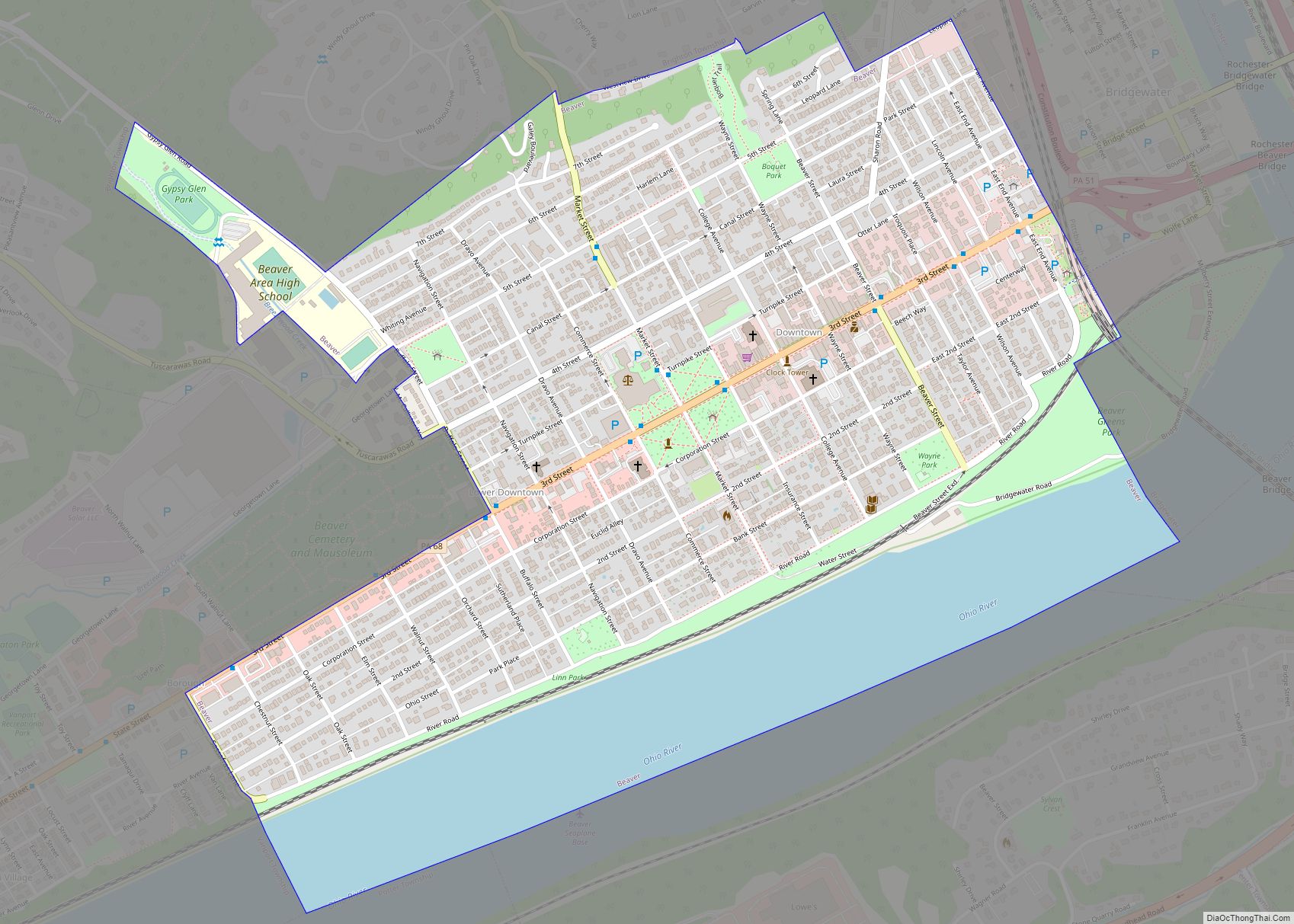
Online Interactive Map
Click on ![]() to view map in "full screen" mode.
to view map in "full screen" mode.
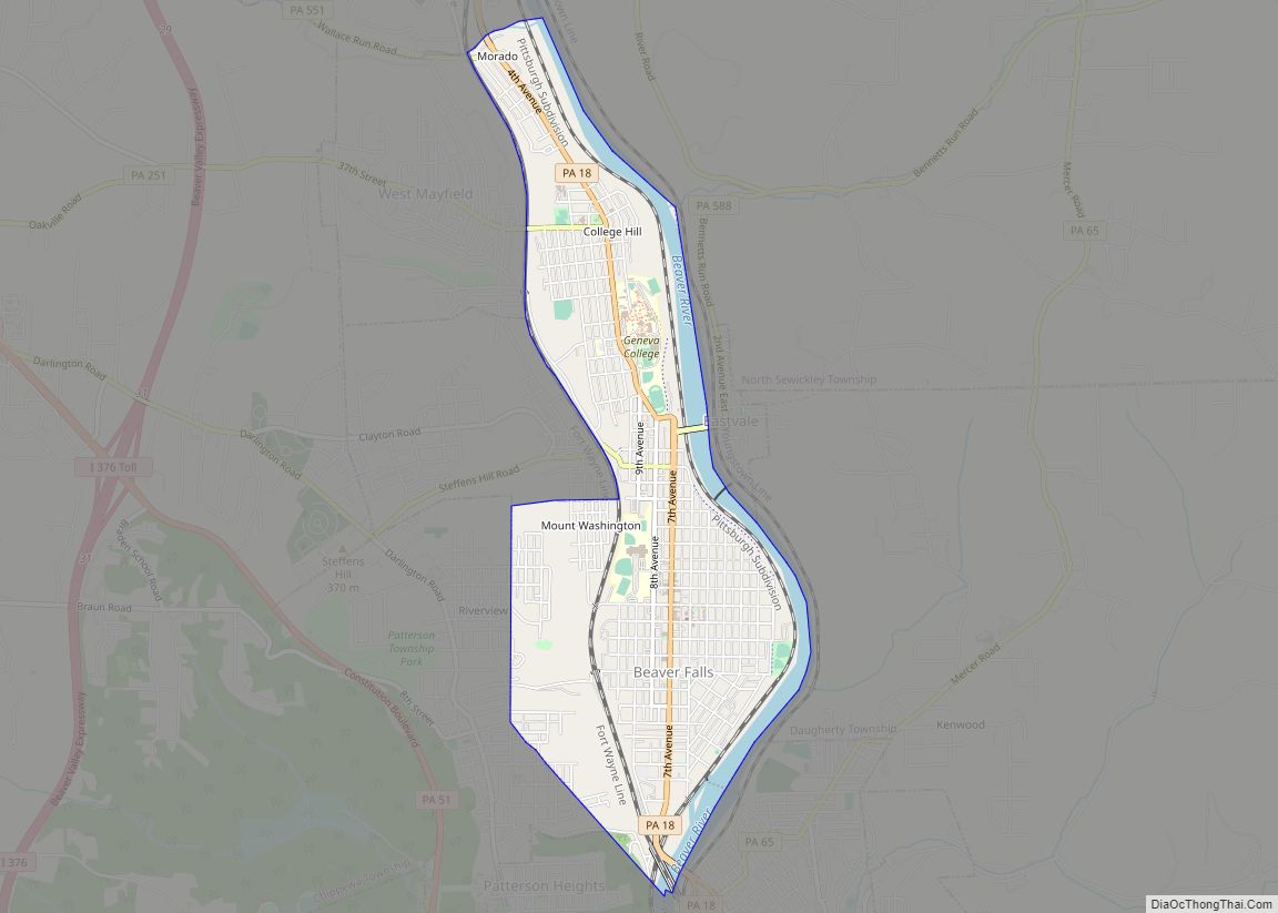
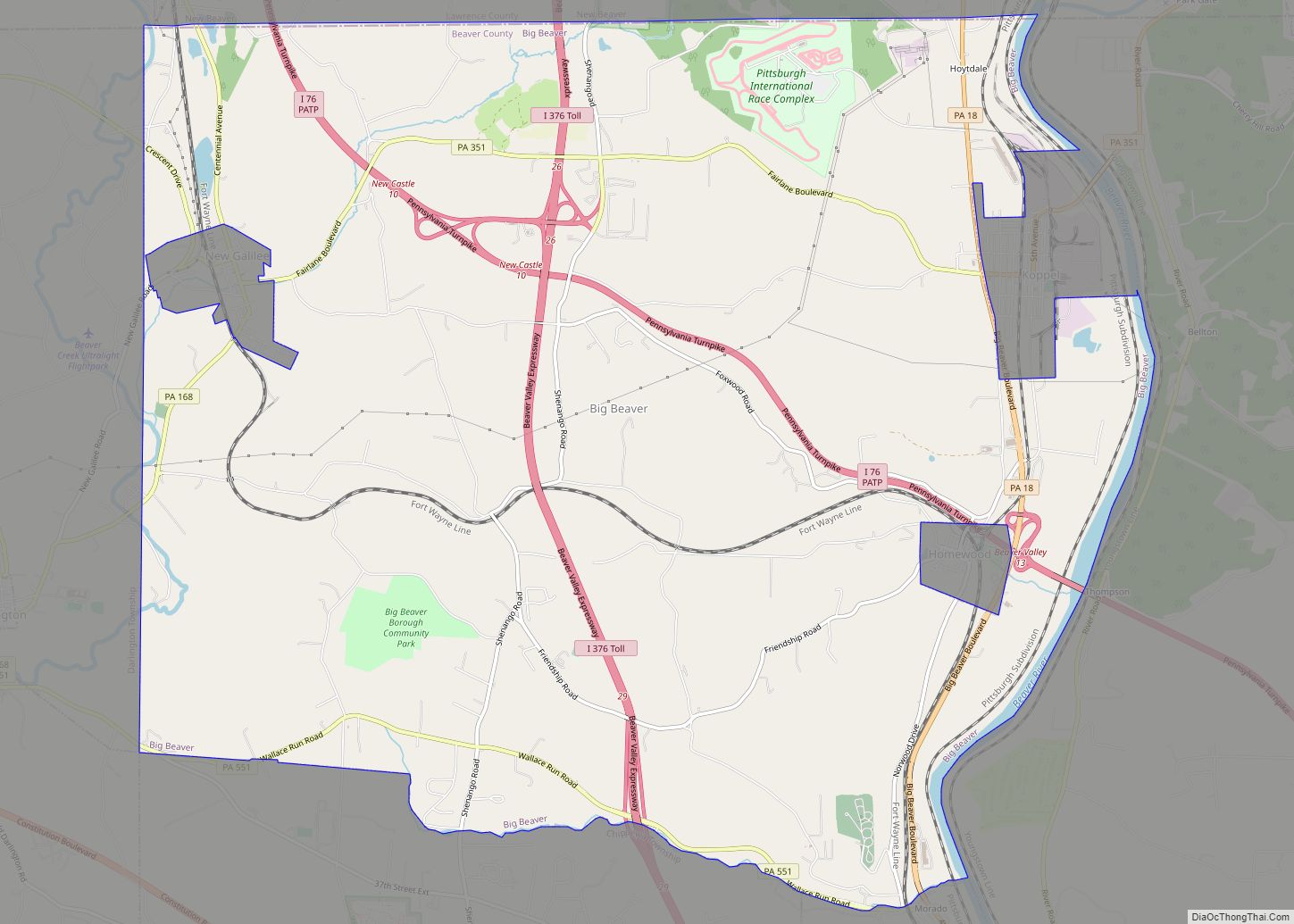
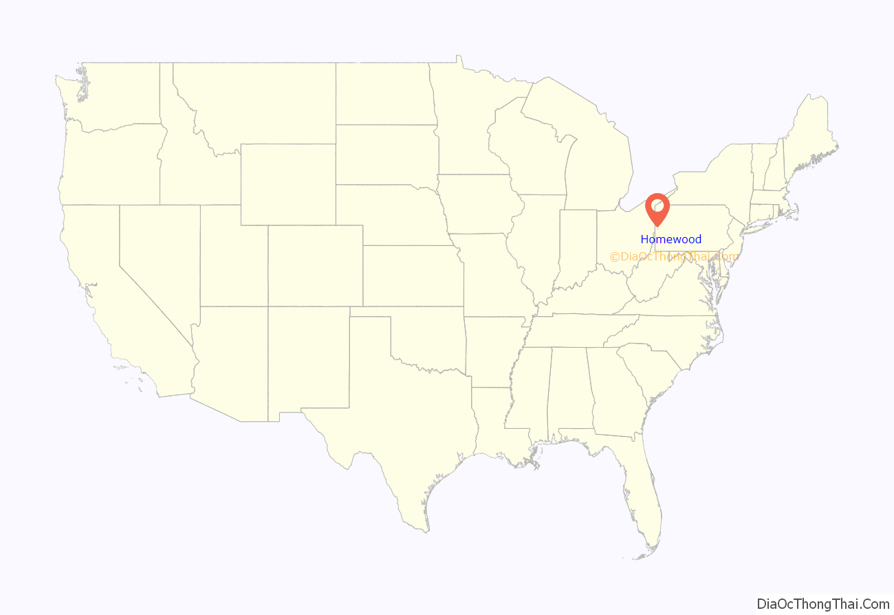
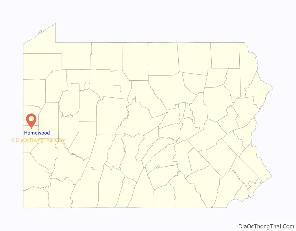
Homewood location map. Where is Homewood borough?
Homewood Road Map
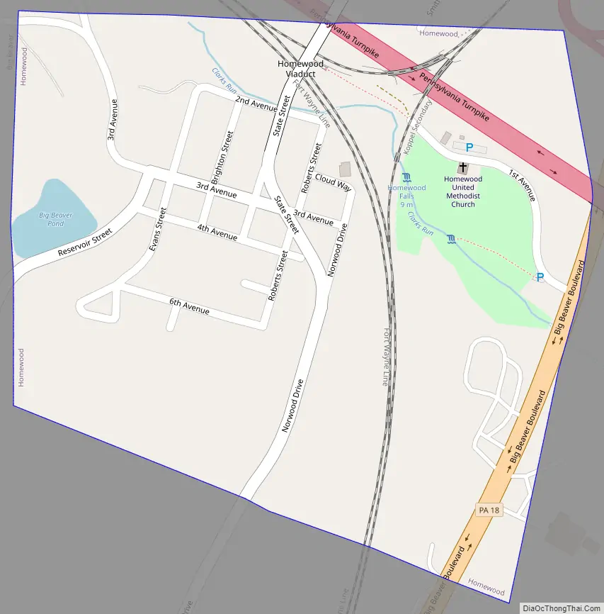
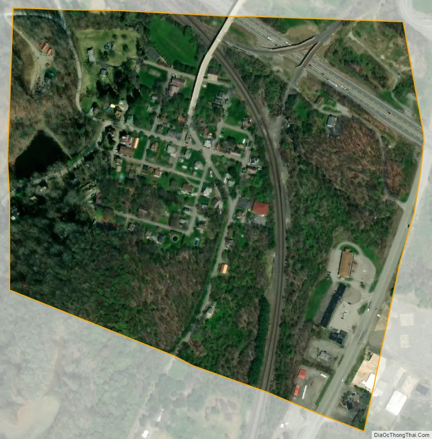
Homewood city Satellite Map
Geography
Homewood is located in northern Beaver County at 40°48′50″N 80°19′47″W / 40.81389°N 80.32972°W / 40.81389; -80.32972 (40.813995, -80.329852). It is entirely surrounded by the borough of Big Beaver.
The Pennsylvania Turnpike (Interstate 76) passes through the northeast corner of the borough, with Exit 13 (Pennsylvania Route 18/Big Beaver Boulevard) located just outside the borough limits. PA-18 runs through the eastern edge of the borough.
According to the United States Census Bureau, the borough has a total area of 0.17 square miles (0.44 km), all land.
The borough has a waterfall within the community, which was named Buttermilk Falls in the year 1870. The waters fall into a natural basin of solid sandstone. The town lends its name to the Homewood Formation, the sandstone rock layer which is exposed at Buttermilk Falls. The Homewood Formation is the upper member of the Pottsville Group (Wanless, 1939).
Homewood is drained by Clarks Run, which flows into the Beaver River a short distance to the east.
See also
Map of Pennsylvania State and its subdivision:- Adams
- Allegheny
- Armstrong
- Beaver
- Bedford
- Berks
- Blair
- Bradford
- Bucks
- Butler
- Cambria
- Cameron
- Carbon
- Centre
- Chester
- Clarion
- Clearfield
- Clinton
- Columbia
- Crawford
- Cumberland
- Dauphin
- Delaware
- Elk
- Erie
- Fayette
- Forest
- Franklin
- Fulton
- Greene
- Huntingdon
- Indiana
- Jefferson
- Juniata
- Lackawanna
- Lancaster
- Lawrence
- Lebanon
- Lehigh
- Luzerne
- Lycoming
- Mc Kean
- Mercer
- Mifflin
- Monroe
- Montgomery
- Montour
- Northampton
- Northumberland
- Perry
- Philadelphia
- Pike
- Potter
- Schuylkill
- Snyder
- Somerset
- Sullivan
- Susquehanna
- Tioga
- Union
- Venango
- Warren
- Washington
- Wayne
- Westmoreland
- Wyoming
- York
- Alabama
- Alaska
- Arizona
- Arkansas
- California
- Colorado
- Connecticut
- Delaware
- District of Columbia
- Florida
- Georgia
- Hawaii
- Idaho
- Illinois
- Indiana
- Iowa
- Kansas
- Kentucky
- Louisiana
- Maine
- Maryland
- Massachusetts
- Michigan
- Minnesota
- Mississippi
- Missouri
- Montana
- Nebraska
- Nevada
- New Hampshire
- New Jersey
- New Mexico
- New York
- North Carolina
- North Dakota
- Ohio
- Oklahoma
- Oregon
- Pennsylvania
- Rhode Island
- South Carolina
- South Dakota
- Tennessee
- Texas
- Utah
- Vermont
- Virginia
- Washington
- West Virginia
- Wisconsin
- Wyoming