Maytown is an unincorporated community and census-designated place (CDP) in Lancaster County, Pennsylvania, United States. The population was 4,098 at the 2020 census.
| Name: | Maytown CDP |
|---|---|
| LSAD Code: | 57 |
| LSAD Description: | CDP (suffix) |
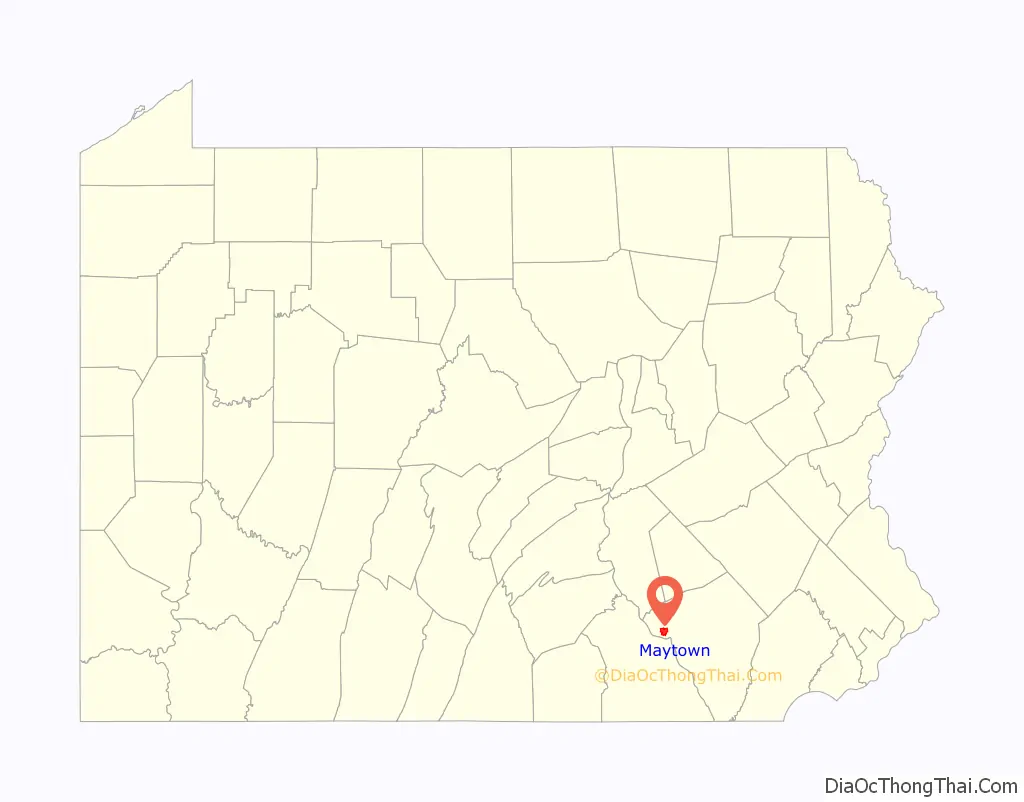
| State: | Pennsylvania |
| County: | Lancaster County |
| Elevation: | 460 ft (140 m) |
| Total Area: | 3.68 sq mi (9.53 km²) |
| Land Area: | 3.68 sq mi (9.53 km²) |
| Water Area: | 0.00 sq mi (0.00 km²) |
| Total Population: | 4,098 |
| Population Density: | 1,113.59/sq mi (429.98/km²) |
| ZIP code: | 17547 |
| FIPS code: | 4248224 |
| GNISfeature ID: | 1180586 |
Online Interactive Map
Click on ![]() to view map in "full screen" mode.
to view map in "full screen" mode.
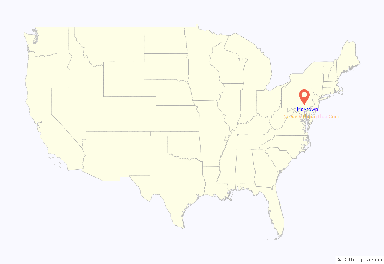
Maytown location map. Where is Maytown CDP?
History
Maytown is noted as the birthplace of 19th-century politician Simon Cameron, who served in the Cabinet of President Abraham Lincoln.
The Grove Mansion was listed on the National Register of Historic Places in 1983. William H. Strayer, born in Maytown in 1847, earned the Congressional Medal of Honor on May 22, 1872, along with William F. Cody and two others.
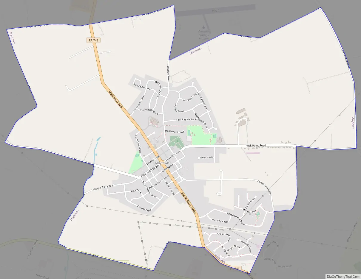
Maytown Road Map
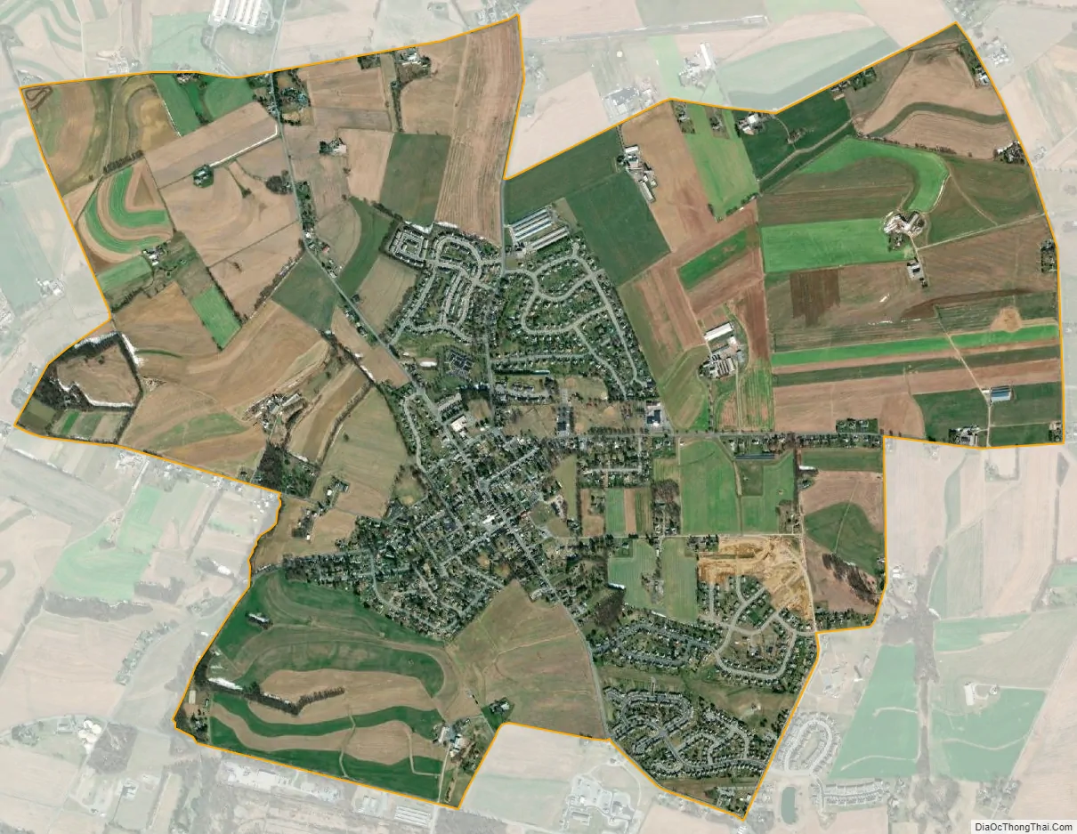
Maytown city Satellite Map
Geography
Maytown is located in western Lancaster County, in the western part of East Donegal Township. Pennsylvania Route 743 (Maytown Road / South River Street) passes through the center of town, leading north 6 miles (10 km) to Elizabethtown and south 3 miles (5 km) to Marietta. Pennsylvania Route 441 forms part of the southern edge of the Maytown CDP; it leads northwest 14 miles (23 km) to Middletown and southeast 6 miles (10 km) to Columbia. Lancaster, the county seat, is 15 miles (24 km) east of Maytown via Routes 441 and 23.
According to the U.S. Census Bureau, Maytown has a total area of 3.7 square miles (9.5 km), of which 0.7 acres (2,999 m), or 0.03%, are water. The community drains east and west to unnamed direct tributaries of the Susquehanna River.
See also
Map of Pennsylvania State and its subdivision:- Adams
- Allegheny
- Armstrong
- Beaver
- Bedford
- Berks
- Blair
- Bradford
- Bucks
- Butler
- Cambria
- Cameron
- Carbon
- Centre
- Chester
- Clarion
- Clearfield
- Clinton
- Columbia
- Crawford
- Cumberland
- Dauphin
- Delaware
- Elk
- Erie
- Fayette
- Forest
- Franklin
- Fulton
- Greene
- Huntingdon
- Indiana
- Jefferson
- Juniata
- Lackawanna
- Lancaster
- Lawrence
- Lebanon
- Lehigh
- Luzerne
- Lycoming
- Mc Kean
- Mercer
- Mifflin
- Monroe
- Montgomery
- Montour
- Northampton
- Northumberland
- Perry
- Philadelphia
- Pike
- Potter
- Schuylkill
- Snyder
- Somerset
- Sullivan
- Susquehanna
- Tioga
- Union
- Venango
- Warren
- Washington
- Wayne
- Westmoreland
- Wyoming
- York
- Alabama
- Alaska
- Arizona
- Arkansas
- California
- Colorado
- Connecticut
- Delaware
- District of Columbia
- Florida
- Georgia
- Hawaii
- Idaho
- Illinois
- Indiana
- Iowa
- Kansas
- Kentucky
- Louisiana
- Maine
- Maryland
- Massachusetts
- Michigan
- Minnesota
- Mississippi
- Missouri
- Montana
- Nebraska
- Nevada
- New Hampshire
- New Jersey
- New Mexico
- New York
- North Carolina
- North Dakota
- Ohio
- Oklahoma
- Oregon
- Pennsylvania
- Rhode Island
- South Carolina
- South Dakota
- Tennessee
- Texas
- Utah
- Vermont
- Virginia
- Washington
- West Virginia
- Wisconsin
- Wyoming


