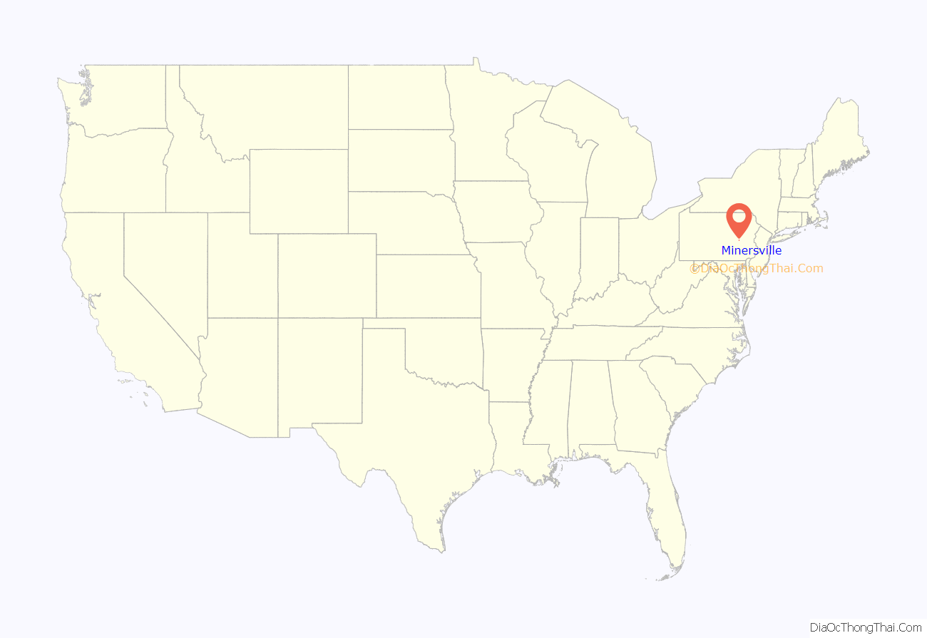
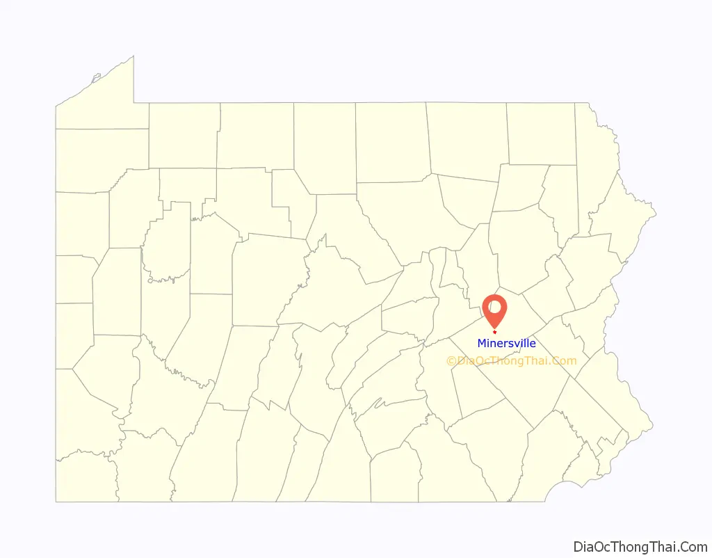
Minersville is a borough in Schuylkill County, Pennsylvania, United States. Anthracite coal deposits are plentiful in the region. The population was 4,388 at the 2020 census.
Minersville is located 50.8 miles (81.8 km) west of Allentown, 100 miles (160 km) northwest of Philadelphia, and 138.4 miles (222.7 km) west of New York City.
| Name: | Minersville borough |
|---|---|
| LSAD Code: | 21 |
| LSAD Description: | borough (suffix) |
| State: | Pennsylvania |
| County: | Schuylkill County |
| Incorporated: | 1831 |
| Total Area: | 0.66 sq mi (1.70 km²) |
| Land Area: | 0.66 sq mi (1.70 km²) |
| Water Area: | 0.00 sq mi (0.00 km²) |
| Total Population: | 4,370 |
| Population Density: | 6,651.45/sq mi (2,568.97/km²) |
| Area code: | 570 |
| FIPS code: | 4250088 |
| Website: | https://minersvillepa.gov/ |
Online Interactive Map
Click on ![]() to view map in "full screen" mode.
to view map in "full screen" mode.
Minersville location map. Where is Minersville borough?
History
In the year 1783, a settler by the name of Adolph Oliver Busch traveled through the valley between the Thomaston Mountains and the Gap Rocks. At this junction, several mountain streams converged where this settler built a log cabin and a sawmill on the west Branch of the Schuylkill River, just below the mouth of Wolf Creek. Shortly thereafter, he built a tavern on the South Side of the Sunbury Trail on the present site of the Saint Michael the Archangel Church.
This tavern was referred to as the “Half Way House”, because it was half-way between Reading and Sunbury. The Sunbury Trail was the first road through Schuylkill County and was known as the Kings Highway which was authorized by the Crown of England, King George III in 1770. The early settlers engaged in timbering as their first livelihood, but experienced difficulty in transporting the heavy logs out of the valley. The rough timber was floated by raft to Schuylkill Haven to the Schuylkill Canal and on to Reading where it was sold or traded for other products. Necho Allen discovered coal in 1799, but it was not until 1814 that any actual mining took place. Dr. McFarland, a scientist, opened a vein at York Farm near Pottsville. Later, in 1818, Jacob Reed, son of the original founder, opened another vein in the Minersville Area.
The completion of the Schuylkill Haven and Mine Hill Railroad provided the means to transport the coal produced in the region. The development of the coal industry grew rapidly and attracted many immigrants. Experienced English and Welsh miners arrived first from their respective countries. The next arrivals were Germans and Irish immigrants, soon to be followed by many other ethnic groups that make up the community.
The influx of inhabitants to the community promoted the need to begin municipal planning. Titus Bennett laid out the town in 1830 on parts of two tracts of land patented to Lawrence Lewis and Robert M. Lewis on July 20, 1829, at that time part of Branch Township. On May 2, 1830, Minersville citizens held an election at the home of David Buckwater for the purpose of electing a Burgess. Samuel Richert was elected to this position, as well as the following men who served on the first Council: John Provst, John Patrick, Dr. Anthony Steinberger, John L. Swaine, John B. Hahn, David Buckwater and Daniel R. Bennet. The first president of the town council was Daniel R. Bennet; first treasurer, Thomas J. Harman, Clerk, and Milligan G. Gable, High Constable. Minersville was incorporated as a borough on April 1, 1831 by Act of the legislature approved by Governor George Wolf. Minersville School District was involved in a national court case gaining much attention; Minersville School District v. Gobitis, 1940. This case dealt with a family whose children would not salute the flag or recite the Pledge of Allegiance because of their religious beliefs (they were Jehovah’s Witnesses). This case would put Minersville “on the map,” as it reached all the way to the Supreme Court. The final verdict was that the school district could, in fact, make students stand, salute, and recite the Pledge of Allegiance. This decision came under much scrutiny and would not stay long, as it would be overturned shortly thereafter by West Virginia State Board of Education v. Barnette.
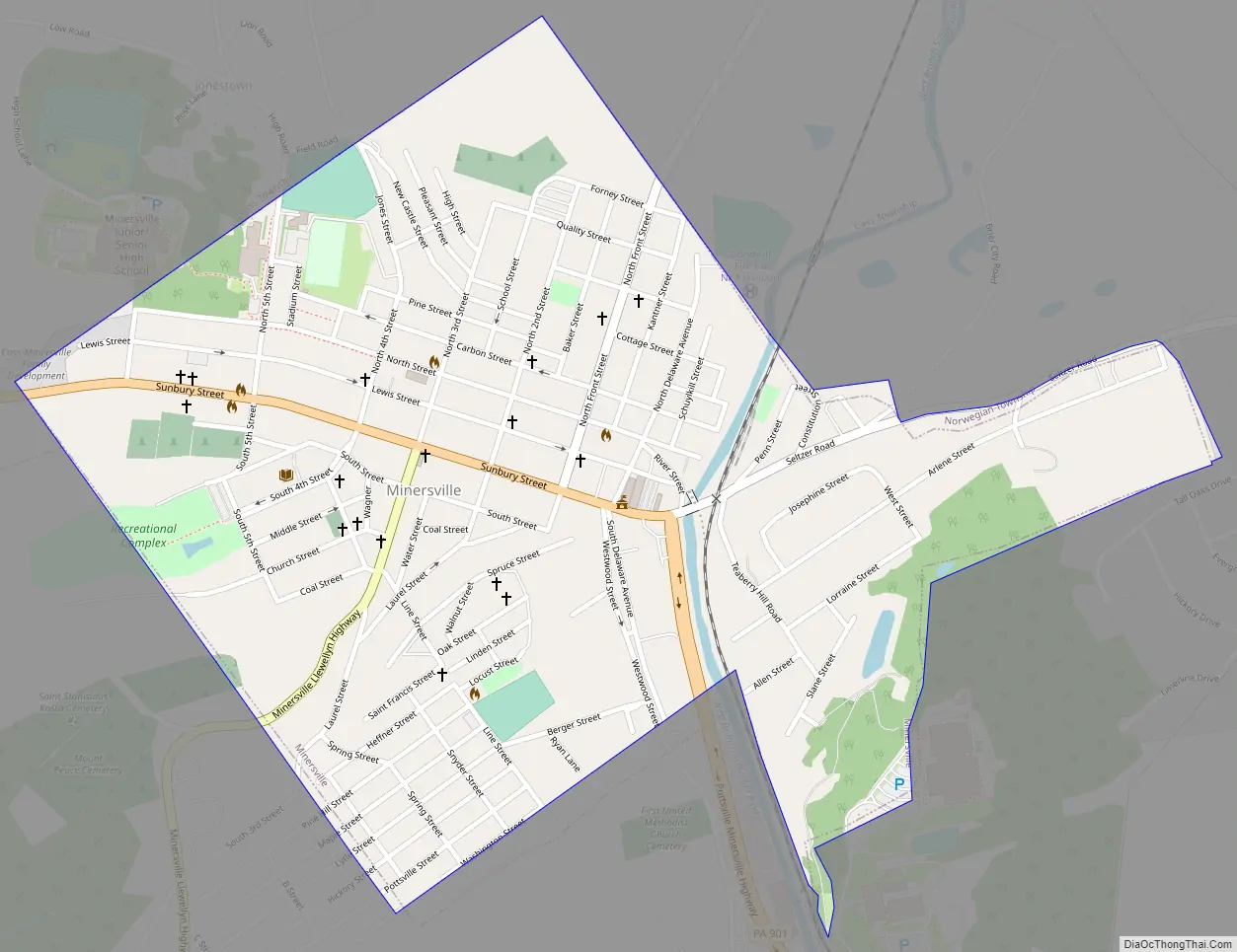
Minersville Road Map
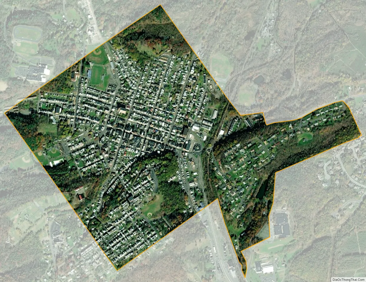
Minersville city Satellite Map
Geography
Minersville is located at 40°41′26″N 76°15′37″W / 40.69056°N 76.26028°W / 40.69056; -76.26028 (40.690455, -76.260242).
According to the United States Census Bureau, the borough has a total area of 0.7 square miles (1.8 km), all land.
See also
Map of Pennsylvania State and its subdivision:- Adams
- Allegheny
- Armstrong
- Beaver
- Bedford
- Berks
- Blair
- Bradford
- Bucks
- Butler
- Cambria
- Cameron
- Carbon
- Centre
- Chester
- Clarion
- Clearfield
- Clinton
- Columbia
- Crawford
- Cumberland
- Dauphin
- Delaware
- Elk
- Erie
- Fayette
- Forest
- Franklin
- Fulton
- Greene
- Huntingdon
- Indiana
- Jefferson
- Juniata
- Lackawanna
- Lancaster
- Lawrence
- Lebanon
- Lehigh
- Luzerne
- Lycoming
- Mc Kean
- Mercer
- Mifflin
- Monroe
- Montgomery
- Montour
- Northampton
- Northumberland
- Perry
- Philadelphia
- Pike
- Potter
- Schuylkill
- Snyder
- Somerset
- Sullivan
- Susquehanna
- Tioga
- Union
- Venango
- Warren
- Washington
- Wayne
- Westmoreland
- Wyoming
- York
- Alabama
- Alaska
- Arizona
- Arkansas
- California
- Colorado
- Connecticut
- Delaware
- District of Columbia
- Florida
- Georgia
- Hawaii
- Idaho
- Illinois
- Indiana
- Iowa
- Kansas
- Kentucky
- Louisiana
- Maine
- Maryland
- Massachusetts
- Michigan
- Minnesota
- Mississippi
- Missouri
- Montana
- Nebraska
- Nevada
- New Hampshire
- New Jersey
- New Mexico
- New York
- North Carolina
- North Dakota
- Ohio
- Oklahoma
- Oregon
- Pennsylvania
- Rhode Island
- South Carolina
- South Dakota
- Tennessee
- Texas
- Utah
- Vermont
- Virginia
- Washington
- West Virginia
- Wisconsin
- Wyoming


