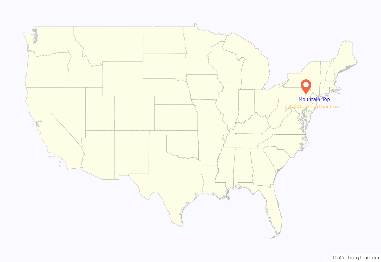
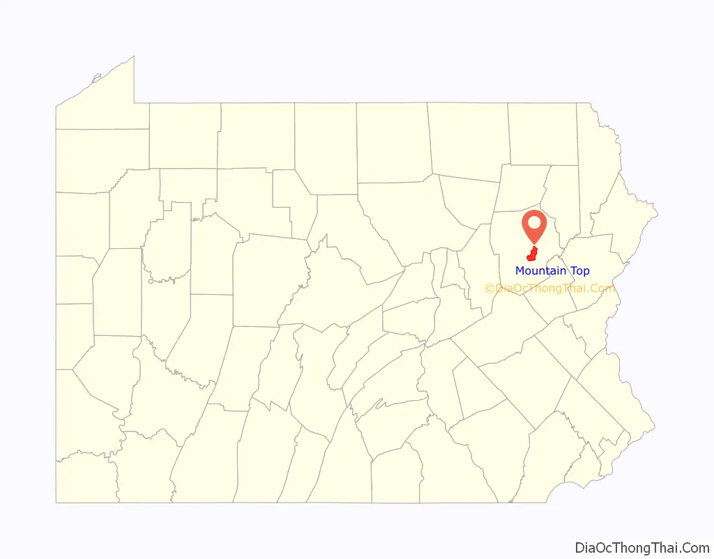
Mountain Top is an unincorporated area and census-designated place (CDP) in Luzerne County, Pennsylvania, United States. As of the 2010 census, the CDP population was 10,982.
The Mountain Top CDP is located along Pennsylvania Route 309 (south of Wilkes-Barre) in Fairview, Wright,Rice townships and Dorrance Township.
| Name: | Mountain Top CDP |
|---|---|
| LSAD Code: | 57 |
| LSAD Description: | CDP (suffix) |
| State: | Pennsylvania |
| County: | Luzerne County |
| Elevation: | 1,580 ft (480 m) |
| Total Area: | 15.02 sq mi (38.90 km²) |
| Land Area: | 15.02 sq mi (38.90 km²) |
| Water Area: | 0.00 sq mi (0.00 km²) |
| Total Population: | 11,489 |
| Population Density: | 764.86/sq mi (295.31/km²) |
| ZIP code: | 18707 |
| Area code: | 570 and 272 |
| FIPS code: | 4251384 |
| GNISfeature ID: | 2389520 |
Online Interactive Map
Click on ![]() to view map in "full screen" mode.
to view map in "full screen" mode.
Mountain Top location map. Where is Mountain Top CDP?
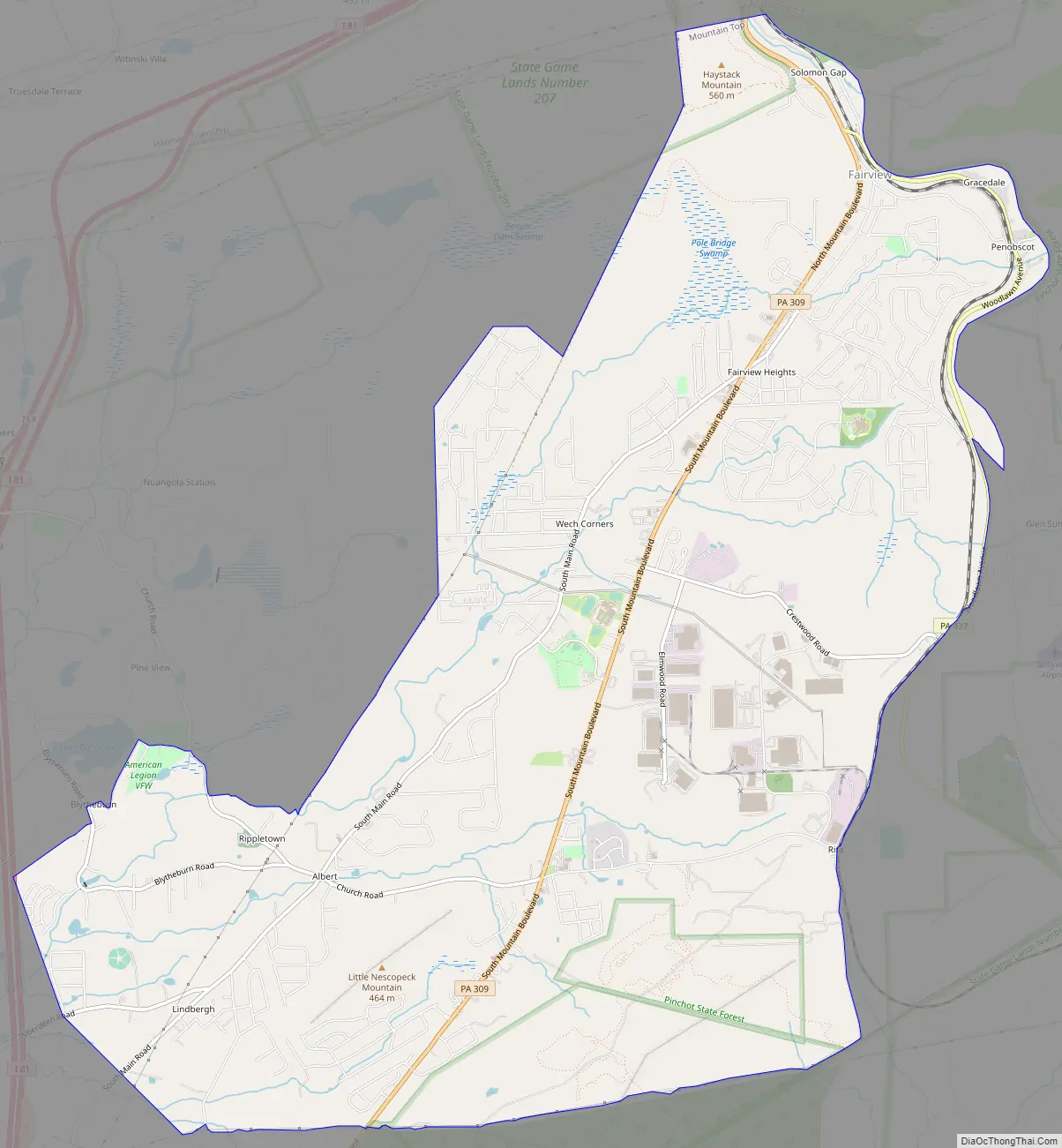
Mountain Top Road Map
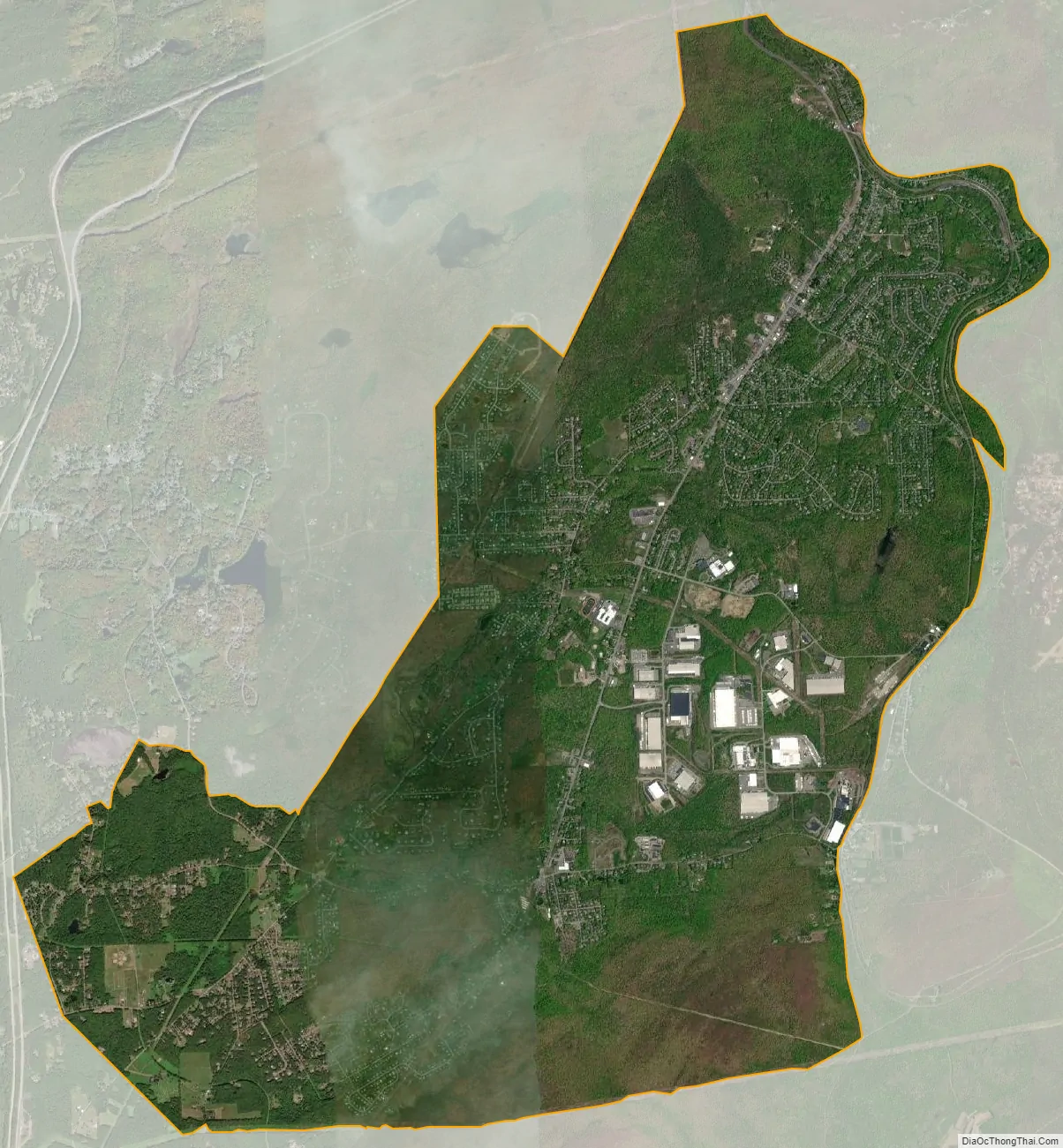
Mountain Top city Satellite Map
Geography
Mountain Top, once named “Penobscot”, is located in central Luzerne County at 41°8′7″N 75°54′16″W / 41.13528°N 75.90444°W / 41.13528; -75.90444 (41.1353022, -75.9044749). The CDP extends north to Solomon Gap, which separates Penobscot Knob to the west from Haystack Mountain to the east. To the south, the CDP includes the settlements of Fairview Heights, Wech Corners, Rita, Albert, Rippletown, and Lindbergh. The ridge of Nescopeck Mountain is in the southeast part of the CDP. According to the United States Census Bureau, the CDP has a total area of 15.1 square miles (39.0 km), all of it land.
The Mountain Top CDP is within the Susquehanna River watershed. The village center sits on a drainage divide between Solomon Creek, which flows north through Solomon Gap to the Susquehanna near Wilkes-Barre, and Big Wapwallopen Creek, which flows to the southwest to the Susquehanna at Wapwallopen. East of the CDP the ground rises to Arbutus Peak and Stony Cabin Ridge, both 2,080 feet (630 m) above sea level, beyond which is the Lehigh River basin leading to the Delaware River. Mountain Top is 10 miles (16 km) northwest of White Haven, at the head end of the Lehigh River, 16 miles (26 km) northeast of Hazleton, and 8 miles (13 km) south of Wilkes-Barre on Pennsylvania Route 309. Consequently, even though regional railroads are much diminished in scope and influence, Mountain Top Yard, once used as a marshaling yard at the top of the Ashley Planes funicular (cable-driven) railway, is still an important regional element of the transportation infrastructure connecting Allentown and Philadelphia with points north and west via trackage to several yards in New York state.
The elevation within the Mountain Top CDP ranges from 1,070 feet (330 m) above sea level along Big Wapwallopen Creek in the southwest, to 1,860 feet (570 m) atop Nescopeck Mountain southwest of Rita, to 1,871 feet (570 m) at the east end of Penobscot Mountain in the north of the CDP. The central village of Mountain Top sits at 1,580 feet (480 m) just south of Penobscot Mountain.
See also
Map of Pennsylvania State and its subdivision:- Adams
- Allegheny
- Armstrong
- Beaver
- Bedford
- Berks
- Blair
- Bradford
- Bucks
- Butler
- Cambria
- Cameron
- Carbon
- Centre
- Chester
- Clarion
- Clearfield
- Clinton
- Columbia
- Crawford
- Cumberland
- Dauphin
- Delaware
- Elk
- Erie
- Fayette
- Forest
- Franklin
- Fulton
- Greene
- Huntingdon
- Indiana
- Jefferson
- Juniata
- Lackawanna
- Lancaster
- Lawrence
- Lebanon
- Lehigh
- Luzerne
- Lycoming
- Mc Kean
- Mercer
- Mifflin
- Monroe
- Montgomery
- Montour
- Northampton
- Northumberland
- Perry
- Philadelphia
- Pike
- Potter
- Schuylkill
- Snyder
- Somerset
- Sullivan
- Susquehanna
- Tioga
- Union
- Venango
- Warren
- Washington
- Wayne
- Westmoreland
- Wyoming
- York
- Alabama
- Alaska
- Arizona
- Arkansas
- California
- Colorado
- Connecticut
- Delaware
- District of Columbia
- Florida
- Georgia
- Hawaii
- Idaho
- Illinois
- Indiana
- Iowa
- Kansas
- Kentucky
- Louisiana
- Maine
- Maryland
- Massachusetts
- Michigan
- Minnesota
- Mississippi
- Missouri
- Montana
- Nebraska
- Nevada
- New Hampshire
- New Jersey
- New Mexico
- New York
- North Carolina
- North Dakota
- Ohio
- Oklahoma
- Oregon
- Pennsylvania
- Rhode Island
- South Carolina
- South Dakota
- Tennessee
- Texas
- Utah
- Vermont
- Virginia
- Washington
- West Virginia
- Wisconsin
- Wyoming


