Orangeville is a borough in Columbia County, Pennsylvania, United States. It is part of Northeastern Pennsylvania. The population was 478 at the 2020 census. It is part of the Bloomsburg-Berwick micropolitan area.
| Name: | Orangeville borough |
|---|---|
| LSAD Code: | 21 |
| LSAD Description: | borough (suffix) |
| State: | Pennsylvania |
| County: | Columbia County |
| Incorporated: | 1900 |
| Elevation: | 580 ft (180 m) |
| Total Area: | 0.45 sq mi (1.17 km²) |
| Land Area: | 0.45 sq mi (1.15 km²) |
| Water Area: | 0.01 sq mi (0.02 km²) |
| Total Population: | 479 |
| Population Density: | 1,076.40/sq mi (415.48/km²) |
| ZIP code: | 17859 |
| Area code: | 570 |
| FIPS code: | 4256912 |
Online Interactive Map
Click on ![]() to view map in "full screen" mode.
to view map in "full screen" mode.
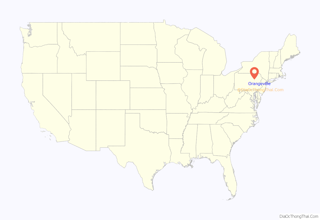
Orangeville location map. Where is Orangeville borough?

History
In 1822, an Ohio native Clemuel G. Ricketts made a plan to set up a community near Knob Mountain, although there were settlers in the area before that time. This community became Orangeville. Soon after the town was laid out, several buildings, including a house and a tannery, were erected in the area. Once five or six houses were built in the town, a post office was built there. Several names were originally considered for the community, including Knobtown, Rickettsville, and The Trap, but Orangeville was chosen after Orange County, New York, and Orange, New Jersey. In 1853, a business making plows and grain-threshers was built in the community. Orangeville was incorporated in 1900.
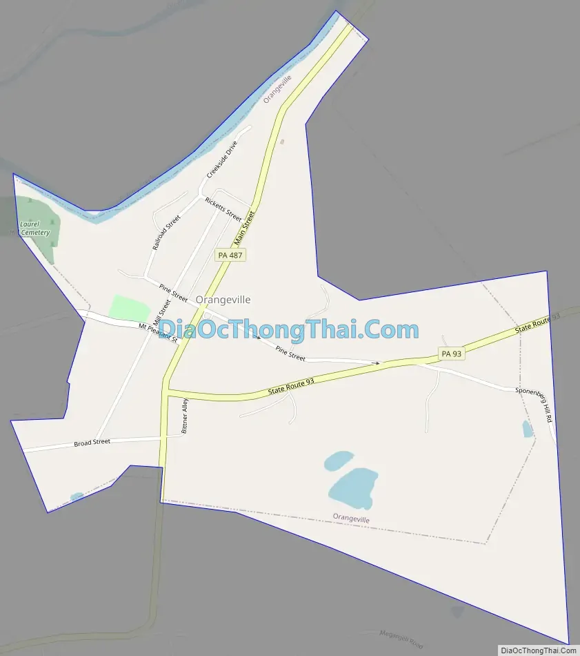
Orangeville Road Map
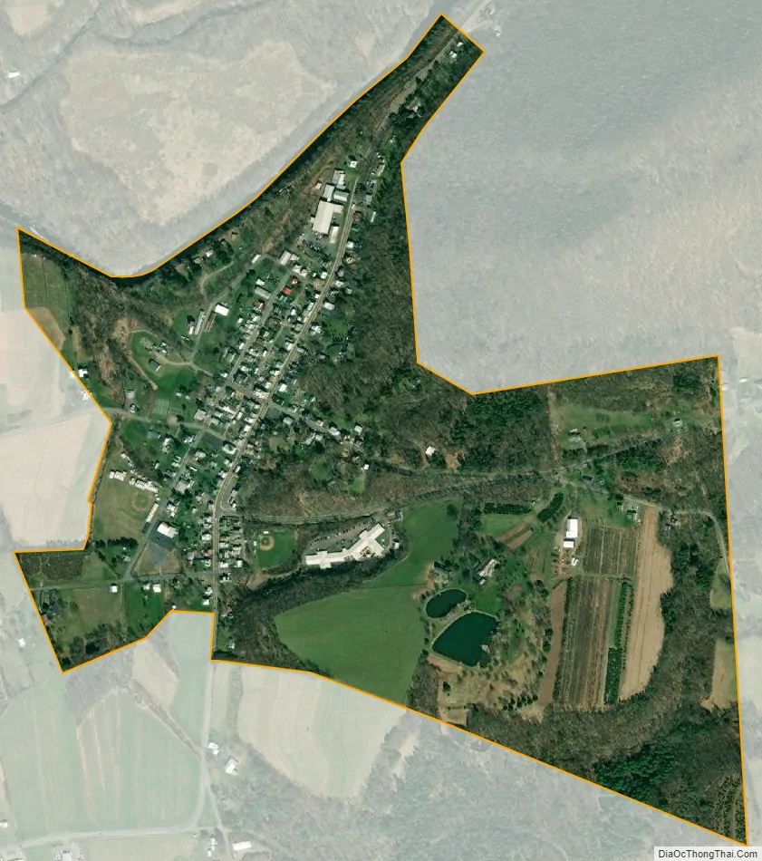
Orangeville city Satellite Map
Geography
Orangeville is located north of the center of Columbia County at 41°04′43″N 76°24′52″W / 41.078618°N 76.414573°W / 41.078618; -76.414573. It is entirely surrounded by Orange Township, a separate municipality. According to the U.S. Census Bureau, the borough has a total area of 0.46 square miles (1.2 km), of which 0.008 square miles (0.02 km), or 1.84%, is water.
Orangeville is located 7 miles (11 km) north of Bloomsburg via Pennsylvania Route 487. Benton is 10 miles (16 km) to the north via PA 487. Pennsylvania Route 93 leads east from Orangeville 10 miles (16 km) to Berwick. Fishing Creek, a tributary of the Susquehanna River, runs on the northwestern edge of Orangeville. Knob Mountain’s southwestern base is in the northeastern part of Orangeville.
See also
Map of Pennsylvania State and its subdivision:- Adams
- Allegheny
- Armstrong
- Beaver
- Bedford
- Berks
- Blair
- Bradford
- Bucks
- Butler
- Cambria
- Cameron
- Carbon
- Centre
- Chester
- Clarion
- Clearfield
- Clinton
- Columbia
- Crawford
- Cumberland
- Dauphin
- Delaware
- Elk
- Erie
- Fayette
- Forest
- Franklin
- Fulton
- Greene
- Huntingdon
- Indiana
- Jefferson
- Juniata
- Lackawanna
- Lancaster
- Lawrence
- Lebanon
- Lehigh
- Luzerne
- Lycoming
- Mc Kean
- Mercer
- Mifflin
- Monroe
- Montgomery
- Montour
- Northampton
- Northumberland
- Perry
- Philadelphia
- Pike
- Potter
- Schuylkill
- Snyder
- Somerset
- Sullivan
- Susquehanna
- Tioga
- Union
- Venango
- Warren
- Washington
- Wayne
- Westmoreland
- Wyoming
- York
- Alabama
- Alaska
- Arizona
- Arkansas
- California
- Colorado
- Connecticut
- Delaware
- District of Columbia
- Florida
- Georgia
- Hawaii
- Idaho
- Illinois
- Indiana
- Iowa
- Kansas
- Kentucky
- Louisiana
- Maine
- Maryland
- Massachusetts
- Michigan
- Minnesota
- Mississippi
- Missouri
- Montana
- Nebraska
- Nevada
- New Hampshire
- New Jersey
- New Mexico
- New York
- North Carolina
- North Dakota
- Ohio
- Oklahoma
- Oregon
- Pennsylvania
- Rhode Island
- South Carolina
- South Dakota
- Tennessee
- Texas
- Utah
- Vermont
- Virginia
- Washington
- West Virginia
- Wisconsin
- Wyoming