West Pittston is a borough in the Greater Pittston area of Luzerne County, Pennsylvania, United States. It is located on the Susquehanna River (opposite of Pittston City). In 2020, the population was 4,644.
The town once produced mine screens, glass, crackers, and many other goods. West Pittston rose to national attention in September 2011, when catastrophic flooding (caused by the remnants of Tropical Storm Lee) left much of the borough under water.
| Name: | West Pittston borough |
|---|---|
| LSAD Code: | 21 |
| LSAD Description: | borough (suffix) |
| State: | Pennsylvania |
| County: | Luzerne County |
| Incorporated: | 1857 |
| Total Area: | 0.94 sq mi (2.43 km²) |
| Land Area: | 0.82 sq mi (2.12 km²) |
| Water Area: | 0.12 sq mi (0.31 km²) |
| Total Population: | 4,644 |
| Population Density: | 5,806.10/sq mi (2,242.86/km²) |
| Area code: | 570 |
| FIPS code: | 4283856 |
| Website: | westpittstonborough.com |
Online Interactive Map
Click on ![]() to view map in "full screen" mode.
to view map in "full screen" mode.
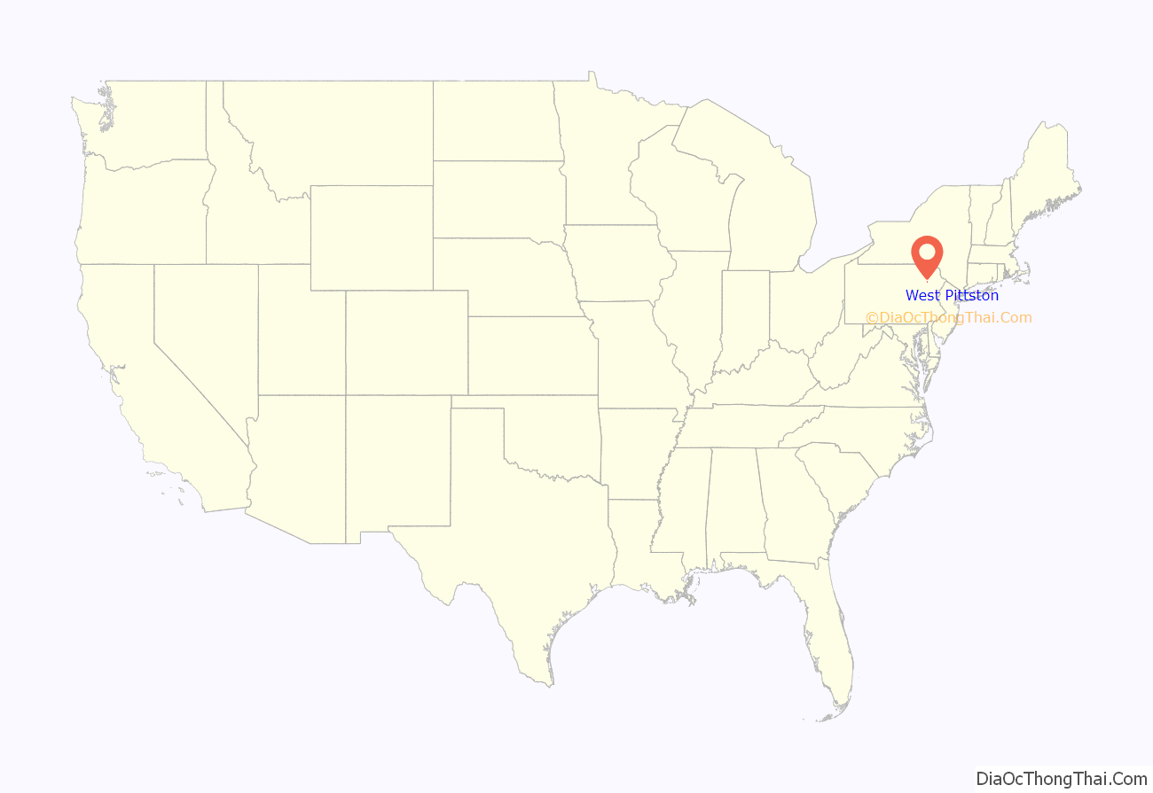
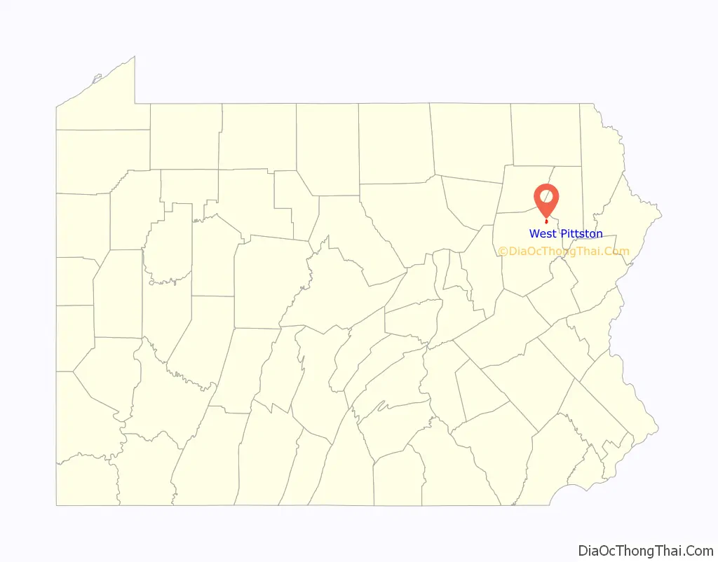
West Pittston location map. Where is West Pittston borough?
History
West Pittston was settled in the 1770s. On July 1, 1778, during the Revolutionary War, Fort Jenkins (a patriot stockade in present-day West Pittston) surrendered to the British (under Major John Butler). It was later burned to the ground. On July 3, the Battle of Wyoming was fought only several miles outside of West Pittston. It was incorporated as a borough in 1857. The West Pittston Police Department was also established that same year. West Pittston was the home of Company D, 1st Battalion, 109th Infantry Regiment, which is part of the 28th Infantry Division.
Two bridges were constructed over the Susquehanna River connecting Pittston City and West Pittston. In 1914, the Penn Bridge Company constructed the Water Street Bridge. Today, the Water Street Bridge (Firefighters’ Memorial Bridge) is illuminated by fiber optic cable. The colors of the lights can be changed manually to reflect holidays and local sporting rivalries.
In 1928, a parallel bridge (the Fort Jenkins Bridge) was constructed north of the Water Street Bridge. The Fort Jenkins Bridge, which was later renamed the Dale J. Kridlo Memorial Bridge, is part of U.S. Route 11. U.S. 11 runs through the heart of West Pittston.
In June 1972, Hurricane Agnes was responsible for massive flooding in and around the Greater Pittston area. From 1974 to 1989, alleged ghost hauntings took place in the home of Jack and Janet Smurl in West Pittston; it inspired the 1991 film The Haunted.
On September 8, 2011, the Susquehanna River, spurred by heavy rains from Tropical Storm Lee, crested at a record 42.66 feet (13.00 m). It flooded more than a quarter of the town. This was considered to be a historic flooding event which displaced thousands of people and caused millions of dollars in damages to businesses and homes. Following record flooding, the non-profit organization West Pittston Tomorrow was founded. Its purpose was to improve the damaged community. It expanded the public library and created community gardens.
Firefighters’ Memorial Bridge facing West Pittston
Specialist Dale J. Kridlo Memorial Bridge (U.S. Route 11); West Pittston is on the left
West Pittston Library
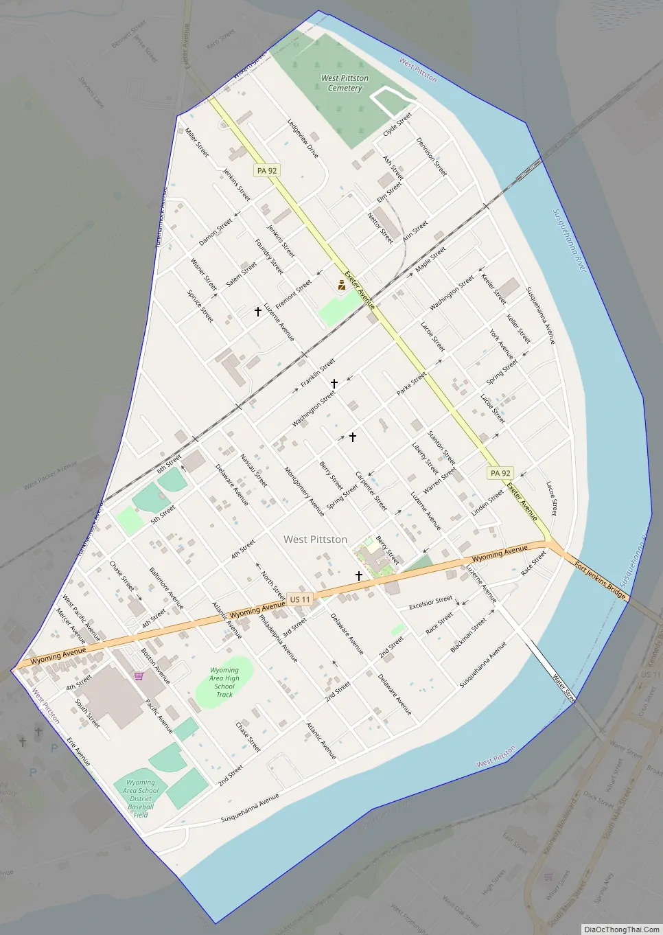
West Pittston Road Map
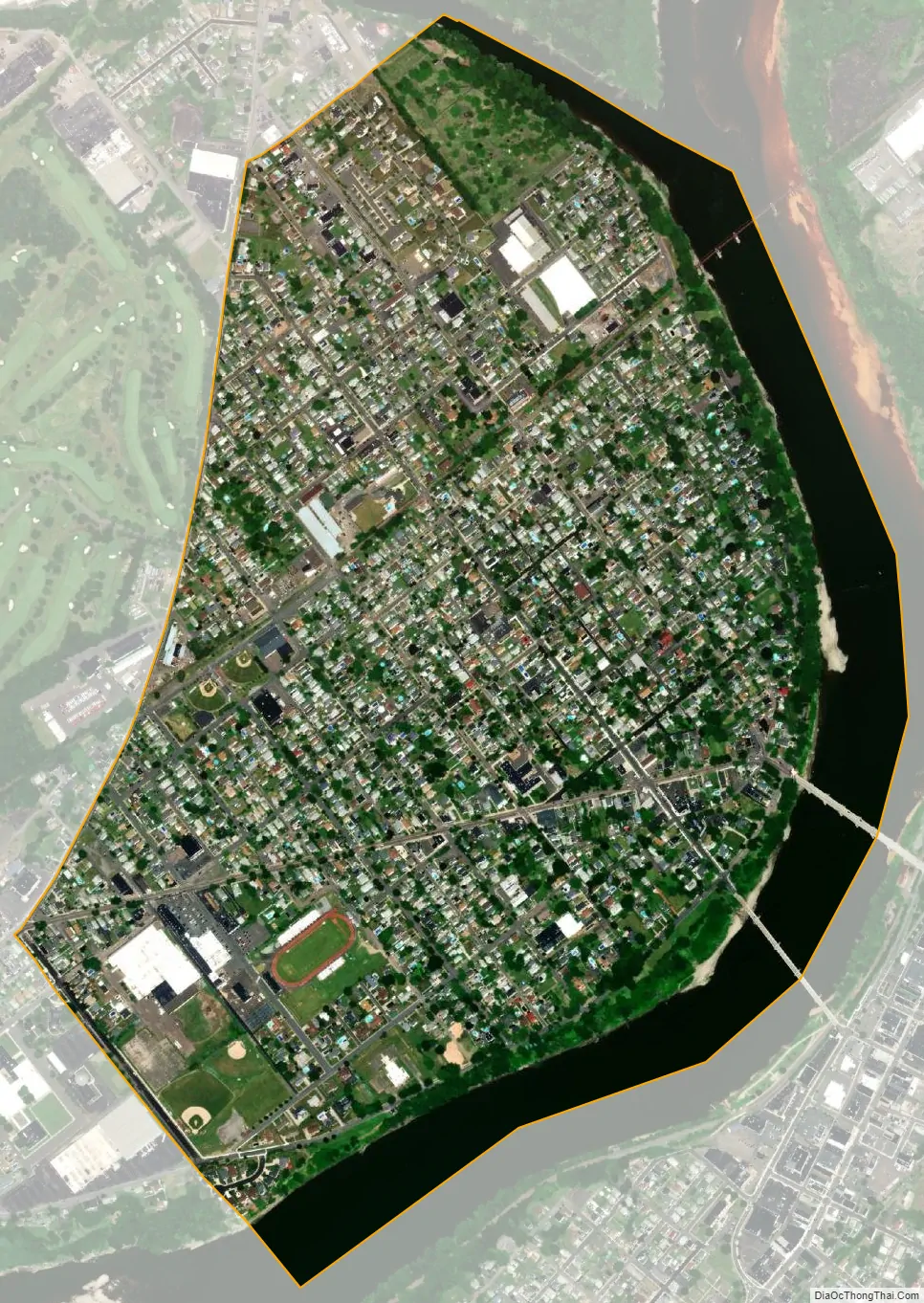
West Pittston city Satellite Map
Geography
West Pittston is located at 41°19′45″N 75°47′57″W / 41.32917°N 75.79917°W / 41.32917; -75.79917 (41.329265, -75.799048).
According to the United States Census Bureau, the borough has a total area of 0.97 square miles (2.5 km), of which 0.81 square miles (2.1 km) is land and 0.15 square miles (0.4 km), or 15.10%, is water. West Pittston lies on the western side of the Susquehanna River in northern Luzerne County. The City of Wilkes-Barre is located to the southwest. The City of Pittston is located directly across the river (to the east). The borough is situated within the Wyoming Area School District.
See also
Map of Pennsylvania State and its subdivision:- Adams
- Allegheny
- Armstrong
- Beaver
- Bedford
- Berks
- Blair
- Bradford
- Bucks
- Butler
- Cambria
- Cameron
- Carbon
- Centre
- Chester
- Clarion
- Clearfield
- Clinton
- Columbia
- Crawford
- Cumberland
- Dauphin
- Delaware
- Elk
- Erie
- Fayette
- Forest
- Franklin
- Fulton
- Greene
- Huntingdon
- Indiana
- Jefferson
- Juniata
- Lackawanna
- Lancaster
- Lawrence
- Lebanon
- Lehigh
- Luzerne
- Lycoming
- Mc Kean
- Mercer
- Mifflin
- Monroe
- Montgomery
- Montour
- Northampton
- Northumberland
- Perry
- Philadelphia
- Pike
- Potter
- Schuylkill
- Snyder
- Somerset
- Sullivan
- Susquehanna
- Tioga
- Union
- Venango
- Warren
- Washington
- Wayne
- Westmoreland
- Wyoming
- York
- Alabama
- Alaska
- Arizona
- Arkansas
- California
- Colorado
- Connecticut
- Delaware
- District of Columbia
- Florida
- Georgia
- Hawaii
- Idaho
- Illinois
- Indiana
- Iowa
- Kansas
- Kentucky
- Louisiana
- Maine
- Maryland
- Massachusetts
- Michigan
- Minnesota
- Mississippi
- Missouri
- Montana
- Nebraska
- Nevada
- New Hampshire
- New Jersey
- New Mexico
- New York
- North Carolina
- North Dakota
- Ohio
- Oklahoma
- Oregon
- Pennsylvania
- Rhode Island
- South Carolina
- South Dakota
- Tennessee
- Texas
- Utah
- Vermont
- Virginia
- Washington
- West Virginia
- Wisconsin
- Wyoming


