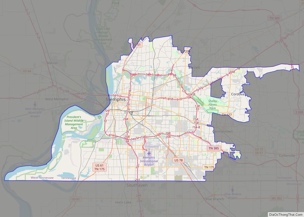
Bartlett is a city in Shelby County, Tennessee, United States. The population was 57,786 at the 2020 U.S. Census.
| Name: | Bartlett city |
|---|---|
| LSAD Code: | 25 |
| LSAD Description: | city (suffix) |
| State: | Tennessee |
| County: | Shelby County |
| Founded: | 1829 |
| Incorporated: | 1866 |
| Elevation: | 298 ft (90.8 m) |
| Total Area: | 32.31 sq mi (83.68 km²) |
| Land Area: | 32.30 sq mi (83.64 km²) |
| Water Area: | 0.01 sq mi (0.03 km²) |
| Total Population: | 57,786 |
| Population Density: | 1,789.32/sq mi (690.85/km²) |
| ZIP code: | 38133, 38134, 38135, 38002 |
| Area code: | 901 |
| FIPS code: | 4703440 |
| GNISfeature ID: | 1304976 |
| Website: | www.cityofbartlett.org |
Online Interactive Map
Click on ![]() to view map in "full screen" mode.
to view map in "full screen" mode.
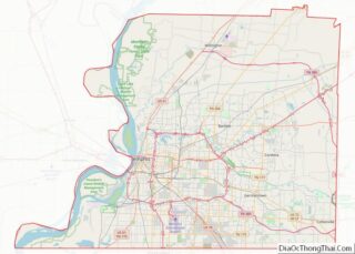
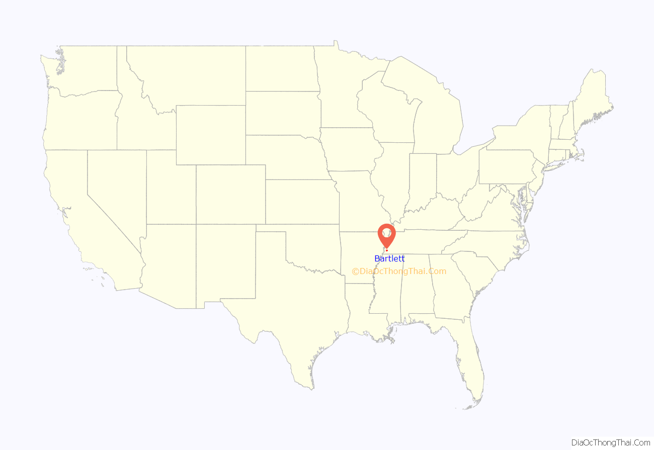
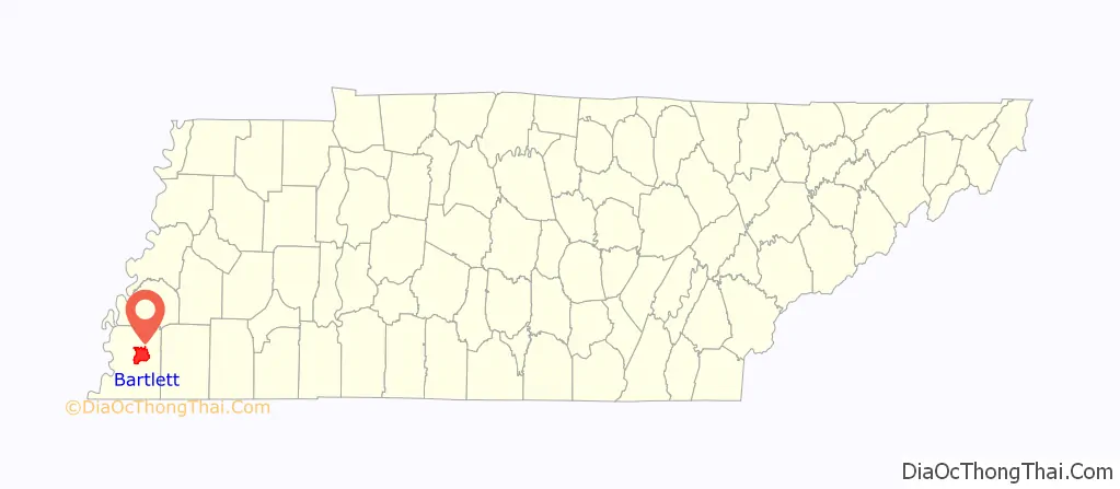
Bartlett location map. Where is Bartlett city?
History
Bartlett, originally called “Union Depot”, first served as the last major Tennessean depot along the westward stagecoach route from Nashville. It later shifted to serve as a rail station after the stagecoach route was replaced by the Memphis & Ohio Railroad. An agricultural community gradually emerged around the depot and subsequent station that saw little growth until after the American Civil War.
The community saw quick growth during Reconstruction, and by 1886 was home to a school, two gristmills, three churches, several general stores, and about 300 inhabitants. It had been officially incorporated on November 1, 1866, with a population of less than 100 under the inaugural mayorship of Bryan Wither. The city derived its name from Major Gabriel M. Bartlett, a planter and pioneer settler of the area, whose homeplace was located on the old Raleigh-Somerville Road (Stage Road) at the present location of Bartlett Station Plaza.
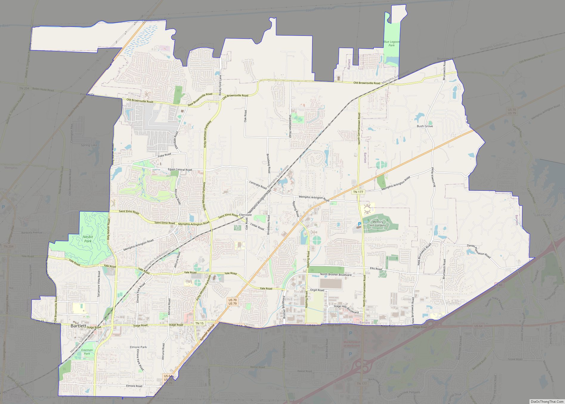
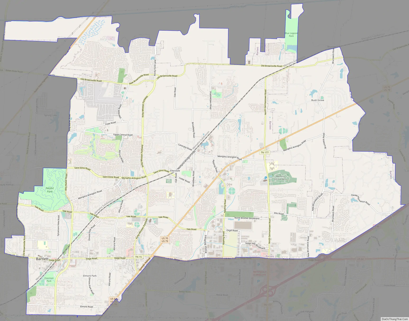
Bartlett Road Map
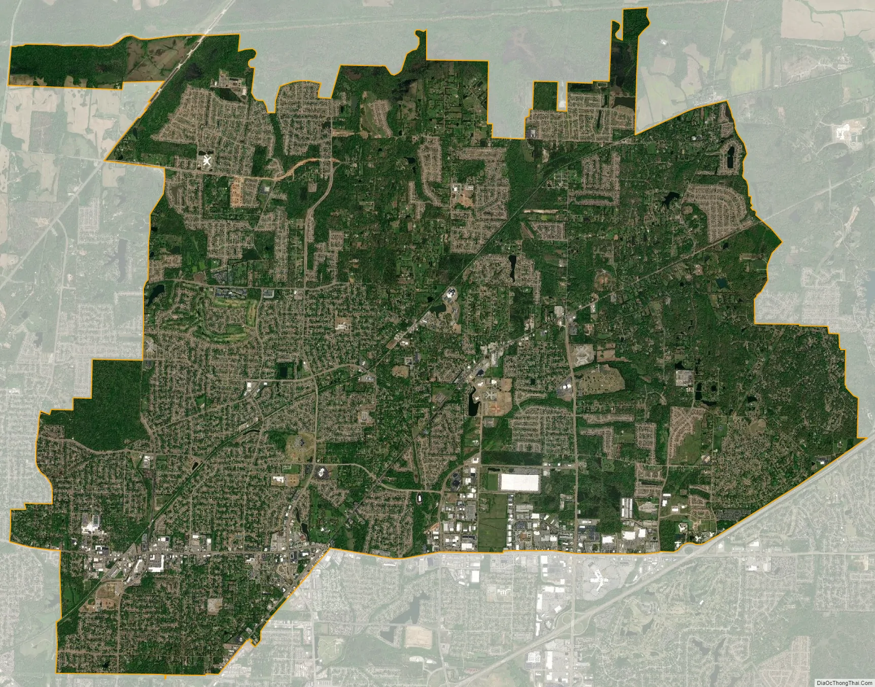
Bartlett city Satellite Map
Geography
Bartlett is adjacent to the northeastern boundary of Memphis.
According to the City of Bartlett, the city limits encompass a total area of 23.42 square miles (60.7 km). The annexation reserves of the city extend another 20.54 square miles (53.2 km).
See also
Map of Tennessee State and its subdivision:- Anderson
- Bedford
- Benton
- Bledsoe
- Blount
- Bradley
- Campbell
- Cannon
- Carroll
- Carter
- Cheatham
- Chester
- Claiborne
- Clay
- Cocke
- Coffee
- Crockett
- Cumberland
- Davidson
- Decatur
- DeKalb
- Dickson
- Dyer
- Fayette
- Fentress
- Franklin
- Gibson
- Giles
- Grainger
- Greene
- Grundy
- Hamblen
- Hamilton
- Hancock
- Hardeman
- Hardin
- Hawkins
- Haywood
- Henderson
- Henry
- Hickman
- Houston
- Humphreys
- Jackson
- Jefferson
- Johnson
- Knox
- Lake
- Lauderdale
- Lawrence
- Lewis
- Lincoln
- Loudon
- Macon
- Madison
- Marion
- Marshall
- Maury
- McMinn
- McNairy
- Meigs
- Monroe
- Montgomery
- Moore
- Morgan
- Obion
- Overton
- Perry
- Pickett
- Polk
- Putnam
- Rhea
- Roane
- Robertson
- Rutherford
- Scott
- Sequatchie
- Sevier
- Shelby
- Smith
- Stewart
- Sullivan
- Sumner
- Tipton
- Trousdale
- Unicoi
- Union
- Van Buren
- Warren
- Washington
- Wayne
- Weakley
- White
- Williamson
- Wilson
- Alabama
- Alaska
- Arizona
- Arkansas
- California
- Colorado
- Connecticut
- Delaware
- District of Columbia
- Florida
- Georgia
- Hawaii
- Idaho
- Illinois
- Indiana
- Iowa
- Kansas
- Kentucky
- Louisiana
- Maine
- Maryland
- Massachusetts
- Michigan
- Minnesota
- Mississippi
- Missouri
- Montana
- Nebraska
- Nevada
- New Hampshire
- New Jersey
- New Mexico
- New York
- North Carolina
- North Dakota
- Ohio
- Oklahoma
- Oregon
- Pennsylvania
- Rhode Island
- South Carolina
- South Dakota
- Tennessee
- Texas
- Utah
- Vermont
- Virginia
- Washington
- West Virginia
- Wisconsin
- Wyoming