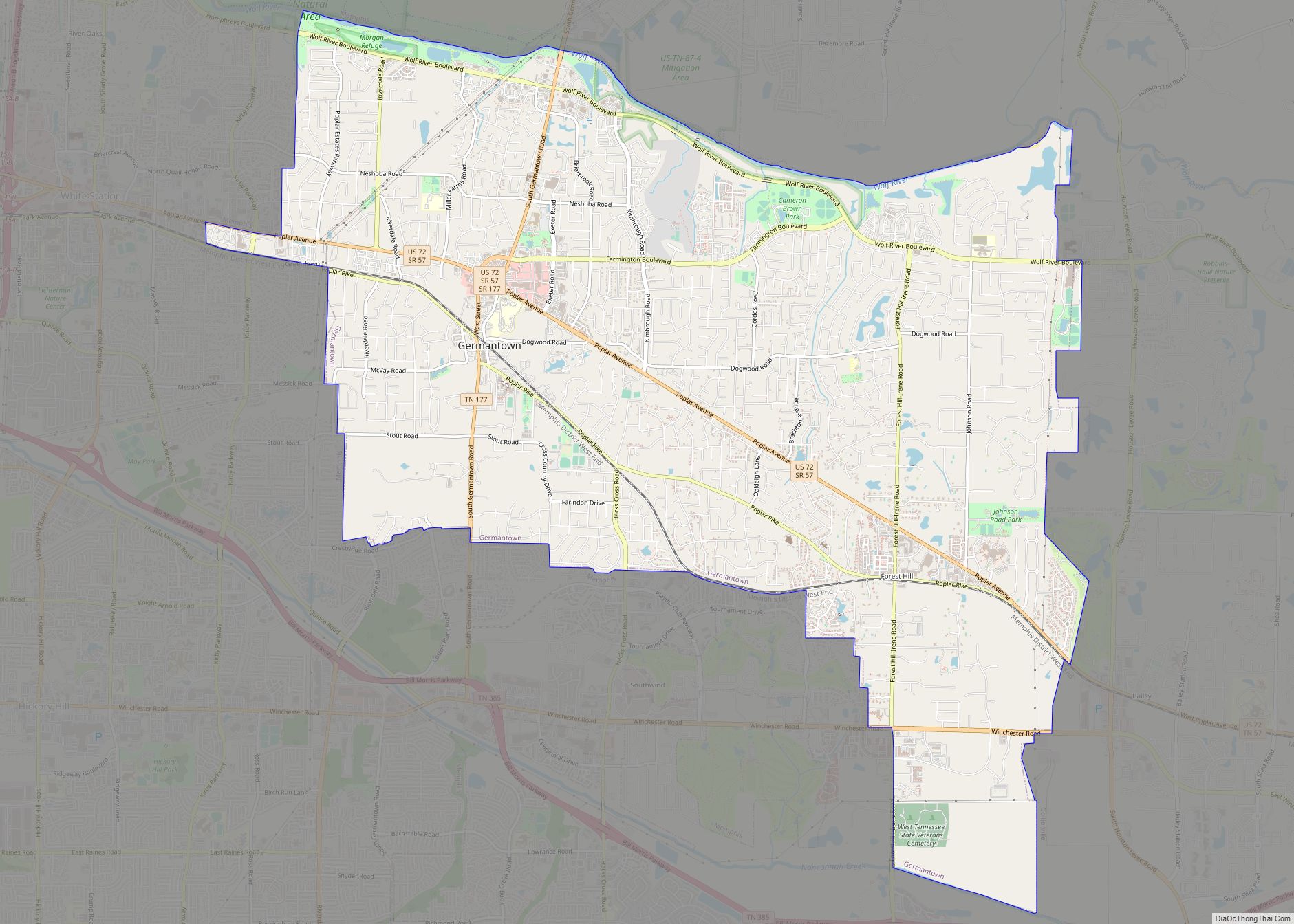
Germantown is a city in Shelby County, Tennessee, United States. The population was 41,333 at the 2020 census.
Germantown is a suburb of Memphis, bordering it to the east-southeast. Germantown was founded in 1841 by mostly German emigrants. The town hosts Festivals year round to celebrate their history and German Culture. In the city center is the “Old Germantown” neighborhood, anchored by a railroad depot (a 1948 reproduction of the 1868 original) and railroad tracks that recall the community’s earliest days of development as an outpost along the Memphis and Charleston Railroad.
The city hosts many horse shows and competitions annually, most notably the Germantown Charity Horse Show in June. Other major annual events include the Germantown Festival, an arts and crafts fair, in early September.
Germantown has the lowest crime rate for any city its size in the State of Tennessee and the police and fire departments have average emergency response time of five minutes (police just under 4 minutes & fire department 5.2 minutes). The parks and recreation department is nationally accredited. The Arbor Day Foundation has designated Germantown a “Tree City USA” for 23 consecutive years. Only 3.2% of Germantown citizens are below the poverty line.
| Name: | Germantown city |
|---|---|
| LSAD Code: | 25 |
| LSAD Description: | city (suffix) |
| State: | Tennessee |
| County: | Shelby County |
| Founded: | 1825 |
| Incorporated: | 1841 |
| Elevation: | 377 ft (115 m) |
| Total Area: | 20.01 sq mi (51.83 km²) |
| Land Area: | 19.99 sq mi (51.76 km²) |
| Water Area: | 0.03 sq mi (0.06 km²) |
| Total Population: | 41,333 |
| Population Density: | 2,068.10/sq mi (798.49/km²) |
| ZIP code: | 38125, 38138, 38139 |
| Area code: | 901 |
| FIPS code: | 4728960 |
| GNISfeature ID: | 1285318 |
| Website: | http://www.germantown-tn.gov/ |
Online Interactive Map
Click on ![]() to view map in "full screen" mode.
to view map in "full screen" mode.
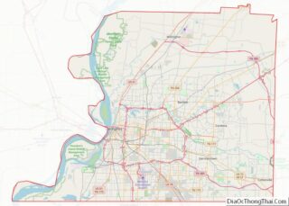
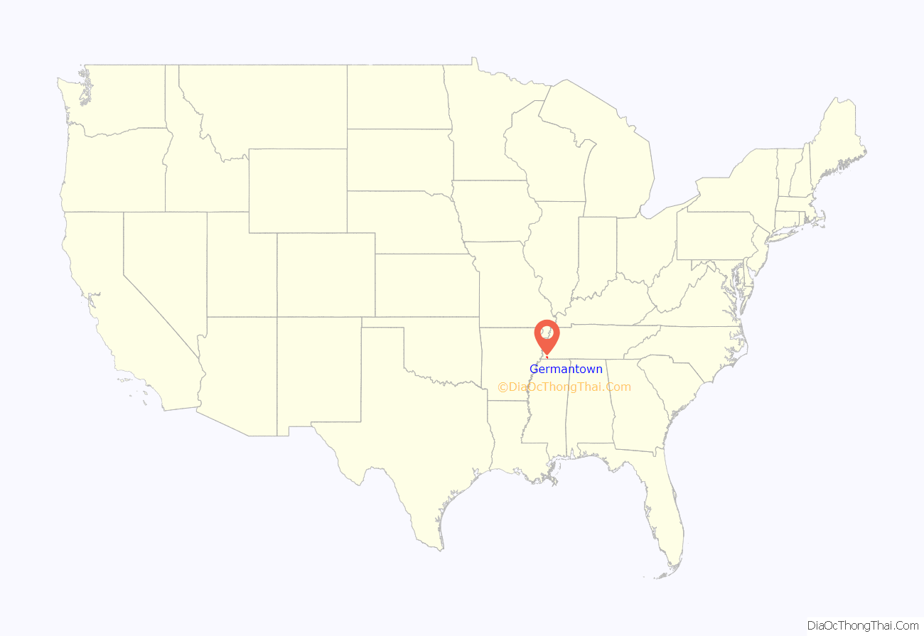
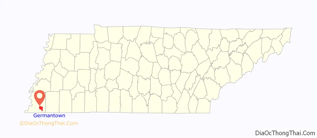
Germantown location map. Where is Germantown city?
History
Germantown was founded along the Chickasaw Trace on a ridge between the Wolf River and Nonconnah Creek, about 16 miles east of the Mississippi River.
The first settlers arrived in Germantown about 1825. Between 1825 and 1830, Miss Frances Wright established Nashoba Plantation, a utopian community intended to educate emancipated slaves and teach them a trade. By 1830, the first store was opened as more settlers moved into the area.
The community became known as Pea Ridge in 1833. Town lots were laid out in 1834 by surveyor N. T. German. The name was changed to Germantown in 1836. This coincidentally also reflected the settling of German families.
The town was incorporated in 1841. The Memphis-Charleston Railroad was built through the community in 1852. Germantown experienced setbacks through the period of the Civil War (1861-1865); the yellow fever epidemics reduced its population to a few hundred.
The town rebounded slowly. Churches destroyed in the war were rebuilt, schools were constructed and the population began to return around the turn of the century. The city name was briefly changed to Neshoba, a Chickasaw word meaning ‘wolf’, during World War I, because of widespread anti-German sentiment in the United States at that time.
During the twentieth century, the community derived its strength through involvement of citizens, as evidenced in the churches, garden clubs and civic organizations. The Poplar Pike Improvement Association and the Germantown Civic Club played vital roles in the physical and social development of the community.
In the last half of the century, after WWII the population grew from about 400 to more than 40,000. Over several decades, elected and civic leadership, with support of citizens, worked proactively to control suburban growth through development regulations, aesthetic controls and strategic planning efforts.
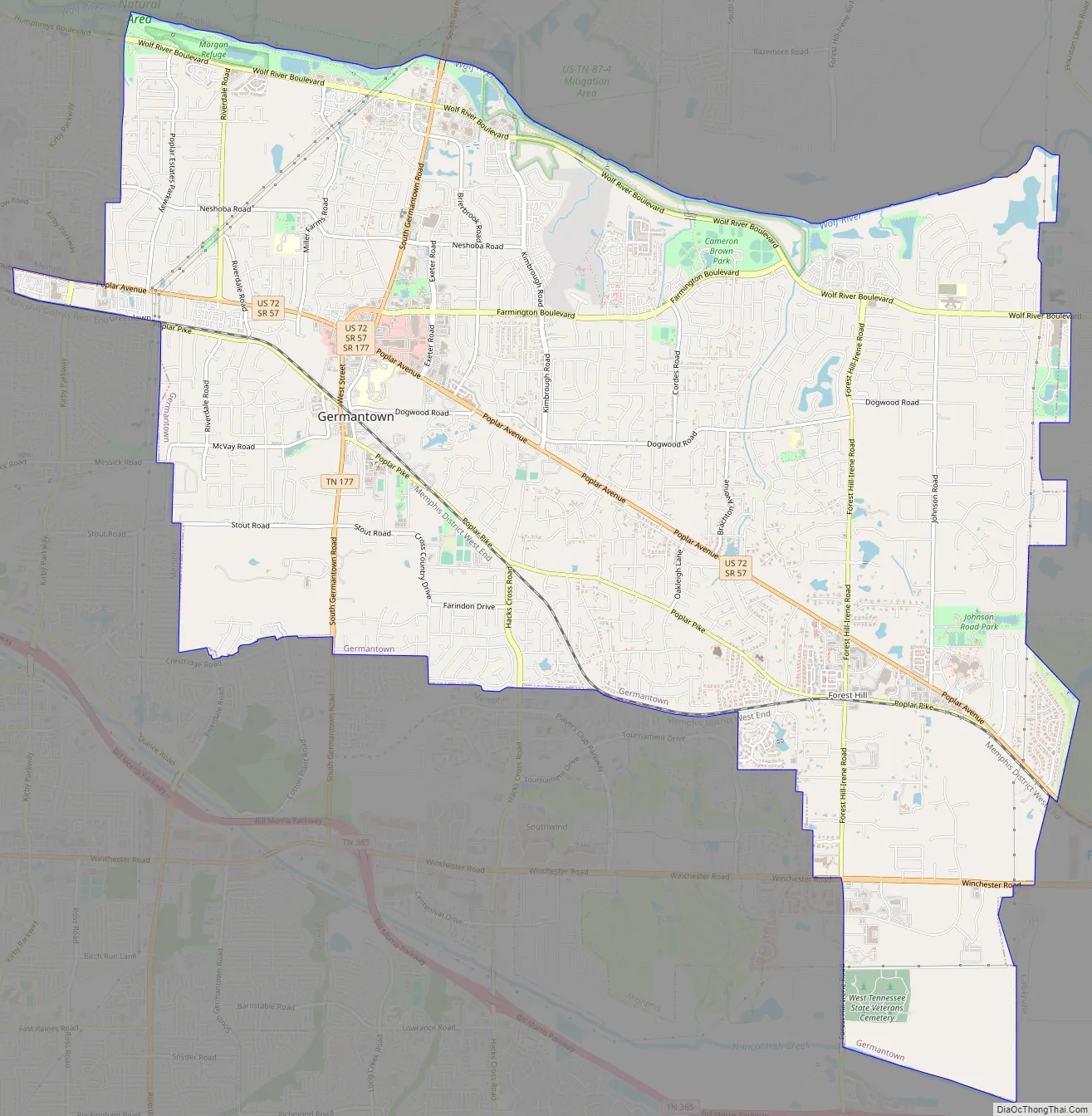
Germantown Road Map
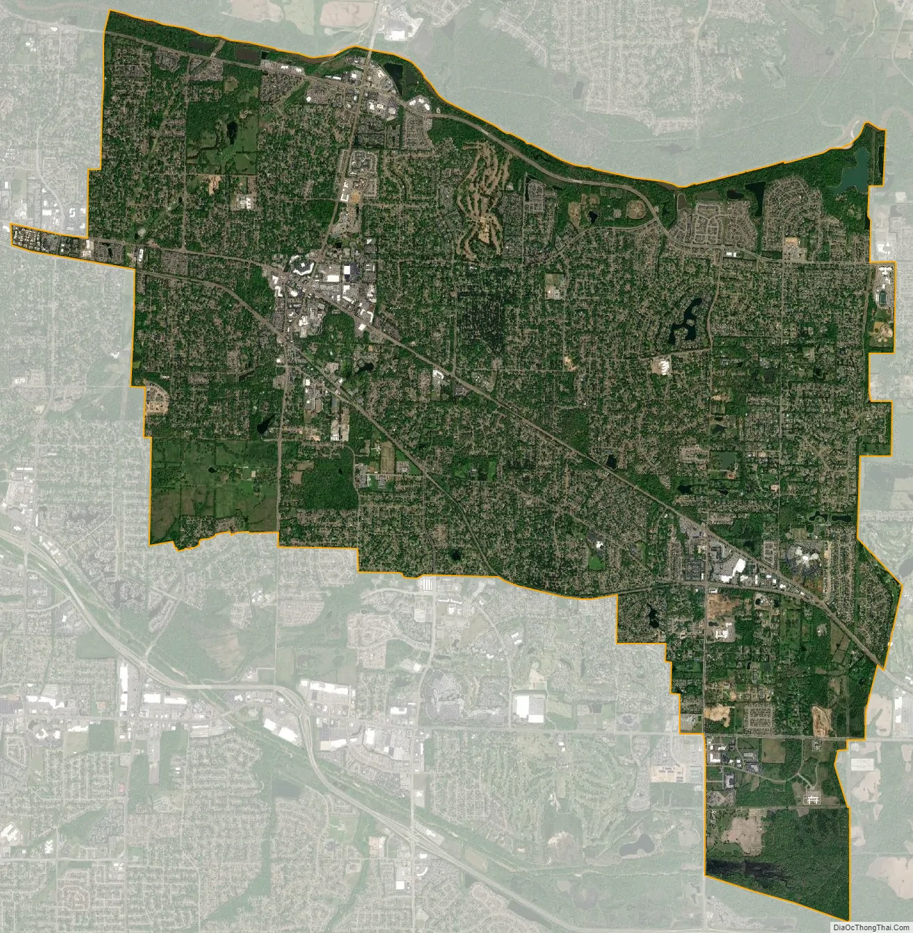
Germantown city Satellite Map
Geography
Germantown is located at 35°5′20″N 89°47′38″W / 35.08889°N 89.79389°W / 35.08889; -89.79389 (35.089023, −89.793997). It is part of the Memphis metropolitan area.
According to the United States Census Bureau, the city has a total area of 17.6 square miles (46 km), of which 0.04 square miles (0.10 km), or 0.17%, is water.
See also
Map of Tennessee State and its subdivision:- Anderson
- Bedford
- Benton
- Bledsoe
- Blount
- Bradley
- Campbell
- Cannon
- Carroll
- Carter
- Cheatham
- Chester
- Claiborne
- Clay
- Cocke
- Coffee
- Crockett
- Cumberland
- Davidson
- Decatur
- DeKalb
- Dickson
- Dyer
- Fayette
- Fentress
- Franklin
- Gibson
- Giles
- Grainger
- Greene
- Grundy
- Hamblen
- Hamilton
- Hancock
- Hardeman
- Hardin
- Hawkins
- Haywood
- Henderson
- Henry
- Hickman
- Houston
- Humphreys
- Jackson
- Jefferson
- Johnson
- Knox
- Lake
- Lauderdale
- Lawrence
- Lewis
- Lincoln
- Loudon
- Macon
- Madison
- Marion
- Marshall
- Maury
- McMinn
- McNairy
- Meigs
- Monroe
- Montgomery
- Moore
- Morgan
- Obion
- Overton
- Perry
- Pickett
- Polk
- Putnam
- Rhea
- Roane
- Robertson
- Rutherford
- Scott
- Sequatchie
- Sevier
- Shelby
- Smith
- Stewart
- Sullivan
- Sumner
- Tipton
- Trousdale
- Unicoi
- Union
- Van Buren
- Warren
- Washington
- Wayne
- Weakley
- White
- Williamson
- Wilson
- Alabama
- Alaska
- Arizona
- Arkansas
- California
- Colorado
- Connecticut
- Delaware
- District of Columbia
- Florida
- Georgia
- Hawaii
- Idaho
- Illinois
- Indiana
- Iowa
- Kansas
- Kentucky
- Louisiana
- Maine
- Maryland
- Massachusetts
- Michigan
- Minnesota
- Mississippi
- Missouri
- Montana
- Nebraska
- Nevada
- New Hampshire
- New Jersey
- New Mexico
- New York
- North Carolina
- North Dakota
- Ohio
- Oklahoma
- Oregon
- Pennsylvania
- Rhode Island
- South Carolina
- South Dakota
- Tennessee
- Texas
- Utah
- Vermont
- Virginia
- Washington
- West Virginia
- Wisconsin
- Wyoming