Halls is a town in Lauderdale County, Tennessee, United States. The population was 2,255 at the 2010 census.
The town was founded in 1882 as a railroad station stop. It is named after Hansford R. Hall, one of the founders. Among the early business ventures were sawmills and cotton gins, founded in the 1880s to process local lumber and cotton.
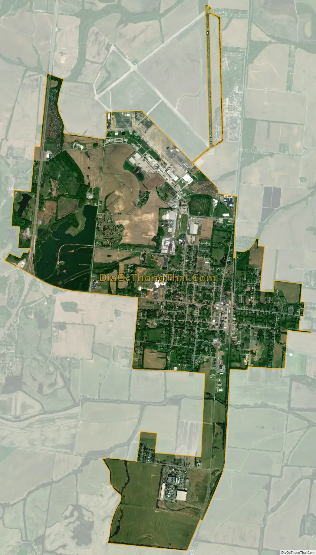
Halls is home to the Veterans’ Museum on the grounds of the Dyersburg Army Air Base, which documents the history of the World War II Army Air Corps. It was the main base for the B-17 Flying Fortress bombers in the mid-1940s.
| Name: | Halls town |
|---|---|
| LSAD Code: | 43 |
| LSAD Description: | town (suffix) |
| State: | Tennessee |
| County: | Lauderdale County |
| Elevation: | 318 ft (97 m) |
| Total Area: | 3.69 sq mi (9.56 km²) |
| Land Area: | 3.68 sq mi (9.54 km²) |
| Water Area: | 0.01 sq mi (0.02 km²) |
| Total Population: | 2,091 |
| Population Density: | 567.90/sq mi (219.25/km²) |
| ZIP code: | 38040 |
| Area code: | 731 |
| FIPS code: | 4731820 |
| GNISfeature ID: | 1286606 |
| Website: | www.town.halls.tn.us |
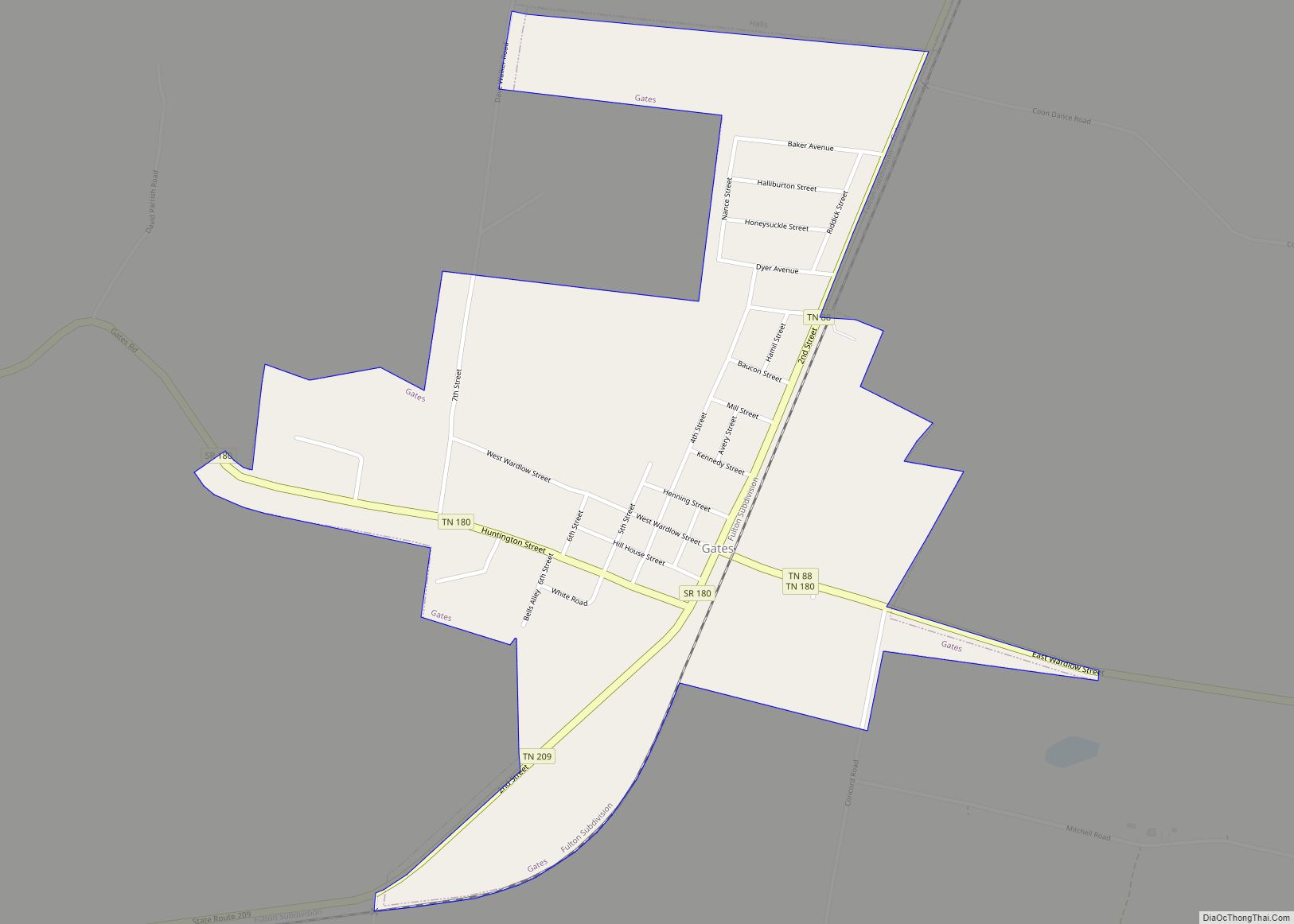
Online Interactive Map
Click on ![]() to view map in "full screen" mode.
to view map in "full screen" mode.
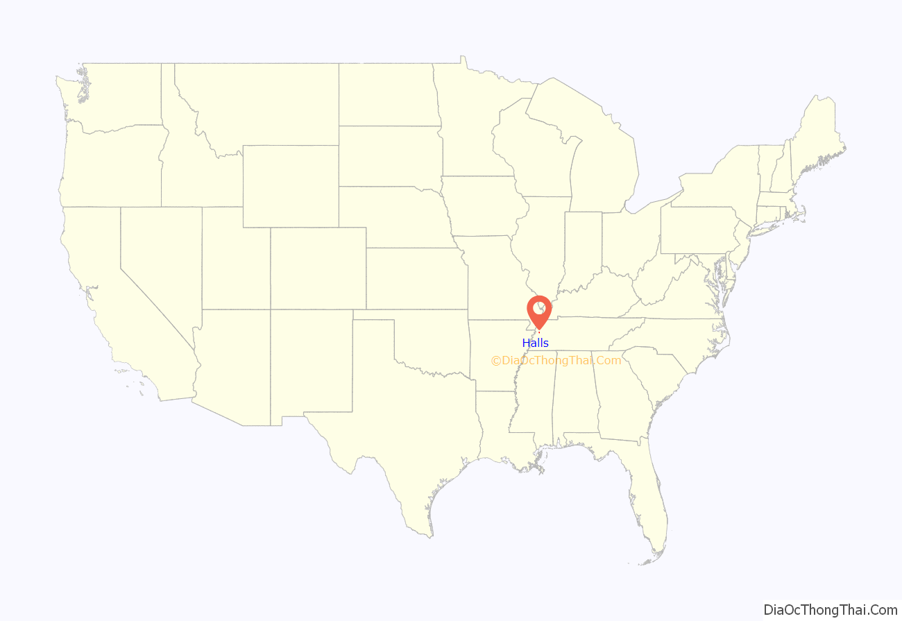
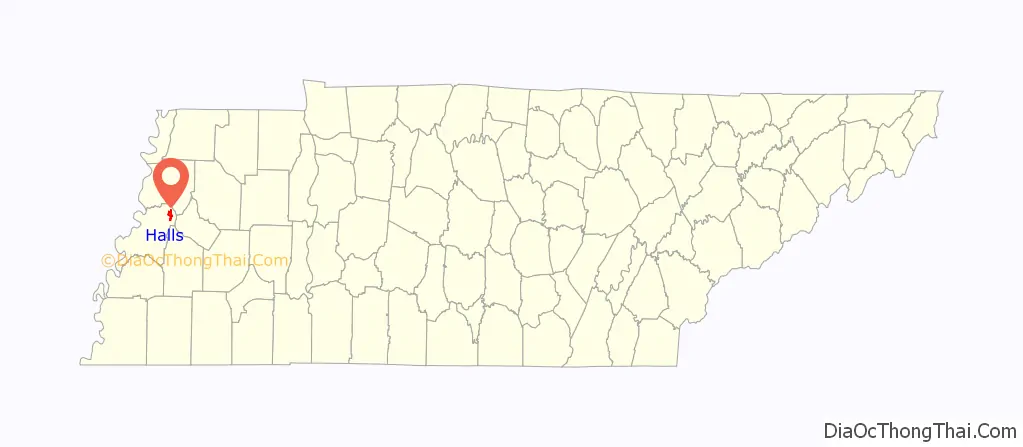
Halls location map. Where is Halls town?
History
The town was not established until 1882, when the Newport News & Mississippi Valley Railroad line (later the Illinois Central Railroad) set up a railroad stop here. The village was originally named Hall’s Station in honor of Hansford R. Hall, one of the founders. Other founders were J. S. Stephens and S. A. Jordan, early businessmen of Lauderdale County.
E. Stanfield, general merchant, was first to set up a business at Hall’s Station in 1882. Other early businesses included Young & Sawyer, a steam-powered cotton gin; D. P. Shoffner, steam sawmill and wagon material; J. H. Farmer, saw-, grist- and planing-mill and cotton gin. As of 1887 there were about 400 people in the community.
On January 17, 1999 a tornado struck Halls damaging a restaurant and The Halls First United Methodist Church. The church has since been rebuilt in another location.
Halls Road Map
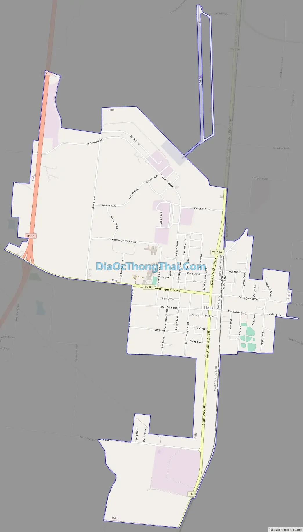
Halls city Satellite Map
Geography
Halls is located at 35°52′32″N 89°23′46″W / 35.87556°N 89.39611°W / 35.87556; -89.39611.
According to the United States Census Bureau, the town has a total area of 3.7 square miles (9.6 km), of which 3.7 square miles (9.6 km) is land and 0.27% is water.
Halls is situated on the southeastern edge of the New Madrid Seismic Zone, an area with a high earthquake risk.
See also
Map of Tennessee State and its subdivision:- Anderson
- Bedford
- Benton
- Bledsoe
- Blount
- Bradley
- Campbell
- Cannon
- Carroll
- Carter
- Cheatham
- Chester
- Claiborne
- Clay
- Cocke
- Coffee
- Crockett
- Cumberland
- Davidson
- Decatur
- DeKalb
- Dickson
- Dyer
- Fayette
- Fentress
- Franklin
- Gibson
- Giles
- Grainger
- Greene
- Grundy
- Hamblen
- Hamilton
- Hancock
- Hardeman
- Hardin
- Hawkins
- Haywood
- Henderson
- Henry
- Hickman
- Houston
- Humphreys
- Jackson
- Jefferson
- Johnson
- Knox
- Lake
- Lauderdale
- Lawrence
- Lewis
- Lincoln
- Loudon
- Macon
- Madison
- Marion
- Marshall
- Maury
- McMinn
- McNairy
- Meigs
- Monroe
- Montgomery
- Moore
- Morgan
- Obion
- Overton
- Perry
- Pickett
- Polk
- Putnam
- Rhea
- Roane
- Robertson
- Rutherford
- Scott
- Sequatchie
- Sevier
- Shelby
- Smith
- Stewart
- Sullivan
- Sumner
- Tipton
- Trousdale
- Unicoi
- Union
- Van Buren
- Warren
- Washington
- Wayne
- Weakley
- White
- Williamson
- Wilson
- Alabama
- Alaska
- Arizona
- Arkansas
- California
- Colorado
- Connecticut
- Delaware
- District of Columbia
- Florida
- Georgia
- Hawaii
- Idaho
- Illinois
- Indiana
- Iowa
- Kansas
- Kentucky
- Louisiana
- Maine
- Maryland
- Massachusetts
- Michigan
- Minnesota
- Mississippi
- Missouri
- Montana
- Nebraska
- Nevada
- New Hampshire
- New Jersey
- New Mexico
- New York
- North Carolina
- North Dakota
- Ohio
- Oklahoma
- Oregon
- Pennsylvania
- Rhode Island
- South Carolina
- South Dakota
- Tennessee
- Texas
- Utah
- Vermont
- Virginia
- Washington
- West Virginia
- Wisconsin
- Wyoming