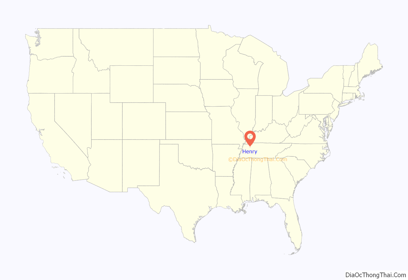
Henry is a town in Henry County, Tennessee. The population was 520 at the 2000 census and 464 at the 2010 census, showing decline of 56. Gospel singer Bobby Jones was born here.
| Name: | Henry town |
|---|---|
| LSAD Code: | 43 |
| LSAD Description: | town (suffix) |
| State: | Tennessee |
| County: | Henry County |
| Elevation: | 548 ft (167 m) |
| Total Area: | 1.28 sq mi (3.33 km²) |
| Land Area: | 1.28 sq mi (3.33 km²) |
| Water Area: | 0.00 sq mi (0.00 km²) |
| Total Population: | 446 |
| Population Density: | 347.08/sq mi (134.01/km²) |
| ZIP code: | 38231 |
| Area code: | 731 |
| FIPS code: | 4733400 |
| GNISfeature ID: | 1287430 |
Online Interactive Map
Click on ![]() to view map in "full screen" mode.
to view map in "full screen" mode.
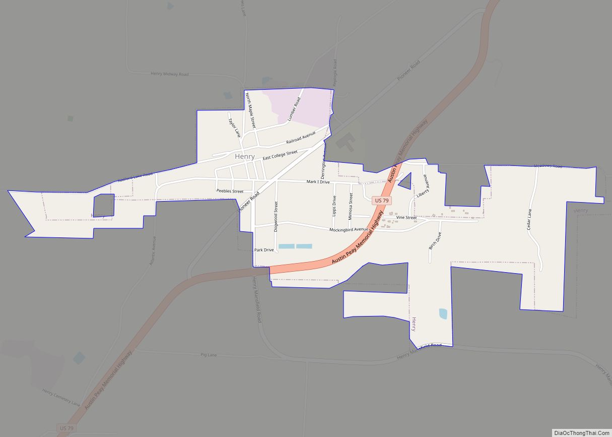
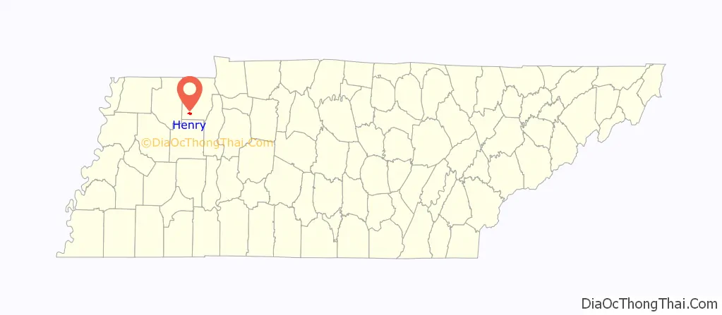
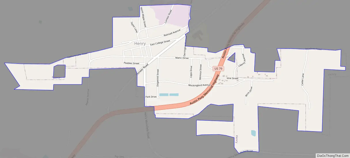
Henry location map. Where is Henry town?
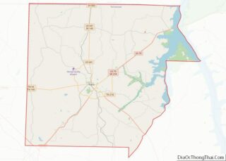
Henry Road Map
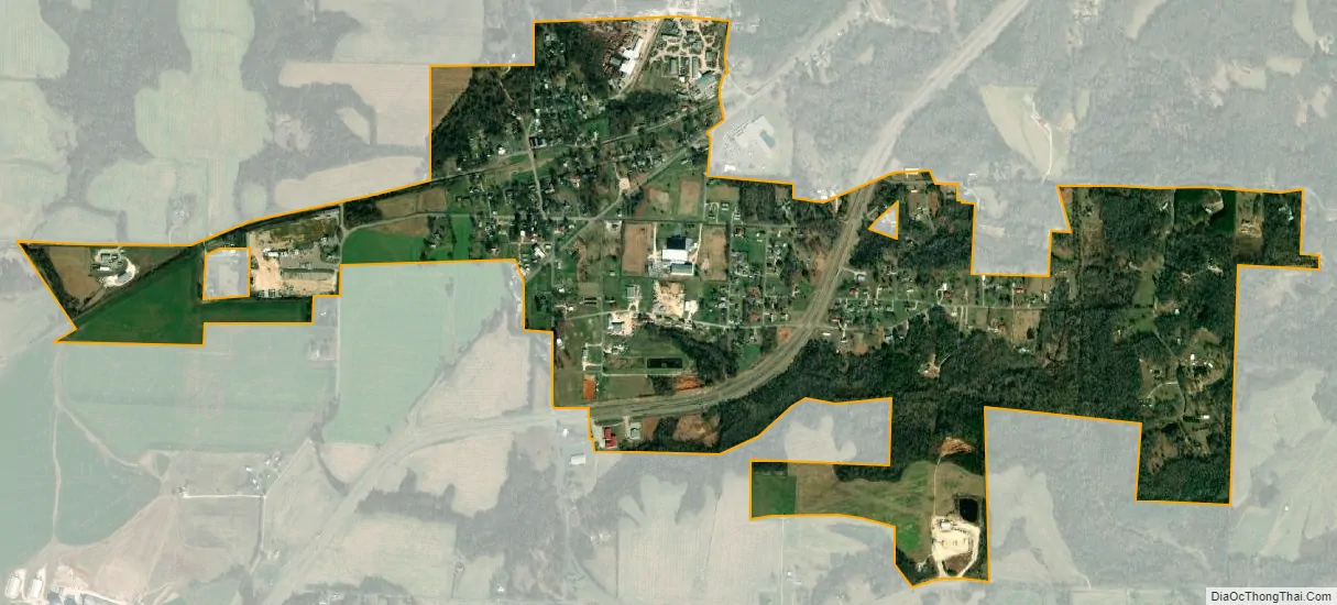
Henry city Satellite Map
Geography
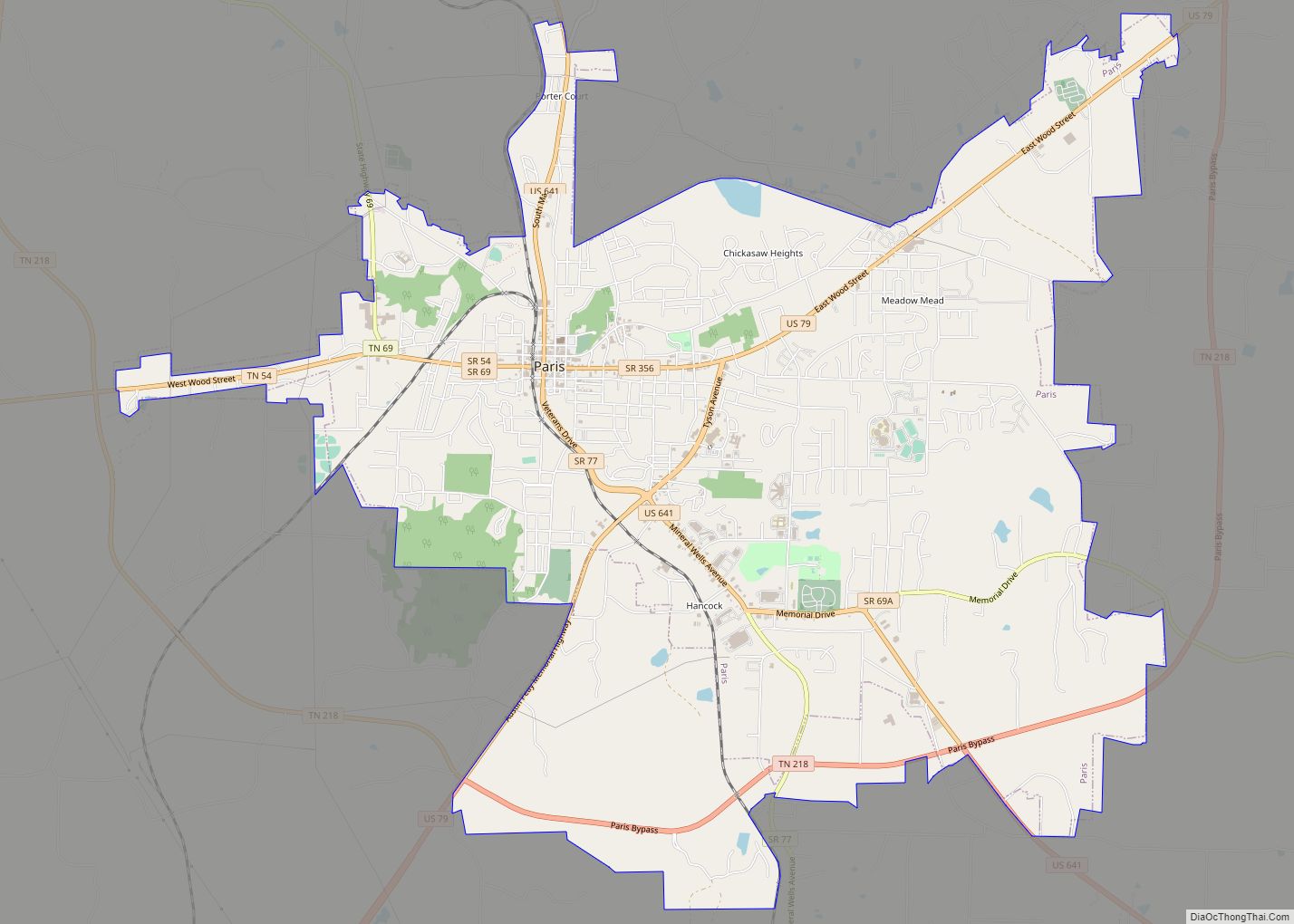
Henry is located in southwestern Henry County at 36°12′8″N 88°25′6″W / 36.20222°N 88.41833°W / 36.20222; -88.41833 (36.202197, -88.418208). U.S. Route 79 runs through the eastern and southern sides of the town, leading northeast 9 miles (14 km) to Paris, the county seat, and southwest 7 miles (11 km) to McKenzie.
According to the United States Census Bureau, the town has a total area of 1.4 square miles (3.7 km), all land.
See also
Map of Tennessee State and its subdivision:- Anderson
- Bedford
- Benton
- Bledsoe
- Blount
- Bradley
- Campbell
- Cannon
- Carroll
- Carter
- Cheatham
- Chester
- Claiborne
- Clay
- Cocke
- Coffee
- Crockett
- Cumberland
- Davidson
- Decatur
- DeKalb
- Dickson
- Dyer
- Fayette
- Fentress
- Franklin
- Gibson
- Giles
- Grainger
- Greene
- Grundy
- Hamblen
- Hamilton
- Hancock
- Hardeman
- Hardin
- Hawkins
- Haywood
- Henderson
- Henry
- Hickman
- Houston
- Humphreys
- Jackson
- Jefferson
- Johnson
- Knox
- Lake
- Lauderdale
- Lawrence
- Lewis
- Lincoln
- Loudon
- Macon
- Madison
- Marion
- Marshall
- Maury
- McMinn
- McNairy
- Meigs
- Monroe
- Montgomery
- Moore
- Morgan
- Obion
- Overton
- Perry
- Pickett
- Polk
- Putnam
- Rhea
- Roane
- Robertson
- Rutherford
- Scott
- Sequatchie
- Sevier
- Shelby
- Smith
- Stewart
- Sullivan
- Sumner
- Tipton
- Trousdale
- Unicoi
- Union
- Van Buren
- Warren
- Washington
- Wayne
- Weakley
- White
- Williamson
- Wilson
- Alabama
- Alaska
- Arizona
- Arkansas
- California
- Colorado
- Connecticut
- Delaware
- District of Columbia
- Florida
- Georgia
- Hawaii
- Idaho
- Illinois
- Indiana
- Iowa
- Kansas
- Kentucky
- Louisiana
- Maine
- Maryland
- Massachusetts
- Michigan
- Minnesota
- Mississippi
- Missouri
- Montana
- Nebraska
- Nevada
- New Hampshire
- New Jersey
- New Mexico
- New York
- North Carolina
- North Dakota
- Ohio
- Oklahoma
- Oregon
- Pennsylvania
- Rhode Island
- South Carolina
- South Dakota
- Tennessee
- Texas
- Utah
- Vermont
- Virginia
- Washington
- West Virginia
- Wisconsin
- Wyoming