Huntingdon is a town in Carroll County, Tennessee, United States. The population was 4,439 at the 2020 census and 3,985 in 2010. It is the county seat of Carroll County.
| Name: | Huntingdon town |
|---|---|
| LSAD Code: | 43 |
| LSAD Description: | town (suffix) |
| State: | Tennessee |
| County: | Carroll County |
| Elevation: | 410 ft (120 m) |
| Total Area: | 11.89 sq mi (30.79 km²) |
| Land Area: | 11.84 sq mi (30.66 km²) |
| Water Area: | 0.05 sq mi (0.13 km²) |
| Total Population: | 4,439 |
| Population Density: | 374.95/sq mi (144.77/km²) |
| ZIP code: | 38344 |
| Area code: | 731 |
| FIPS code: | 4736580 |
| GNISfeature ID: | 1288761 |
| Website: | www.huntingdontn.com |
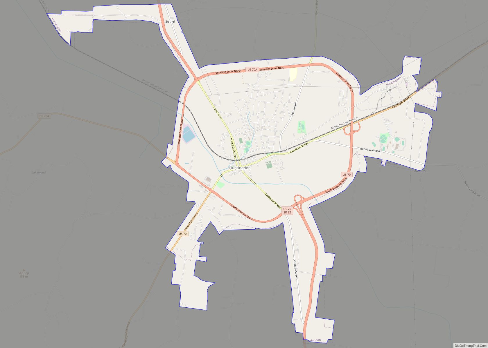
Online Interactive Map
Click on ![]() to view map in "full screen" mode.
to view map in "full screen" mode.
Huntingdon location map. Where is Huntingdon town?


History
European-American settlers named Huntingdon for Memucan Hunt, who first owned the town site in western Tennessee. Huntingdon was home to many prominent farming families. Prominent families in the area were the Ingrams and the Masseys, who had settled in the area as early as 1820.
Huntingdon Road Map
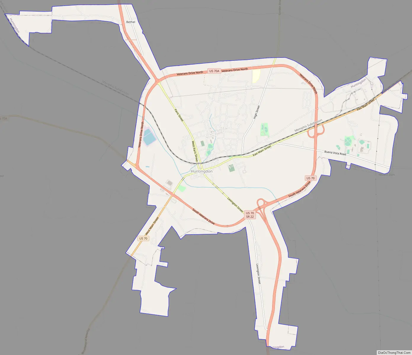
Huntingdon city Satellite Map

Geography
Huntingdon is located slightly east of the center of Carroll County at 36°0′26″N 88°25′14″W / 36.00722°N 88.42056°W / 36.00722; -88.42056 (36.007154, -88.420683).
According to the United States Census Bureau, the town has a total area of 11.9 square miles (30.9 km), of which 11.9 square miles (30.8 km) is land and 0.04 square miles (0.1 km), or 0.42%, is water.
Climate
See also
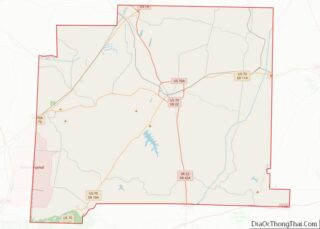
Map of Tennessee State and its subdivision:- Anderson
- Bedford
- Benton
- Bledsoe
- Blount
- Bradley
- Campbell
- Cannon
- Carroll
- Carter
- Cheatham
- Chester
- Claiborne
- Clay
- Cocke
- Coffee
- Crockett
- Cumberland
- Davidson
- Decatur
- DeKalb
- Dickson
- Dyer
- Fayette
- Fentress
- Franklin
- Gibson
- Giles
- Grainger
- Greene
- Grundy
- Hamblen
- Hamilton
- Hancock
- Hardeman
- Hardin
- Hawkins
- Haywood
- Henderson
- Henry
- Hickman
- Houston
- Humphreys
- Jackson
- Jefferson
- Johnson
- Knox
- Lake
- Lauderdale
- Lawrence
- Lewis
- Lincoln
- Loudon
- Macon
- Madison
- Marion
- Marshall
- Maury
- McMinn
- McNairy
- Meigs
- Monroe
- Montgomery
- Moore
- Morgan
- Obion
- Overton
- Perry
- Pickett
- Polk
- Putnam
- Rhea
- Roane
- Robertson
- Rutherford
- Scott
- Sequatchie
- Sevier
- Shelby
- Smith
- Stewart
- Sullivan
- Sumner
- Tipton
- Trousdale
- Unicoi
- Union
- Van Buren
- Warren
- Washington
- Wayne
- Weakley
- White
- Williamson
- Wilson
- Alabama
- Alaska
- Arizona
- Arkansas
- California
- Colorado
- Connecticut
- Delaware
- District of Columbia
- Florida
- Georgia
- Hawaii
- Idaho
- Illinois
- Indiana
- Iowa
- Kansas
- Kentucky
- Louisiana
- Maine
- Maryland
- Massachusetts
- Michigan
- Minnesota
- Mississippi
- Missouri
- Montana
- Nebraska
- Nevada
- New Hampshire
- New Jersey
- New Mexico
- New York
- North Carolina
- North Dakota
- Ohio
- Oklahoma
- Oregon
- Pennsylvania
- Rhode Island
- South Carolina
- South Dakota
- Tennessee
- Texas
- Utah
- Vermont
- Virginia
- Washington
- West Virginia
- Wisconsin
- Wyoming