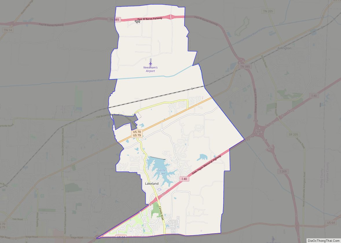
Lakeland is a city in Shelby County, Tennessee, United States, and a part of the Memphis metropolitan area. The population was 12,430 at the 2010 census.
| Name: | Lakeland city |
|---|---|
| LSAD Code: | 25 |
| LSAD Description: | city (suffix) |
| State: | Tennessee |
| County: | Shelby County |
| Elevation: | 397 ft (121 m) |
| Total Area: | 23.87 sq mi (61.83 km²) |
| Land Area: | 23.46 sq mi (60.75 km²) |
| Water Area: | 0.42 sq mi (1.08 km²) |
| Total Population: | 13,904 |
| Population Density: | 592.77/sq mi (228.87/km²) |
| ZIP code: | 38002 |
| Area code: | 901 |
| FIPS code: | 4740350 |
| GNISfeature ID: | 1313627 |
| Website: | www.lakelandtn.gov |
Online Interactive Map
Click on ![]() to view map in "full screen" mode.
to view map in "full screen" mode.
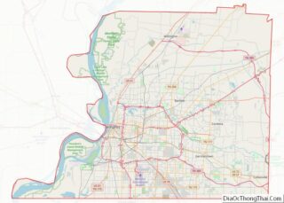
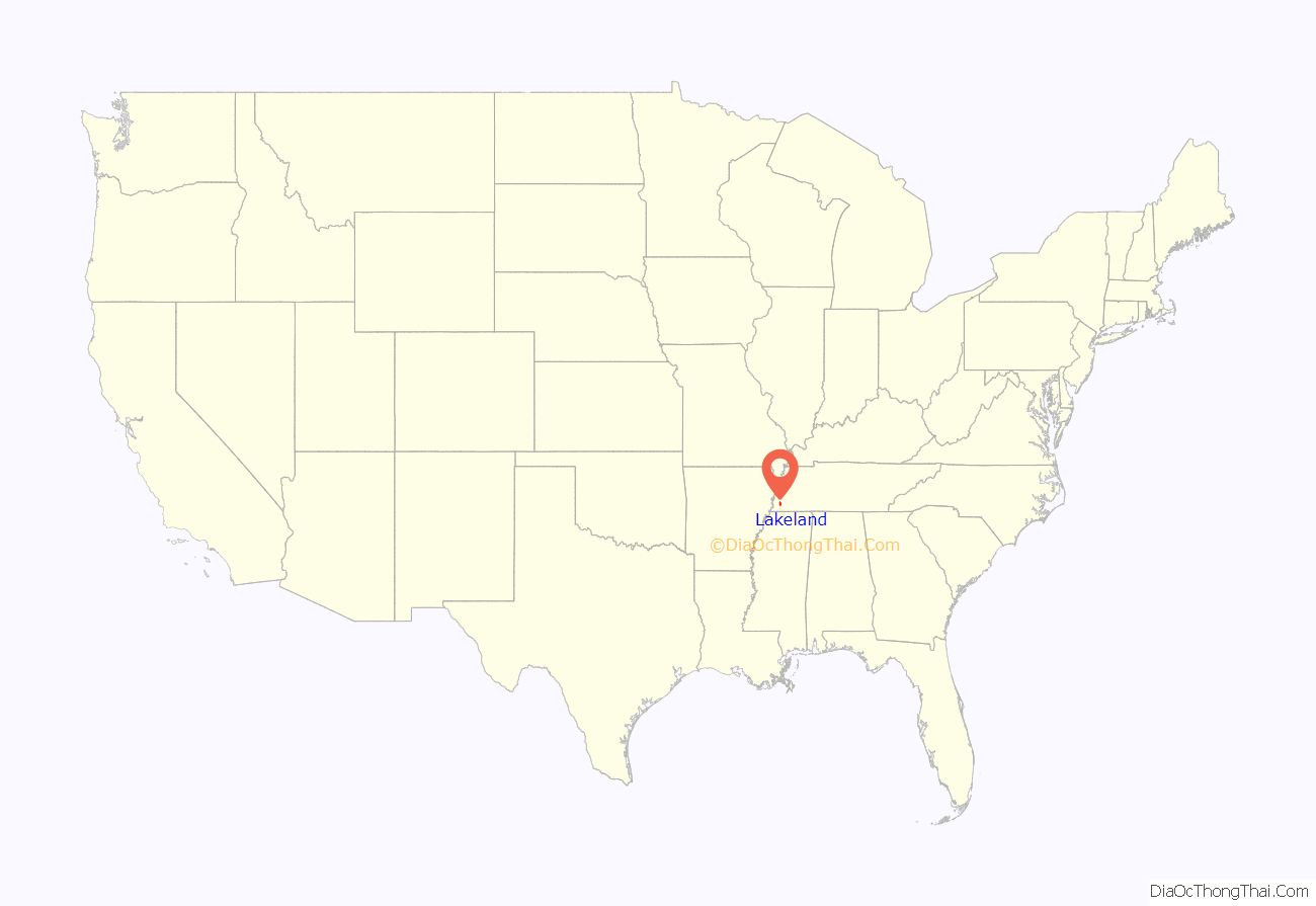
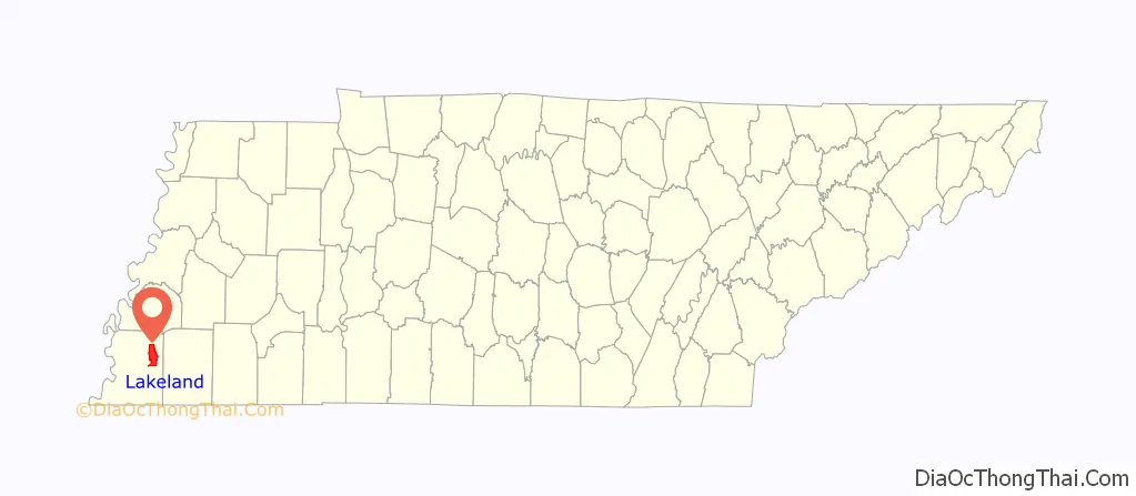
Lakeland location map. Where is Lakeland city?
History
The city was the location of the now defunct Lakeland Amusement Park. It had two railroads within the park property, including the 3 ft (914 mm) narrow gauge Huff ‘n’ Puff Railroad and a separate 16 in (406 mm) miniature railway railroad made by the Allan Herschell Company.
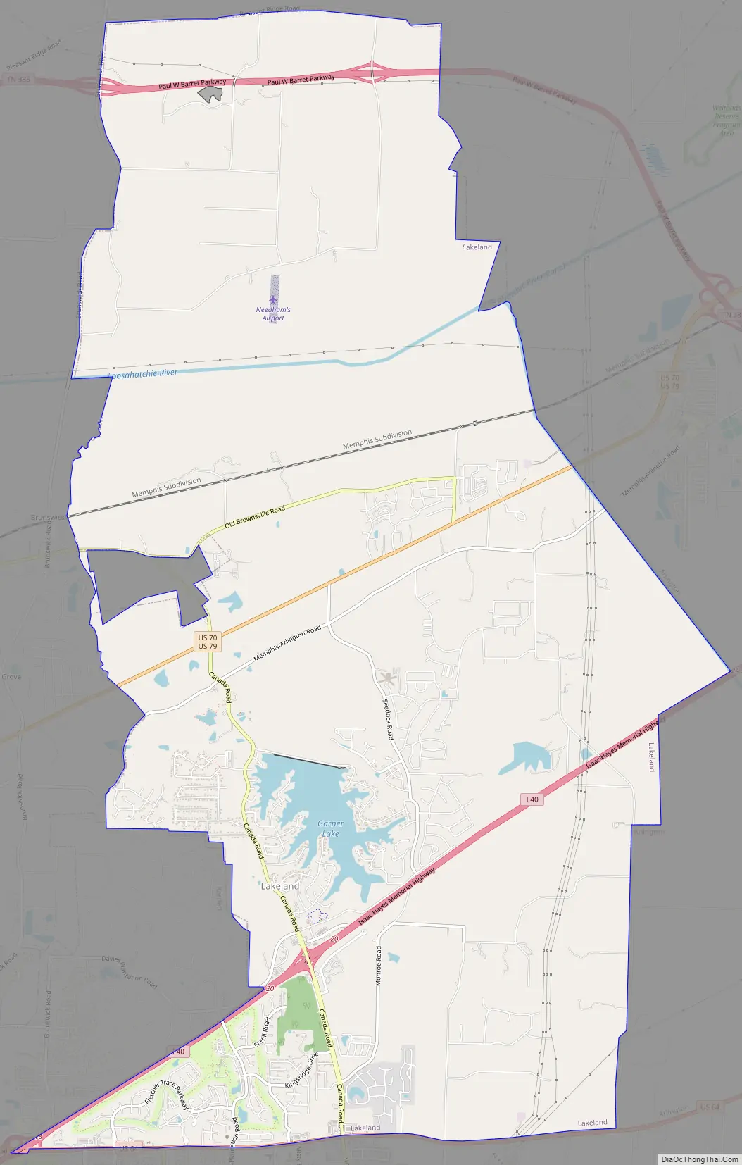
Lakeland Road Map
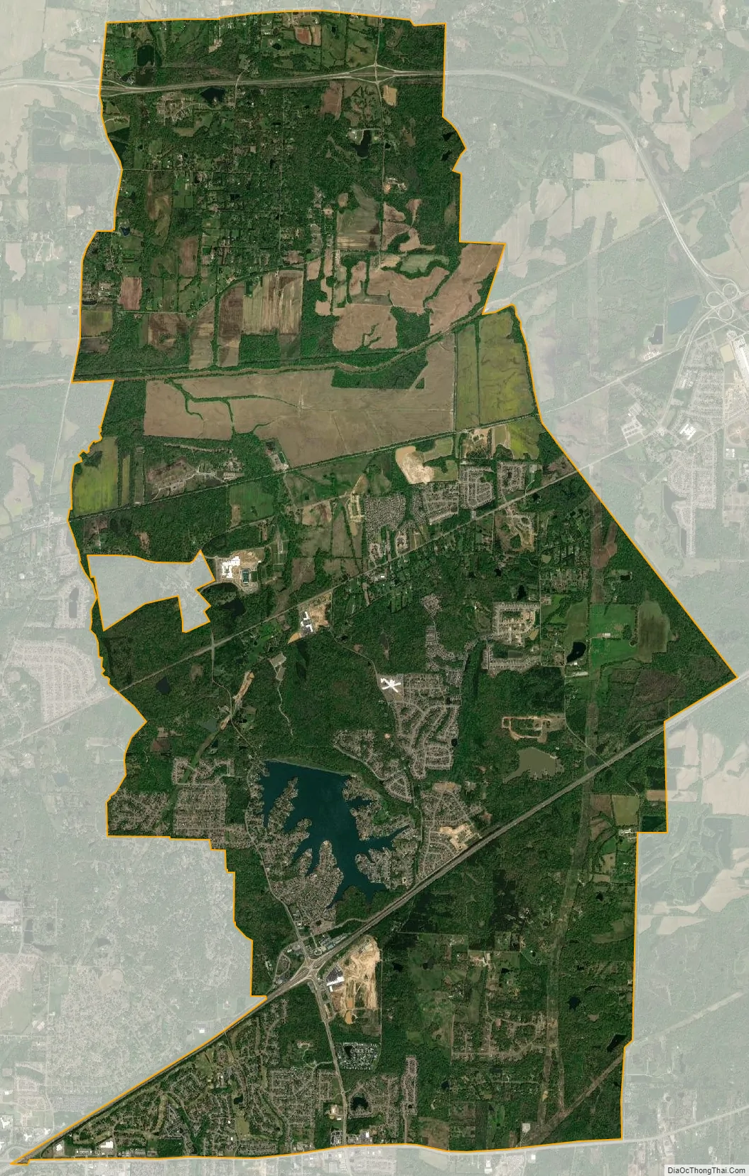
Lakeland city Satellite Map
Geography
Lakeland is located at 35°13′50″N 89°44′25″W / 35.23056°N 89.74028°W / 35.23056; -89.74028. According to the United States Census Bureau, the city has a total area of 18.0 square miles (47 km), of which 17.6 square miles (46 km) is land and 0.4 square miles (1.0 km) (2.33%) is water.
See also
Map of Tennessee State and its subdivision:- Anderson
- Bedford
- Benton
- Bledsoe
- Blount
- Bradley
- Campbell
- Cannon
- Carroll
- Carter
- Cheatham
- Chester
- Claiborne
- Clay
- Cocke
- Coffee
- Crockett
- Cumberland
- Davidson
- Decatur
- DeKalb
- Dickson
- Dyer
- Fayette
- Fentress
- Franklin
- Gibson
- Giles
- Grainger
- Greene
- Grundy
- Hamblen
- Hamilton
- Hancock
- Hardeman
- Hardin
- Hawkins
- Haywood
- Henderson
- Henry
- Hickman
- Houston
- Humphreys
- Jackson
- Jefferson
- Johnson
- Knox
- Lake
- Lauderdale
- Lawrence
- Lewis
- Lincoln
- Loudon
- Macon
- Madison
- Marion
- Marshall
- Maury
- McMinn
- McNairy
- Meigs
- Monroe
- Montgomery
- Moore
- Morgan
- Obion
- Overton
- Perry
- Pickett
- Polk
- Putnam
- Rhea
- Roane
- Robertson
- Rutherford
- Scott
- Sequatchie
- Sevier
- Shelby
- Smith
- Stewart
- Sullivan
- Sumner
- Tipton
- Trousdale
- Unicoi
- Union
- Van Buren
- Warren
- Washington
- Wayne
- Weakley
- White
- Williamson
- Wilson
- Alabama
- Alaska
- Arizona
- Arkansas
- California
- Colorado
- Connecticut
- Delaware
- District of Columbia
- Florida
- Georgia
- Hawaii
- Idaho
- Illinois
- Indiana
- Iowa
- Kansas
- Kentucky
- Louisiana
- Maine
- Maryland
- Massachusetts
- Michigan
- Minnesota
- Mississippi
- Missouri
- Montana
- Nebraska
- Nevada
- New Hampshire
- New Jersey
- New Mexico
- New York
- North Carolina
- North Dakota
- Ohio
- Oklahoma
- Oregon
- Pennsylvania
- Rhode Island
- South Carolina
- South Dakota
- Tennessee
- Texas
- Utah
- Vermont
- Virginia
- Washington
- West Virginia
- Wisconsin
- Wyoming