Memphis is a city in the U.S. state of Tennessee. It is the seat of Shelby County in the southwest part of the state; it is situated along the Mississippi River. With a population of 633,104 at the 2020 U.S. census, Memphis is the second-most populous city in Tennessee, after Nashville.
Memphis is the fifth-most populous city in the Southeast, the nation’s 28th-largest overall, as well as the largest city bordering the Mississippi River and third largest Metropolitan statistical area behind Saint Louis, MO and the Twin Cities on the Mississippi River. The Memphis metropolitan area includes West Tennessee and the greater Mid-South region, which includes portions of neighboring Arkansas, Mississippi and the Missouri Bootheel. One of the more historic and culturally significant cities of the Southern United States, Memphis has a wide variety of landscapes and distinct neighborhoods.
The first European explorer to visit the area of present-day Memphis was Spanish conquistador Hernando de Soto in 1541. The high Chickasaw Bluffs protecting the location from the waters of the Mississippi was contested by Spanish, French, and English colonizers as Memphis developed. By 1819, when modern Memphis was founded, it was part of the United States territory. John Overton, James Winchester, and Andrew Jackson founded the city. Based on the wealth of cotton plantations and river traffic along the Mississippi, Memphis grew into one of the largest cities of the Antebellum South. After the American Civil War and the end of slavery, the city continued to grow into the 20th century. It became among the largest world markets for cotton and lumber.
Home to Tennessee’s largest African-American population, Memphis played a prominent role in the American Civil Rights Movement. Leader Martin Luther King Jr. was assassinated there in 1968 after activities supporting a strike by the city’s maintenance workers. The National Civil Rights Museum was established there and is a Smithsonian affiliate institution.
Since the civil rights era, Memphis has become one of the nation’s leading commercial centers in transportation and logistics. The largest employer is FedEx, which maintains its global air hub at Memphis International Airport. In 2021, Memphis was the world’s second-busiest cargo airport. The International Port of Memphis also hosts the fifth-busiest inland water port in the U.S. The Globalization and World Cities Research Network considers Memphis a “Sufficiency” level global city as of 2020.
Memphis is a center for media and entertainment, notably a historic music scene. With blues clubs on Beale Street originating the unique Memphis blues sound, the city has been nicknamed the “Home of the Blues”. Its music has continued to be shaped by a multicultural mix of influences: country, rock and roll, soul, and hip-hop.
The city is home to a major professional sports team, the Grizzlies of the NBA. Other attractions include Graceland, the Memphis Pyramid, Sun Studio, the Blues Hall of Fame and Stax Museum of American Soul Music. Memphis-style barbecue has achieved international prominence, and the city hosts the annual World Championship Barbecue Cooking Contest, which attracts more than 100,000 visitors each year. Higher-level educational institutions include the University of Memphis and Rhodes College.
| Name: | Memphis city |
|---|---|
| LSAD Code: | 25 |
| LSAD Description: | city (suffix) |
| State: | Tennessee |
| County: | Shelby County |
| Founded: | May 22, 1819 (1819-05-22) |
| Incorporated: | December 19, 1826 (1826-12-19) |
| Elevation: | 337 ft (103 m) |
| Land Area: | 294.92 sq mi (763.83 km²) |
| Water Area: | 7.63 sq mi (19.77 km²) |
| Population Density: | 2,146.71/sq mi (828.85/km²) |
| Area code: | 901 |
| FIPS code: | 4748000 |
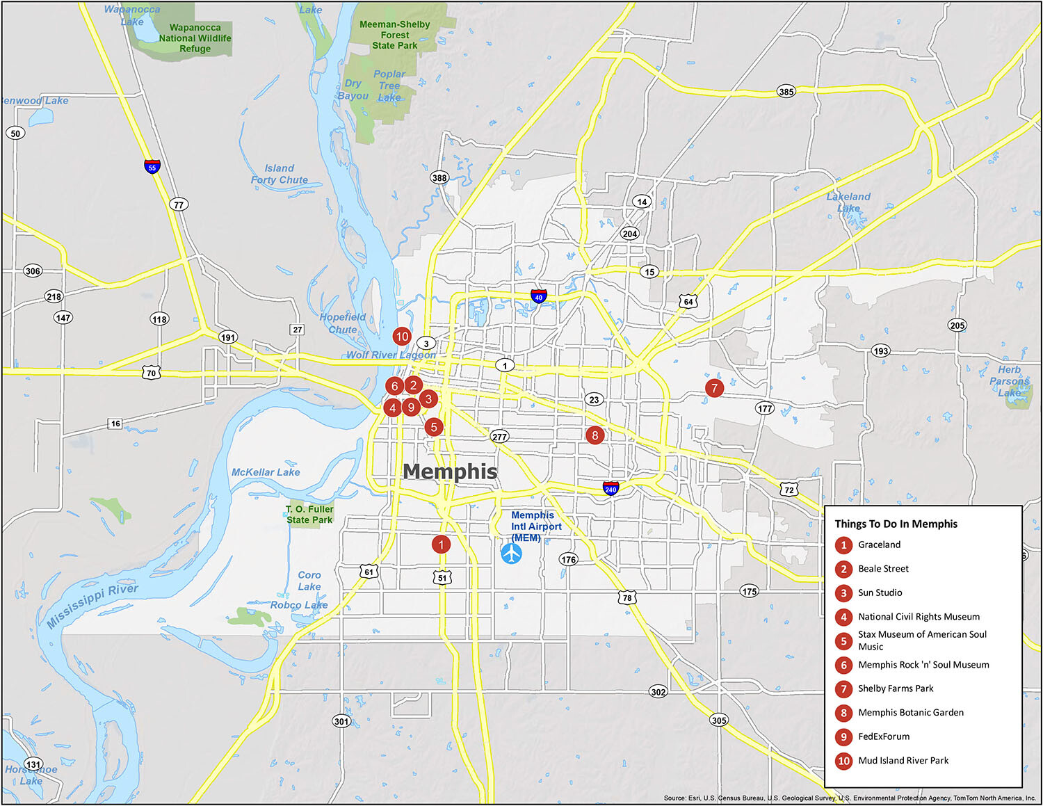
Discover the wonders of Memphis, Tennessee with this interactive map. From the famous Beale Street, Graceland and the National Civil Rights Museum to the buzzing nightlife, restaurants and attractions, you can find all the must-see places in the city. Whether you’re looking for a day trip or a long weekend, our Memphis map is here to guide you and help you experience the best of the Bluff City.
Online Interactive Map
Click on ![]() to view map in "full screen" mode.
to view map in "full screen" mode.
This is the map to take you on a guided tour of the city. You’ll learn about the history, see the landmarks, and discover the best places to eat, drink, and get entertained. You are sure to find something that excites you. Whether you love the architecture, the cuisine, the nightlife, or something else, Memphis is a city that is worth exploring.
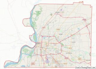
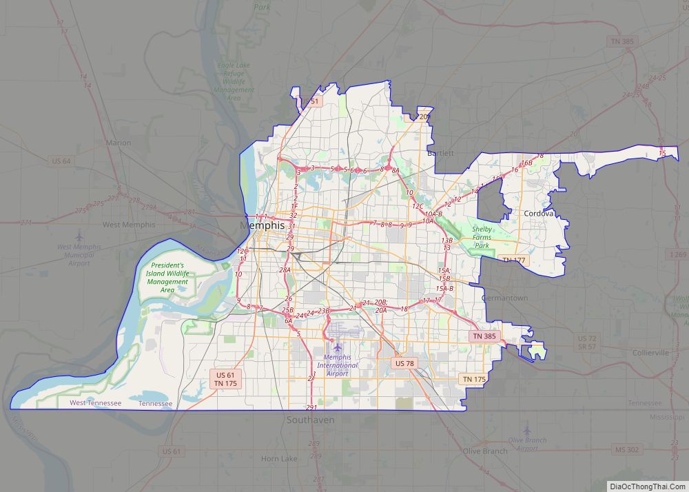
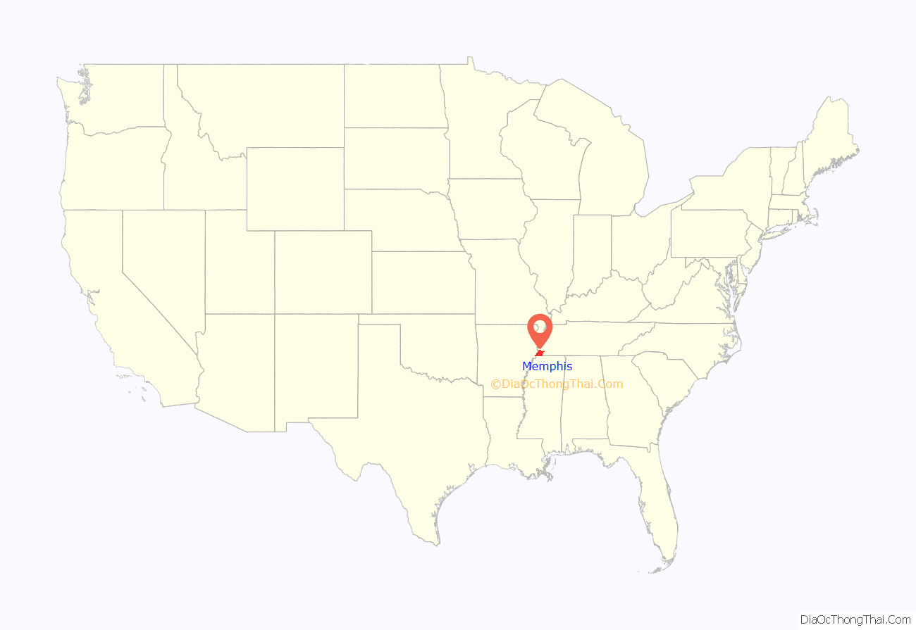
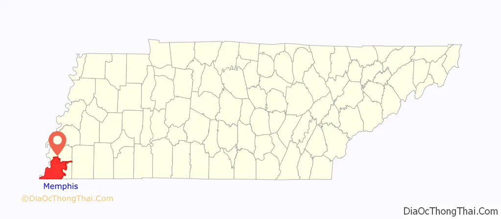
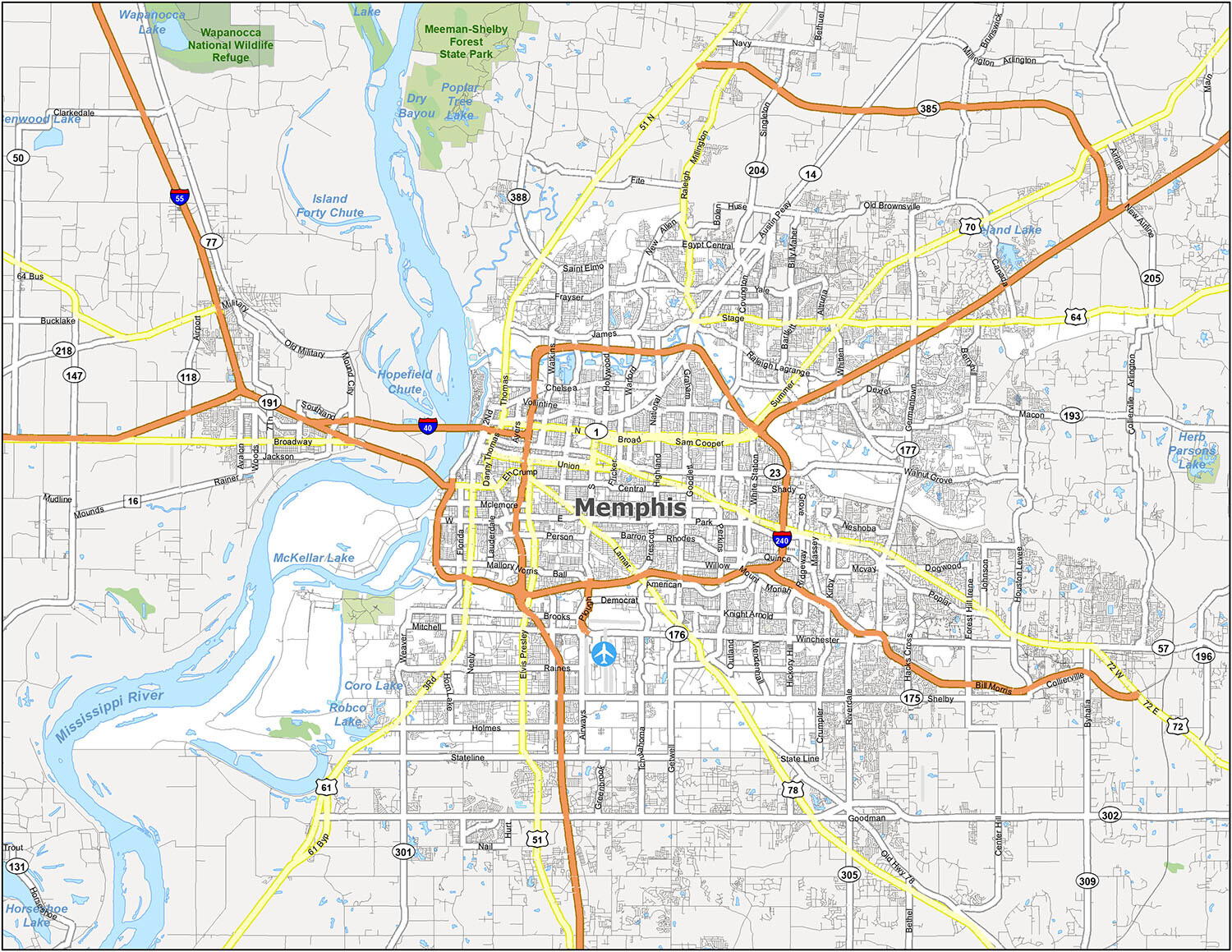
Memphis location map. Where is Memphis city?
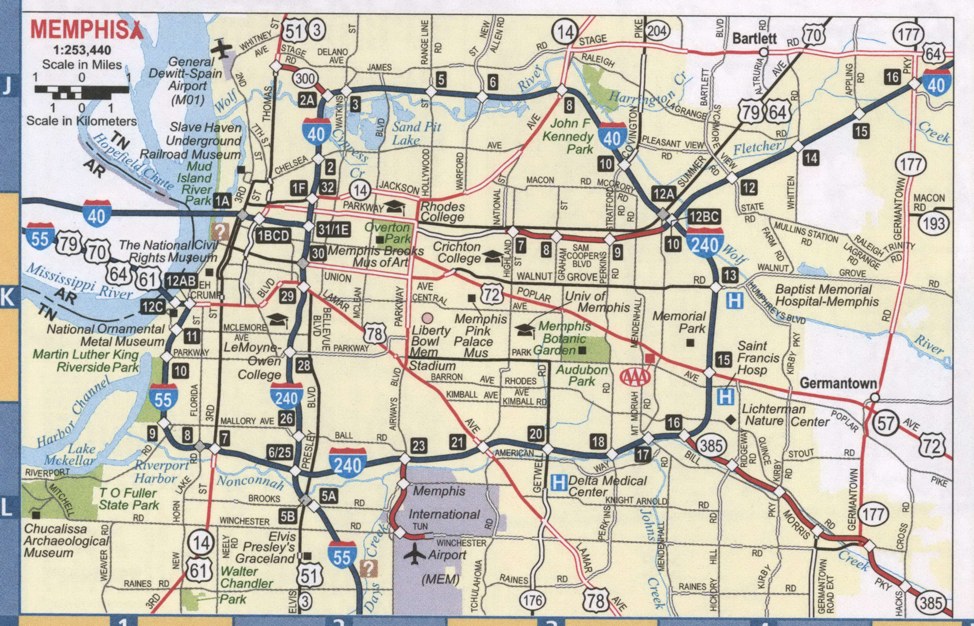
Memphis Road Map
Make the most of your trip to Memphis with detailed maps of the city and information on the best places to visit. Whether you’re visiting Memphis for business or on vacation, this road map is the perfect companion to help you navigate the city with interstates, highways, and major roads. I-40, I-55, I-240, US Highways 14, 15, 51, 57, 61, 64, 70, 72, 78, 79, 175, 177, 193, 277, Austin Peay Hwy, Covington Pike, Poplar Pike, Bill Morris Pky, Germantown Pky, Jim McGehee Pky, Kirby Pky, North Pky, Singleton Pky, Truse Pky, 2nd St, 3rd St, Airways Blvd, Arkansas St, Bellevue Blvd, Broad Ave, Brooks Rd, Chelsea Ave, Danny Thomas Blvd, Elvis Presley Blvd, Eh Crump Blvd, GE Patterson Ave, Germantown Rd, Holly Cir, Hollywood St, Jackson Ave, James Rd, Kirby Whitten Rd, Lamar Ave, Macon Rd, National St, Plough Blvd, Poplar Ave, Prescott St, Riverside Dr, Sam Cooper Blvd, Shelby Dr, Stage Rd, Summer Ave, Terminal Access Rd, Thomas St, Trezevant St, Union Ave, White Station Rd, Whitten Rd, Winchester Rd are some of the major roads in the city. There are also plenty of things to see and do, even if you only have a day or two to spare. But if you plan on getting outside the city, then take a look at our Tennessee road map to find all the interstates and highways statewide.
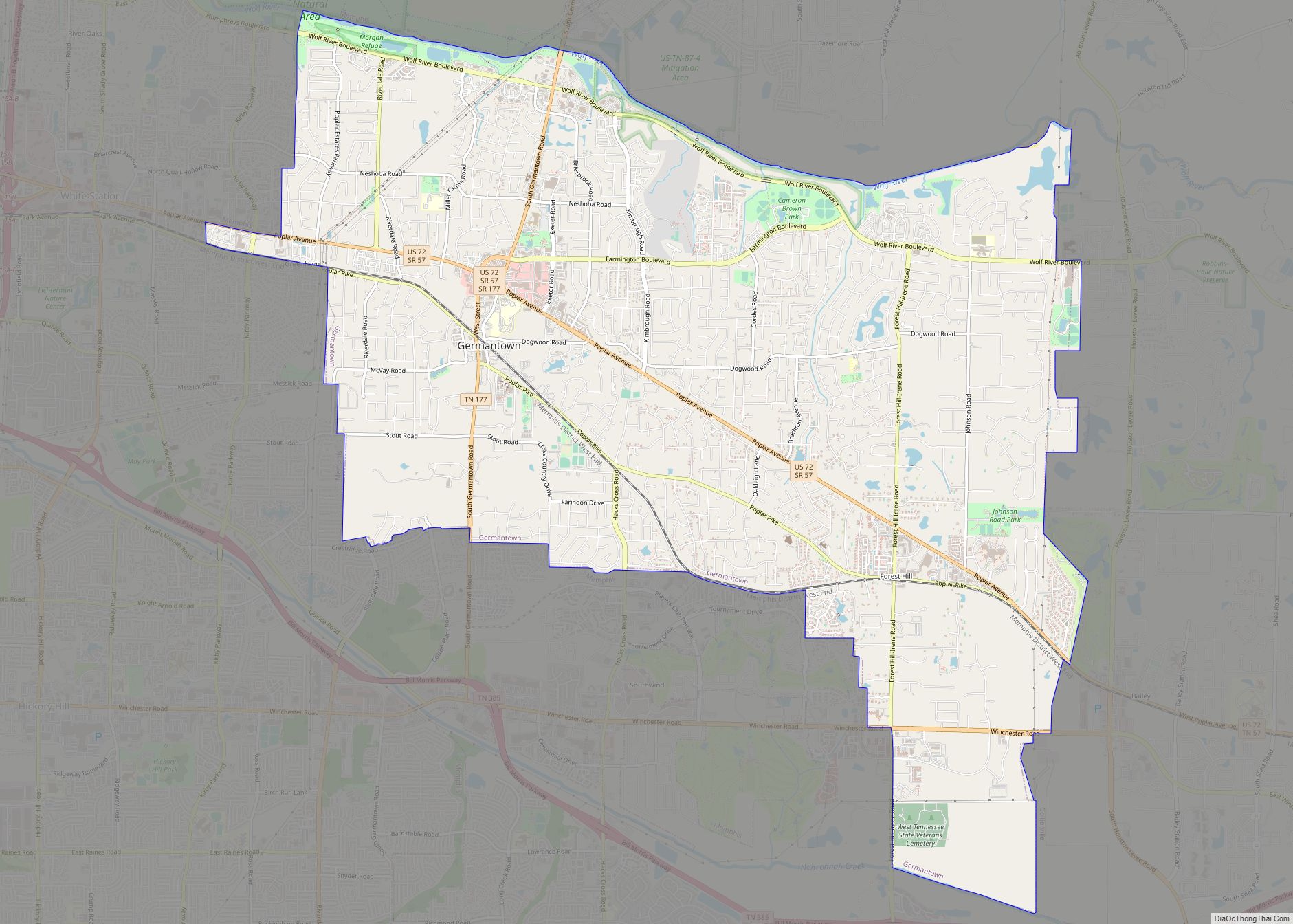
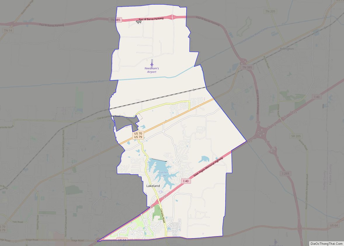
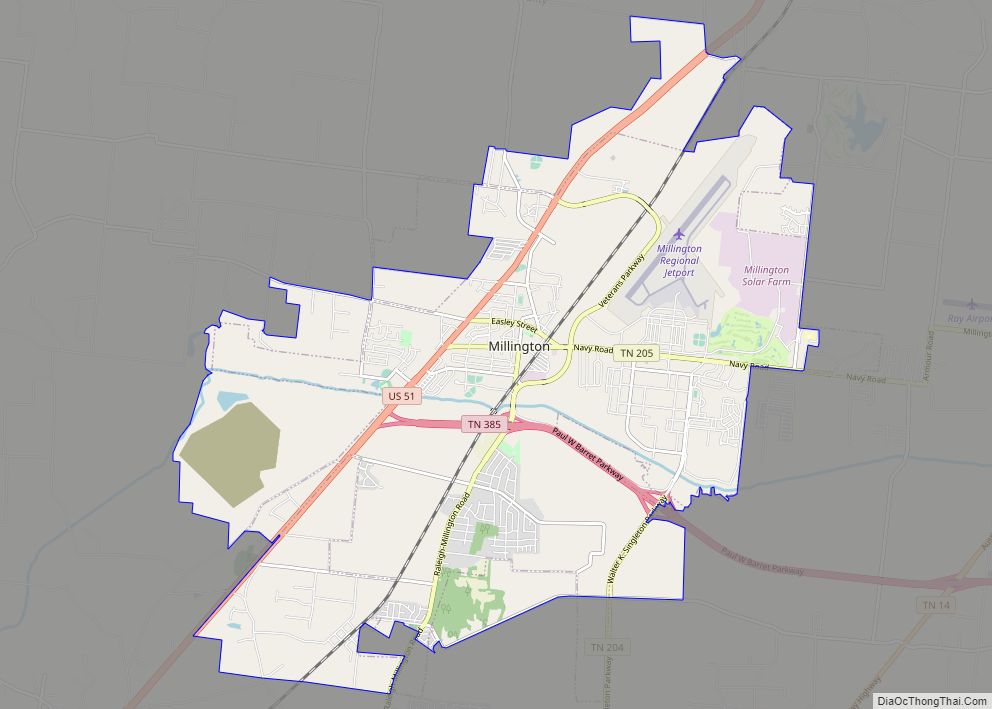
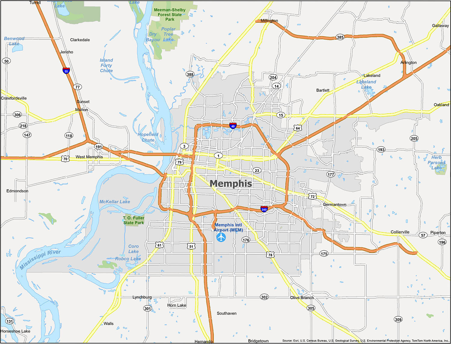
Discover the charm of Memphis and explore the city with ease with this printable map. With this map, you can easily find your way around the city and appreciate the pride of the local population. Whether you are planning a vacation or a business trip, this map is a great resource for finding your way around Memphis, including the Memphis International Airport (MEM). You can also explore the nearby cities, towns, and census-designated places of Bartlett, Clarkedale, Gallaway, Germantown, Hernando, Horn Lake, Lakeland, Marion, Millington, Olive Branch, Piperton, Southaven, Turrell, West Memphis, Arlington, Byhalia, Collierville, Crawfordsville, Edmondson, Horseshoe Lake, Jericho, Oakland, Sunset, Walls, Bridgetown, and Lynchburg.
10 things to do in Memphis city
This is the map to take you on a guided tour of the city. You’ll learn about the history, see the landmarks, and discover the best places to eat, drink, and get entertained. You are sure to find something that excites you. Whether you love the architecture, the cuisine, the nightlife, or something else, Memphis is a city that is worth exploring.
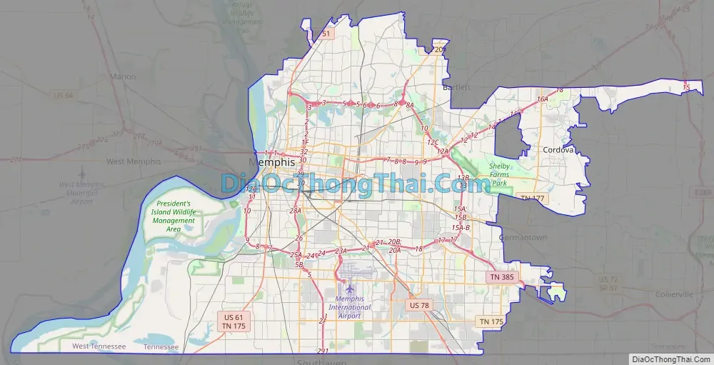
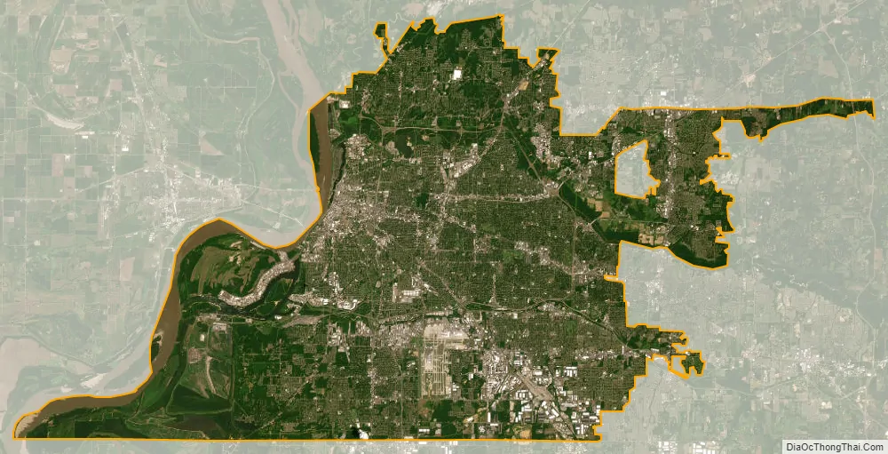
Memphis city Satellite Map
Geography
According to the United States Census Bureau, the city has a total area of 324.0 square miles (839.2 km), of which 315.1 square miles (816.0 km) is land and 9.0 square miles (23.2 km), or 2.76%, is water.
Cityscape
Downtown Memphis rises from a bluff along the Mississippi River. The city and metro area spread out through suburbanization, and encompass southwest Tennessee, northern Mississippi, and eastern Arkansas. Several large parks were founded in the city in the early 20th century, notably Overton Park in Midtown and the 4,500-acre (18 km) Shelby Farms. The city is a national transportation hub and Mississippi River crossing for Interstate 40, (east-west), Interstate 55 (north-south), barge traffic, Memphis International Airport (FedEx’s “SuperHub” facility) and numerous freight railroads that serve the city.
Riverfront
The Memphis Riverfront stretches along the Mississippi River from the Meeman-Shelby Forest State Park in the north, to the T. O. Fuller State Park in the south. The River Walk is a park system that connects downtown Memphis from Mississippi River Greenbelt Park in the north, to Tom Lee Park in the south.
Deannexation
In recent years, the city has decided to deannex some of its territory. It has gone through a three-phase process to deannex five areas within the city limits, returning them to unincorporated Shelby County. The first phase of deannexation occurred on January 1, 2020, when the Eads and River Bottoms areas returned to county jurisdiction. As a result, the Shelby County Sheriff is responsible for patrolling these former parts of Memphis. The first phase of the deannexation process reduced the city’s size by 5% and its population by 0.03%.
Aquifer
Shelby County is located over four natural aquifers, one of which is recognized as the “Memphis Sand Aquifer” or simply as the “Memphis Aquifer”. Located 350 to 1,100 feet (110 to 340 m) underground, this artesian water source is considered soft and estimated by Memphis Light, Gas and Water to contain more than 100 trillion US gallons (380 km) of water.
Climate
Memphis has a humid subtropical climate (Köppen Cfa, Trewartha Cf), with four distinct seasons, and is located in USDA Plant Hardiness Zone 8a in downtown, cooling to 7b for much of the surrounding region. Winter weather comes alternately from the upper Great Plains and the Gulf of Mexico, which can lead to drastic swings in temperature. Summer weather may come from Texas (very hot and humid) or the Gulf (hot and very humid). July has a daily average temperature of 82.8 °F (28.2 °C), with high levels of humidity due to moisture encroaching from the Gulf of Mexico. Afternoon and evening thunderstorms are frequent during summer, but usually brief, lasting no longer than an hour. Early autumn is pleasantly drier and mild, but can be hot until late October. Late autumn is rainy and cooler; precipitation peaks again in November and December. Winters are mild to chilly, with a January daily average temperature of 42.1 °F (5.6 °C). Snow occurs sporadically in winter, with an average seasonal snowfall of 2.7 inches (6.9 cm). Ice storms and freezing rain pose a greater danger, as they can often pull tree limbs down on power lines and make driving hazardous. Severe thunderstorms can occur at any time of the year though mainly during the spring months. Large hail, strong winds, flooding, and frequent lightning can accompany these storms. Some storms spawn tornadoes.
The lowest temperature ever recorded in Memphis was −13 °F (−25 °C) on December 24, 1963, and the highest temperature ever was 108 °F (42 °C) on July 13, 1980. Over the course of a year, there is an average of 4.4 days of highs below freezing, 6.9 nights of lows below 20 °F (−7 °C), 43 nights of lows below freezing, 64 days of highs above 90 °F (32 °C), and 2.1 days of highs above 100 °F (38 °C).
Memphis temperatures dropped to -4 F during the 1985 North American cold wave and during the December 1989 United States cold wave.
Annual precipitation is high (54.94 inches [1,400 mm]) and relatively evenly distributed throughout the year. Average monthly rainfall is especially high in March through May, and December, while August and September are relatively drier.
See also
Map of Tennessee State and its subdivision:- Anderson
- Bedford
- Benton
- Bledsoe
- Blount
- Bradley
- Campbell
- Cannon
- Carroll
- Carter
- Cheatham
- Chester
- Claiborne
- Clay
- Cocke
- Coffee
- Crockett
- Cumberland
- Davidson
- Decatur
- DeKalb
- Dickson
- Dyer
- Fayette
- Fentress
- Franklin
- Gibson
- Giles
- Grainger
- Greene
- Grundy
- Hamblen
- Hamilton
- Hancock
- Hardeman
- Hardin
- Hawkins
- Haywood
- Henderson
- Henry
- Hickman
- Houston
- Humphreys
- Jackson
- Jefferson
- Johnson
- Knox
- Lake
- Lauderdale
- Lawrence
- Lewis
- Lincoln
- Loudon
- Macon
- Madison
- Marion
- Marshall
- Maury
- McMinn
- McNairy
- Meigs
- Monroe
- Montgomery
- Moore
- Morgan
- Obion
- Overton
- Perry
- Pickett
- Polk
- Putnam
- Rhea
- Roane
- Robertson
- Rutherford
- Scott
- Sequatchie
- Sevier
- Shelby
- Smith
- Stewart
- Sullivan
- Sumner
- Tipton
- Trousdale
- Unicoi
- Union
- Van Buren
- Warren
- Washington
- Wayne
- Weakley
- White
- Williamson
- Wilson
- Alabama
- Alaska
- Arizona
- Arkansas
- California
- Colorado
- Connecticut
- Delaware
- District of Columbia
- Florida
- Georgia
- Hawaii
- Idaho
- Illinois
- Indiana
- Iowa
- Kansas
- Kentucky
- Louisiana
- Maine
- Maryland
- Massachusetts
- Michigan
- Minnesota
- Mississippi
- Missouri
- Montana
- Nebraska
- Nevada
- New Hampshire
- New Jersey
- New Mexico
- New York
- North Carolina
- North Dakota
- Ohio
- Oklahoma
- Oregon
- Pennsylvania
- Rhode Island
- South Carolina
- South Dakota
- Tennessee
- Texas
- Utah
- Vermont
- Virginia
- Washington
- West Virginia
- Wisconsin
- Wyoming