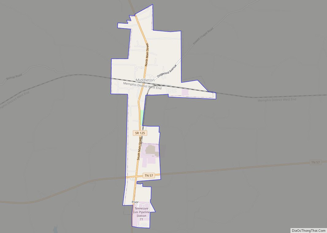
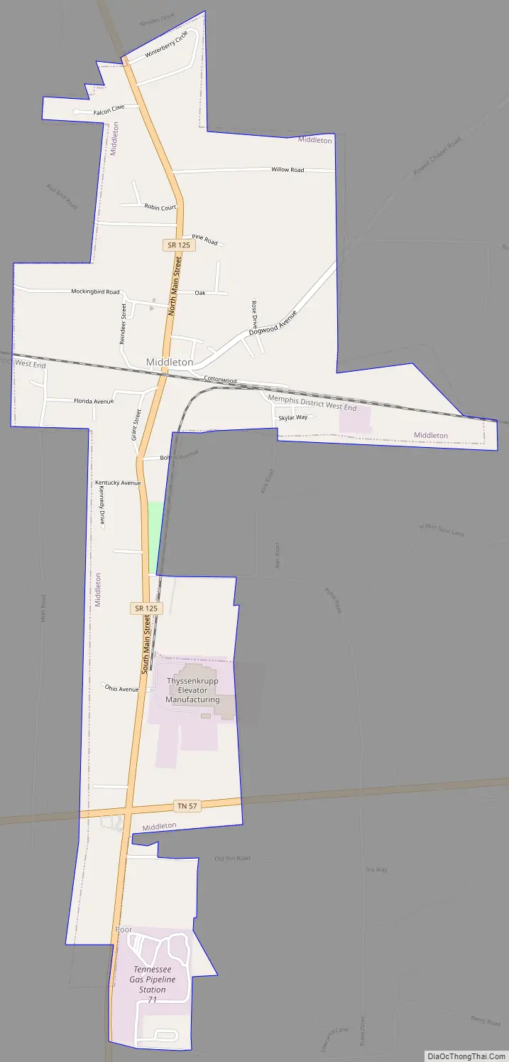
Middleton is a city in Hardeman County, Tennessee, United States. The population was 706 at the 2010 census, up from 602 at the 2000 census. It is located at the intersection of Tennessee State Route 125 and Tennessee State Route 57. Its slogan is the “Crossroads of the South”.
| Name: | Middleton city |
|---|---|
| LSAD Code: | 25 |
| LSAD Description: | city (suffix) |
| State: | Tennessee |
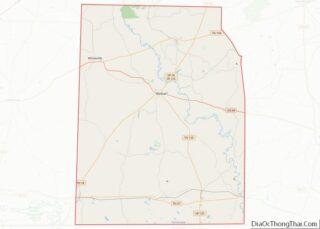
| County: | Hardeman County |
| Elevation: | 417 ft (127 m) |
| Total Area: | 2.10 sq mi (5.43 km²) |
| Land Area: | 2.09 sq mi (5.41 km²) |
| Water Area: | 0.01 sq mi (0.02 km²) |
| Total Population: | 658 |
| Population Density: | 314.83/sq mi (121.54/km²) |
| ZIP code: | 38052 |
| Area code: | 731 |
| FIPS code: | 4748340 |
| GNISfeature ID: | 1293713 |
| Website: | cityofmiddleton.org |
Online Interactive Map
Click on ![]() to view map in "full screen" mode.
to view map in "full screen" mode.
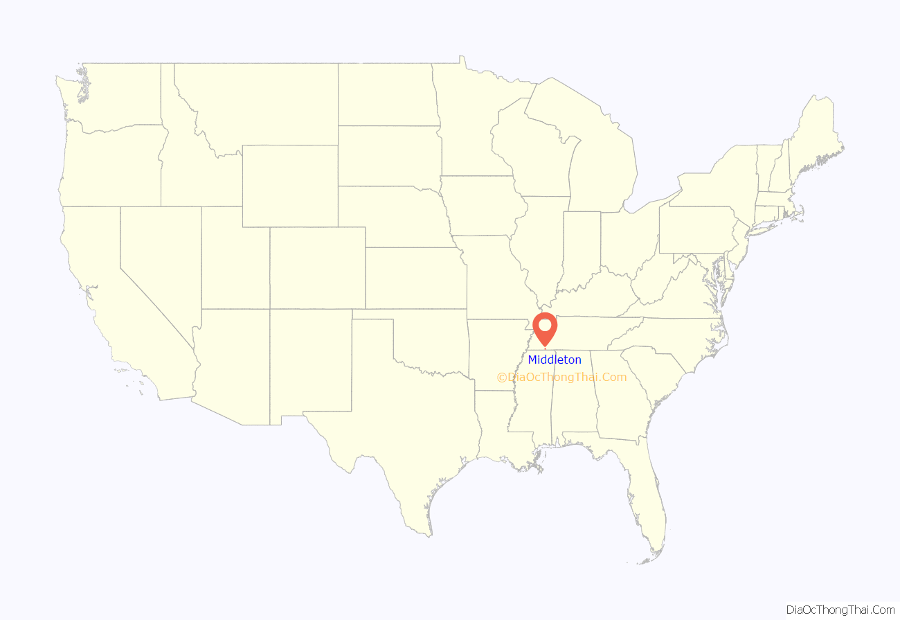
Middleton location map. Where is Middleton city?

History
It is believed that early settlers in Middleton came from Slab Town, a small settlement about 3 miles (5 km) north. The town was originally called “Jenkins-McCommons Crossing”, after Jesse Jenksins and William Taylor McCommons. These two men came to the area from North Carolina in 1849 and donated the majority of land where Middleton is today. Following the expansion of the Memphis and Charleston Railroad and the construction of a railroad depot, Middleton was chartered in 1850. It was named after an official at the Memphis and Charleston Railroad. The town suffered greatly during the Civil War. After the war, only one building, a small log structure that served as a store, was left standing.
Middleton Road Map
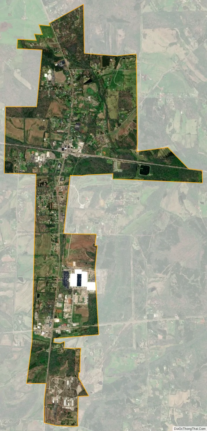
Middleton city Satellite Map
Geography
Middleton is located in southeastern Hardeman County at 35°3′32″N 88°53′30″W / 35.05889°N 88.89167°W / 35.05889; -88.89167 (35.058798, -88.891728). Tennessee State Route 125 is the city’s Main Street, leading north 15 miles (24 km) to Bolivar, the county seat, and south 4 miles (6 km) to the Mississippi border. Walnut, Mississippi, is 8 miles (13 km) south of Middleton. Tennessee State Route 57 (Tennessee Avenue) crosses Route 125 in the southern part of Middleton, leading east 16 miles (26 km) to Ramer and west 17 miles (27 km) to Grand Junction.
According to the United States Census Bureau, Middleton has a total area of 1.9 square miles (5.0 km), of which 0.01 square miles (0.02 km), or 0.36%, are water. The city drains east to Cypress Creek, a north-flowing tributary of the Hatchie River.
See also
Map of Tennessee State and its subdivision:- Anderson
- Bedford
- Benton
- Bledsoe
- Blount
- Bradley
- Campbell
- Cannon
- Carroll
- Carter
- Cheatham
- Chester
- Claiborne
- Clay
- Cocke
- Coffee
- Crockett
- Cumberland
- Davidson
- Decatur
- DeKalb
- Dickson
- Dyer
- Fayette
- Fentress
- Franklin
- Gibson
- Giles
- Grainger
- Greene
- Grundy
- Hamblen
- Hamilton
- Hancock
- Hardeman
- Hardin
- Hawkins
- Haywood
- Henderson
- Henry
- Hickman
- Houston
- Humphreys
- Jackson
- Jefferson
- Johnson
- Knox
- Lake
- Lauderdale
- Lawrence
- Lewis
- Lincoln
- Loudon
- Macon
- Madison
- Marion
- Marshall
- Maury
- McMinn
- McNairy
- Meigs
- Monroe
- Montgomery
- Moore
- Morgan
- Obion
- Overton
- Perry
- Pickett
- Polk
- Putnam
- Rhea
- Roane
- Robertson
- Rutherford
- Scott
- Sequatchie
- Sevier
- Shelby
- Smith
- Stewart
- Sullivan
- Sumner
- Tipton
- Trousdale
- Unicoi
- Union
- Van Buren
- Warren
- Washington
- Wayne
- Weakley
- White
- Williamson
- Wilson
- Alabama
- Alaska
- Arizona
- Arkansas
- California
- Colorado
- Connecticut
- Delaware
- District of Columbia
- Florida
- Georgia
- Hawaii
- Idaho
- Illinois
- Indiana
- Iowa
- Kansas
- Kentucky
- Louisiana
- Maine
- Maryland
- Massachusetts
- Michigan
- Minnesota
- Mississippi
- Missouri
- Montana
- Nebraska
- Nevada
- New Hampshire
- New Jersey
- New Mexico
- New York
- North Carolina
- North Dakota
- Ohio
- Oklahoma
- Oregon
- Pennsylvania
- Rhode Island
- South Carolina
- South Dakota
- Tennessee
- Texas
- Utah
- Vermont
- Virginia
- Washington
- West Virginia
- Wisconsin
- Wyoming