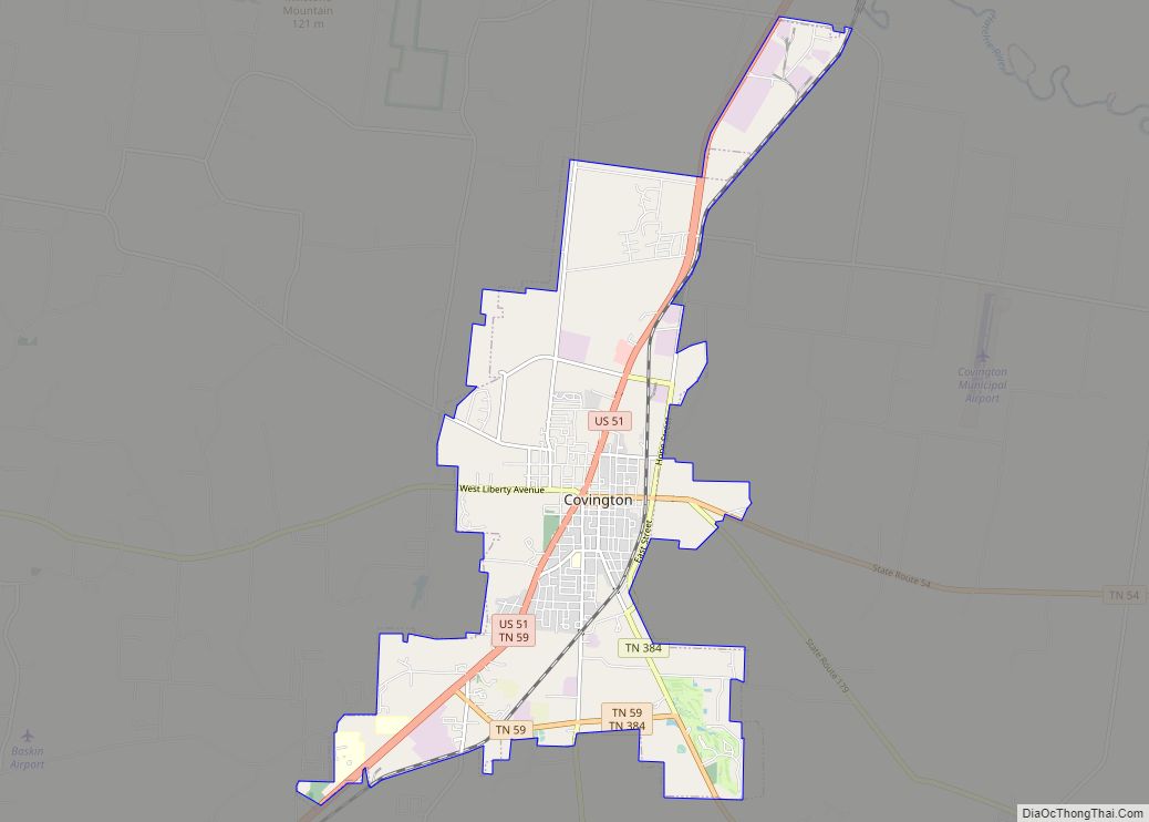
Munford is a city in Tipton County, Tennessee. The population was 5,927 at the 2010 census, when it was listed as a town.
| Name: | Munford city |
|---|---|
| LSAD Code: | 25 |
| LSAD Description: | city (suffix) |
| State: | Tennessee |
| County: | Tipton County |
| Elevation: | 446 ft (136 m) |
| Total Area: | 9.49 sq mi (24.58 km²) |
| Land Area: | 9.48 sq mi (24.55 km²) |
| Water Area: | 0.01 sq mi (0.04 km²) |
| Total Population: | 6,302 |
| Population Density: | 664.91/sq mi (256.73/km²) |
| ZIP code: | 38058 |
| Area code: | 901 |
| FIPS code: | 4751540 |
| GNISfeature ID: | 1295096 |
| Website: | munford.com |
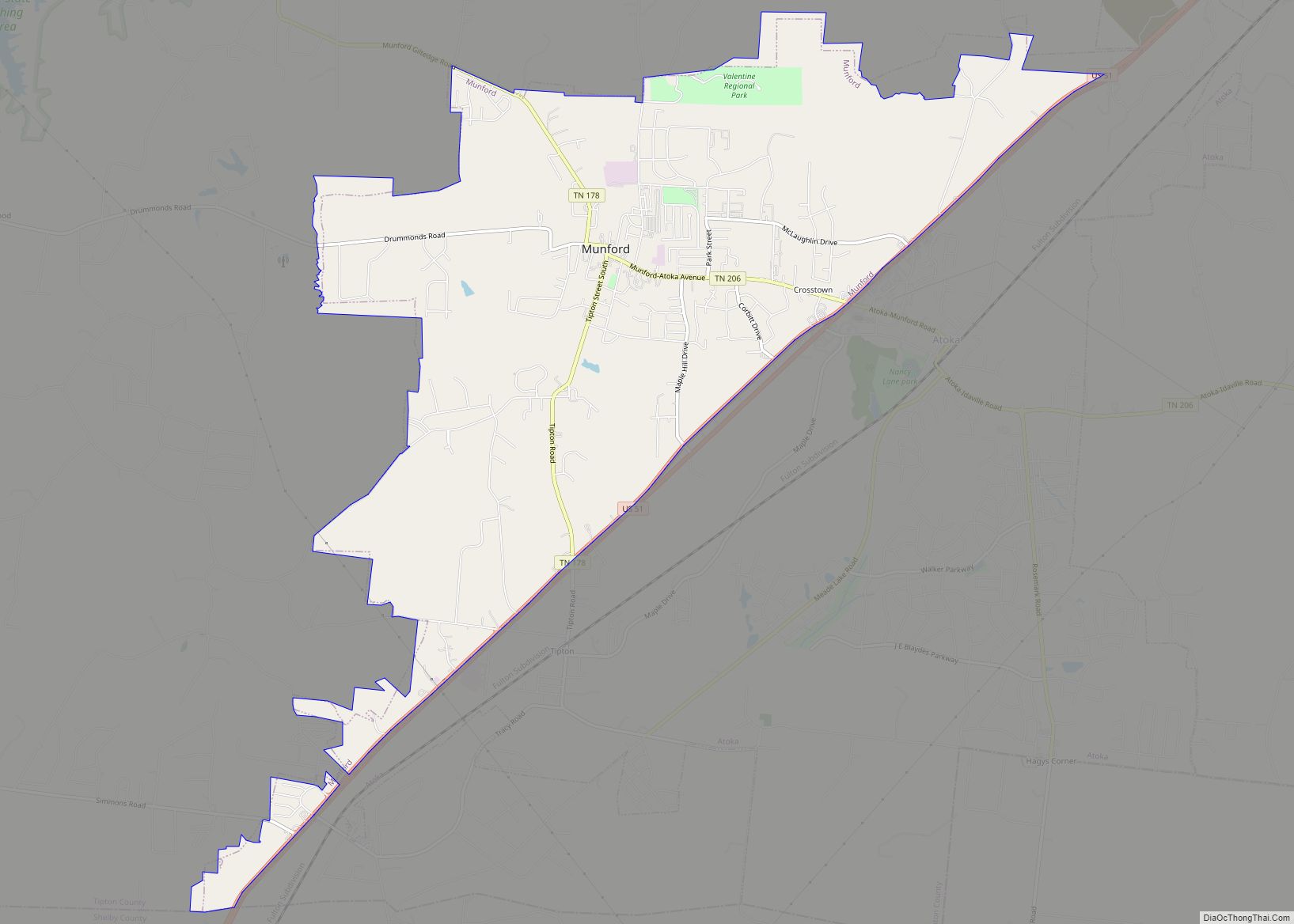
Online Interactive Map
Click on ![]() to view map in "full screen" mode.
to view map in "full screen" mode.
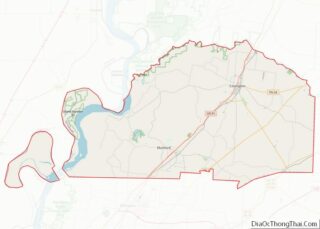
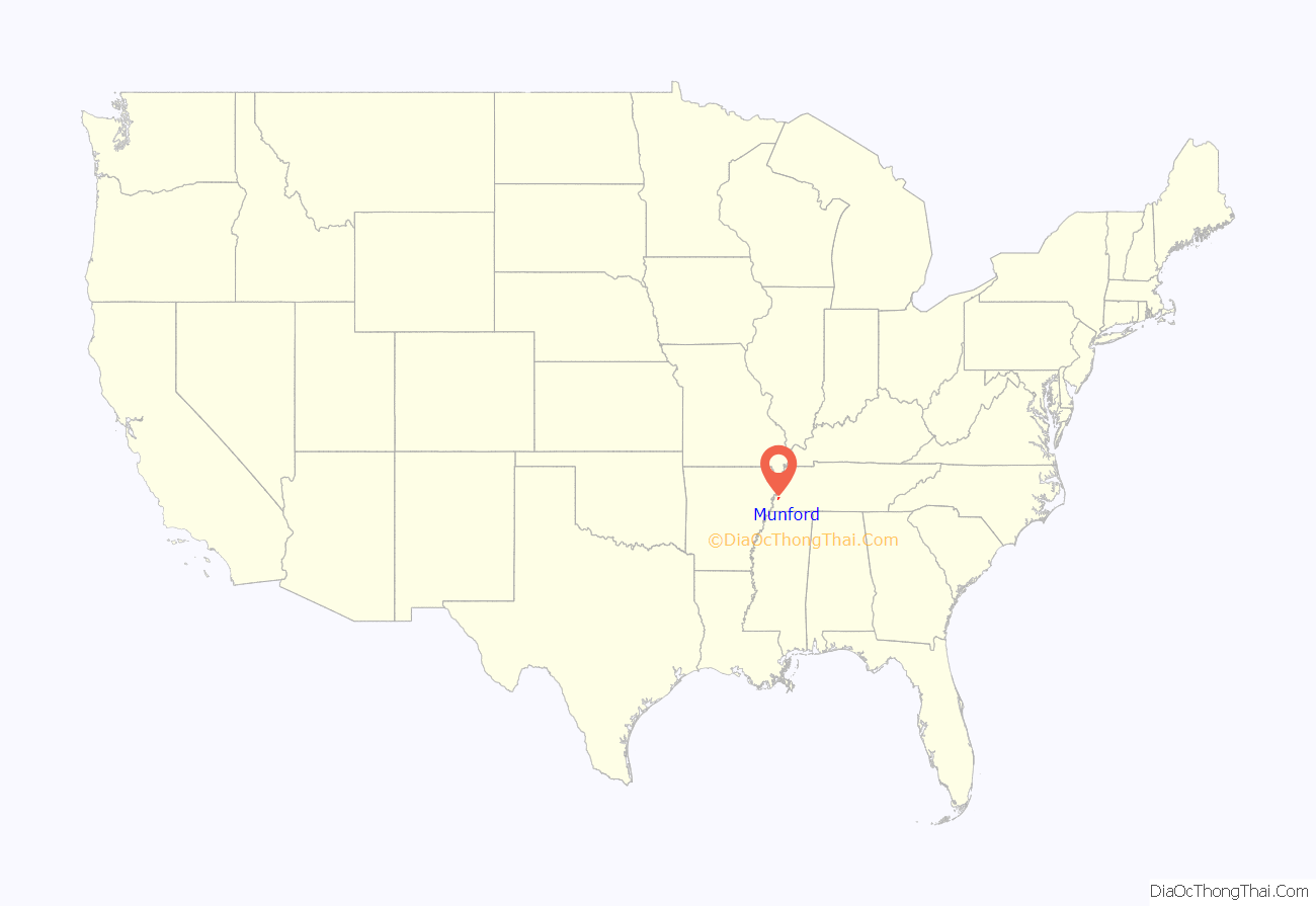
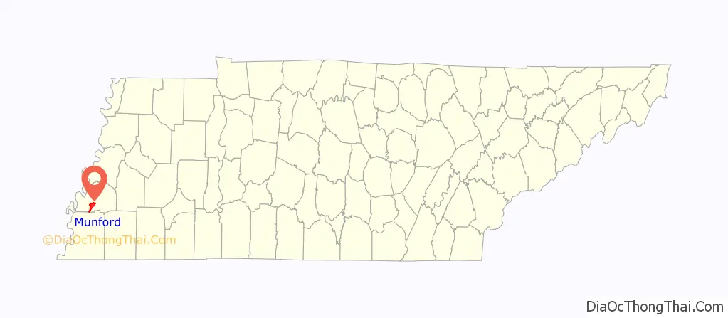
Munford location map. Where is Munford city?
History
Beginning as a small village which grew around the Mt. Zion Methodist Episcopal Church in the early 1850s, it was officially named “Mt. Zion” after the opening of a post office there in 1856. This office closed in 1874, and in 1886 when Mt. Zion applied to the United States Post Office Department to have it reopened, the application was approved on the condition that it do so with a new name, to avoid confusion with Mt. Zion, Pennsylvania. At that time Pennsylvania was commonly abbreviated as “Penn” and Tennessee was commonly abbreviated “Tenn.” The newly appointed Post Master G. B. Sale asked his daughter Lola to choose a name, and they agreed to name it after Colonel Richard Henry Munford (1807–1884) of Covington, Tennessee. The town was officially incorporated as “Munford” by an act of the Tennessee General Assembly in 1905, and Sterling Hicks Bass, Sr. was elected as its first mayor.
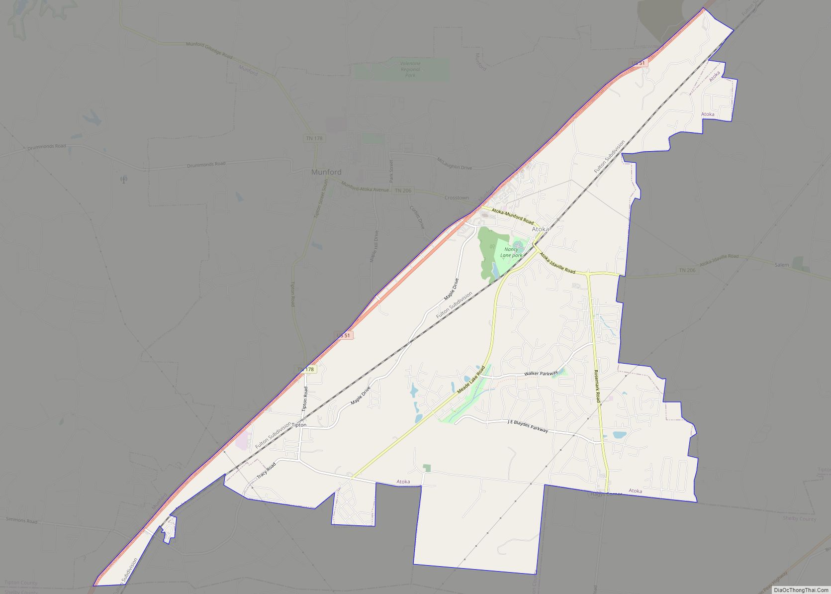
Munford Road Map
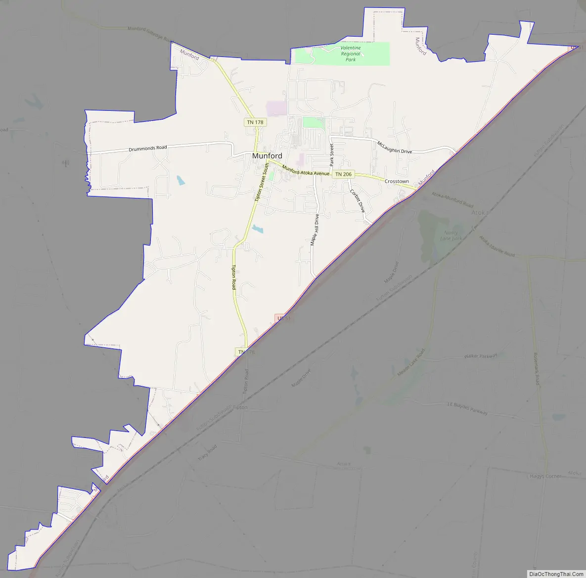
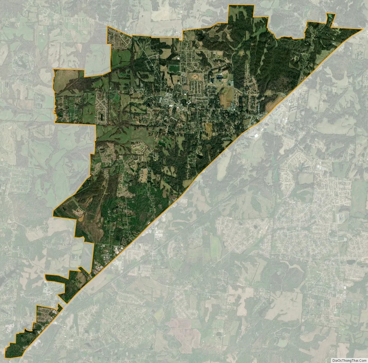
Munford city Satellite Map
Geography
Munford is located at 35°26′41″N 89°48′38″W / 35.444660°N 89.810567°W / 35.444660; -89.810567.
According to the United States Census Bureau, the city has a total area of 8.1 square miles (21 km), of which 8.0 square miles (21 km) is land and 0.12% is water.
See also
Map of Tennessee State and its subdivision:- Anderson
- Bedford
- Benton
- Bledsoe
- Blount
- Bradley
- Campbell
- Cannon
- Carroll
- Carter
- Cheatham
- Chester
- Claiborne
- Clay
- Cocke
- Coffee
- Crockett
- Cumberland
- Davidson
- Decatur
- DeKalb
- Dickson
- Dyer
- Fayette
- Fentress
- Franklin
- Gibson
- Giles
- Grainger
- Greene
- Grundy
- Hamblen
- Hamilton
- Hancock
- Hardeman
- Hardin
- Hawkins
- Haywood
- Henderson
- Henry
- Hickman
- Houston
- Humphreys
- Jackson
- Jefferson
- Johnson
- Knox
- Lake
- Lauderdale
- Lawrence
- Lewis
- Lincoln
- Loudon
- Macon
- Madison
- Marion
- Marshall
- Maury
- McMinn
- McNairy
- Meigs
- Monroe
- Montgomery
- Moore
- Morgan
- Obion
- Overton
- Perry
- Pickett
- Polk
- Putnam
- Rhea
- Roane
- Robertson
- Rutherford
- Scott
- Sequatchie
- Sevier
- Shelby
- Smith
- Stewart
- Sullivan
- Sumner
- Tipton
- Trousdale
- Unicoi
- Union
- Van Buren
- Warren
- Washington
- Wayne
- Weakley
- White
- Williamson
- Wilson
- Alabama
- Alaska
- Arizona
- Arkansas
- California
- Colorado
- Connecticut
- Delaware
- District of Columbia
- Florida
- Georgia
- Hawaii
- Idaho
- Illinois
- Indiana
- Iowa
- Kansas
- Kentucky
- Louisiana
- Maine
- Maryland
- Massachusetts
- Michigan
- Minnesota
- Mississippi
- Missouri
- Montana
- Nebraska
- Nevada
- New Hampshire
- New Jersey
- New Mexico
- New York
- North Carolina
- North Dakota
- Ohio
- Oklahoma
- Oregon
- Pennsylvania
- Rhode Island
- South Carolina
- South Dakota
- Tennessee
- Texas
- Utah
- Vermont
- Virginia
- Washington
- West Virginia
- Wisconsin
- Wyoming