Rural Hill is a census-designated place (CDP) in Wilson County, Tennessee. The population was 2,132 at the 2010 census.
| Name: | Rural Hill CDP |
|---|---|
| LSAD Code: | 57 |
| LSAD Description: | CDP (suffix) |
| State: | Tennessee |
| County: | Wilson County |
| Elevation: | 581 ft (177 m) |
| Total Area: | 4.07 sq mi (10.55 km²) |
| Land Area: | 4.06 sq mi (10.51 km²) |
| Water Area: | 0.01 sq mi (0.04 km²) |
| Total Population: | 2,047 |
| Population Density: | 504.19/sq mi (194.68/km²) |
| ZIP code: | 37076;37122 |
| Area code: | 615 |
| FIPS code: | 4765642 |
| GNISfeature ID: | 1312881 |
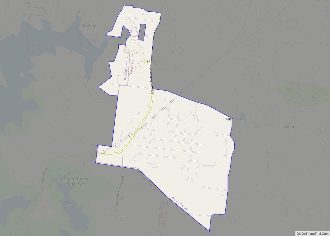
Online Interactive Map
Click on ![]() to view map in "full screen" mode.
to view map in "full screen" mode.
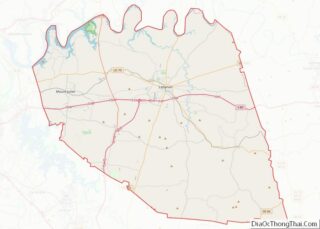
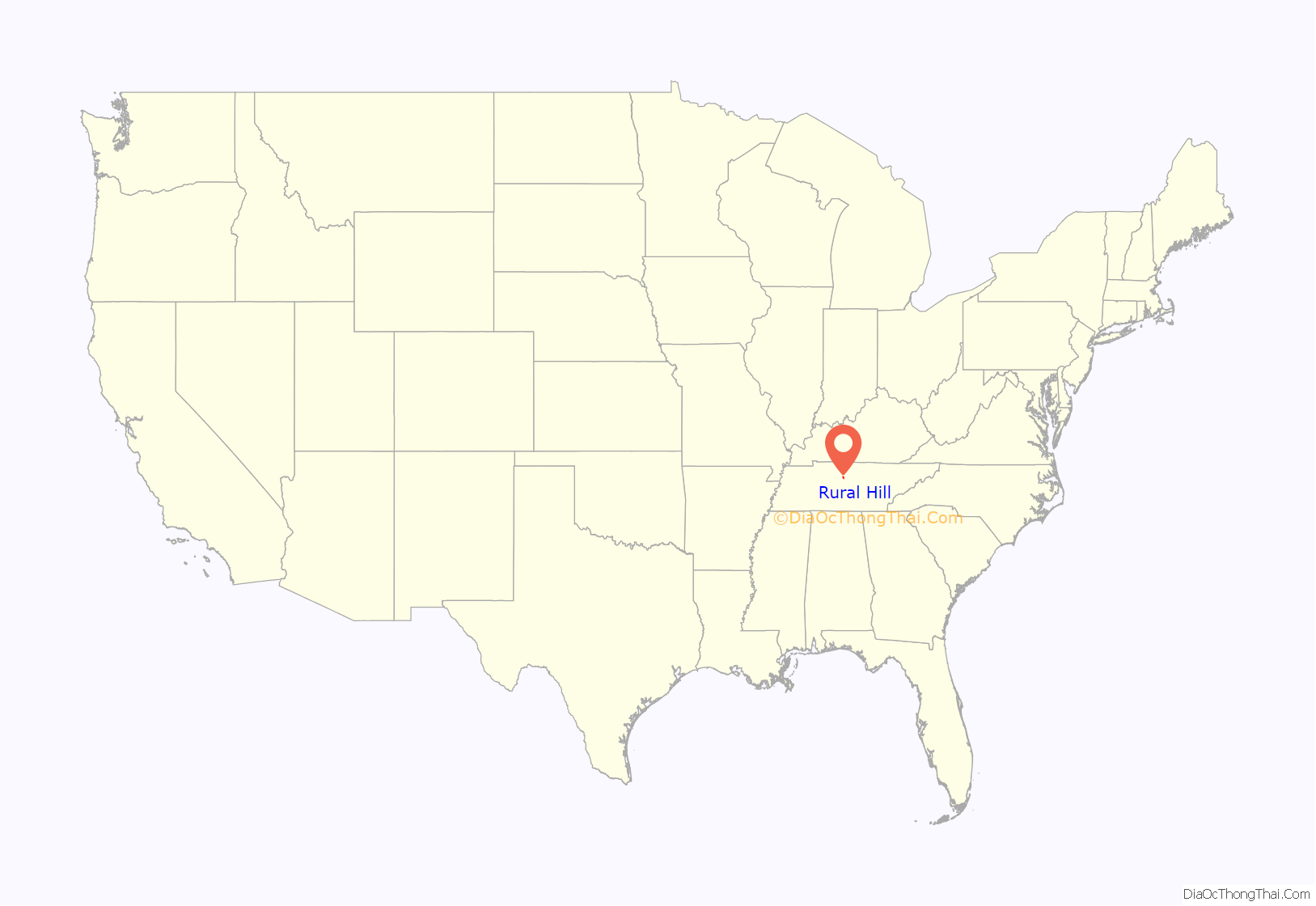
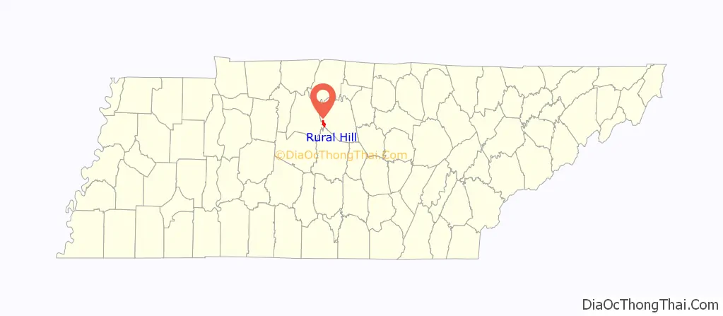
Rural Hill location map. Where is Rural Hill CDP?
History
The community is sometimes spelled “Ruralhill” in official records. It was located four miles west of Gladeville on Stewart Ferry Pike. On February 9, 1833 A.B. Curry was made the postmaster of the first post office established at Rural Hill, making it one of the earliest post offices in Wilson County. From the time it was opened, the post office had one interruption of service of less than one year before closing in 1903. Rural Hill is mentioned as having held a debate between the candidates for the constitutional convention held in 1834. Rural Hill is also mentioned at least twice in the Official Records of the War of the Rebellion, Series I Volume 20 mentions two skirmishes between Union patrols and advanced confederate outposts from the Confederate Army of Tennessee, then under the command of Gen. Braxton Bragg and encamped in Murfreesboro. On November 18, 1862 and again on December 20, Union scouting met Confederate resistance at the then important cross roads of Rural Hill, which was the first town east of the Stones River past Stewart’s Ferry. These skirmishes both preceded the Union advance from Nashville to Murfreesboro that culminated in the Battle of Stones River.
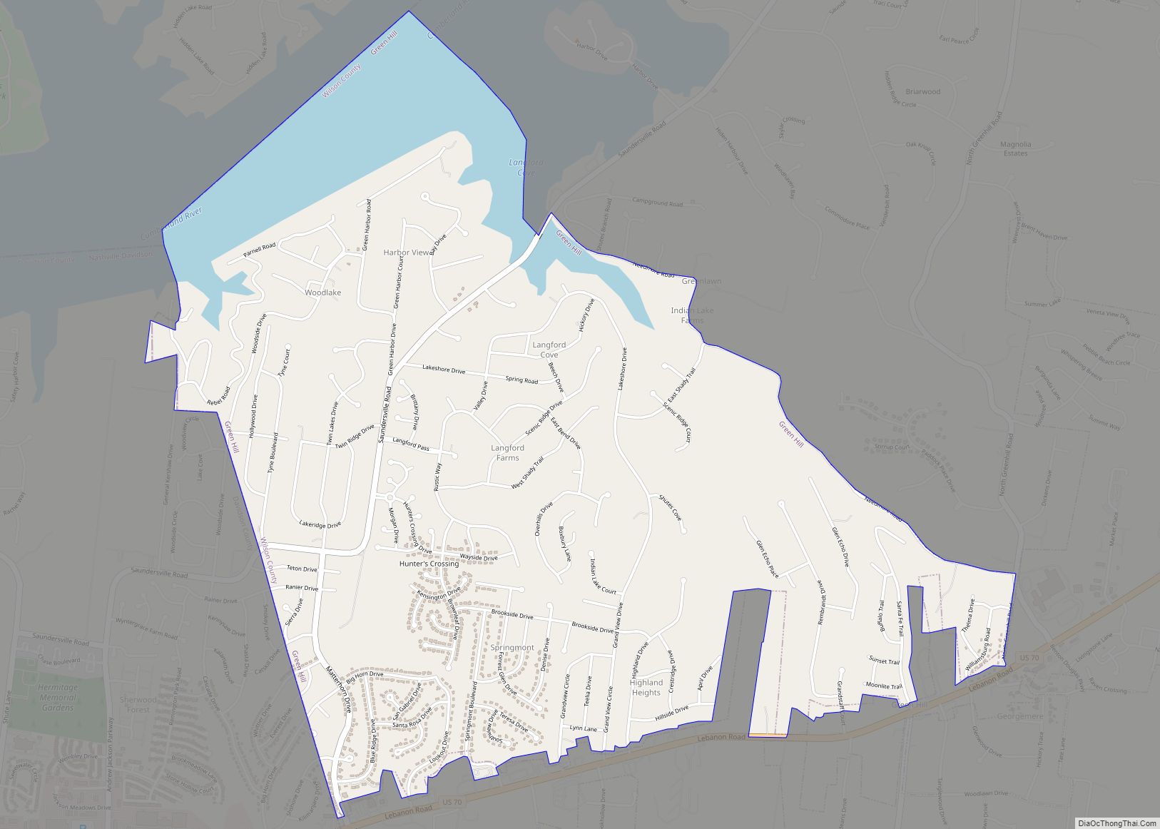
Rural Hill Road Map

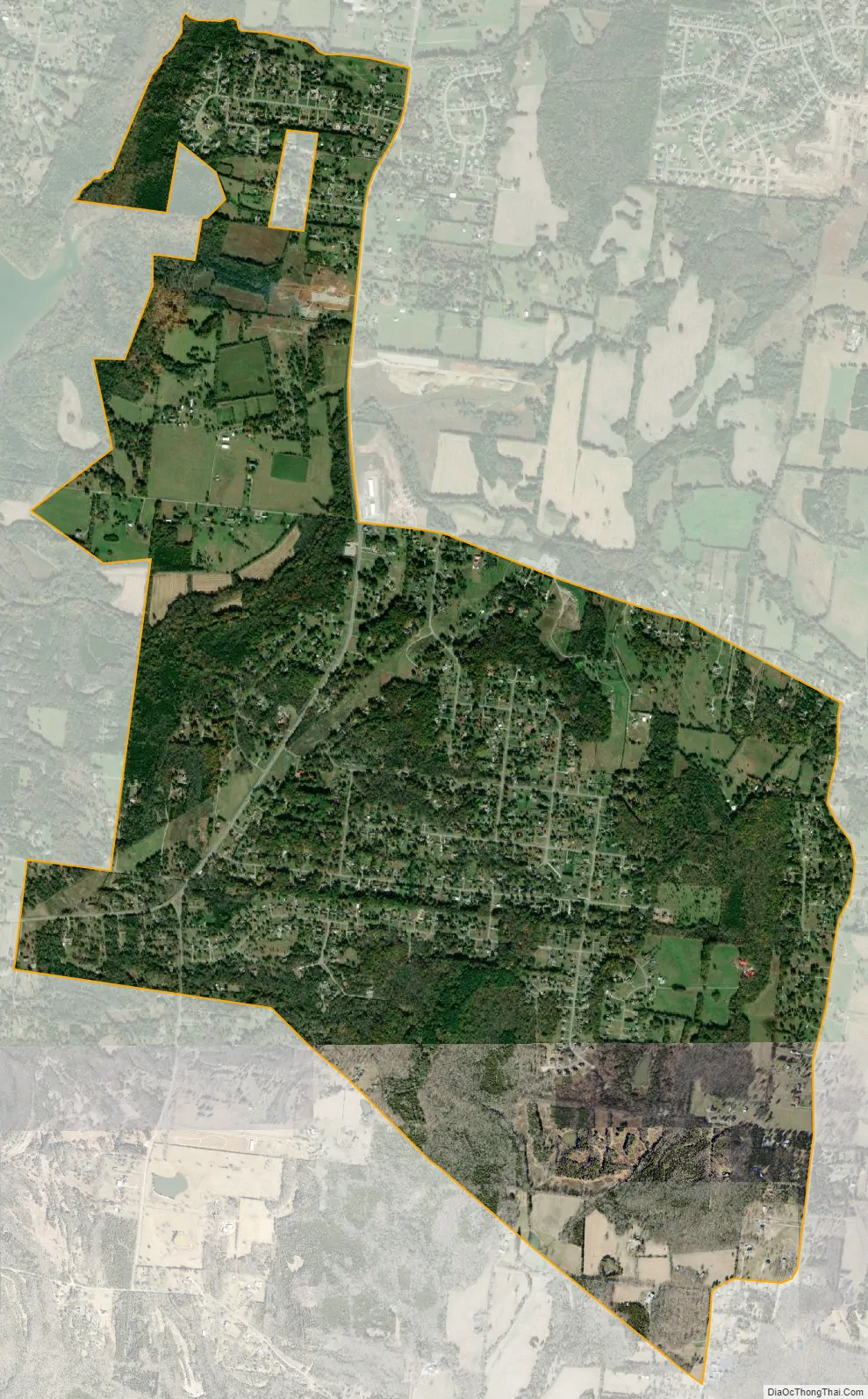
Rural Hill city Satellite Map
Geography
Rural Hill is located at 36°7′7″N 86°31′8″W / 36.11861°N 86.51889°W / 36.11861; -86.51889 (36.118696, -86.518771).
According to the United States Census Bureau, the CDP has a total area of 3.8 square miles (9.8 km), of which 3.8 square miles (9.8 km) is land and 0.02 square miles (0.052 km) (0.39%) is water.
See also
Map of Tennessee State and its subdivision:- Anderson
- Bedford
- Benton
- Bledsoe
- Blount
- Bradley
- Campbell
- Cannon
- Carroll
- Carter
- Cheatham
- Chester
- Claiborne
- Clay
- Cocke
- Coffee
- Crockett
- Cumberland
- Davidson
- Decatur
- DeKalb
- Dickson
- Dyer
- Fayette
- Fentress
- Franklin
- Gibson
- Giles
- Grainger
- Greene
- Grundy
- Hamblen
- Hamilton
- Hancock
- Hardeman
- Hardin
- Hawkins
- Haywood
- Henderson
- Henry
- Hickman
- Houston
- Humphreys
- Jackson
- Jefferson
- Johnson
- Knox
- Lake
- Lauderdale
- Lawrence
- Lewis
- Lincoln
- Loudon
- Macon
- Madison
- Marion
- Marshall
- Maury
- McMinn
- McNairy
- Meigs
- Monroe
- Montgomery
- Moore
- Morgan
- Obion
- Overton
- Perry
- Pickett
- Polk
- Putnam
- Rhea
- Roane
- Robertson
- Rutherford
- Scott
- Sequatchie
- Sevier
- Shelby
- Smith
- Stewart
- Sullivan
- Sumner
- Tipton
- Trousdale
- Unicoi
- Union
- Van Buren
- Warren
- Washington
- Wayne
- Weakley
- White
- Williamson
- Wilson
- Alabama
- Alaska
- Arizona
- Arkansas
- California
- Colorado
- Connecticut
- Delaware
- District of Columbia
- Florida
- Georgia
- Hawaii
- Idaho
- Illinois
- Indiana
- Iowa
- Kansas
- Kentucky
- Louisiana
- Maine
- Maryland
- Massachusetts
- Michigan
- Minnesota
- Mississippi
- Missouri
- Montana
- Nebraska
- Nevada
- New Hampshire
- New Jersey
- New Mexico
- New York
- North Carolina
- North Dakota
- Ohio
- Oklahoma
- Oregon
- Pennsylvania
- Rhode Island
- South Carolina
- South Dakota
- Tennessee
- Texas
- Utah
- Vermont
- Virginia
- Washington
- West Virginia
- Wisconsin
- Wyoming