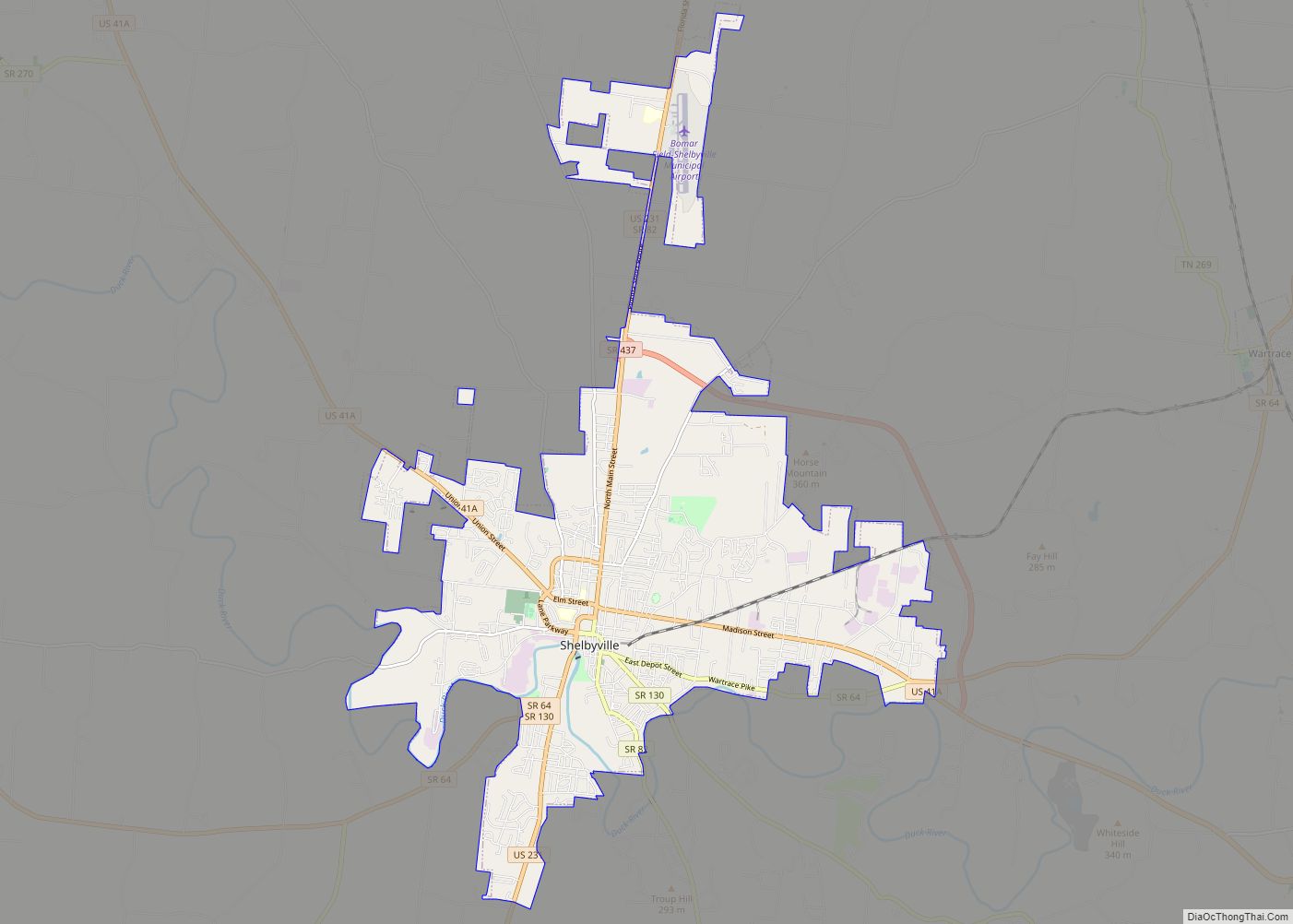
Shelbyville is a city in and the county seat of Bedford County, Tennessee, United States. The town was laid out in 1810 and incorporated in 1819. Shelbyville had a population of 20,335 residents at the 2010 census. The town is a hub of the Tennessee Walking Horse industry and has been nicknamed “The Walking Horse Capital of the World”.
| Name: | Shelbyville city |
|---|---|
| LSAD Code: | 25 |
| LSAD Description: | city (suffix) |
| State: | Tennessee |
| County: | Bedford County |
| Incorporated: | 1819 |
| Elevation: | 755 ft (230 m) |
| Total Area: | 18.44 sq mi (47.76 km²) |
| Land Area: | 18.44 sq mi (47.76 km²) |
| Water Area: | 0.00 sq mi (0.00 km²) |
| Total Population: | 23,557 |
| Population Density: | 1,277.56/sq mi (493.27/km²) |
| ZIP code: | 37160-37162 |
| Area code: | 931 |
| FIPS code: | 4767760 |
| GNISfeature ID: | 1269993 |
| Website: | www.shelbyvilletn.org |
Online Interactive Map
Click on ![]() to view map in "full screen" mode.
to view map in "full screen" mode.
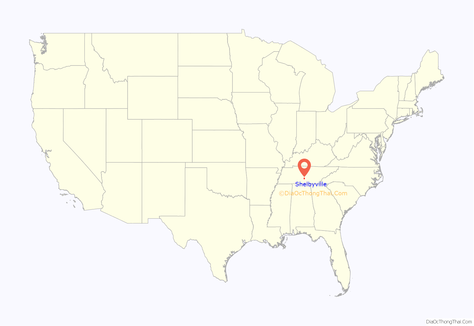
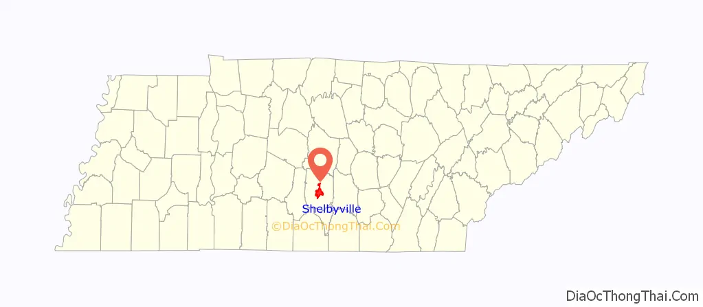
Shelbyville location map. Where is Shelbyville city?
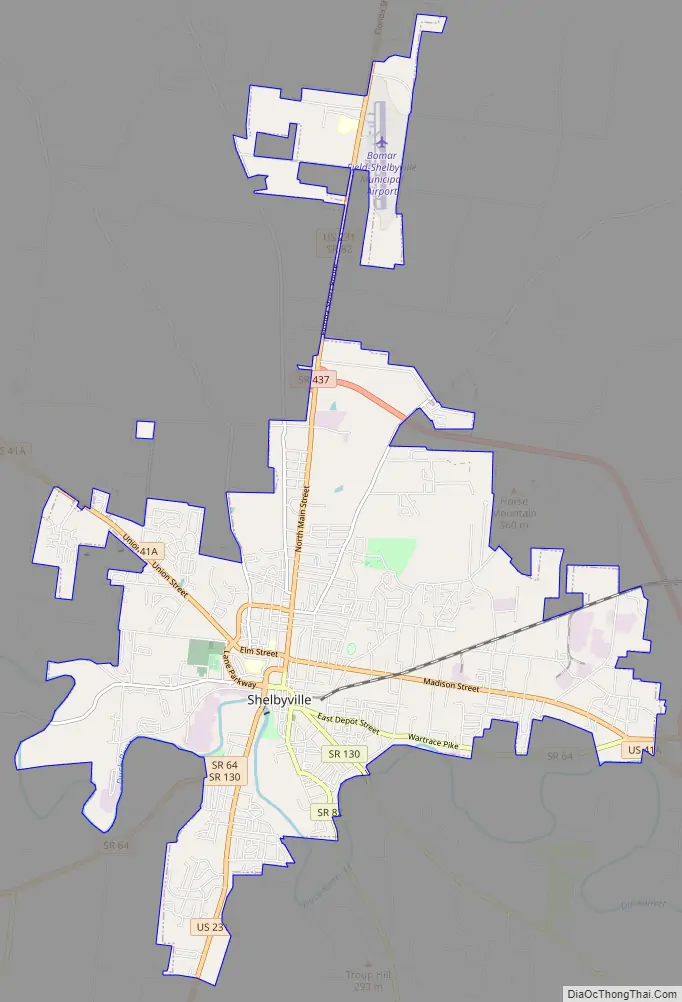
Shelbyville Road Map
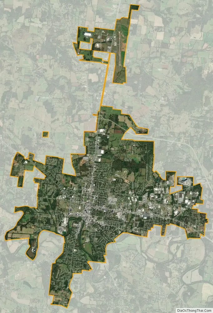
Shelbyville city Satellite Map
Geography
Shelbyville is in Middle Tennessee on a Highland Rim limestone bluff upon the banks of Duck River, which flows around the southern and eastern sides of town.
According to the United States Census Bureau, the city has a total area of 18.6 square miles (48.2 km), all land.
Climate
See also
Map of Tennessee State and its subdivision:- Anderson
- Bedford
- Benton
- Bledsoe
- Blount
- Bradley
- Campbell
- Cannon
- Carroll
- Carter
- Cheatham
- Chester
- Claiborne
- Clay
- Cocke
- Coffee
- Crockett
- Cumberland
- Davidson
- Decatur
- DeKalb
- Dickson
- Dyer
- Fayette
- Fentress
- Franklin
- Gibson
- Giles
- Grainger
- Greene
- Grundy
- Hamblen
- Hamilton
- Hancock
- Hardeman
- Hardin
- Hawkins
- Haywood
- Henderson
- Henry
- Hickman
- Houston
- Humphreys
- Jackson
- Jefferson
- Johnson
- Knox
- Lake
- Lauderdale
- Lawrence
- Lewis
- Lincoln
- Loudon
- Macon
- Madison
- Marion
- Marshall
- Maury
- McMinn
- McNairy
- Meigs
- Monroe
- Montgomery
- Moore
- Morgan
- Obion
- Overton
- Perry
- Pickett
- Polk
- Putnam
- Rhea
- Roane
- Robertson
- Rutherford
- Scott
- Sequatchie
- Sevier
- Shelby
- Smith
- Stewart
- Sullivan
- Sumner
- Tipton
- Trousdale
- Unicoi
- Union
- Van Buren
- Warren
- Washington
- Wayne
- Weakley
- White
- Williamson
- Wilson
- Alabama
- Alaska
- Arizona
- Arkansas
- California
- Colorado
- Connecticut
- Delaware
- District of Columbia
- Florida
- Georgia
- Hawaii
- Idaho
- Illinois
- Indiana
- Iowa
- Kansas
- Kentucky
- Louisiana
- Maine
- Maryland
- Massachusetts
- Michigan
- Minnesota
- Mississippi
- Missouri
- Montana
- Nebraska
- Nevada
- New Hampshire
- New Jersey
- New Mexico
- New York
- North Carolina
- North Dakota
- Ohio
- Oklahoma
- Oregon
- Pennsylvania
- Rhode Island
- South Carolina
- South Dakota
- Tennessee
- Texas
- Utah
- Vermont
- Virginia
- Washington
- West Virginia
- Wisconsin
- Wyoming