Tiptonville is a town in and the county seat of Lake County, Tennessee, United States. Its population was 2,439 as of the 2000 census and 4,464 in 2010, showing an increase of 2,025. It is also home to the Northwest Correctional Complex, a maximum security prison, known for once housing mass murderer Jessie Dotson.
| Name: | Tiptonville town |
|---|---|
| LSAD Code: | 43 |
| LSAD Description: | town (suffix) |
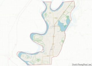
| State: | Tennessee |
| County: | Lake County |
| Incorporated: | 1900 |
| Elevation: | 302 ft (92 m) |
| Total Area: | 3.34 sq mi (8.65 km²) |
| Land Area: | 3.31 sq mi (8.59 km²) |
| Water Area: | 0.02 sq mi (0.06 km²) |
| Total Population: | 3,976 |
| Population Density: | 1,199.40/sq mi (463.02/km²) |
| ZIP code: | 38079 |
| Area code: | 731 |
| FIPS code: | 4774540 |
| GNISfeature ID: | 1272690 |
| Website: | tiptonville.org |
Online Interactive Map
Click on ![]() to view map in "full screen" mode.
to view map in "full screen" mode.
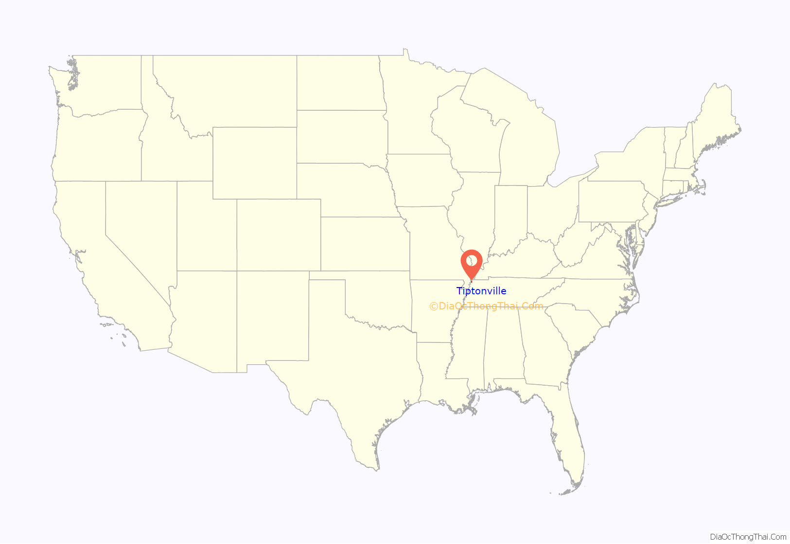
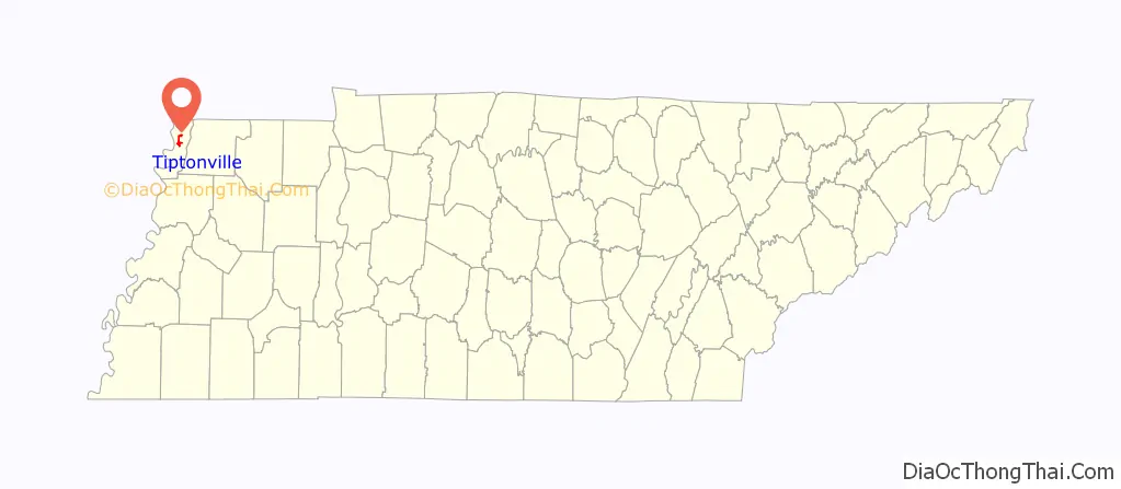
Tiptonville location map. Where is Tiptonville town?
History
Tiptonville was established in 1857, but was not incorporated until 1900. It was designated the county seat when Lake County was created in 1870.
Tiptonville was the scene of the surrender of Confederate forces at the end of the 1862 Battle of Island Number Ten in the American Civil War. The monument for this battle is located on State Route 22 approximately three miles north of Tiptonville, since the island itself, the focal point of the battle, has been eroded by the flow of the Mississippi River and no longer exists.
On March 19, 1901, Tiptonville was destroyed by a fire three days after a mob of white townsmen had lynched Ike Fitzgerald, a black man accused of raping a white woman. Whites speculated that the blaze, which burned 30 buildings and residences, including all of the stores on the main street, had been deliberately set by African Americans in reprisal for Fitzgerald’s lynching.
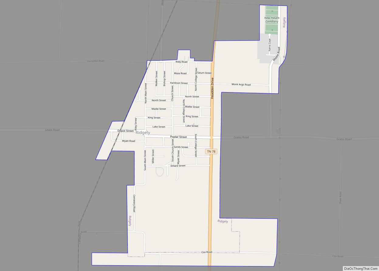
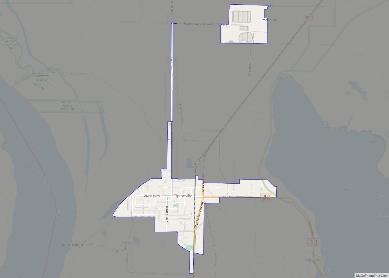
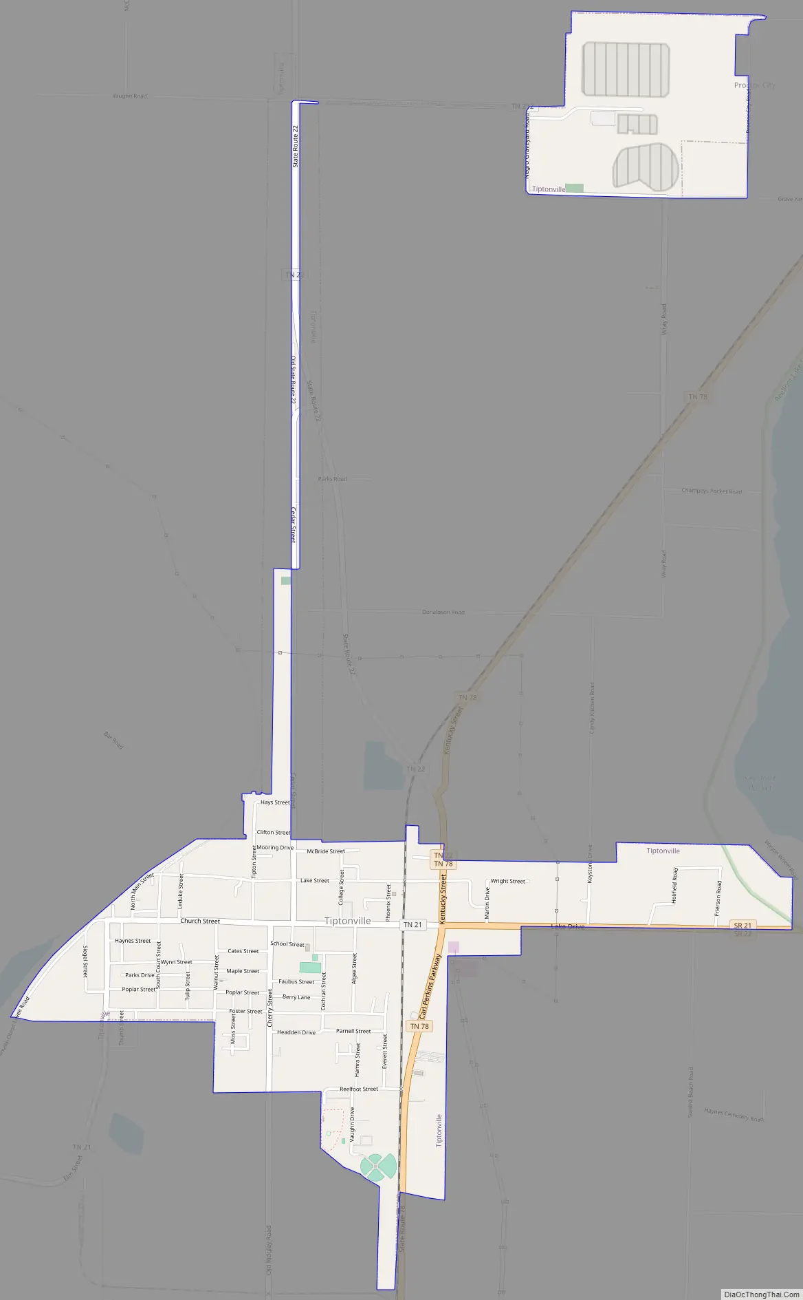
Tiptonville Road Map
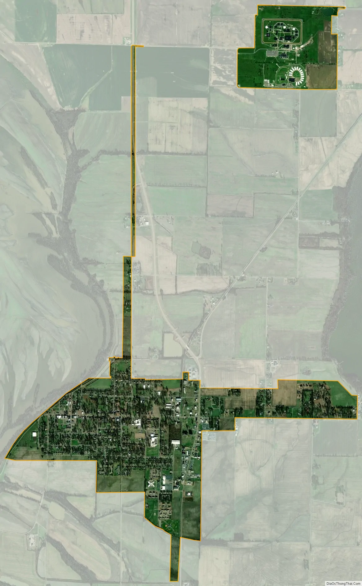
Tiptonville city Satellite Map
Geography
Tiptonville is located at 36°22′39″N 89°28′34″W / 36.37750°N 89.47611°W / 36.37750; -89.47611 (36.377610, −89.476022), on a small rise known as the Tiptonville Dome and within the New Madrid Seismic Zone. The Mississippi River is to the west and north, the Kentucky Bend is to the north, and Reelfoot Lake is to the east.
According to the United States Census Bureau, the town has a total area of 1.4 square miles (3.6 km), all land.
See also
Map of Tennessee State and its subdivision:- Anderson
- Bedford
- Benton
- Bledsoe
- Blount
- Bradley
- Campbell
- Cannon
- Carroll
- Carter
- Cheatham
- Chester
- Claiborne
- Clay
- Cocke
- Coffee
- Crockett
- Cumberland
- Davidson
- Decatur
- DeKalb
- Dickson
- Dyer
- Fayette
- Fentress
- Franklin
- Gibson
- Giles
- Grainger
- Greene
- Grundy
- Hamblen
- Hamilton
- Hancock
- Hardeman
- Hardin
- Hawkins
- Haywood
- Henderson
- Henry
- Hickman
- Houston
- Humphreys
- Jackson
- Jefferson
- Johnson
- Knox
- Lake
- Lauderdale
- Lawrence
- Lewis
- Lincoln
- Loudon
- Macon
- Madison
- Marion
- Marshall
- Maury
- McMinn
- McNairy
- Meigs
- Monroe
- Montgomery
- Moore
- Morgan
- Obion
- Overton
- Perry
- Pickett
- Polk
- Putnam
- Rhea
- Roane
- Robertson
- Rutherford
- Scott
- Sequatchie
- Sevier
- Shelby
- Smith
- Stewart
- Sullivan
- Sumner
- Tipton
- Trousdale
- Unicoi
- Union
- Van Buren
- Warren
- Washington
- Wayne
- Weakley
- White
- Williamson
- Wilson
- Alabama
- Alaska
- Arizona
- Arkansas
- California
- Colorado
- Connecticut
- Delaware
- District of Columbia
- Florida
- Georgia
- Hawaii
- Idaho
- Illinois
- Indiana
- Iowa
- Kansas
- Kentucky
- Louisiana
- Maine
- Maryland
- Massachusetts
- Michigan
- Minnesota
- Mississippi
- Missouri
- Montana
- Nebraska
- Nevada
- New Hampshire
- New Jersey
- New Mexico
- New York
- North Carolina
- North Dakota
- Ohio
- Oklahoma
- Oregon
- Pennsylvania
- Rhode Island
- South Carolina
- South Dakota
- Tennessee
- Texas
- Utah
- Vermont
- Virginia
- Washington
- West Virginia
- Wisconsin
- Wyoming