Wartrace is a town in Bedford County, Tennessee, United States. The population was 548 at the 2000 census and 651 at the 2010 census. It is located northeast of Shelbyville. The downtown area is listed on the National Register of Historic Places as the Wartrace Historic District.
Wartrace is a hub of the Tennessee Walking Horse industry and has been nicknamed “the cradle of the Tennessee Walking Horse”. It is home to the Wartrace Horse Show, held annually since 1906, and the Tennessee Walking Horse National Museum has been headquartered in downtown Wartrace since 2012.
| Name: | Wartrace town |
|---|---|
| LSAD Code: | 43 |
| LSAD Description: | town (suffix) |
| State: | Tennessee |
| County: | Bedford County |
| Incorporated: | 1858 |
| Elevation: | 833 ft (254 m) |
| Total Area: | 0.88 sq mi (2.27 km²) |
| Land Area: | 0.88 sq mi (2.27 km²) |
| Water Area: | 0.00 sq mi (0.00 km²) |
| Total Population: | 653 |
| Population Density: | 745.43/sq mi (287.78/km²) |
| ZIP code: | 37183 |
| Area code: | 931 |
| FIPS code: | 4778120 |
| GNISfeature ID: | 1304389 |
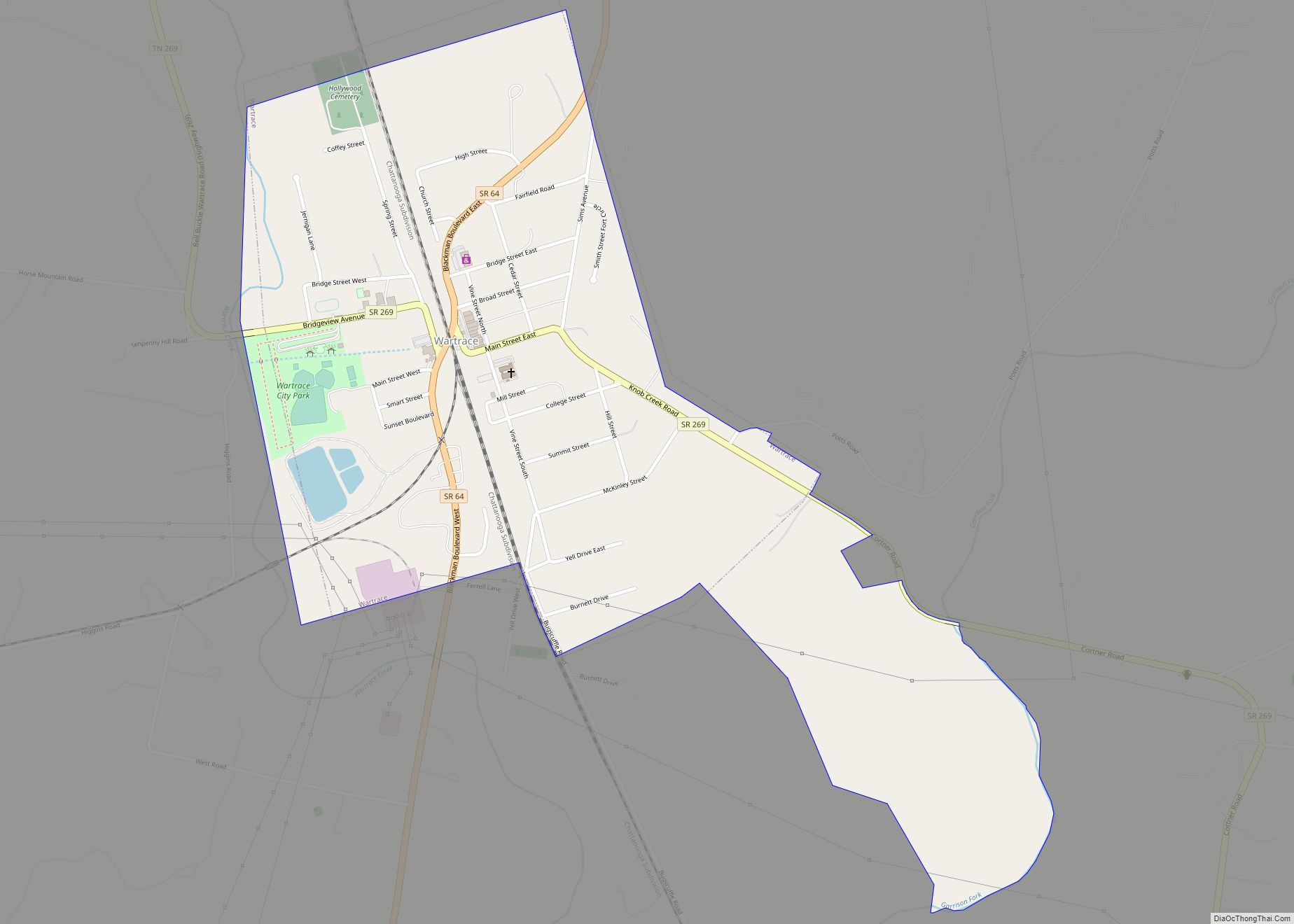
Online Interactive Map
Click on ![]() to view map in "full screen" mode.
to view map in "full screen" mode.
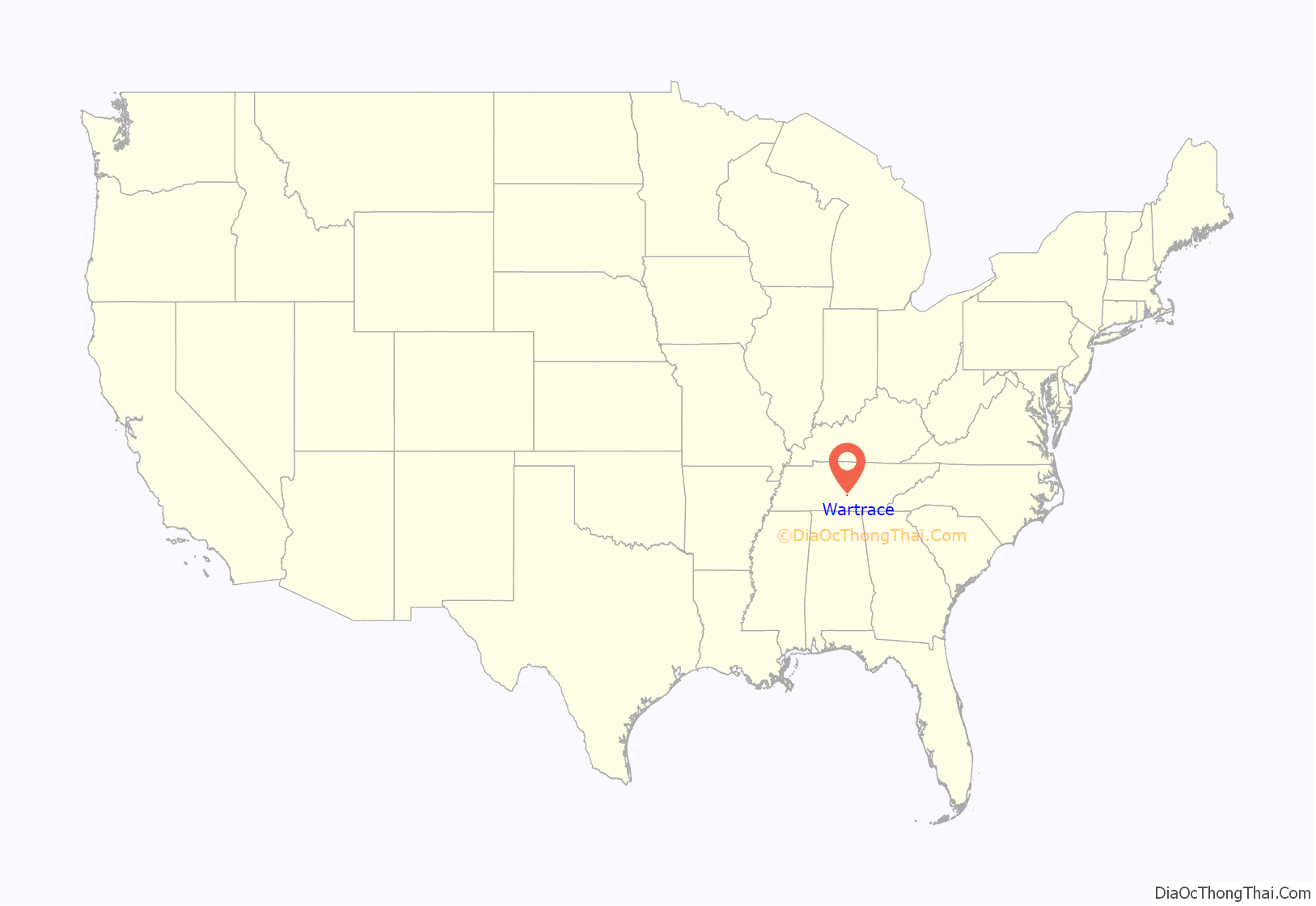
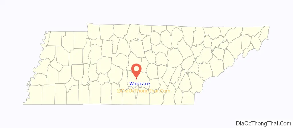
Wartrace location map. Where is Wartrace town?
History
The name “Wartrace” is rooted in a Native American trail that once passed through the area. The town, initially known as “Wartrace Depot,” was established in the early 1850s as a stop on the newly constructed Nashville and Chattanooga Railroad.
During the Civil War, the town was the winter headquarters of Confederate General William J. Hardee during the aftermath of the Battle of Stones River, and the Old Chockley Tavern in Wartrace was a gathering place for Confederate officers during the Tullahoma Campaign. A skirmish was fought at Wartrace on April 11, 1862.
With the increase in rail travel in the late 19th century, Wartrace experienced a boom period. At its height, the town had six inns and hotels, and serviced 13 trains per day. One hotel, the Walking Horse Hotel, is still in business today. One of the local historic homes is also now operated as the Blue Victorian in Wartrace B&B.
Wartrace is connected to Shelbyville by the Walking Horse and Eastern Railroad, a historic rail line that is still in part-time operation.
In the early 1900s, Wartrace served as a breeding center for the Tennessee Walking Horse, and the Wartrace Horse Show was founded in the town.
In 1972, Cascade K-5 opened as a result of the Bell Buckle School fire which displaced students within city limits of Bell Buckle, Tennessee, Shelbyville, Tennessee, and Wartrace. Cascade Middle & High School have a varsity football team, drama club (The Black Curtain Players), marching band, men & women’s soccer, softball, and baseball teams. In the fall of 2012, the Cascade High School Marching Band won the Division 1 TN Marching Band State Championship at Riverdale High School (Murfreesboro, Tennessee) under the direction of former drum major and Emory University alumna Sierra Cortner.
Wartrace Road Map
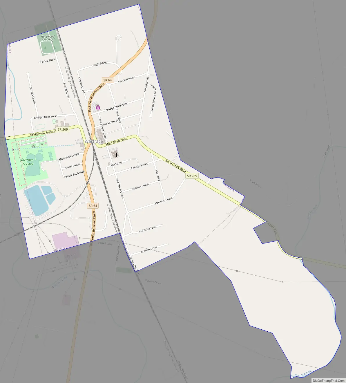
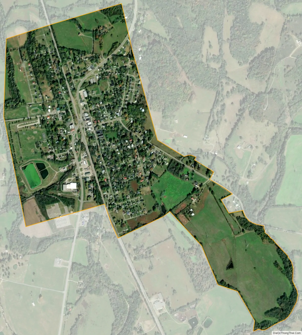
Wartrace city Satellite Map
Geography
Wartrace is located at 35°31′37″N 86°19′51″W / 35.52694°N 86.33083°W / 35.52694; -86.33083 (35.526872, -86.330739).
According to the United States Census Bureau, the town has a total area of 0.7 square miles (1.8 km), all of it land.
Climate
Climate is characterized by relatively high temperatures and evenly distributed precipitation throughout the year. The Köppen Climate Classification subtype for this climate is “Cfa” (Humid Subtropical Climate).
See also
Map of Tennessee State and its subdivision:- Anderson
- Bedford
- Benton
- Bledsoe
- Blount
- Bradley
- Campbell
- Cannon
- Carroll
- Carter
- Cheatham
- Chester
- Claiborne
- Clay
- Cocke
- Coffee
- Crockett
- Cumberland
- Davidson
- Decatur
- DeKalb
- Dickson
- Dyer
- Fayette
- Fentress
- Franklin
- Gibson
- Giles
- Grainger
- Greene
- Grundy
- Hamblen
- Hamilton
- Hancock
- Hardeman
- Hardin
- Hawkins
- Haywood
- Henderson
- Henry
- Hickman
- Houston
- Humphreys
- Jackson
- Jefferson
- Johnson
- Knox
- Lake
- Lauderdale
- Lawrence
- Lewis
- Lincoln
- Loudon
- Macon
- Madison
- Marion
- Marshall
- Maury
- McMinn
- McNairy
- Meigs
- Monroe
- Montgomery
- Moore
- Morgan
- Obion
- Overton
- Perry
- Pickett
- Polk
- Putnam
- Rhea
- Roane
- Robertson
- Rutherford
- Scott
- Sequatchie
- Sevier
- Shelby
- Smith
- Stewart
- Sullivan
- Sumner
- Tipton
- Trousdale
- Unicoi
- Union
- Van Buren
- Warren
- Washington
- Wayne
- Weakley
- White
- Williamson
- Wilson
- Alabama
- Alaska
- Arizona
- Arkansas
- California
- Colorado
- Connecticut
- Delaware
- District of Columbia
- Florida
- Georgia
- Hawaii
- Idaho
- Illinois
- Indiana
- Iowa
- Kansas
- Kentucky
- Louisiana
- Maine
- Maryland
- Massachusetts
- Michigan
- Minnesota
- Mississippi
- Missouri
- Montana
- Nebraska
- Nevada
- New Hampshire
- New Jersey
- New Mexico
- New York
- North Carolina
- North Dakota
- Ohio
- Oklahoma
- Oregon
- Pennsylvania
- Rhode Island
- South Carolina
- South Dakota
- Tennessee
- Texas
- Utah
- Vermont
- Virginia
- Washington
- West Virginia
- Wisconsin
- Wyoming