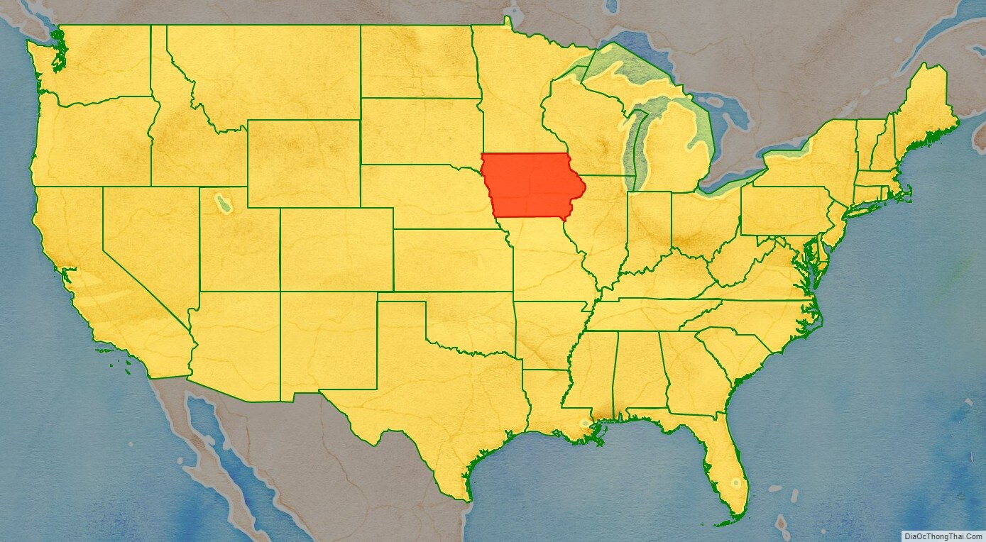
Iowa (/ˈaɪəwə/ (listen)) is a state in the upper Midwestern region of the United States, bordered by the Mississippi River to the east and the Missouri River and Big Sioux River to the west. It is bordered by six states: Wisconsin to the northeast, Illinois to the east and southeast, Missouri to the south, Nebraska to the west, South Dakota to the northwest, and Minnesota to the north.
During the 18th and early 19th centuries, Iowa was a part of French Louisiana and Spanish Louisiana; its state flag is patterned after the flag of France. After the Louisiana Purchase, people laid the foundation for an agriculture-based economy in the heart of the Corn Belt. In the latter half of the 20th century, Iowa’s agricultural economy transitioned to a diversified economy of advanced manufacturing, processing, financial services, information technology, biotechnology, and green energy production.
Iowa is the 26th most extensive in total area and the 31st most populous of the 50 U.S. states, with a population of 3,190,369, according to the 2020 census. The state’s capital, most populous city, and largest metropolitan area fully located within the state is Des Moines. A portion of the larger Omaha, Nebraska, metropolitan area extends into three counties of southwest Iowa. Iowa has been listed as one of the safest U.S. states to live in.
| Before statehood: | American Indians of Iowa Iowa Territory |
|---|---|
| Admitted to the Union: | December 28, 1846 (29th) |
| Capital: | Des Moines |
| Capital – largest city: | largest city |
| Largest metro and urban areas: | Des Moines |
| Elevation: | 1,100 ft (340 m) |
| Total Area: | 55,857.1 sq mi (144,669.2 km) |
| Area Rank: | 26th |
| Total Population: | 3,190,369 |
| Population Rank: | 30th |
| Population Density: | 57.1/sq mi (22.0/km) |
| Population Density Rank: | 36th |
| Median Household Income: | $61,691 |
| Income Rank: | 30th |
| Demonym(s): | Iowan |
| USPS abbreviation: | IA |
| ISO 3166 code: | US-IA |
| Website: | www.iowa.gov |
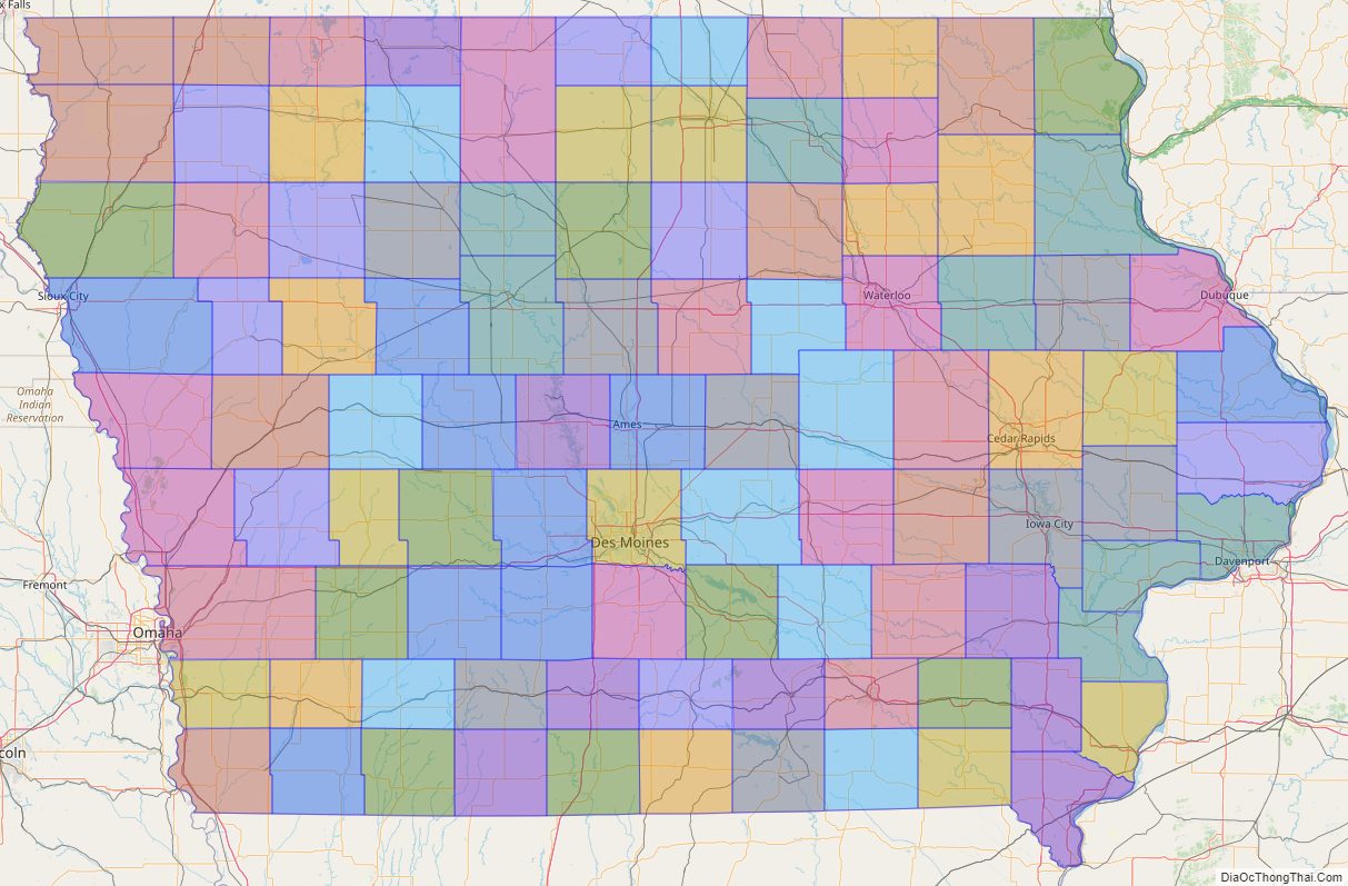
Online Interactive Map
Click on ![]() to view map in "full screen" mode.
to view map in "full screen" mode.
Iowa location map. Where is Iowa state?
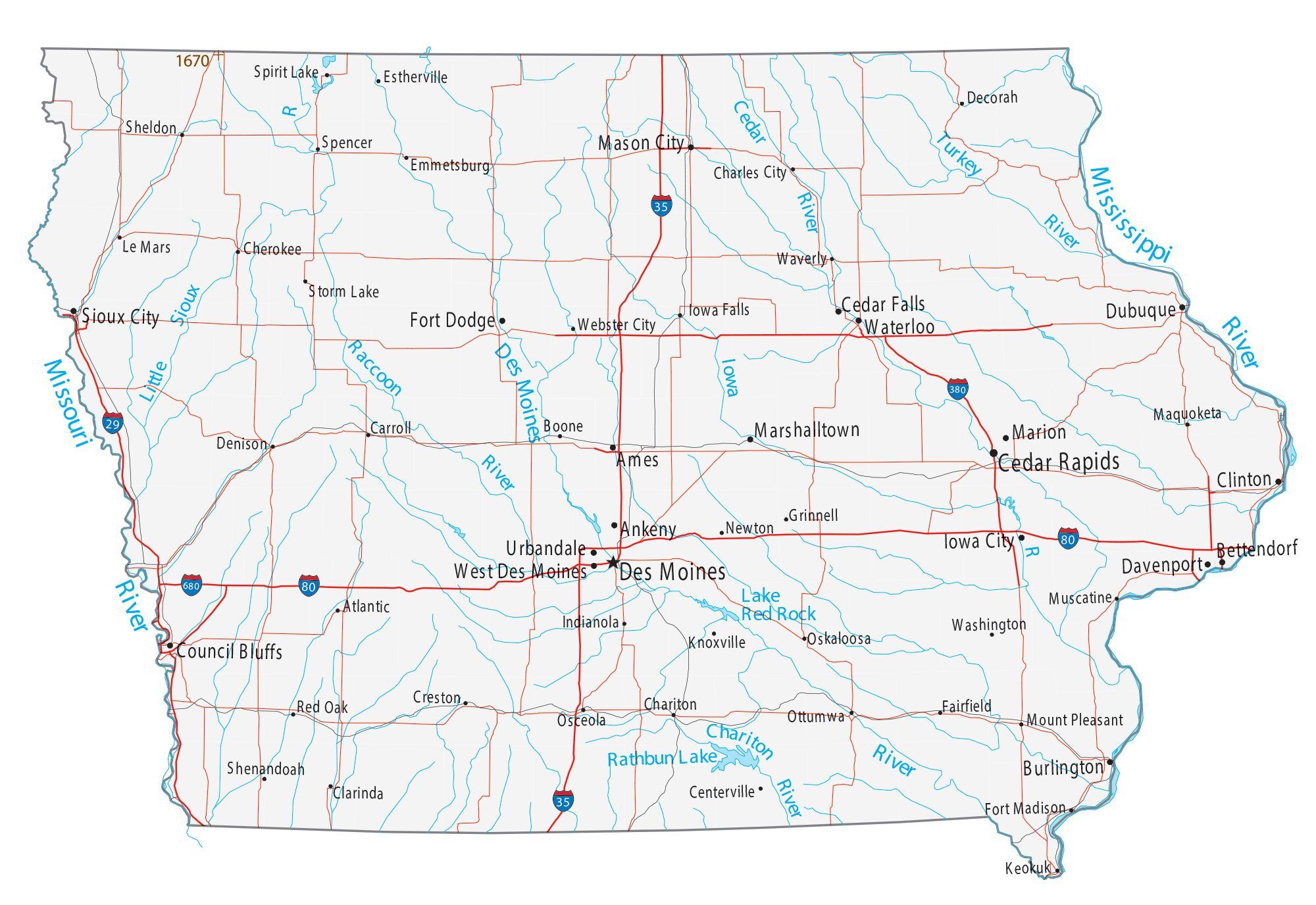
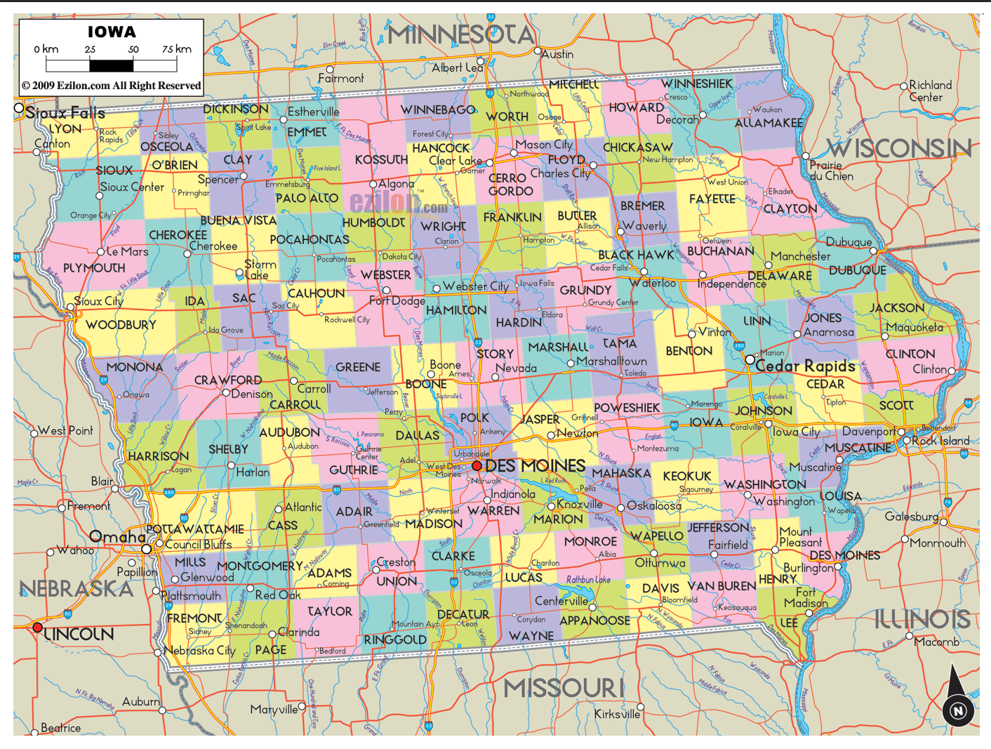
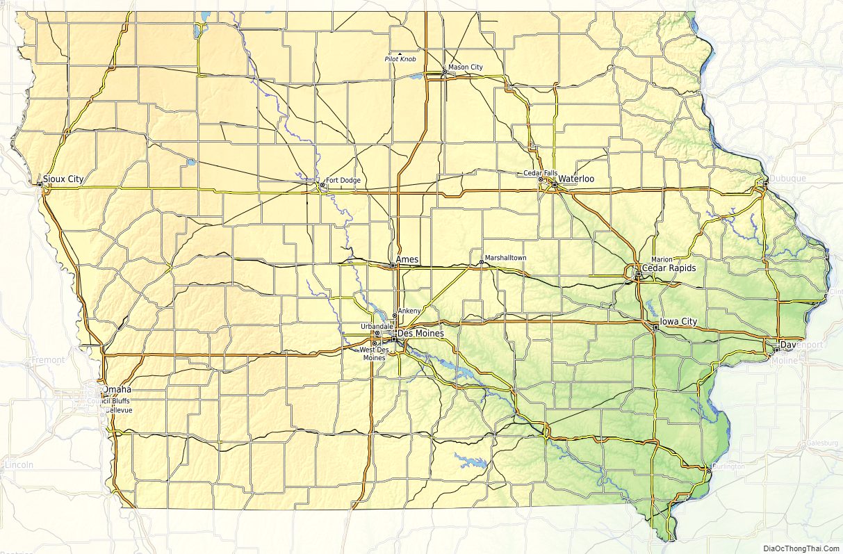
Iowa Road Map
Iowa Map – Roads & Cities
Iowa Street Map
Iowa State Map – Places and Landmarks
Iowa Political Map
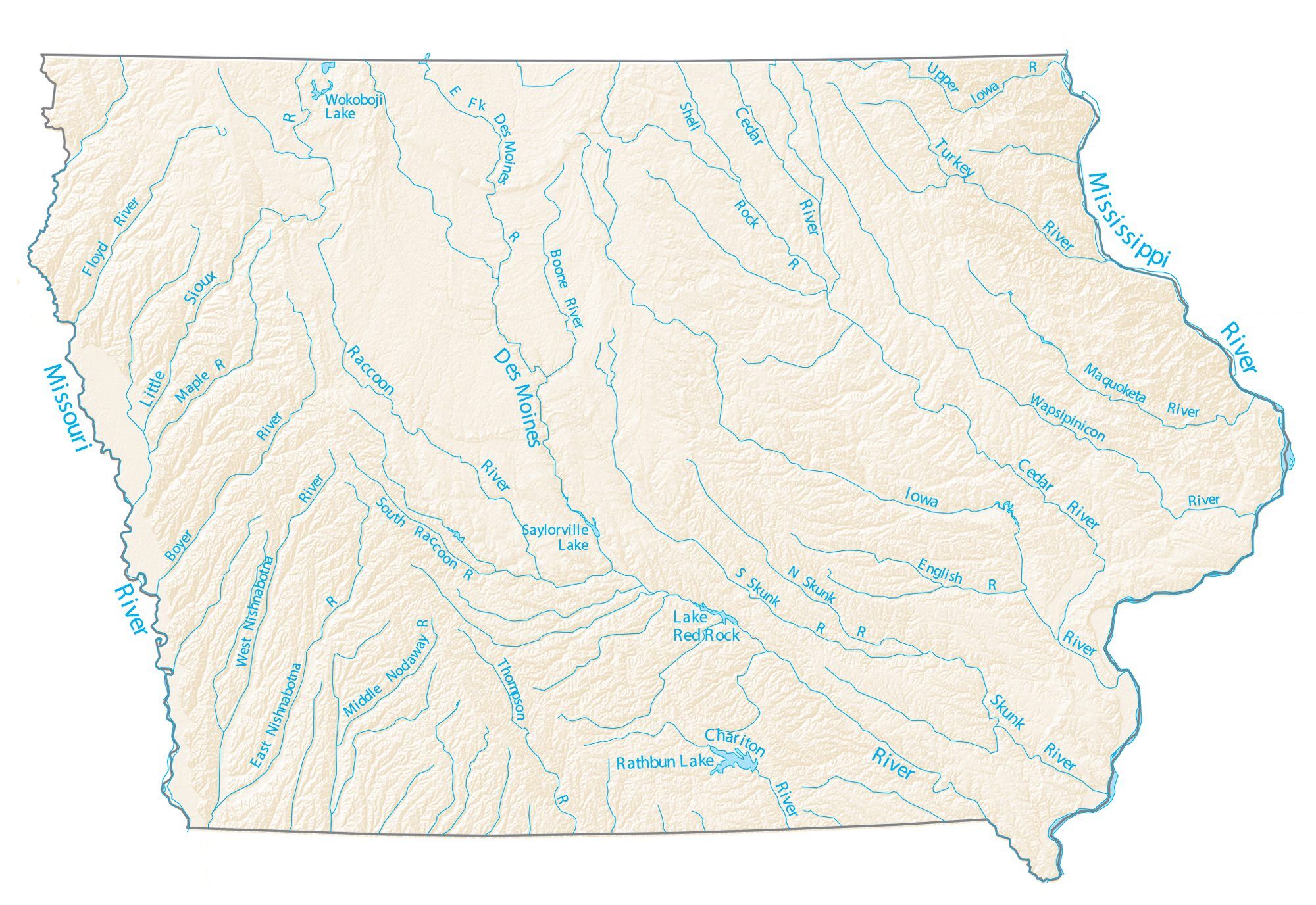
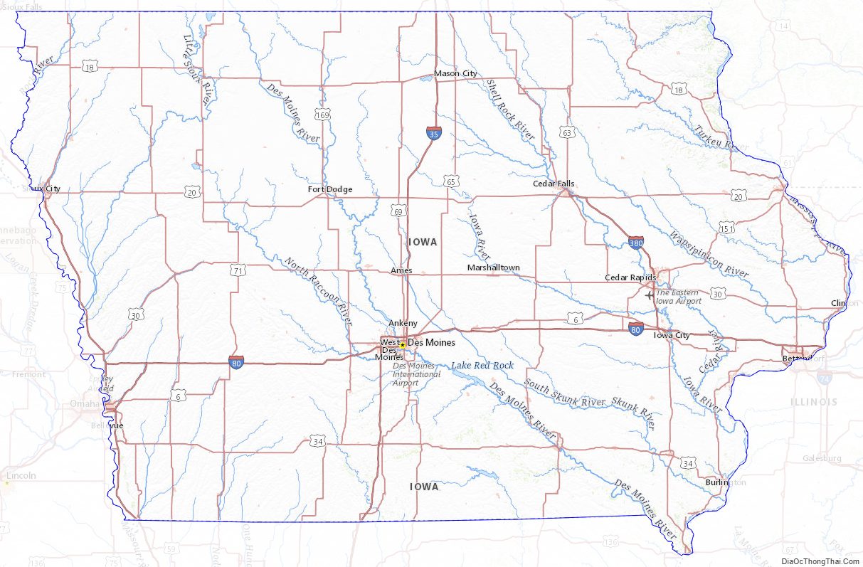
Iowa Lakes and Rivers Map
Geography
Boundaries
Iowa is bordered by the Mississippi River on the east along with the Missouri River and the Big Sioux River on the west. The northern boundary is a line along 43 degrees, 30 minutes north latitude. The southern border is the Des Moines River and a not-quite-straight line along approximately 40 degrees 35 minutes north, as decided by the U.S. Supreme Court in Missouri v. Iowa (1849) after a standoff between Missouri and Iowa known as the Honey War.
Iowa is the only state whose east and west borders are formed almost entirely by rivers. Carter Lake, Iowa, is the only city in the state located west of the Missouri River.
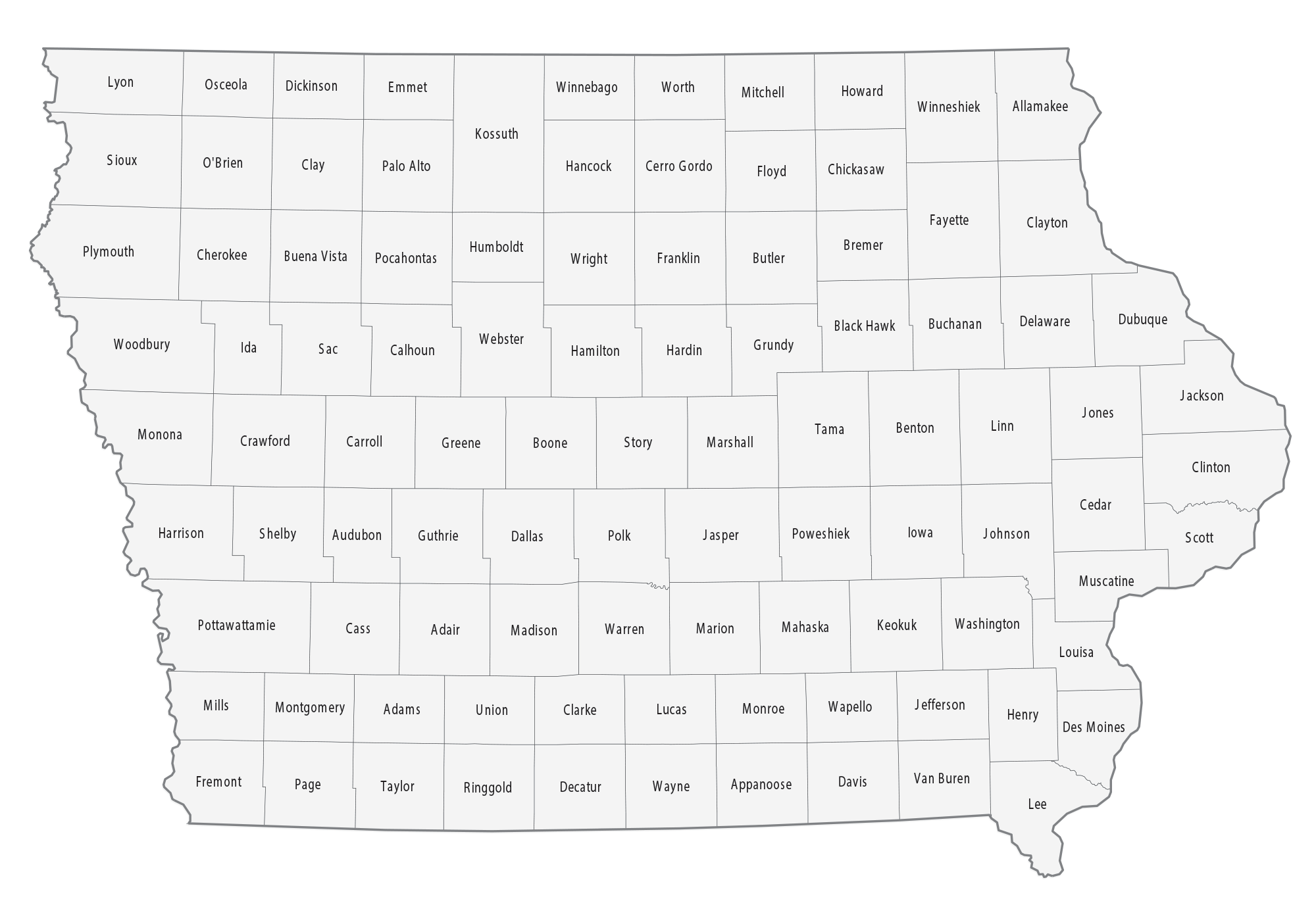
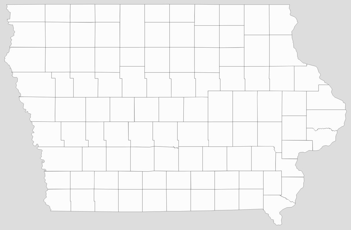
Iowa has 99 counties, but 100 county seats because Lee County has two. The state capital, Des Moines, is in Polk County.
Geology and terrain
Iowa’s bedrock geology generally decreases in age from east to west. In northwest Iowa, Cretaceous bedrock can be 74 million years old; in eastern Iowa Cambrian bedrock dates to c. 500 million years ago. The oldest radiometrically dated bedrock in the state is the 2.9 billion year old Otter Creek Layered Mafic Complex. Precambrian rock is exposed only in the northwest of the state.
Iowa can be divided into eight landforms based on glaciation, soils, topography, and river drainage. Loess hills lie along the western border of the state, some of which are several hundred feet thick. Northeast Iowa along the Upper Mississippi River is part of the Driftless Area, consisting of steep hills and valleys which appear as mountainous.
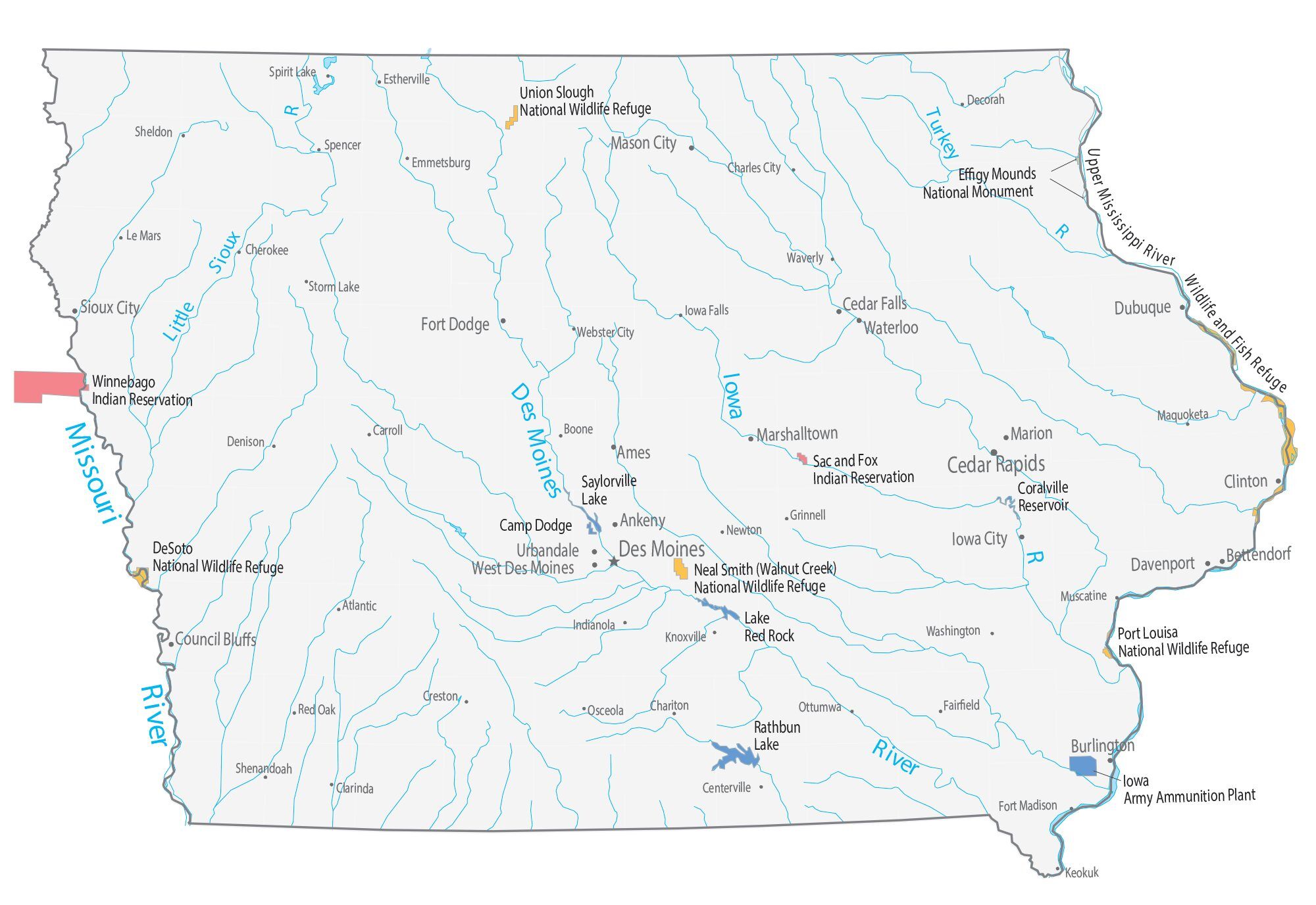
Several natural lakes exist, most notably Spirit Lake, West Okoboji Lake, and East Okoboji Lake in northwest Iowa (see Iowa Great Lakes). To the east lies Clear Lake. Man-made lakes include Lake Odessa, Saylorville Lake, Lake Red Rock, Coralville Lake, Lake MacBride, and Rathbun Lake. Before European settlement, 4 to 6 million acres of the state was covered with wetlands, about 95% of these wetlands have been drained.
Ecology and environment
Iowa’s natural vegetation is tallgrass prairie and savanna in upland areas, with dense forest and wetlands in flood plains and protected river valleys, and pothole wetlands in northern prairie areas. Most of Iowa is used for agriculture; crops cover 60% of the state, grasslands (mostly pasture and hay with some prairie and wetland) cover 30%, and forests cover 7%; urban areas and water cover another 1% each.
The southern part of Iowa is categorized as the Central forest-grasslands transition ecoregion. The Northern, drier part of Iowa is categorized as part of the Central tall grasslands.
There is a dearth of natural areas in Iowa; less than 1% of the tallgrass prairie that once covered most of Iowa remains intact; only about 5% of the state’s prairie pothole wetlands remain, and most of the original forest has been lost. As of 2005 Iowa ranked 49th of U.S. states in public land holdings. Threatened or endangered animals in Iowa include the interior least tern, piping plover, Indiana bat, pallid sturgeon, the Iowa Pleistocene land snail, Higgins’ eye pearly mussel, and the Topeka shiner. Endangered or threatened plants include western prairie fringed orchid, eastern prairie fringed orchid, Mead’s milkweed, prairie bush clover, and northern wild monkshood.
The explosion in the number of high-density livestock facilities in Iowa has led to increased rural water contamination and a decline in air quality.
Other factors negatively affecting Iowa’s environment include the extensive use of older coal-fired power plants, fertilizer and pesticide runoff from crop production, and diminishment of the Jordan Aquifer.
Climate
Iowa has a humid continental climate throughout the state (Köppen climate classification Dfa) with extremes of both heat and cold. The average annual temperature at Des Moines is 50 °F (10 °C); for some locations in the north, such as Mason City, the figure is about 45 °F (7 °C), while Keokuk, on the Mississippi River, averages 52 °F (11 °C). Snowfall is common, with Des Moines getting about 26 days of snowfall a year, and other places, such as Shenandoah getting about 11 days of snowfall in a year.
Spring ushers in the beginning of the severe weather season. Iowa averages about 50 days of thunderstorm activity per year. The 30-year annual average of tornadoes in Iowa is 47. In 2008, twelve people were killed by tornadoes in Iowa, making it the deadliest year since 1968 and also the second most tornadoes in a year with 105, matching the total from 2001.
Iowa summers are known for heat and humidity, with daytime temperatures sometimes near 90 °F (32 °C) and occasionally exceeding 100 °F (38 °C). Average winters in the state have been known to drop well below freezing, even dropping below −18 °F (−28 °C). Iowa’s all-time hottest temperature of 118 °F (48 °C) was recorded at Keokuk on July 20, 1934, during a nationwide heat wave; the all-time lowest temperature of −47 °F (−44 °C) was recorded in Washta on January 12, 1912.
Iowa has a relatively smooth gradient of varying precipitation across the state, with areas in the southeast of the state receiving an average of over 38 inches (97 cm) of rain annually, and the northwest of the state receiving less than 28 inches (71 cm). The pattern of precipitation across Iowa is seasonal, with more rain falling in the summer months. Virtually statewide, the driest month is January or February, and the wettest month is June, owing to frequent showers and thunderstorms, some of which produce hail, damaging winds and/or tornadoes. In Des Moines, roughly in the center of the state, over two-thirds of the 34.72 inches (88.2 cm) of rain falls from April through September, and about half the average annual precipitation falls from May through August, peaking in June.
Settlements
Iowa’s population is more urban than rural, with 61 percent living in urban areas in 2000, a trend that began in the early 20th century. Urban counties in Iowa grew 8.5% from 2000 to 2008, while rural counties declined by 4.2%. The shift from rural to urban has caused population increases in more urbanized counties such as Dallas, Johnson, Linn, Polk, and Scott, at the expense of more rural counties.
Iowa, in common with other Midwestern states (especially Kansas, Nebraska, North Dakota, and South Dakota), is feeling the brunt of rural flight, although Iowa has been gaining population since approximately 1990. Some smaller communities, such as Denison and Storm Lake, have mitigated this population loss through gains in immigrant laborers.
Another demographic problem for Iowa is the brain drain, in which educated young adults leave the state in search of better prospects in higher education or employment. During the 1990s, Iowa had the second highest exodus rate for single, educated young adults, second only to North Dakota.
Iowa Physical Map
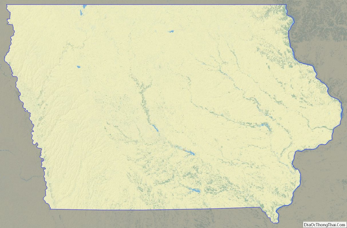

Iowa Topographic Map
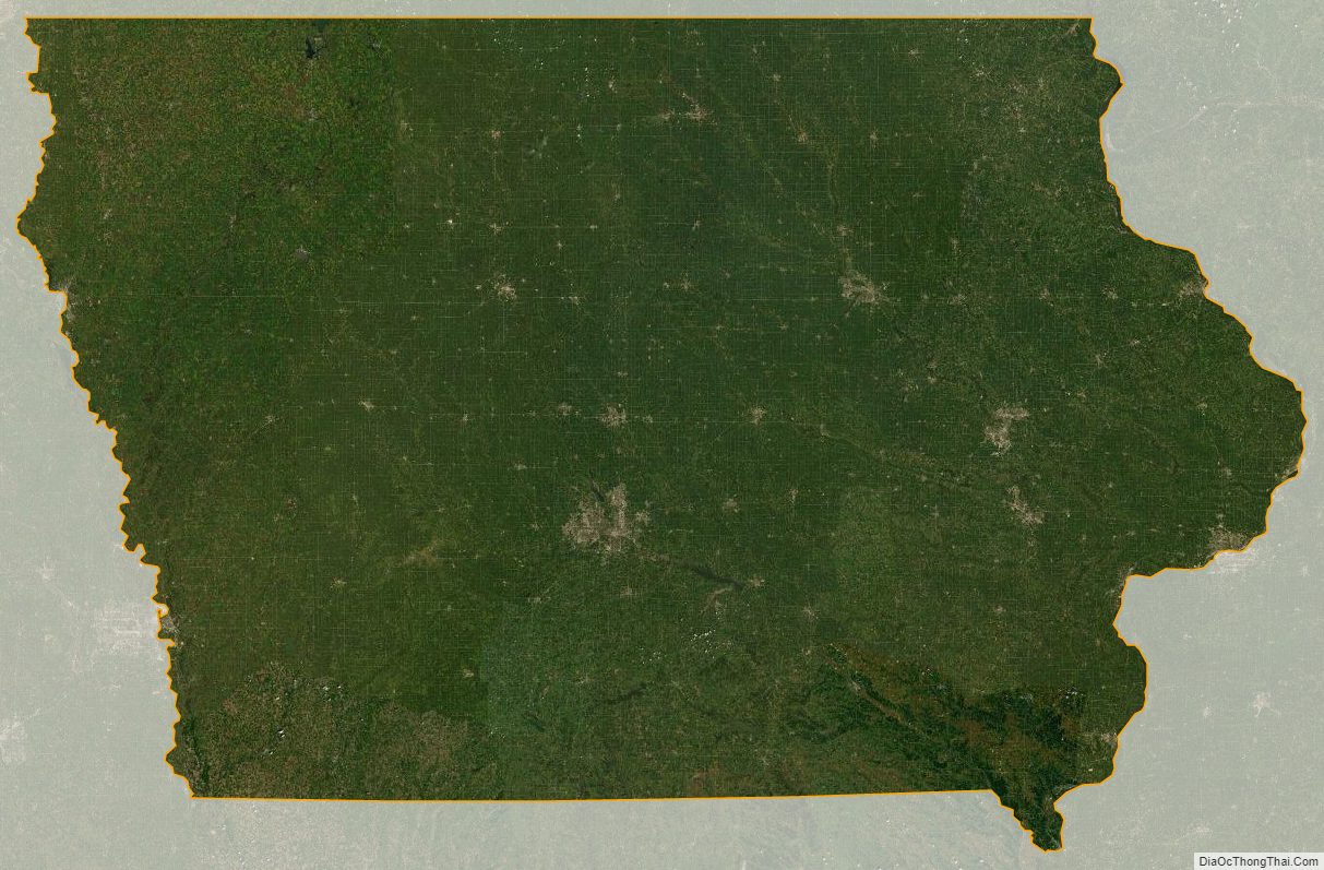
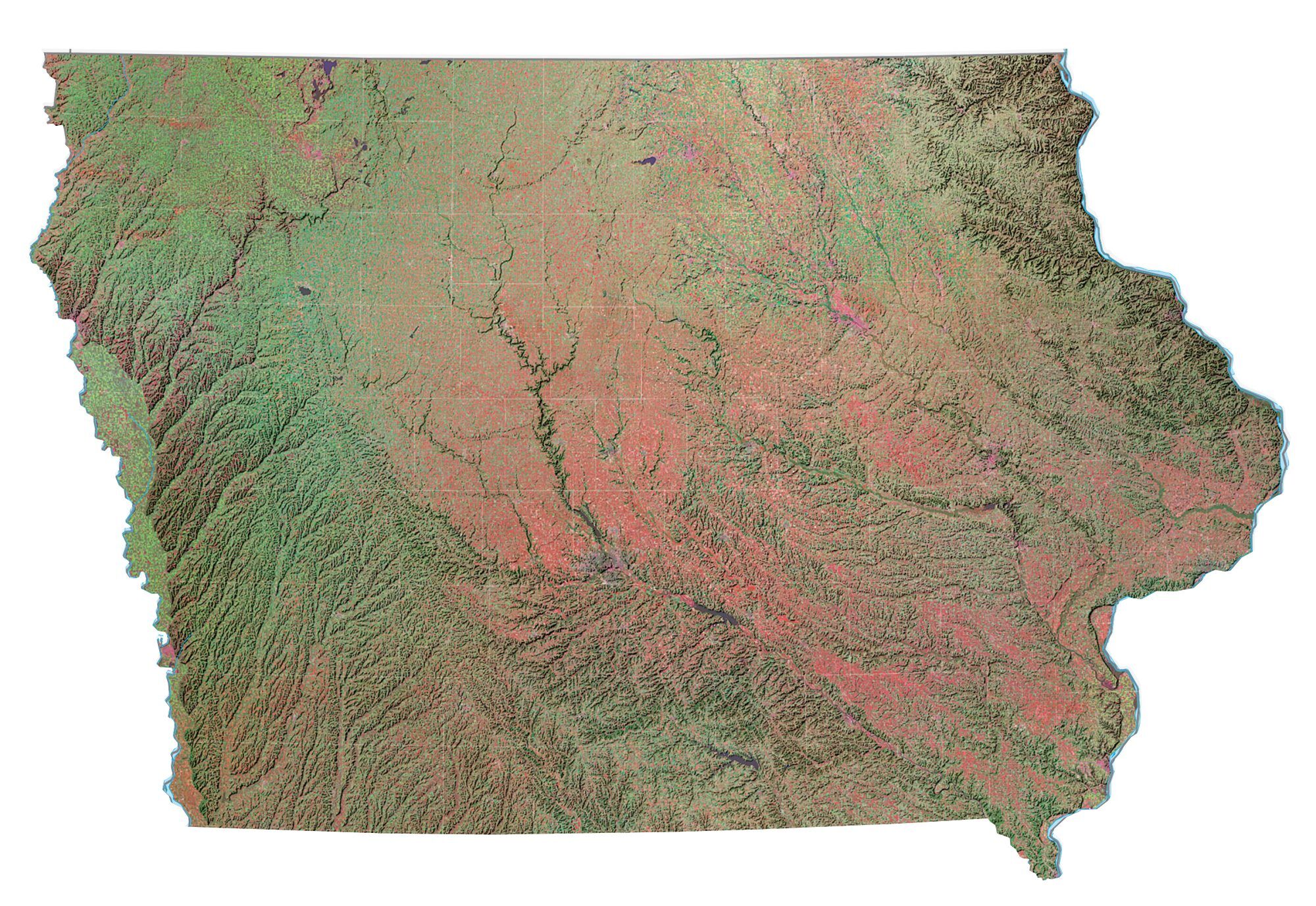
Iowa Satellite Map
Others printable maps
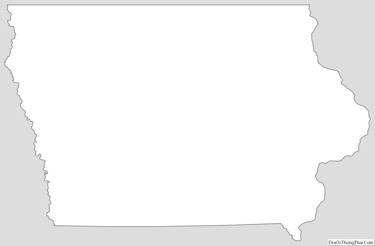
Iowa Outline Map
Blank Iowa County Map
See also
Map of Iowa State and its subdivision:- Adair
- Adams
- Allamakee
- Appanoose
- Audubon
- Benton
- Black Hawk
- Boone
- Bremer
- Buchanan
- Buena Vista
- Butler
- Calhoun
- Carroll
- Cass
- Cedar
- Cerro Gordo
- Cherokee
- Chickasaw
- Clarke
- Clay
- Clayton
- Clinton
- Crawford
- Dallas
- Davis
- Decatur
- Delaware
- Des Moines
- Dickinson
- Dubuque
- Emmet
- Fayette
- Floyd
- Franklin
- Fremont
- Greene
- Grundy
- Guthrie
- Hamilton
- Hancock
- Hardin
- Harrison
- Henry
- Howard
- Humboldt
- Ida
- Iowa
- Jackson
- Jasper
- Jefferson
- Johnson
- Jones
- Keokuk
- Kossuth
- Lee
- Linn
- Louisa
- Lucas
- Lyon
- Madison
- Mahaska
- Marion
- Marshall
- Mills
- Mitchell
- Monona
- Monroe
- Montgomery
- Muscatine
- O'Brien
- Osceola
- Page
- Palo Alto
- Plymouth
- Pocahontas
- Polk
- Pottawattamie
- Poweshiek
- Ringgold
- Sac
- Scott
- Shelby
- Sioux
- Story
- Tama
- Taylor
- Union
- Van Buren
- Wapello
- Warren
- Washington
- Wayne
- Webster
- Winnebago
- Winneshiek
- Woodbury
- Worth
- Wright
- Alabama
- Alaska
- Arizona
- Arkansas
- California
- Colorado
- Connecticut
- Delaware
- District of Columbia
- Florida
- Georgia
- Hawaii
- Idaho
- Illinois
- Indiana
- Iowa
- Kansas
- Kentucky
- Louisiana
- Maine
- Maryland
- Massachusetts
- Michigan
- Minnesota
- Mississippi
- Missouri
- Montana
- Nebraska
- Nevada
- New Hampshire
- New Jersey
- New Mexico
- New York
- North Carolina
- North Dakota
- Ohio
- Oklahoma
- Oregon
- Pennsylvania
- Rhode Island
- South Carolina
- South Dakota
- Tennessee
- Texas
- Utah
- Vermont
- Virginia
- Washington
- West Virginia
- Wisconsin
- Wyoming


