Bussey is a city in southeast Marion County, Iowa, United States. The population was 387 at the time of the 2020 census.
| Name: | Bussey city |
|---|---|
| LSAD Code: | 25 |
| LSAD Description: | city (suffix) |
| State: | Iowa |
| County: | Marion County |
| Elevation: | 850 ft (260 m) |
| Total Area: | 0.31 sq mi (0.81 km²) |
| Land Area: | 0.31 sq mi (0.81 km²) |
| Water Area: | 0.00 sq mi (0.00 km²) |
| Total Population: | 387 |
| Population Density: | 1,244.37/sq mi (480.42/km²) |
| ZIP code: | 50044 |
| Area code: | 641 |
| FIPS code: | 1909730 |
| GNISfeature ID: | 0455013 |
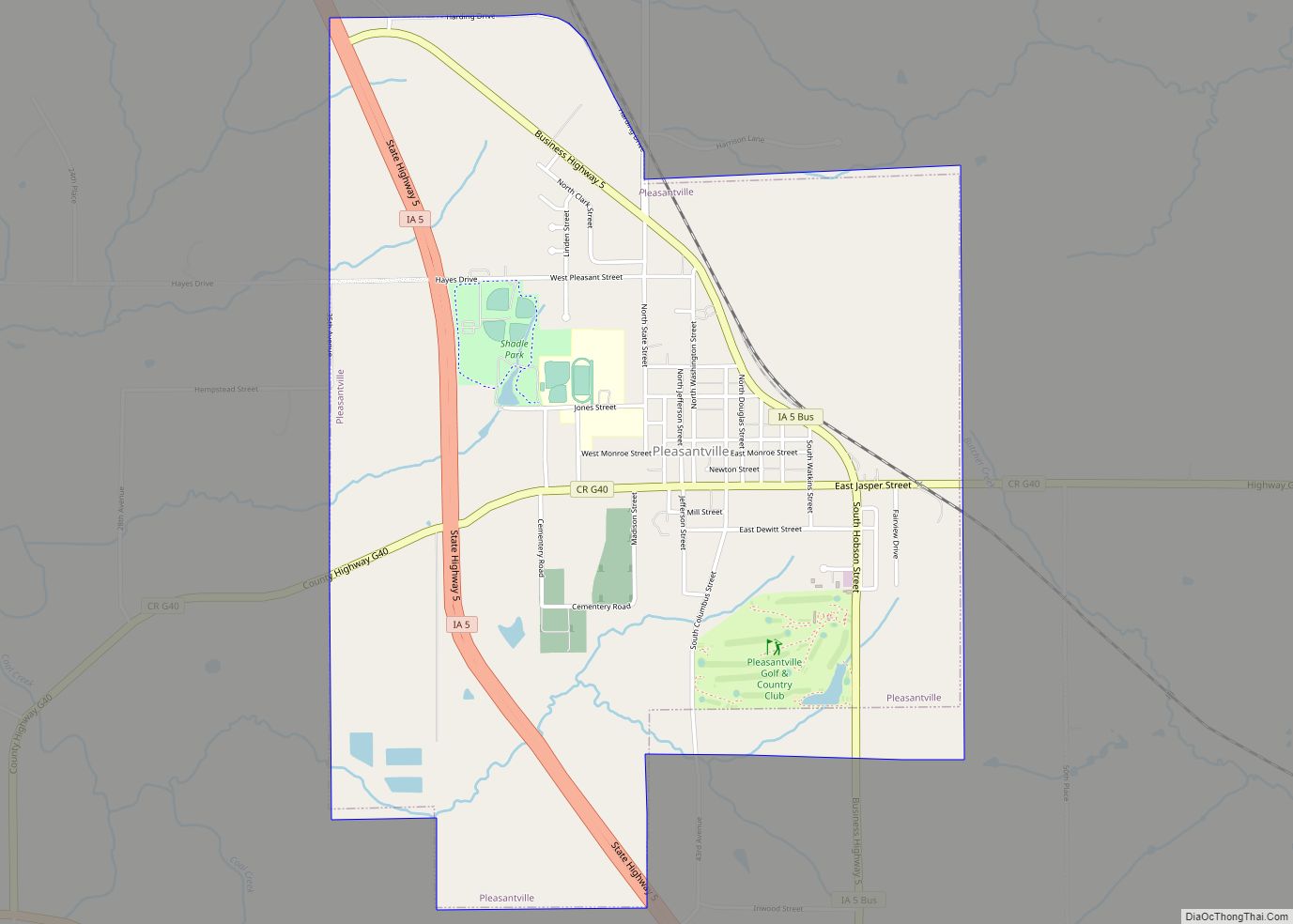
Online Interactive Map
Click on ![]() to view map in "full screen" mode.
to view map in "full screen" mode.
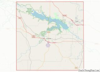
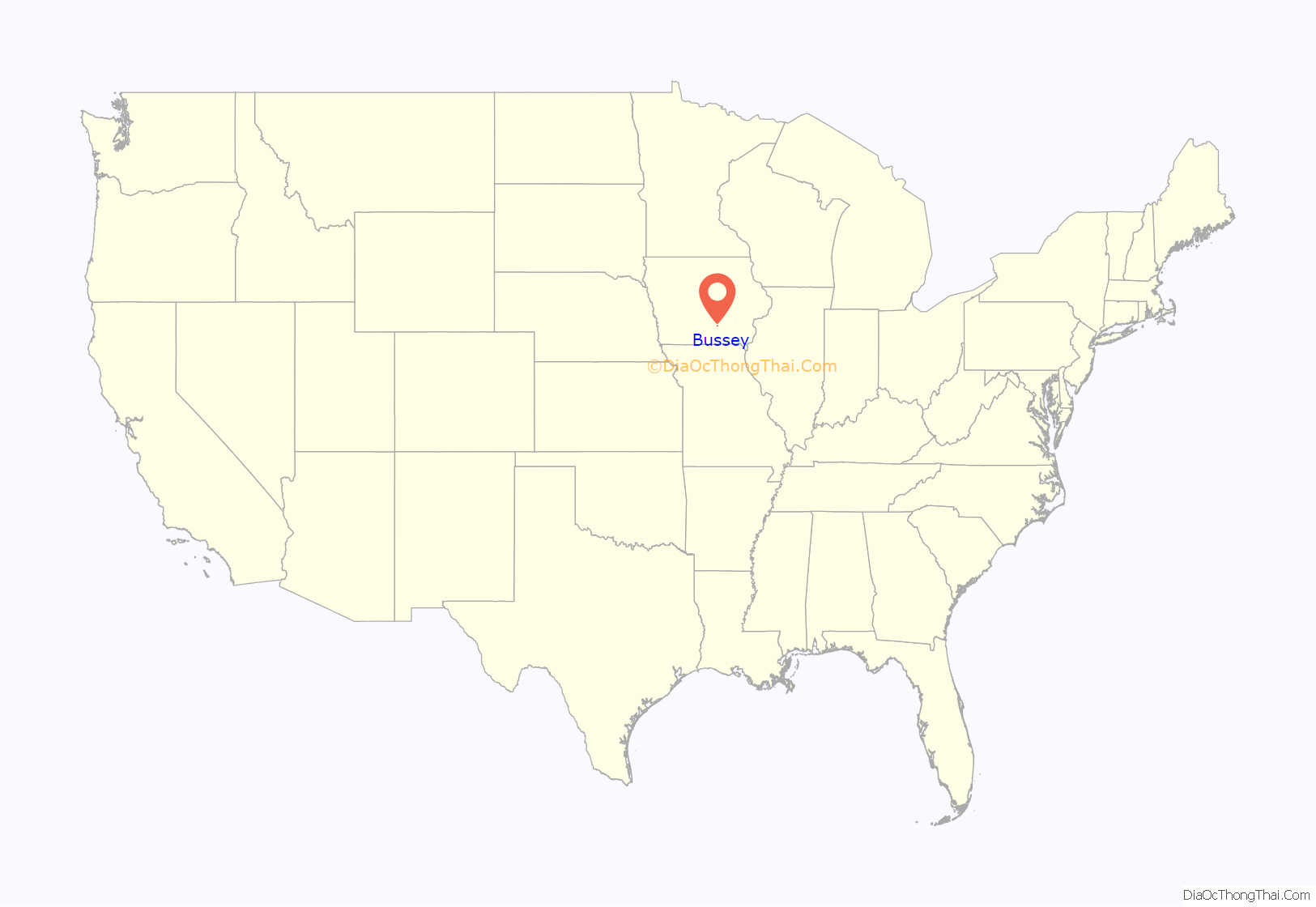
Bussey location map. Where is Bussey city?
History
Jesse Bussey, originally from Greene County, Pennsylvania, bought the land for the town of Bussey in 1867. He laid out the town of Bussey on the line of the Albia, Knoxville and Des Moines Railroad in 1875, the same year the line was acquired by the Chicago, Burlington and Quincy Railroad. Mr Bussey went into the lumber and grain business there. By 1880, the population was close to 100, with four general merchandise stores and one drug store. The town was incorporated in 1895. There were some problems with the initial incorporation, so a second vote was held in 1899, after which James Bussey was elected as the first mayor.
In the late 19th and early 20th centuries, there were numerous coal mines in the Bussey area. In the early 1890s, the Powers company had two mine shafts in the area with a private tramway connecting them to the company’s tipple along the railroad line. J. A. Powers founded the O.K. Coal Company in Bussey, with a mile-long railroad spur to a mine a mile south of town. This mine was the largest producer in Marion County from 1895 to around 1902. Powers reorganized the O.K. company as the Mammoth Vein Coal Company when it moved its primary operations to Everist, a coal camp 3 miles west of Bussey and a mile north of Marysville. The Cricket Coal Company, later the Equality Coal Company, was based in Bussey and had a shaft outside of town, producing 18,000 tons of coal in 1915 from a coal seam that was 4 to 6 feet thick.
United Mine Workers local 69 was organized in Bussey in 1899. In 1902 it had 275 members, but by 1907 most of the local mining activity had moved to Everist, and it had only 8 members. Prior to union organization, the minimum wage was $1.50 per day, but by 1902, this had increased to $2.15 per day. By 1907, wages ranged from $1.90 to $2.70 per day. A second union local, UMW local 2482, had 216 members in Bussey in 1912.
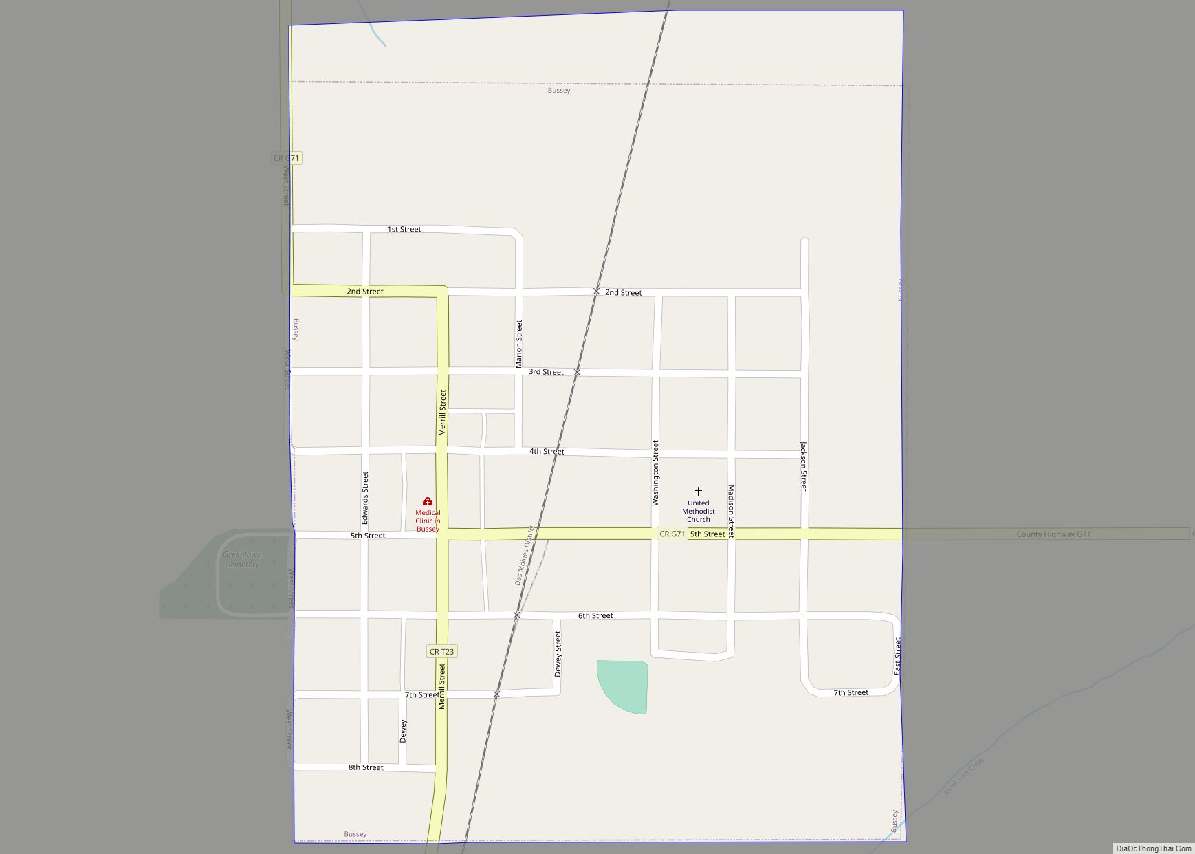
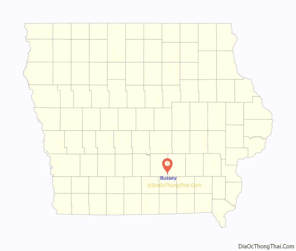
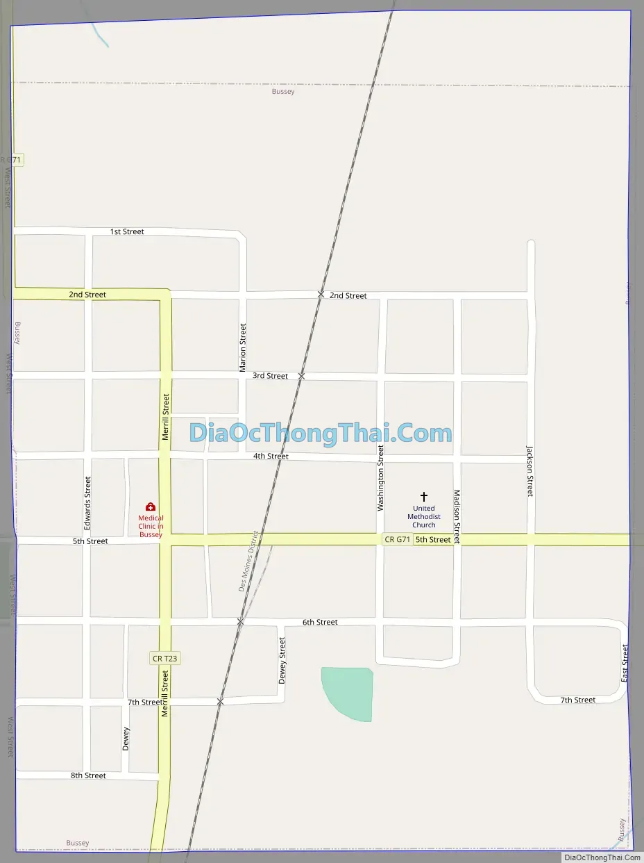
Bussey Road Map
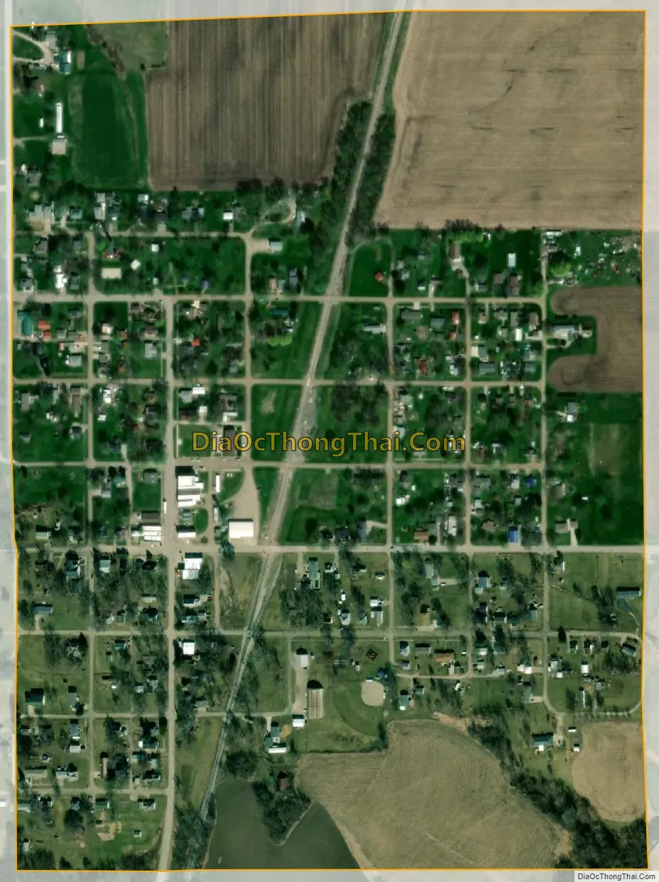
Bussey city Satellite Map
Geography
Bussey is located at the intersection of routes G71 and T23. It is three quarter mile west of the Marion-Mahaska county line and two miles north of the Marion-Monroe county line. North Coal Creek flows past the community and on to its confluence with the Des Moines River seven miles to the northeast. Knoxville is approximately 14 miles to the northwest and Oskaloosa is approximately 13 miles to the northeast in Mahaska County.
According to the United States Census Bureau, the city has a total area of 0.33 square miles (0.85 km), all of it land.
See also
Map of Iowa State and its subdivision:- Adair
- Adams
- Allamakee
- Appanoose
- Audubon
- Benton
- Black Hawk
- Boone
- Bremer
- Buchanan
- Buena Vista
- Butler
- Calhoun
- Carroll
- Cass
- Cedar
- Cerro Gordo
- Cherokee
- Chickasaw
- Clarke
- Clay
- Clayton
- Clinton
- Crawford
- Dallas
- Davis
- Decatur
- Delaware
- Des Moines
- Dickinson
- Dubuque
- Emmet
- Fayette
- Floyd
- Franklin
- Fremont
- Greene
- Grundy
- Guthrie
- Hamilton
- Hancock
- Hardin
- Harrison
- Henry
- Howard
- Humboldt
- Ida
- Iowa
- Jackson
- Jasper
- Jefferson
- Johnson
- Jones
- Keokuk
- Kossuth
- Lee
- Linn
- Louisa
- Lucas
- Lyon
- Madison
- Mahaska
- Marion
- Marshall
- Mills
- Mitchell
- Monona
- Monroe
- Montgomery
- Muscatine
- O'Brien
- Osceola
- Page
- Palo Alto
- Plymouth
- Pocahontas
- Polk
- Pottawattamie
- Poweshiek
- Ringgold
- Sac
- Scott
- Shelby
- Sioux
- Story
- Tama
- Taylor
- Union
- Van Buren
- Wapello
- Warren
- Washington
- Wayne
- Webster
- Winnebago
- Winneshiek
- Woodbury
- Worth
- Wright
- Alabama
- Alaska
- Arizona
- Arkansas
- California
- Colorado
- Connecticut
- Delaware
- District of Columbia
- Florida
- Georgia
- Hawaii
- Idaho
- Illinois
- Indiana
- Iowa
- Kansas
- Kentucky
- Louisiana
- Maine
- Maryland
- Massachusetts
- Michigan
- Minnesota
- Mississippi
- Missouri
- Montana
- Nebraska
- Nevada
- New Hampshire
- New Jersey
- New Mexico
- New York
- North Carolina
- North Dakota
- Ohio
- Oklahoma
- Oregon
- Pennsylvania
- Rhode Island
- South Carolina
- South Dakota
- Tennessee
- Texas
- Utah
- Vermont
- Virginia
- Washington
- West Virginia
- Wisconsin
- Wyoming