LeClaire is a city in Scott County, Iowa, United States. The population was 4,710 in 2020, a 65.4% increase from 2,847 in 2000, making it one of the fastest-growing communities in the Quad Cities. LeClaire is considered a suburb and part of the Quad Cities Metropolitan Area, which include the area of Davenport and Bettendorf, Iowa, and Rock Island, Moline, and East Moline, Illinois.
| Name: | Le Claire city |
|---|---|
| LSAD Code: | 25 |
| LSAD Description: | city (suffix) |
| State: | Iowa |
| County: | Scott County |
| Elevation: | 587 ft (179 m) |
| Land Area: | 4.65 sq mi (12.05 km²) |
| Water Area: | 0.20 sq mi (0.52 km²) |
| Population Density: | 1,012.25/sq mi (390.83/km²) |
| ZIP code: | 52753 |
| Area code: | 563 |
| FIPS code: | 1944085 |
| GNISfeature ID: | 0466067 |
| Website: | Tourism: www.visitleclaire.com Official: www.leclaireiowa.gov |
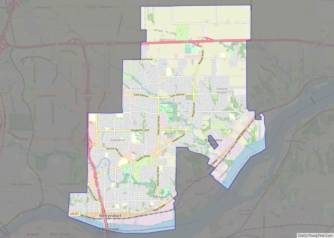
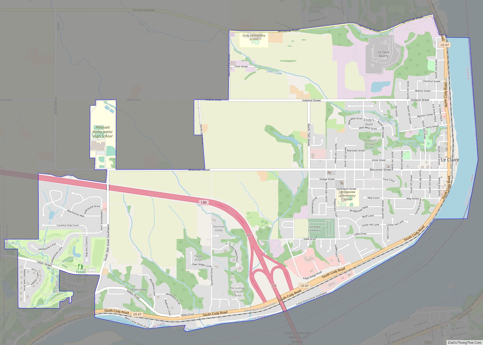
Online Interactive Map
Click on ![]() to view map in "full screen" mode.
to view map in "full screen" mode.
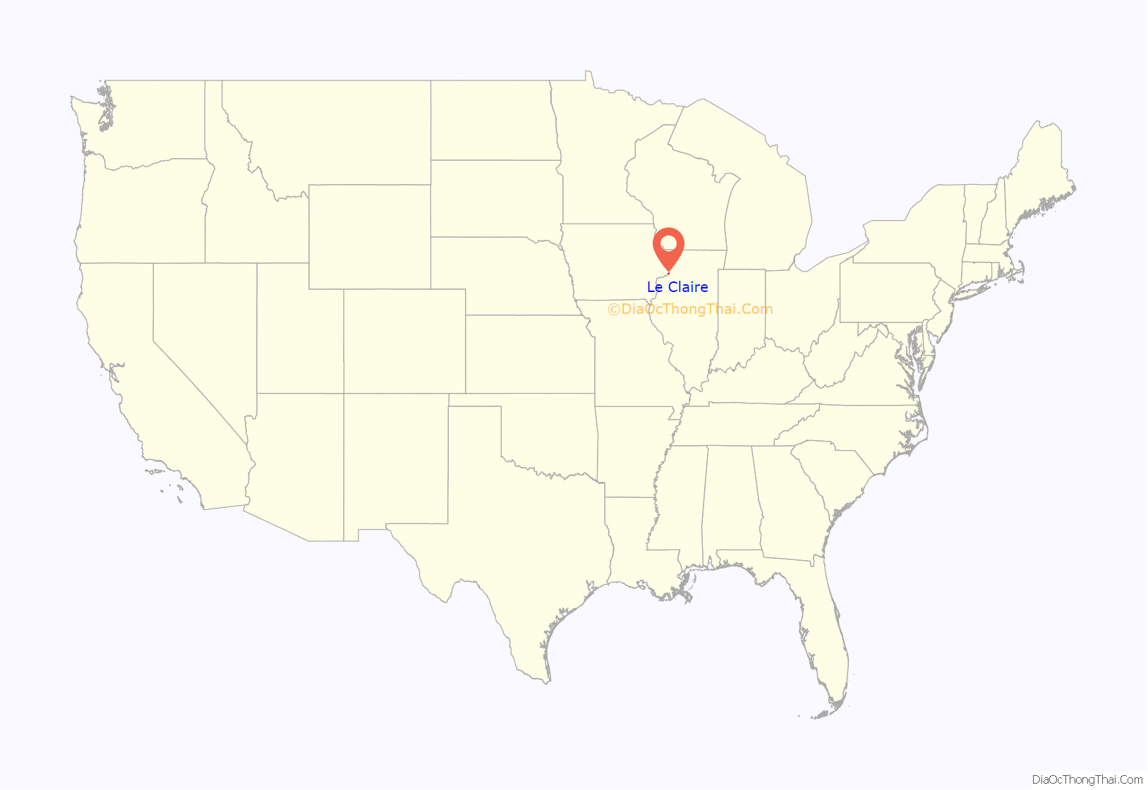
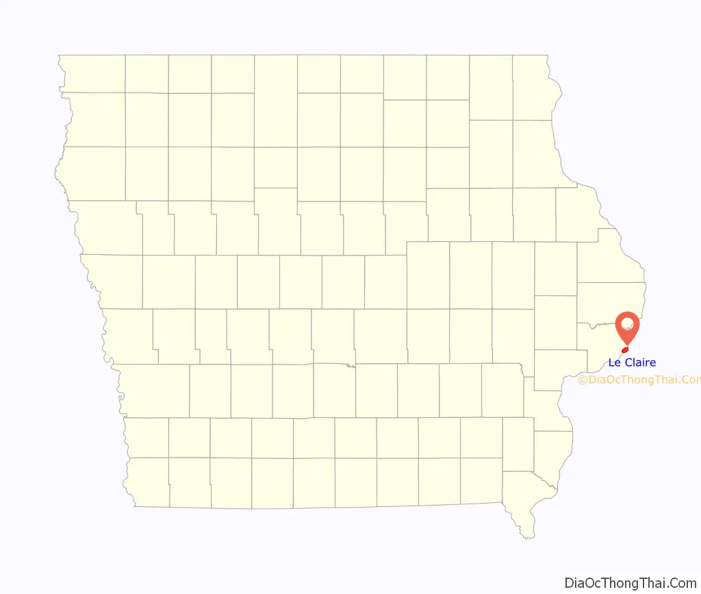
Le Claire location map. Where is Le Claire city?
History
The city takes its name from Antoine LeClaire, a Métis trader of First Nations-French Canadian descent, who originally owned the land. Although the city’s official name is “LeClaire,” it is often spelled “Le Claire,” and has also been recorded as “LeClare.”
The town was incorporated in 1855, having been settled by European Americans as early as the 1830s.
A Canadian Pacific Railway train derailed on 3 January 2020 around 11:00 a.m. near the Buffalo Bill Museum in downtown LeClaire, just yards from the Mississippi River. At least a dozen rail cars and tankers toppled off their tracks, forcing police to send a hazardous materials team to the site. Officials say Canadian Pacific Railway had found no significant air or water contamination. No one was injured and no buildings were damaged in the derailment, although some vehicles in a nearby parking lot were damaged.
LeClaire is known as the site of the reality television series American Pickers, aired by the History Channel, and home to Antique Archeology, an antiques store featured on the show. It is the birthplace of William Frederick Cody, aka Buffalo Bill Cody.
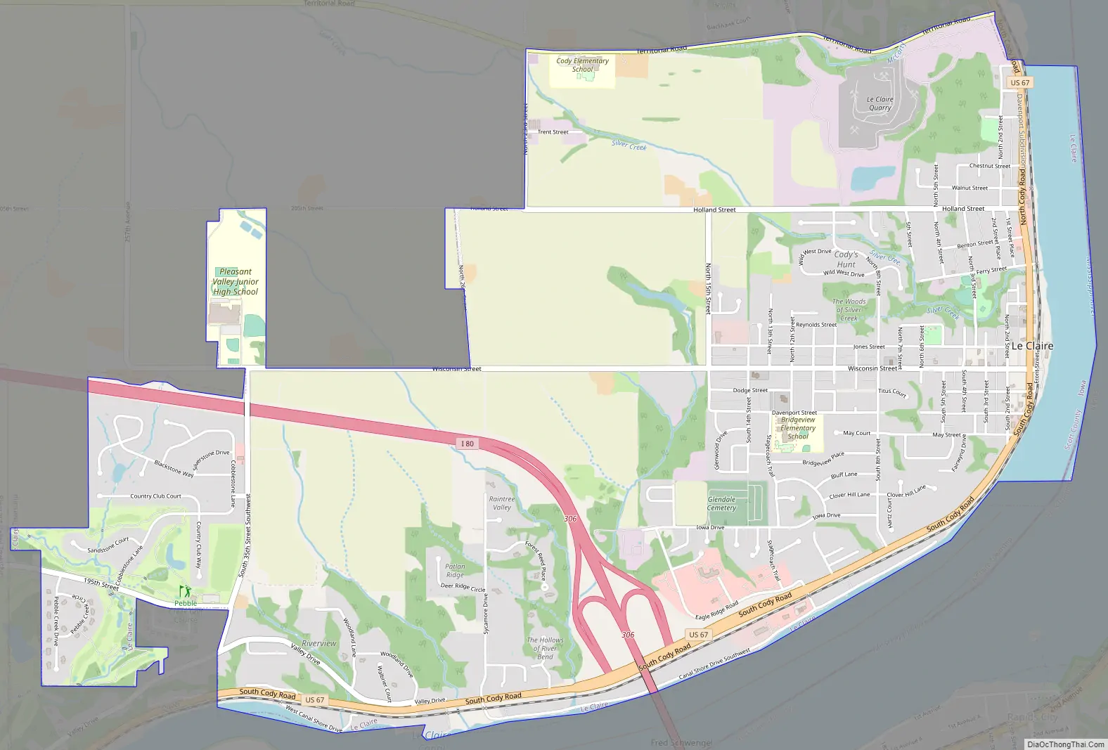
Le Claire Road Map
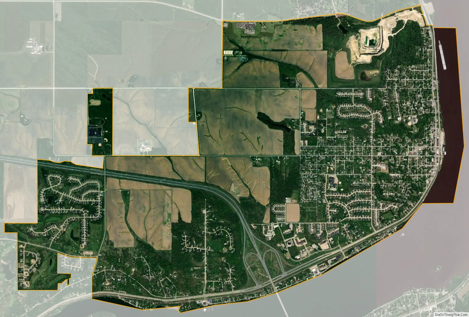
Le Claire city Satellite Map
Geography
LeClaire is located at 41°35′46″N 90°21′23″W / 41.59611°N 90.35639°W / 41.59611; -90.35639 (41.596233, -90.356252).
According to the United States Census Bureau, the city has a total area of 4.87 square miles (12.61 km), of which 4.67 square miles (12.10 km) is land and 0.20 square miles (0.52 km) is water.
See also
Map of Iowa State and its subdivision:- Adair
- Adams
- Allamakee
- Appanoose
- Audubon
- Benton
- Black Hawk
- Boone
- Bremer
- Buchanan
- Buena Vista
- Butler
- Calhoun
- Carroll
- Cass
- Cedar
- Cerro Gordo
- Cherokee
- Chickasaw
- Clarke
- Clay
- Clayton
- Clinton
- Crawford
- Dallas
- Davis
- Decatur
- Delaware
- Des Moines
- Dickinson
- Dubuque
- Emmet
- Fayette
- Floyd
- Franklin
- Fremont
- Greene
- Grundy
- Guthrie
- Hamilton
- Hancock
- Hardin
- Harrison
- Henry
- Howard
- Humboldt
- Ida
- Iowa
- Jackson
- Jasper
- Jefferson
- Johnson
- Jones
- Keokuk
- Kossuth
- Lee
- Linn
- Louisa
- Lucas
- Lyon
- Madison
- Mahaska
- Marion
- Marshall
- Mills
- Mitchell
- Monona
- Monroe
- Montgomery
- Muscatine
- O'Brien
- Osceola
- Page
- Palo Alto
- Plymouth
- Pocahontas
- Polk
- Pottawattamie
- Poweshiek
- Ringgold
- Sac
- Scott
- Shelby
- Sioux
- Story
- Tama
- Taylor
- Union
- Van Buren
- Wapello
- Warren
- Washington
- Wayne
- Webster
- Winnebago
- Winneshiek
- Woodbury
- Worth
- Wright
- Alabama
- Alaska
- Arizona
- Arkansas
- California
- Colorado
- Connecticut
- Delaware
- District of Columbia
- Florida
- Georgia
- Hawaii
- Idaho
- Illinois
- Indiana
- Iowa
- Kansas
- Kentucky
- Louisiana
- Maine
- Maryland
- Massachusetts
- Michigan
- Minnesota
- Mississippi
- Missouri
- Montana
- Nebraska
- Nevada
- New Hampshire
- New Jersey
- New Mexico
- New York
- North Carolina
- North Dakota
- Ohio
- Oklahoma
- Oregon
- Pennsylvania
- Rhode Island
- South Carolina
- South Dakota
- Tennessee
- Texas
- Utah
- Vermont
- Virginia
- Washington
- West Virginia
- Wisconsin
- Wyoming