Sherrill is a city in Dubuque County, Iowa, United States. The population was 189 at the time of the 2020 census, up from 186 in 2000.
| Name: | Sherrill city |
|---|---|
| LSAD Code: | 25 |
| LSAD Description: | city (suffix) |
| State: | Iowa |
| County: | Dubuque County |
| Elevation: | 981 ft (299 m) |
| Total Area: | 0.13 sq mi (0.34 km²) |
| Land Area: | 0.13 sq mi (0.34 km²) |
| Water Area: | 0.00 sq mi (0.00 km²) |
| Total Population: | 189 |
| Population Density: | 1,431.82/sq mi (551.28/km²) |
| ZIP code: | 52073 |
| Area code: | 563 |
| FIPS code: | 1972660 |
| GNISfeature ID: | 0461574 |
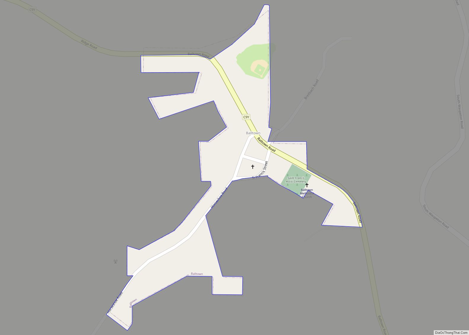
Online Interactive Map
Click on ![]() to view map in "full screen" mode.
to view map in "full screen" mode.
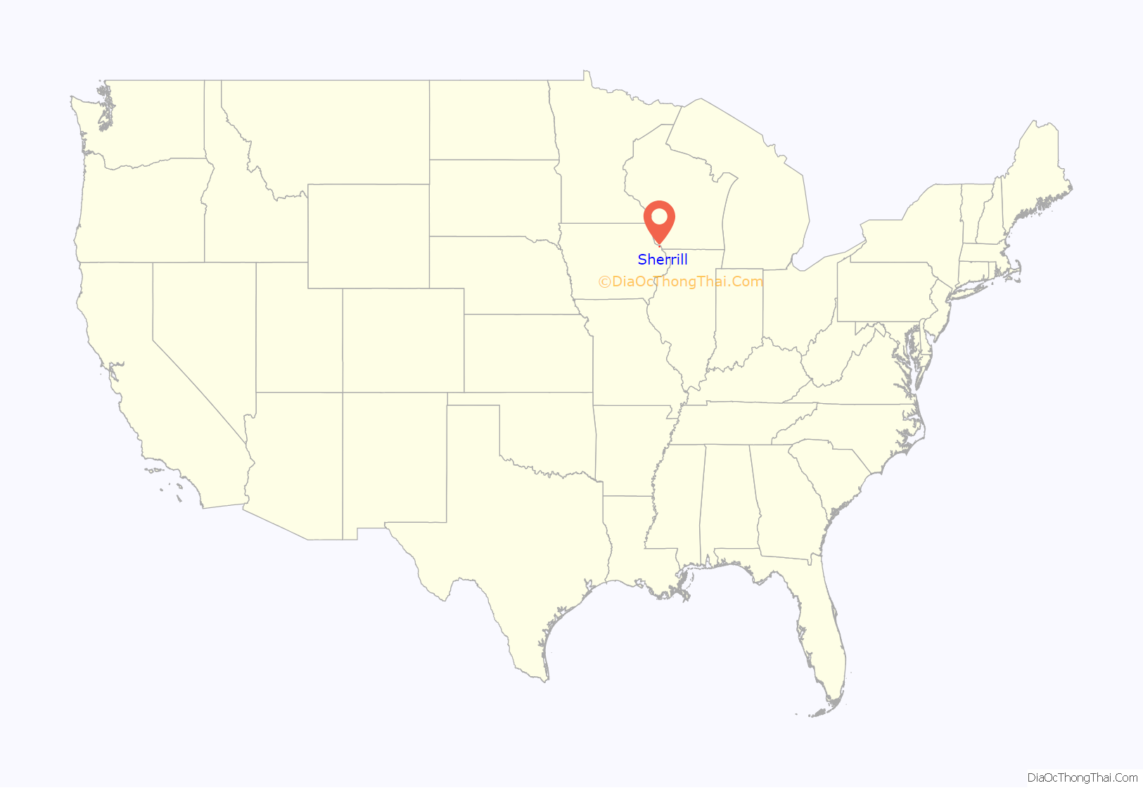
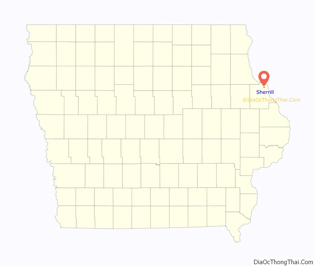
Sherrill location map. Where is Sherrill city?
History
Sherrill was named for two brothers, Adam and Isaac Sherrill, and was originally called Sherrill’s Mound or Mount, since the city is at the base of a prominent hill. In 1856, Peter Fries, an Austrian immigrant, built a large, stone inn at the main crossroads of the city. It was popular with newlyweds, and Jesse James and his gang were reported to have stayed there before their famous raid on Northfield, Minnesota. The structure has survived and been restored as the Black Horse Inn. Large numbers of German immigrants settled in Sherrill and the surrounding rural area in the 19th century. German Catholic (SS. Peter and Paul), German Lutheran (St. Matthew), German Methodist, and German Evangelical churches were founded and remain active. Sherrill was one of ten “Beer Towns” incorporated in Dubuque County in 1933 to ensure that the city’s taverns could serve beer, under a possibly mistaken interpretation of Iowa law that licenses to dispense beer could only be granted to premises inside incorporated places. Sherrill’s post office was established in 1858, with Peter Fries as postmaster. Its Zip Code is 52073.
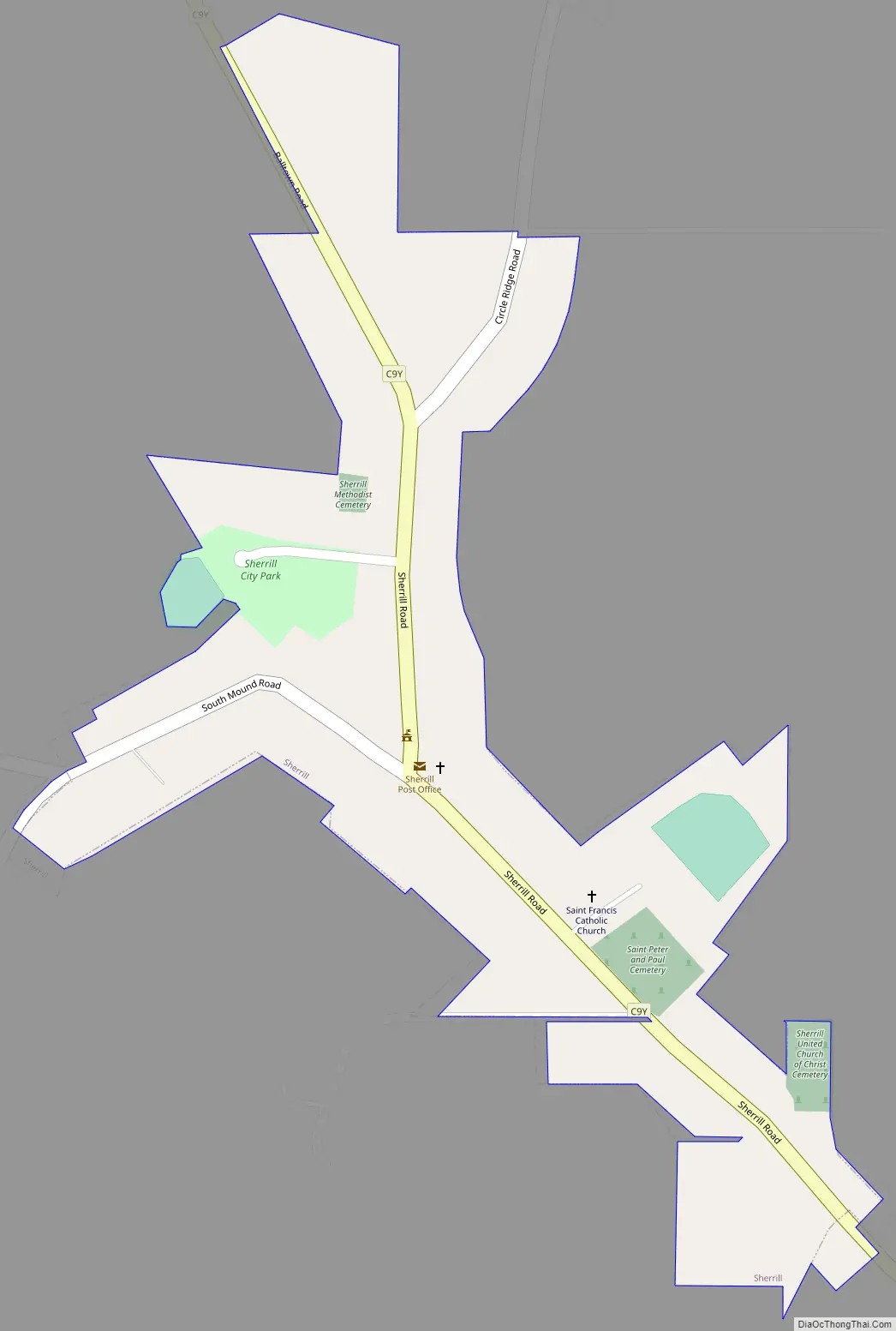
Sherrill Road Map
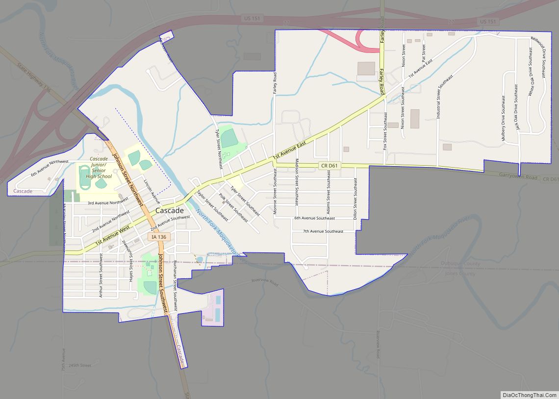
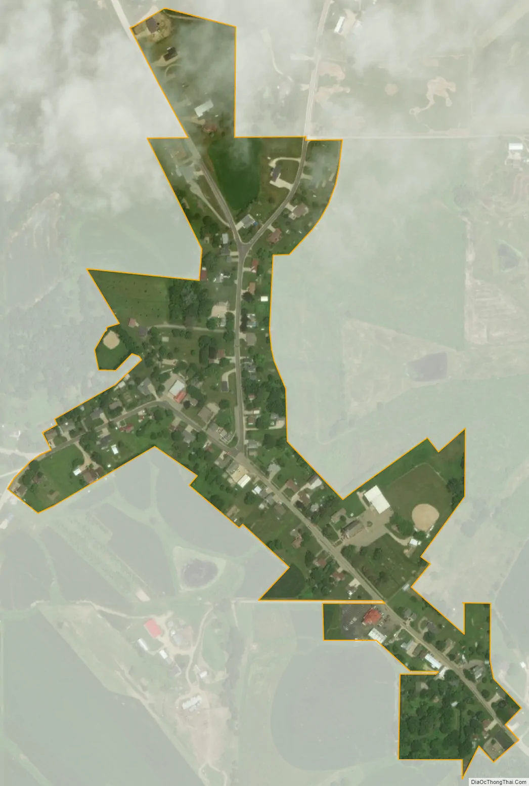
Sherrill city Satellite Map
Geography
Sherrill is located at 42°36′10″N 90°46′56″W / 42.60278°N 90.78222°W / 42.60278; -90.78222 (42.602857, -90.782139).
According to the United States Census Bureau, the city has a total area of 0.13 square miles (0.34 km), all land.
See also
Map of Iowa State and its subdivision:- Adair
- Adams
- Allamakee
- Appanoose
- Audubon
- Benton
- Black Hawk
- Boone
- Bremer
- Buchanan
- Buena Vista
- Butler
- Calhoun
- Carroll
- Cass
- Cedar
- Cerro Gordo
- Cherokee
- Chickasaw
- Clarke
- Clay
- Clayton
- Clinton
- Crawford
- Dallas
- Davis
- Decatur
- Delaware
- Des Moines
- Dickinson
- Dubuque
- Emmet
- Fayette
- Floyd
- Franklin
- Fremont
- Greene
- Grundy
- Guthrie
- Hamilton
- Hancock
- Hardin
- Harrison
- Henry
- Howard
- Humboldt
- Ida
- Iowa
- Jackson
- Jasper
- Jefferson
- Johnson
- Jones
- Keokuk
- Kossuth
- Lee
- Linn
- Louisa
- Lucas
- Lyon
- Madison
- Mahaska
- Marion
- Marshall
- Mills
- Mitchell
- Monona
- Monroe
- Montgomery
- Muscatine
- O'Brien
- Osceola
- Page
- Palo Alto
- Plymouth
- Pocahontas
- Polk
- Pottawattamie
- Poweshiek
- Ringgold
- Sac
- Scott
- Shelby
- Sioux
- Story
- Tama
- Taylor
- Union
- Van Buren
- Wapello
- Warren
- Washington
- Wayne
- Webster
- Winnebago
- Winneshiek
- Woodbury
- Worth
- Wright
- Alabama
- Alaska
- Arizona
- Arkansas
- California
- Colorado
- Connecticut
- Delaware
- District of Columbia
- Florida
- Georgia
- Hawaii
- Idaho
- Illinois
- Indiana
- Iowa
- Kansas
- Kentucky
- Louisiana
- Maine
- Maryland
- Massachusetts
- Michigan
- Minnesota
- Mississippi
- Missouri
- Montana
- Nebraska
- Nevada
- New Hampshire
- New Jersey
- New Mexico
- New York
- North Carolina
- North Dakota
- Ohio
- Oklahoma
- Oregon
- Pennsylvania
- Rhode Island
- South Carolina
- South Dakota
- Tennessee
- Texas
- Utah
- Vermont
- Virginia
- Washington
- West Virginia
- Wisconsin
- Wyoming