Allendale is a village in Wabash Precinct, Wabash County, Illinois. The population was 475 at the 2010 census.
| Name: | Allendale village |
|---|---|
| LSAD Code: | 47 |
| LSAD Description: | village (suffix) |
| State: | Illinois |
| County: | Wabash County |
| Elevation: | 479 ft (146 m) |
| Total Area: | 0.31 sq mi (0.79 km²) |
| Land Area: | 0.31 sq mi (0.79 km²) |
| Water Area: | 0.00 sq mi (0.00 km²) |
| Total Population: | 458 |
| Population Density: | 1,491.86/sq mi (576.10/km²) |
| Area code: | Area code 618 |
| FIPS code: | 1700815 |
| GNISfeature ID: | 2397935 |
Online Interactive Map
Click on ![]() to view map in "full screen" mode.
to view map in "full screen" mode.
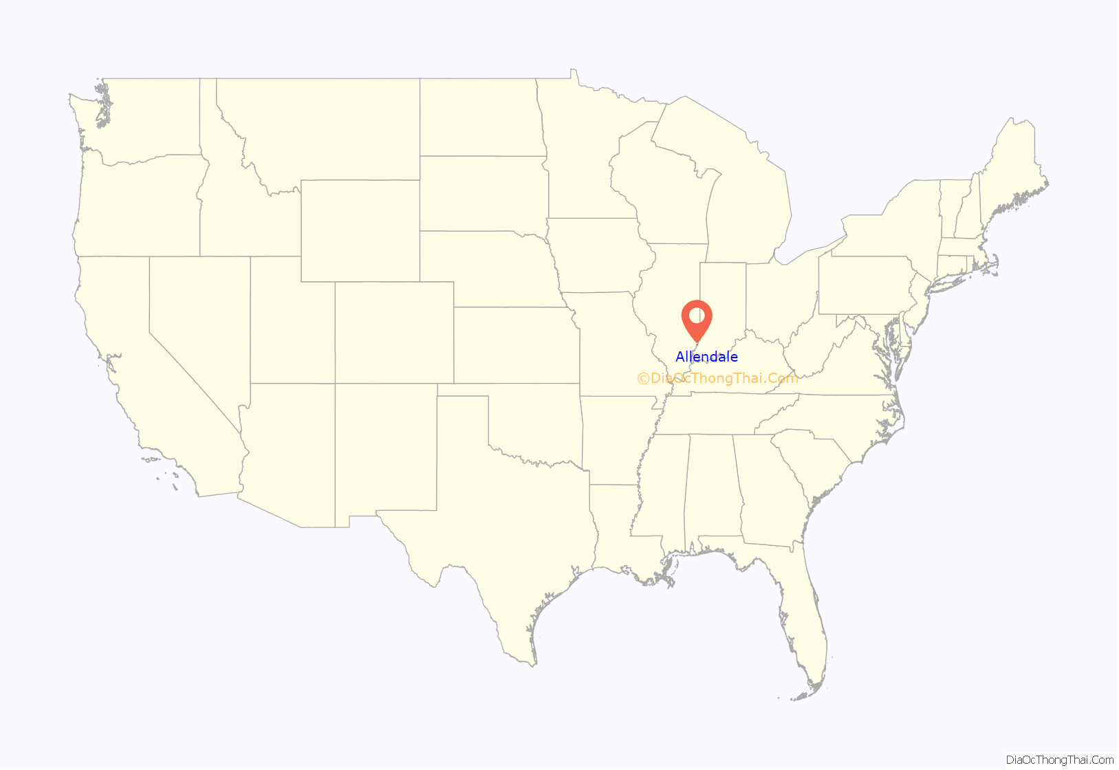
Allendale location map. Where is Allendale village?
History
Allendale was founded in 1869, taking its name from Colonel C. M. Allen, a railroad official.
1989 tornado
On January 7, 1989, an F4 tornado leveled a good portion of the town of Allendale and injured 55 of its residents. The tornado directly impacted Allendale’s school, destroying the grade school portion, built in the 1960s. The high school portion, built in the late 1920s, withstood the storm with minimal damage, despite being condemned two years earlier due to lobbying by Mt. Carmel’s District 348 in an attempt to usurp District 17. Relief funds paid to build a brand new school to be used by the elementary and middle school students of District 17.
Allendale Road Map
Allendale city Satellite Map
Geography
Allendale is located 4 miles (6.4 km) northeast of Patton and 1.75 miles (2.82 km) east-northeast of Adams Corner.
According to the 2010 census, Allendale has a total area of 0.31 square miles (0.80 km), all land.
See also
Map of Illinois State and its subdivision:- Adams
- Alexander
- Bond
- Boone
- Brown
- Bureau
- Calhoun
- Carroll
- Cass
- Champaign
- Christian
- Clark
- Clay
- Clinton
- Coles
- Cook
- Crawford
- Cumberland
- De Kalb
- De Witt
- Douglas
- Dupage
- Edgar
- Edwards
- Effingham
- Fayette
- Ford
- Franklin
- Fulton
- Gallatin
- Greene
- Grundy
- Hamilton
- Hancock
- Hardin
- Henderson
- Henry
- Iroquois
- Jackson
- Jasper
- Jefferson
- Jersey
- Jo Daviess
- Johnson
- Kane
- Kankakee
- Kendall
- Knox
- La Salle
- Lake
- Lake Michigan
- Lawrence
- Lee
- Livingston
- Logan
- Macon
- Macoupin
- Madison
- Marion
- Marshall
- Mason
- Massac
- McDonough
- McHenry
- McLean
- Menard
- Mercer
- Monroe
- Montgomery
- Morgan
- Moultrie
- Ogle
- Peoria
- Perry
- Piatt
- Pike
- Pope
- Pulaski
- Putnam
- Randolph
- Richland
- Rock Island
- Saint Clair
- Saline
- Sangamon
- Schuyler
- Scott
- Shelby
- Stark
- Stephenson
- Tazewell
- Union
- Vermilion
- Wabash
- Warren
- Washington
- Wayne
- White
- Whiteside
- Will
- Williamson
- Winnebago
- Woodford
- Alabama
- Alaska
- Arizona
- Arkansas
- California
- Colorado
- Connecticut
- Delaware
- District of Columbia
- Florida
- Georgia
- Hawaii
- Idaho
- Illinois
- Indiana
- Iowa
- Kansas
- Kentucky
- Louisiana
- Maine
- Maryland
- Massachusetts
- Michigan
- Minnesota
- Mississippi
- Missouri
- Montana
- Nebraska
- Nevada
- New Hampshire
- New Jersey
- New Mexico
- New York
- North Carolina
- North Dakota
- Ohio
- Oklahoma
- Oregon
- Pennsylvania
- Rhode Island
- South Carolina
- South Dakota
- Tennessee
- Texas
- Utah
- Vermont
- Virginia
- Washington
- West Virginia
- Wisconsin
- Wyoming
